- Columbia River Gorge
-
For the Washington-Oregon wine region, see Columbia Gorge AVA.
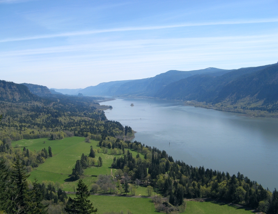
Columbia River Gorge Protected Area  Looking east up the Columbia River Gorge from Crown Point.
Official name: Columbia River Gorge
National Scenic AreaCountry United States States Oregon, Washington Region Pacific Northwest Founded 1986 
Website: http://www.fs.fed.us/r6/columbia/ The Columbia River Gorge is a canyon of the Columbia River in the Pacific Northwest of the United States. Up to 4,000 feet (1,200 m) deep, the canyon stretches for over 80 miles (130 km) as the river winds westward through the Cascade Range forming the boundary between the State of Washington to the north and Oregon to the south. Extending roughly from the confluence of the Columbia with the Deschutes River down to eastern reaches of the Portland metropolitan area, the gorge furnishes the only navigable route through the Cascades and the only water connection between the Columbia River Plateau and the Pacific Ocean.
The gorge holds federally protected status as a National Scenic Area called the Columbia Gorge National Scenic Area and is managed by the United States Forest Service. The gorge is a popular recreational destination.
Contents
Description
The main trees in the gorge are conifers, Bigleaf Maple, cottonwood, Oregon Ash, Vine Maple,[citation needed] and Garry Oak.[1] The wide range of elevation and precipitation in the gorge creates a diverse collection of ecosystems from the temperate rain forest at Oneonta Gorge (with an average annual precipitation of 75 inches (1,900 mm)) to the Celilo grasslands (with average annual precipitation 12 inches (300 mm), with a transitional dry woodland between Hood River and The Dalles.[citation needed] A large variety of endemic wildflowers thrives throughout the gorge.[citation needed]
Atmospheric pressure differentials east and west of the Cascades create a wind tunnel effect in the deep cut of the gorge, generating 35 mph (56 km/h) winds that make it a popular windsurfing and kiteboarding location.
The gorge also contains a high concentration of waterfalls, with over 90 waterfalls on the Oregon side of the gorge alone.[2] Many are along the Historic Columbia River Highway, including the notable 620-foot (190 m)-high Multnomah Falls.
Geology
The Columbia River Gorge began forming as far back as the Miocene, (roughly 12 - 17 million years ago), and continued to take shape through the Pleistocene, (700,000 - 2 million years ago). During this period the Cascades Range was forming, which slowly moved the Columbia River's delta about 100 miles (160 km) north to its current location.[3]
Although the river slowly eroded the land over this period of time, the most drastic changes took place at the end of the last Ice Age when the Missoula Floods cut the steep, dramatic walls that exist today, flooding the river as high up as Crown Point.[4] This quick erosion left many layers of volcanic rock exposed.[3]
 A view of the Columbia River Gorge from the near the top of Mt. Hamilton, looking south from the Washington state side of the gorge. On the far left side of the image, the Bonneville Dam is visible. On the left-center is the small town of North Bonneville. Behind the hills in the center of the image, the peak of Mt. Hood is just barely visible. The large rock at the river's edge on the right side is Beacon Rock. To get an idea of the scale of the image, Beacon Rock is 848 feet (258 m) tall.
History
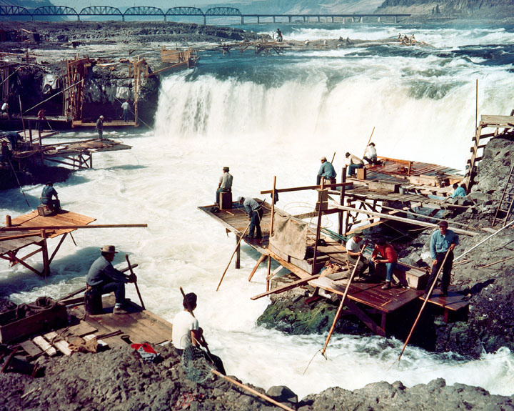
The gorge has supported human habitation for over 13,000 years. Evidence of the Folsom and Marmes people, who crossed the Bering land bridge from Asia, were found in archaeological digs. Excavations near Celilo Falls, a few miles east of The Dalles, show humans have occupied this salmon-fishing site for more than 10,000 years.[citation needed]
The gorge has provided a transportation corridor for thousands of years. American Indians would travel through the Gorge to trade at Celilo Falls, both along the river and over Lolo Pass on the north side of Mount Hood. In 1805, the route was used by the Lewis and Clark Expedition to reach the Pacific.[5] Early European and American settlers subsequently established steamboat lines and railroads through the gorge. Today, the BNSF Railway runs freights along the Washington side of the river, while its rival, the Union Pacific Railroad, runs freights along the Oregon shore. Until 1997, Amtrak's Pioneer also used the Union Pacific tracks. The Portland segment of the Empire Builder uses the BNSF tracks that pass through the gorge.
The Columbia River Highway, built in the early 20th century, was the first major paved highway in the Pacific Northwest. Shipping was greatly simplified after Bonneville Dam and The Dalles Dam submerged the gorge's major rapids.
In November 1986, Congress made it the first U.S. National Scenic Area and established the Columbia River Gorge Commission as part of an interstate compact.[6] In 2004, the gorge became the namesake of the Columbia Gorge American Viticultural Area, a 4,432-acre (1,794 ha) area located on both sides of the river.
Gallery
-

Crown Point in the Columbia River Gorge, looking upstream from Chanticleer Point.
-

Columbia River Gorge, photographed from the southern edge of the Gifford Pinchot National Forest.
-

The view east towards The Dalles from Dog Mountain.
-

Native Indian petroglyphs in the Columbia River Gorge near The Dalles Dam.
-

Kitesurfing on the Columbia River.
-

View of Columbia River Gorge from Cape Horn Trail, looking east toward Beacon Rock.
-

Columbia River Gorge, photographed from Crown point.
-
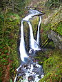
Triple Falls
-

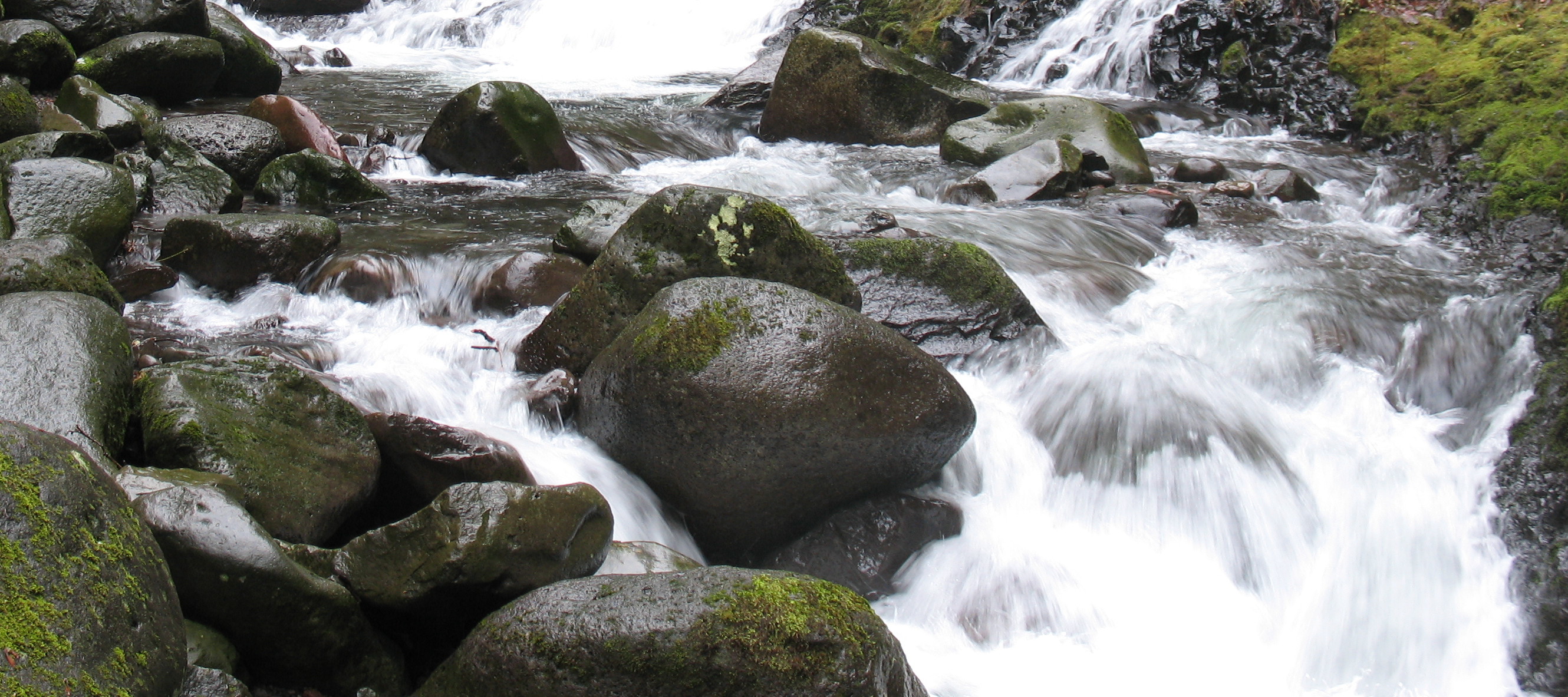
Oneonta Creek
See also
- Barlow Road, the first wagon-compatible pioneer road to provide a safer alternative to traveling through the gorge
- Cascades Rapids
- Columbia Gorge casino, a proposed off-reservation casino in Cascade Locks
- Wahclella Falls
References
- ^ Franklin and Dyrness (1988). Natural Vegetation of Oregon and Washington. Oregon State University Press. ISBN 0-87071-356-6.
- ^ "Columbia River Gorge of Oregon". Northwest Waterfall Survey. Retrieved February 6, 2011.
- ^ a b "Columbia River Gorge". http://www.nwcouncil.org/history/ColumbiaRiverGorge.asp. Retrieved 2008-06-02.
- ^ The Seattle Times' Pacific NW magazine - "Trailing an Apocalypse" - 30 September 2007
- ^ O'Connor, Jim E. (Fall 2004). "The Evolving Landscape of the Columbia River Gorge: Lewis and Clark and Cataclysms on the Columbia". Oregon Historical Quarterly. http://www.historycooperative.org/journals/ohq/105.3/oconnor.html.
- ^ Columbia River Gorge National Scenic Area Act from GorgeFriends.org
External links
- U.S. Forest Service - Columbia River Gorge National Scenic Area
- Columbia River Gorge Commission
- Columbia Gorge Magazine
- Abbott, Carl. Columbia Gorge National Scenic Area in the Oregon Encyclopedia
Columbia River Provinces and
states traversed
Lists - Cities
- Crossings
- Dams
- Rapids
- Tributaries
Geology and Geography - Geology of the Pacific Northwest
- Columbia River Basalt Group
- Columbia River Gorge
- Missoula Floods
- Bonneville Slide/Bridge of the Gods land bridge
- 1700 Cascadia earthquake
- 1980 eruption of Mount St. Helens
- Columbia Mountains
History - Celilo Falls
- Kettle Falls
- Dalles des Morts
- Robert Gray exploration
- Lewis and Clark Expedition
- David Thompson
- Astor Expedition
- Fort Vancouver
- Steamboats of the Columbia River
- Big Bend Gold Rush
- Steamboats of the Arrow Lakes
- Steamboats of the upper Columbia and Kootenay Rivers
- Columbia River Treaty
- Historic Columbia River Highway
- Columbia Basin Project
- Bonneville Power Administration
- Hanford Site
- Sohappy v. Smith
- Boldt Decision
- Vanport flood of 1948
Ecology and culture Ice Age Floods National Geologic Trail in the Pacific Northwest Ice Age Glacial Floods 
Glacial Lakes Glacial Lake Missoula • Glacial Lake ColumbiaTemporary Lakes Lake Lewis • Lake Condon • Lake AllisonIce Age Floods Glacial Residue Ice Age Floods Erosion & Deposition Features Moses Coulee • Channeled Scablands • Grand Coulee • Dry Falls • Drumheller Channels • Crab Creek • Corfu Slide • Palouse Falls • Touchet Formation • Wallula Gap • Columbia River Gorge • Alameda RidgeRelated contemporaneous events Bonneville Flood State of Washington
Olympia (capital) Topics State government | Cities | Towns | Congressional delegation | City governments | Governors | History | Geography | People | Legislative initiatives | Popular initiatives | Legislature | Music | Parks | Highways | Symbols | Visitor attractions
Society Demographics · Economy · Education · Politics
Regions Western Washington Kitsap Peninsula | Long Beach Peninsula | Olympic Peninsula | Puget Sound | San Juan Islands | Skagit ValleyEastern Washington/Inland Empire Shared Larger cities and
metropolitan areasSeattle | Seattle metropolitan area | Spokane | Tacoma | Tri-Cities | Vancouver | Bellevue | Everett | Yakima
Smaller cities Aberdeen | Anacortes | Arlington | Auburn | Bainbridge Island | Battle Ground | Bellingham | Bonney Lake | Bothell | Bremerton | Burien | Camas | Centralia | Cheney | Cle Elum | Coupeville | Covington | Des Moines | East Wenatchee | Edmonds | Ellensburg | Enumclaw | Federal Way | Fort Lewis | Grandview | Hoquiam | Issaquah | Kelso | Kenmore | Kennewick | Kent | Kirkland | Lacey | Lake Forest Park | Lake Stevens | Lakewood | Langley | Longview | Lynden | Lynnwood | Mabton | Maple Valley | Marysville | Mercer Island | Mill Creek | Monroe | Moses Lake | Mountlake Terrace | Mount Vernon | Mukilteo | Naches | Oak Harbor | Olympia | Pasco | Port Angeles | Port Orchard | Port Townsend | Prosser | Pullman | Puyallup | Redmond | Renton | Richland | Sammamish | SeaTac | Sedro-Woolley | Selah | Shelton | Shoreline | Silverdale | Spokane Valley | Sunnyside | Toppenish | Tukwila | Tumwater | University Place | Walla Walla | Wapato | Washougal | Wenatchee | West Richland | Woodinville | Zillah
Counties Adams | Asotin | Benton | Chelan | Clallam | Clark | Columbia | Cowlitz | Douglas | Ferry | Franklin | Garfield | Grant | Grays Harbor | Island | Jefferson | King | Kitsap | Kittitas | Klickitat | Lewis | Lincoln | Mason | Okanogan | Pacific | Pend Oreille | Pierce | San Juan | Skagit | Skamania | Snohomish | Spokane | Stevens | Thurston | Wahkiakum | Walla Walla | Whatcom | Whitman | Yakima
Protected Areas of Oregon Federal Fort Vancouver • Lewis and Clark • Nez PerceDeschutes • Fremont–Winema • Malheur • Mount Hood • Ochoco • Rogue River – Siskiyou • Siuslaw • Umatilla • Umpqua • Wallowa–Whitman • Willamette
National GrasslandsAnkeny • Bandon Marsh • Baskett Slough • Bear Valley • Cape Meares • Cold Springs • Deer Flat • Hart Mountain • Klamath Marsh • Lower Klamath • Malheur • McKay Creek • Nestucca Bay • Oregon Islands • Siletz Bay • Three Arch Rocks • Tualatin River • Umatilla • Upper Klamath • William L. Finley
Badger Creek • Black Canyon • Boulder Creek • Bridge Creek • Bull of the Woods • Clackamas • Copper Salmon • Cummins Creek • Diamond Peak • Drift Creek • Eagle Cap • Gearhart Mountain • Grassy Knob • Hells Canyon • Kalmiopsis • Lower White River • Mark O. Hatfield • Menagerie • Middle Santiam • Mill Creek • Monument Rock • Mount Hood • Mount Jefferson • Mount Thielsen • Mount Washington • Mountain Lakes • North Fork John Day • North Fork Umatilla • Opal Creek • Oregon Badlands • Oregon Islands • Red Buttes • Roaring River • Rock Creek • Rogue–Umpqua Divide • Salmon–Huckleberry • Sky Lakes • Soda Mountain • Spring Basin • Steens Mountain • Strawberry Mountain • Table Rock • Three Arch Rocks • Three Sisters • Waldo Lake • Wenaha–Tucannon • Wild Rogue
Cascade–Siskiyou National Monument • Steens Mountain Cooperative Management and Protection Area • Yaquina Head Outstanding Natural Area
Other
Protected AreasCape Perpetua • Cascade Head Preserve • Christmas Valley Sand Dunes • Columbia River Gorge National Scenic Area • Lost Forest Research Natural Area • South Slough National Estuarine Research Reserve • Upper and Lower Table Rock
State Arcadia Beach • Bob Straub • Bradley • Cape Kiwanda • Cape Lookout • Cape Meares • Clay Myers at Whalen Island • Del Rey Beach • Ecola • Elmer Feldenheimer • Fishing Rock • Fort Stevens • Gearhart Ocean • Haystack Hill • Hug Point • John Yeon • Manhattan Beach • Munson Creek Falls • Neahkahnie–Manzanita • Nehalem Bay • Oceanside Beach • Oswald West • Rockaway Beach • Sunset Beach • Sunset Highway Forest • Symons • Tolovana Beach • Tolovana Beach • Twin Rocks • Wilson River Highway Forest
Agate Beach • Alsea Bay • Beachside • Beaver Creek • Beverly Beach • Boiler Bay • Carl G. Washburne • Collins Creek • D River • Darlingtonia • Devils Lake • Devils Punch Bowl • Driftwood Beach • Ellmaker • Fogarty Creek • Gleneden Beach • Governor Patterson • H.B. Van Duzer • Heceta Head Lighthouse • Jessie M. Honeyman • Joaquin Miller Forest • L. Presley & Vera C. Gill • Lost Creek • Muriel O. Ponsler • Neptune • Neskowin Beach • Ona Beach • Otter Crest • Pritchard • Roads End • Rocky Creek • San Marine • Seal Rock • Smelt Sands • South Beach • Stonefield Beach • Tokatee Klootchman • W. B. Nelson • Whale Watching • Yachats • Yachats Ocean Road • Yaquina Bay
Albert H. Powers • Alfred A. Loeb • Arizona Beach • Bandon • Bolon Island Tideways • Bullards Beach • Cape Arago • Cape Blanco • Cape Sebastian • Conde B. McCullough • Coquille Myrtle Grove • Crissey Field • Elk Creek Tunnel Forest • Face Rock • Floras Lake • Geisel Monument • Golden and Silver Falls • Harris Beach • Hoffman • Humbug Mountain • Hutchinson • Maria C. Jackson • McVay Rock • Ophir • Otter Point • Paradise Point • Pistol River • Port Orford Cedar Forest • Port Orford Heads • Samuel H. Boardman • Seven Devils • Shore Acres • Sisters Rock • Sunset Bay • Sweet Myrtle • Umpqua • Umpqua Lighthouse • Umpqua Myrtle • William M. Tugman • Winchuck • Yoakam Point
Banks–Vernonia • Bonnie Lure • Government Island • L. L. "Stub" Stewart • Mary S. Young • Milo McIver • Tryon Creek • Willamette Stone
Ainsworth • Benson • Bonneville • Bridal Veil Falls • Crown Point • Dabney • Dalton Point • George W. Joseph • Guy W. Talbot • Historic Columbia River Highway • John B. Yeon • Koberg Beach • Lang Forest • Lewis and Clark • Lindsey Creek • Mayer • McLoughlin • Memaloose • Multnomah Falls • Portland Women's Forum • Rocky Butte • Rooster Rock • Seneca Fouts • Shepperd's Dell • Sheridan • Starvation Creek • Viento • Vinzenz Lausmann • Wyeth • Wygant
Alderwood • Bald Peak • Blachly Mountain Forest • Bowers Rock • Cascadia • Champoeg • Detroit Lake • Dexter • Elijah Bristow • Erratic Rock • Fall Creek • Fort Yamhill • Holman • Jasper • Lowell • Luckiamute • Maples • Maud Williamson • Molalla River • North Santiam • Sarah Helmick • Silver Falls • State Capitol • Thompson's Mills • Washburne • Willamette Mission
Ben Hur Lampman • Canyon Creek Forest • Casey • Collier Memorial • Illinois River Forks • Jackson F. Kimball • Joseph H. Stewart • Klamath Falls – Lakeview Forest • OC&E Woods Line • Prospect • Rough and Ready Forest • Stage Coach Forest • TouVelle • Tub Springs • Valley of the Rogue • Wolf Creek Inn
Cline Falls • Deschutes River • Dyer • Elliott Corbett • La Pine • Ochoco • Peter Skene Ogden • Pilot Butte • Prineville Reservoir • Redmond–Bend Juniper • Sisters • Smith Rock • The Cove Palisades • Tumalo • White River Falls
Bates • Battle Mountain Forest • Blue Mountain Forest • Booth • Catherine Creek • Chandler • Clyde Holliday • Crooked Creek • Deadman's Pass • Emigrant Springs • Farewell Bend • Fort Rock • Fort Rock Cave • Frenchglen Hotel • Goose Lake • Hat Rock • Hilgard Junction • Kam Wah Chung • Lake Owyhee • Minam • Ontario • Pete French Round Barn • Red Bridge • Succor Creek • Sumpter Valley Dredge • Ukiah–Dale Forest • Unity Forest • Unity Lake • Wallowa Lake • Wallowa Lake Highway Forest • Wallowa River
Bridge Creek • Dean Creek • Denman • E.E. Wilson • Elkhorn • Fern Ridge • Irrigon • Jewell Meadows • Klamath • Ladd Marsh • Lower Deschutes • Phillip W. Schneider • Prineville • Riverside • Sauvie Island • Snake River Islands • Summer Lake • Wenaha • White River • Willow Creek
Regions Portland metroBlue Lake • Cooper Mountain • Glendoveer • Howell • Oregon Zoo • Oxbow • Smith and Bybee • Mount Talbert
Cities PortlandForest Park • Washington Park
Heritage registers: National Register of Historic Places • National Historic Landmarks • National Natural Landmarks • World Network of Biosphere Reserves Coordinates: 45°42′17″N 121°47′30″W / 45.70472°N 121.79167°W
Categories:- Archaeological sites in Oregon
- Archaeological sites in Washington (state)
- Canyons and gorges of Oregon
- Canyons and gorges of Washington (state)
- Protected areas of Clark County, Washington
- Columbia River Gorge
- Columbia River
- Protected areas of Hood River County, Oregon
- Interstate 84 (west)
- Protected areas of Klickitat County, Washington
- Protected areas of Multnomah County, Oregon
- National Scenic Areas
- Protected areas of Sherman County, Oregon
- Protected areas of Skamania County, Washington
- Protected areas of Wasco County, Oregon
- Mount Hood National Forest
- Landforms of Clark County, Washington
- Landforms of Hood River County, Oregon
- Landforms of Klickitat County, Washington
- Landforms of Multnomah County, Oregon
- Landforms of Sherman County, Oregon
- Landforms of Skamania County, Washington
- Landforms of Wasco County, Oregon
-


Wikimedia Foundation. 2010.