- Lisbellaw
Infobox Irish Place|thumb|left|name = Lisbellaw
irish = Lios Béal Átha
scots =
map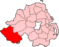
pin coords =
north coord = 54.317 | west coord = 7.537
province =Ulster
county =County Fermanagh
NI district =Fermanagh
UK constituency = Fermanagh and South Tyrone
stdcode = 028, +44 28
posttown =
postcode =
population = 1046
census yr = 2001
web = www.fermanagh.gov.ukLisbellaw ( _ga. Lios Béal Átha; meaning "fort at the approach to a ford") is a
village inCounty Fermanagh ,Northern Ireland , about 5 miles east ofEnniskillen . In the 2001 Census it had a population of 1,046 people. It lies within theFermanagh District Council area.The village is built around the (
Church of Ireland ) parish church, which stands high at its centre and dates from the 18th century. The steep, tight main street houses two grocery shops, a hairdressing salon, two pubs, a Post Office, a dentists surgery, a beauty salon and a hardware store, as well as the (Church of Ireland) Parish Centre, theMethodist andPresbyterian Churches. TheRoman Catholic Church building and aBrethren Gospel Hall lie just off the main street. Just outside the village isCarrybridge , a marina on UpperLough Erne .History
The
Annals of Ulster - a chronicle of medieval Ireland - were compiled in the late 15th century by the scribe Ruaidhri Ó Luinín on Belle Isle nearLisbellaw .port
In 1968 a Rainbow Trout of 8lb 7oz, the Irish record, was caught on Lough Eyes, Lisbellaw.
2001 Census
Lisbellaw is classified as a village by the [http://www.nisra.gov.uk/ NI Statistics and Research Agency (NISRA)] (ie with population between 1,000 and 2,250 people). On Census day (
29 April 2001 ) there were 1,046 people living in Lisbellaw. Of these:
*24.0% were aged under 16 years and 16.7% were aged 60 and over
*48.7% of the population were male and 51.3% were female
*7.3% were from aCatholic background and 91.9% were from a Protestant background
*5.7% of people aged 16-74 were unemployedFor more details see: [http://www.ninis.nisra.gov.uk/ NI Neighbourhood Information Service]
Transport
*Lisbellaw railway station opened on
16 August 1858 and finally closed on1 October 1957 . [cite web | title=Lisbellaw station | work=Railscot - Irish Railways | url=http://www.railscot.co.uk/Ireland/Irish_railways.pdf | accessdate=2007-10-28|format=PDF]References
* [http://www.enniskillen.com/lisbellaw.html Enniskillen.com]
* [http://www.culturenorthernireland.org/town_Home.aspx?co=5&to=117&ca=0&sca=0&navID=1 Culture Northern Ireland]See also
*
List of villages in Northern Ireland
*List of towns in Northern Ireland
*Market Houses in Northern Ireland External links
* [http://cloghmore.bravepages.com/fermanagh/lisbellawMH.html Lisbellaw Market House]
Wikimedia Foundation. 2010.