- Beit She'an
-
Beit She'an Hebrew transcription(s) – Hebrew בֵּית שְׁאָן – ISO 259 Beit Šˀan – Translit. Bet Šəʼan – Also spelled Bet She'an (official)
Beth Shean (unofficial)Arabic transcription(s) – Arabic بيسان 

Logo
 Beit She'an
Coordinates: 32°30′N 35°30′E / 32.5°N 35.5°ECoordinates: 32°30′N 35°30′E / 32.5°N 35.5°E District North Government – Type City – Mayor Jacky Levi Area – Total 7,330 dunams (7.3 km2 / 2.8 sq mi) Population (2009)[1] – Total 16,900 Name meaning House of Tranquillity[2]  Beit She'an (help·info) (Hebrew: בֵּית שְׁאָן Beth Šəān; Arabic: بيسان, Beesān (help·info), Beisan or Bisan)[2] is a city in the North District of Israel which has played an important role historically due to its geographical location at the junction of the Jordan River Valley and Jezreel Valley. It has also played an important role in modern times, acting as the regional center for the numerous villages in the Beit She'an Valley Regional Council.
Contents
History
Beit She'an's location has often been strategically significant, as it sits at the junction of the Jordan River Valley and the Jezreel Valley, essentially controlling access from the interior to the coast, as well as from Jerusalem to the Galilee.
Early Beit She’an
In 1933, archaeologist G.M. FitzGerald, under the auspices of the University of Pennsylvania Museum, carried out a “deep cut” on Tell el-Hosn, the large mound of Beth Shean in order to determine the earliest occupation of the site. His results suggest that settlement began in the Late Neolithic or Early Chalcolithic periods (sixth to fifth millennia BCE.[3] Occupation continued intermittently up to the late Early Bronze Age I (3200-3000), according to pottery finds, and then resumes in the Early Bronze Age III.[4] A large cemetery on the northern side of the mound was in use from the Bronze Age to Byzantine times.[5] Canaanite graves dating from 2000-1600 BCE were discovered in 1926.[6]
Egyptian period
After the Egyptian conquest of Beit She’an by pharaoh Thutmose III in the 15th-century BCE (recorded in an inscription at Karnak),[7] the small town on the summit of the Tell became the center of the Egyptian administration of the region.[8] The Egyptian newcomers changed the organization of the town and left a great deal of material culture behind. A large Canaanite temple (39 meters in length) excavated by the University of Pennsylvania Museum may date from about the same period as Thutmose III’s conquest, though the Hebrew University excavations suggest that it dates to a later period.[9] Artifacts of potential cultic significance were found in the temple. Based on a stele found in the temple and inscribed with Egyptian hieroglyphs, the temple was dedicated to the god Mekal.[10] One of the University Museum’s most important finds near the temple is the Lion and Dog stela (currently in the Israel Museum in Jerusalem), which depicts two combat scenes between these two creatures. The Hebrew University excavations determined that this temple was built on the site of an earlier one.[11]
During the three hundred years of Egyptian rule (18th Dynasty to the 20th Dynasty), the population of Beit She’an appears to have been primarily Egyptian administrative officials and military personnel. The town was completely rebuilt, following a new layout, during the 19th dynasty.[12] The University Museum excavations uncovered two important stelae from the period of Seti I and a monument of Rameses II.[13] Pottery was produced locally, but some was made to mimic Egyptian forms.[14] Other Canaanite goods existed alongside Egyptian imports or locally-made Egyptian style objects.[15] The 20th dynasty saw the construction of large administrative buildings in Beit She’an, including Building 1500, a small palace for the Egyptian governor.[16] During the 20th dynasty, invasions of the "Sea Peoples" upset Egypt’s control over the Eastern Mediterranean. Though the exact circumstances are unclear, the entire site of Beit She’an was destroyed by fire around 1150 BCE. The Egyptians did not attempt to rebuild their administrative center and lost control of the region.
Biblical period
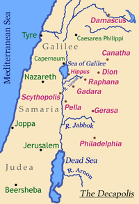 Map of the Decapolis showing the location of Beit She'an, (here called by its Greek name, Scythopolis)
An Iron Age I Canaanite city was constructed on the site of the Egyptian center shortly after its destruction.[17] This period is not well understood due to the dearth of archaeological material, but it appears to be a purely Canaanite settlement devoid of Sea People/Philistine artifacts. However, textual evidence from 1 Samuel 31 states that the Philistines were present at the site and hung the body of King Saul on the walls of Beit She’an.[18] As there is no other Biblical reference to a Philistine presence there, the above incident might refer to an isolated military incursion rather than a permanent presence that far east — which would agree with the archaeological evidence.
During the Iron Age II period, the town became a part of the larger Israelite kingdom under the rule of the Biblical kings David and Solomon (I King 4:12 refers to Beit She’an as a part of the district of Solomon, though the historical accuracy of this list is debated.[19] The Assyrian conquest of northern Israel under Tiglath-Pileser III (732 BCE) brought about the destruction of Beit She’an by fire. Minimal reoccupation occurred until the Hellenistic period.[14]
Roman period
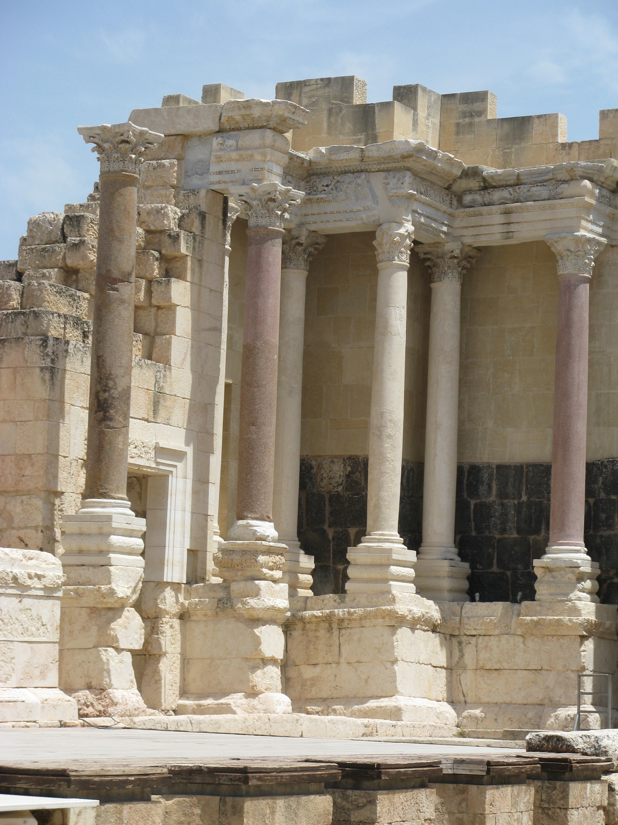
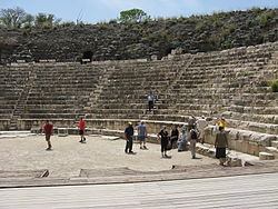 Beit She'an theatre
The Hellenistic period saw the reoccupation of the site of Beit She’an under the new name Scythopolis, possibly named after the Scythian mercenaries who settled there as veterans. Little is known about the Hellenistic city, but during the 3rd century BCE a large temple was constructed on the Tell.[20] It is unknown which deity was worshipped there, but the temple continued to be used during Roman times. The local Greek mythology holds that the city was founded by Dionysus and that his nursemaid Nysa was buried there; thus it was sometimes known as Nysa-Scythopolis. Graves dating from the Hellenistic period are simple singular rock-cut tombs.[21] From 301 to 198 BCE the area was under the control of the Ptolemies, and Beit She'an is mentioned in 3rd-2nd centuries BC written sources describing the Syrian Wars between the Ptolemid and Seleucid dynasties. In 198 BCE the Seleucids conquered the region. The town played a role after the Hasmonean Maccabee Revolt: Josephus records that the Jewish High Priest Jonathan was killed there by Demetrius II Nicator.[22] The city was destroyed by fire at the end of the 2nd century BCE.[23]
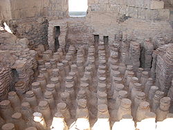 Roman baths
In 63 BC, Pompey made Palestine a part of the Roman empire. Beit She’an was refounded and rebuilt by Gabinius.[24] The town center shifted from the summit of the Tel to its slopes. Scythopolis prospered and became the leading city of the Decapolis, a loose confederation of ten cities that were centers of Greco-Roman culture, an event so significant that the town based its calendar on that year. Pax Romana favoured the city, evidenced by its high-level urban planning and extensive construction including the best preserved Roman theatre of ancient Samaria as well as a hippodrome, cardo, and other trademarks of the Roman influence. Mount Gilboa, 7 kilometres (4.3 mi) away, provided dark basalt blocks as well as water via an aqueduct. The town is said to have sided with the Romans during the Jewish uprising of 66 CE.[24] Excavations have focused less on the Roman period ruins, so less is known about this period. The University Museum excavation of the northern cemetery, however, did uncover significant finds. The Roman era tombs are of the loculus type: a rectangular rock-cut chamber with smaller chambers (loculi) cut into its side.[21] Bodies were placed in the loculi or inside sarcophagi which were the placed in the loculi. A sarcophagus with an inscription identifying its occupant in Greek as “Antiochus, the son of Phallion” may have held the cousin of Herod the Great.[21] One of the most interesting Roman grave finds was a bronze incense shovel with the handle in the form of an animal leg and hoof, now in the University of Pennsylvania Museum.[25]
Byzantine period
Copious archaeological remains were found dating to the Byzantine period (330 CE – 636 CE) and were excavated by the University of Pennsylvania Museum from 1921-23. A rotunda church was constructed on top of the Tell and the entire city was enclosed in a wall.[26] Textual sources mention several other churches in the town.[26] Beit She'an was primarily Christian, as attested to by the large number of churches, but evidence of Jewish habitation and a Samaritan synagogue indicate established communities of these minorities. The pagan temple in the city centre was destroyed, but the nymphaeum and Roman baths were restored. Many of the buildings of Scythopolis were damaged in the Galilee earthquake of 363, and in 409 it became the capital of the northern district, Palaestina Secunda.[23] Dedicatory inscriptions indicate a preference for donations to religious buildings, and many colourful mosaics, such as that featuring the zodiac in the Monastery of Lady Mary, or the one picturing a menorah and shalom in the House of Leontius' Jewish synagogue, were preserved. A Samaritan synagogue's mosaic was unique in abstaining from human or animal images, instead utilising floral and geometrical motifs. Elaborate decorations were also found in the settlement's many luxurious villas, and in the 6th century especially, the city reached its maximum size of 40,000 and spread beyond its period city walls.[23]
The Byzantine period portion of the northern cemetery was excavated in 1926. The tombs from this period consisted of small rock-cut halls with vaulted graves on three sides.[27] A great variety of objects were found in the tombs, including terracotta figurines possibly depicting the Virgin and Child, many terracotta lamps, glass mirrors, bells, tools, knives, finger rings, iron keys, glass beads, bone hairpins, and many other items.[27]
Umayyad period
In 634, Byzantine forces were defeated by the Muslim forces of Caliph Umar Ibn al-Khattab and the city was renamed Baysan. The day of victory came to be known in Arabic as Yawm Baysan or "the day of Baysan."[2] The city was not damaged and the newly arrived Muslims lived together with its Christian population until the 8th century, but the city declined during this period and its glorious Roman-Byzantine architecture was lost to neglect. Structures were built in the streets themselves, narrowing them to mere alleyways, and makeshift shops were opened among the colonnades. The city reached a low point by the 8th century, witnessed by the removal of marble for producing lime, the blocking off of the main street, and the conversion of a main plaza into a cemetery.[28]Al-Muqaddasi wrote that Baysan was "on the river, with plentiful palm trees, and water, though somewhat heavy (brackish)" and Abu Ubayd al-Andalusi noted that the wine produced there was delicious.[2]
On January 18, 749, Umayyad Baysan was completely devastated by the Golan earthquake of 749. A few residential neighborhoods grew up on the ruins, probably established by the survivors, but the city never recovered its magnificence. The city center moved to the southern hill where a Crusader fortress surrounded by a moat was constructed.[29]
Crusader period
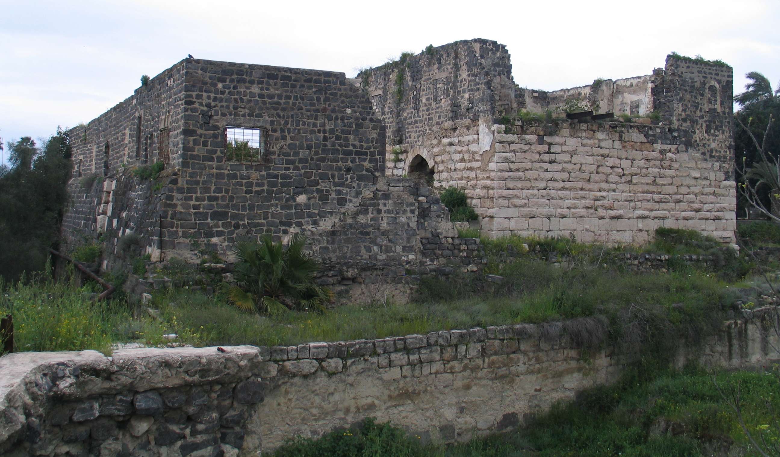
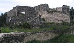 Crusader remains
In the Crusader period, the settlement was part of the Belvoir fiefdom. A small fort was built east of the defunct amphitheater.[30]
Mamluk period
Under Mamluk rule, Beit She'an was the principal town in the district of Damascus and a relay station for the postal service between Damascus and Cairo. It was also the capital of sugar cane processing for the region. Jisr al-Maqtu'a, a bridge consisting of a single arch spanning 25 feet and hung 50 feet above a stream, was built during that period.[2]
Ottoman period
Beit She'an was long home to a Jewish community. The 14th century Jewish topographer Ishtori Haparchi settled there and completed his work Kaftor Vaferech in 1322, the first Hebrew book on the geography of Palestine.[31]
During the 400 years of Ottoman rule, Baysan lost its regional importance. During the reign of Sultan Abdul Hamid II when the Haifa-Damascus extension of the Hejaz railway was constructed, a limited revival took place. The local peasant population was largely impoverished by the Ottoman feudal land system which leased tracts of land to tenants and collected taxes from them for their use.[2]
The Swiss-German traveler Johann Ludwig Burckhardt described Beisan in 1812 as "a village with 70 to 80 houses, whose residents are in a miserable state." In the early 1900s, though still a small and obscure village, Beisan was known for its plentiful water supply, fertile soil, and its production of olives, grapes, figs, almonds, apricots, and apples.[2]
British Mandate
In 1934, Lawrence of Arabia noted that "Bisan is now a purely Arab village," where "very fine views of the river can be had from the housetops." He further noted that, "Many nomad and Bedouin encampments, distinguished by their black tents, were scattered about the riverine plain, their flocks and herds grazing round them."[2] Beisan was home to a mainly Mizrahi Jewish community of 95 until 1936, when the 1936–1939 Arab revolt saw Beisan serve as a center of Arab attacks on Jews in Palestine.[31][32][33] In 1938, after learning of the murder of his close friend and Jewish leader Haim Sturmann, Orde Wingate led his men on an offensive in the Arab section of Beit She'an, the rebels’ suspected base.[34]

According to population surveys conducted in British Mandate Palestine, Beisan consisted of 5,080 Muslim Arabs out of a population of 5,540 (92% of the population), with the remainder being listed as Christians.[35] In 1945, the surrounding "Beisan district" consisted of 16,660 Muslims (67%), 7,590 Jews (30%), and 680 Christians (3%), and Arabs owned 44% of land, Jews owned 34%, and 22% constituted public lands. The 1947 UN Partition Plan allocated Beisan and most of its district to the proposed Jewish state.[2][36][37]
State of Israel
Jewish militias and local Bedouins first clashed during the 1948 Arab-Israeli War in February and March 1948, part of Operation Gideon,[2] which Walid Khalidi argues was part of a wider Plan Dalet.[38] Joseph Weitz, a leading Yishuv figure, wrote in his diary on May 4, 1948 that, "The Beit Shean Valley is the gate for our state in the Galilee...[I]ts clearing is the need of the hour."[2]
Beisan fell to the Jewish militias three days before the end of British Mandate Palestine. After Israel's Declaration of Independence in May 1948, during intense shelling by Syrian border units, the Arab inhabitants, followed by the recapture of the valley by the Haganah, fled across the Jordan River.[39] The property and buildings abandoned after the conflict were then held by the state of Israel.[2] Most Arab Christians relocated to Nazareth. A ma'abarah (refugee camp) inhabited mainly by North African immigrants was erected in Beit She'an, and it later became a development town.
In 1999, Beit She'an was incorporated as a city.[40] Geographically, it lies in the middle of the Beit She'an Valley Regional Council.[41]
Beit She'an was the hometown and political power base of David Levy, a prominent figure in Israeli politics.
Israeli-Arab conflict
In the 1974 Beit She'an attack, militants of the Popular Democratic Front for the Liberation of Palestine, took over an apartment building and murdered a family of four.[32]
In the 2002 Beit She'an attack, six Israelis were killed and over 30 were injured by two Palestinian militants who opened fire and threw grenades at a polling station in the center of Bet She'an where party members were voting in the Likud primary.
Demographics
According to the Israel Central Bureau of Statistics (CBS), the population of the municipality was 16,900 at the end of 2009.[1] In 2005, the ethnic makeup of the city was 99.5% Jewish and other non-Arab (97.3% Jewish), with no significant Arab population. See Population groups in Israel. The population breakdown by gender was 8,200 males and 8,100 females.[42]
The age distribution was as follows:
Age 0 - 4 5 - 9 10 - 14 15 - 19 20 - 29 30 - 44 45 - 59 60 - 64 65 - 74 75+ Percentage 9.9 9.4 9.4 9.4 17.6 17.7 16.7 2.7 4.4 2.8 Source: Israel Central Bureau of Statistics[42] Economy
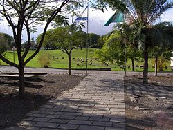 Beit She'an park
According to CBS, as of 2000, in the city there were 4,980 salaried workers and 301 are self-employed. The mean monthly wage in 2000 for a salaried worker in the city is ILS 4,200, a real change of 3.3% over the course of 2000. Salaried males have a mean monthly wage of ILS 5,314 (a real change of 5.1%) versus ILS 2,998 for females (a real change of -1.0%). The mean income for the self-employed is 6,106. There are 470 people who receive unemployment benefits and 1,409 people who receive an income guarantee.
Beit She'an is a center of cotton-growing, and many of residents are employed in the cotton fields of the surrounding kibbutzim. Other local industries include a textile mill and clothing factory.[31]
Education
According to CBS, there are 16 schools and 3,809 students in the city. They are spread out as 10 elementary schools and 2,008 elementary school students, and 10 high schools and 1,801 high school students. 56.2% of 12th grade students were entitled to a matriculation certificate in 2001.
Transportation
Historically, Beit She'an was a railway station in the Jezreel Valley railway, an extension of the Hejaz railway. Currently, no railway is in use in the city, although a planned expansion by Israel Railways seeks to change this by Q1 2011.[43] The main means of transport in Beit She'an is the bus, and the city is served by the Egged (long-distance, bus 961) and Kavim (local) bus companies.[44]
Archaeology
The University of Pennsylvania carried out excavations of ancient Beit She'an in 1921–1933. Relics from the Egyptian period were discovered, most of them in the Rockefeller Museum in Jerusalem. Some are in the University of Pennsylvania Museum in Philadelphia. Excavations at the site were resumed by the Hebrew University of Jerusalem in 1983 and then again from 1989 to 1996 under the direction of A. Mazar.[45] The excavations have revealed no less than 18 successive ancient towns.[46][47] Ancient Beit She'an is one of the most impressive Roman and Byzantine sites in Israel, and it attracts approximately 300,000 tourists annually.[48]
Sports
The local football club, Hapoel Beit She'an spent several seasons in the top division in the 1990s, but folded in 2006 after several relegations. Maccabi Beit She'an currently play in Liga Bet.
Landmarks
The town lies within an area known as the Valley of Springs Regional Council where several springs provide leisure opportunities [1].
Twin towns — Sister cities
Beit She'an is twinned with:
 Cleveland, United States (Since 1995) [49]
See also
- List of Arab towns and villages depopulated during the 1948 Arab-Israeli War
References
- ^ a b "Table 3 - Population of Localities Numbering Above 2,000 Residents and Other Rural Population". Israel Central Bureau of Statistics. 2010-06-30. http://www.cbs.gov.il/population/new_2010/table3.pdf. Retrieved 2010-10-31.
- ^ a b c d e f g h i j k l Shahin, Mariam (2005). Palestine: A Guide. Interlink Books. pp. 159–165. ISBN 156656557X.
- ^ Braun, Eliot. Early Beth Shan (Strata XIX-XIII): G.M. FitzGerald’s Deep Cut on the Tell, p. 28
- ^ Braun, p.62; 64
- ^ Rowe, Alan. The Topography and History of Beth Shan. Philadelphia: 1930, p. v
- ^ Rowe, p. 2
- ^ No. 110: bt š’ir. Mazar, Amihai. “Tel Beth-Shean: History and Archaeology.” In One God, One Cult, One Nation. Ed. R.G. Kratz and H. Spieckermann. New York: 2010, P. 239
- ^ Mazar 242
- ^ Rowe, 10; http://www.rehov.org/project/tel_beth_shean.htm
- ^ Rowe 11
- ^ Mazar 247
- ^ Mazar 250
- ^ Rowe 23-32
- ^ a b http://www.rehov.org/project/tel_beth_shean.htm
- ^ Mazar 256
- ^ Mazar 253
- ^ http://www.rehov.org/project/index.htm
- ^ Mazar 261
- ^ Mazar 263
- ^ Rowe 44
- ^ a b c Rowe 49
- ^ Josephus Ant. XIII, vi, 1,2; Rowe 45
- ^ a b c 3
- ^ a b Rowe 46
- ^ Rowe 53
- ^ a b Rowe 50
- ^ a b Rowe 52
- ^ "Beit She'an". Jewish Virtual Library. http://www.jewishvirtuallibrary.org/jsource/Archaeology/Beitshean.html.
- ^ Israel Antiquities Authority, Death of a City
- ^ "גן לאומי בית שאן" (in Hebrew). Israel National parks authority. http://parks.org.il/BuildaGate5/general2/data_card.php?Cat=~30~~269867317~Card1~&ru=&SiteName=parks&Clt=&Bur=133421493.
- ^ a b c "Bet She'an". Encyclopædia Britannica. http://www.britannica.com/eb/article-9078948/Bet-Shean. Retrieved 2008-10-20.
- ^ a b Ashkenazi, Eli (2007-05-11). "The other Beit She'an". Haaretz. http://www.haaretz.com/hasen/spages/831404.html. Retrieved 2008-10-20.
- ^ "Virtual Israel Experience:Bet She'an". Jewish Virtual Library. http://www.jewishvirtuallibrary.org/jsource/vie/Betshean.html. Retrieved 2008-10-20.
- ^ Michael B. Oren (Winter 2001). "Orde Wingate: Friend Under Fire". Azure: Ideas for the Jewish Nation. http://azure.org.il/article.php?id=279. Retrieved 2007-05-15.
- ^ "Settled Population Of Palestine". United Nations. http://domino.un.org/UNISPAL.nsf/3822b5e39951876a85256b6e0058a478/be931279021bcfb4852563d20078d30b!OpenDocument. Retrieved 2009-02-01.[dead link]
- ^ prepared in December 1945 and January 1946 for the information of the Anglo-American Committee of Inquiry. (1991). A Survey of Palestine: Prepared in December, 1945 and January, 1946 for the Information of the Anglo-American Committee of Inquiry. 1. Institute for Palestine Studies. pp. 12–13. ISBN 0-88728-211-3.
- ^ United Nations. Land Ownership of Palestine—Map prepared by the government of the British Mandate of Palestine on the instructions of the UN Ad Hoc Committee on the Palestine Question (Map). http://domino.un.org/maps/m0094.jpg. Retrieved 2008-10-20.
- ^ Khalidi, Walid (Autumn 1988). "Plan Dalet: Master Plan for the Conquest of Palestine". Journal of Palestine Studies (Journal of Palestine Studies) 18 (1): 4–33. doi:10.1525/jps.1988.18.1.00p00037. JSTOR 2537591.
- ^ WPN Tyler, State lands and rural development in mandatory Palestine, 1920-1948, p. 79
- ^ "הסראיה - בית שאן" (in Hebrew). 7wonders.co.il. http://www.7wonders.co.il/%D7%90%D7%A8%D7%A5-%D7%99%D7%A9%D7%A8%D7%90%D7%9C/%D7%94%D7%A1%D7%A8%D7%90%D7%99%D7%94+-+%D7%91%D7%99%D7%AA+%D7%A9%D7%90%D7%9F. Retrieved 2009-02-08.
- ^ "Beit Shean". Friends of the Earth Middle East (FoEME). http://www.foeme.org/docs/Brochure_Beit_Shean_English.pdf. Retrieved 2009-02-04.[dead link]
- ^ a b "Local Authorities in Israel 2005, Publication #1295 - Municipality Profiles — Beit She'an" (PDF). Israel Central Bureau of Statistics. http://www.cbs.gov.il/publications/local_authorities2005/pdf/120_9200.pdf. Retrieved 2008-07-05. (Hebrew)
- ^ "Valley Railway – Haifa–Beit She'an". http://www.rail.co.il/HE/Development/Planned/Pages/MesilatHaemek.aspx. Retrieved 2008-10-20. (Hebrew)
- ^ "Kavim — Public Transportation Ltd.". Kavim — Public Transportation Ltd.. http://www.kavim-t.co.il/content/page.asp?maincat=1&catId=2&PageId=4. Retrieved 2009-02-07.
- ^ Tel Beth Shean
- ^ "Beth Shean (Israel)". University of Pennsylvania. http://www.sas.upenn.edu/aamw/resources/fieldwork/#Beth%20Shean%20(Israel). Retrieved 2009-02-04.
- ^ Heiser, Lauren (2000-03-10). http://srb.stanford.edu/nur/GP50/laurenh.pdf. Retrieved 2009-02-04.
- ^ "Beit She'an". Israel Ministry of Foreign Affairs. http://www.mfa.gov.il/MFA/Peace%20Process/Regional%20Projects/Jordan%20Rift%20Valley-%20Tourism. Retrieved 2009-02-08.
- ^ "Cleveland Jews support Israel generously". cleveland.com. http://blog.cleveland.com/metro/2008/05/cleveland_jews_support_israel.html. Retrieved 2009-02-08.
- Yoram Tsafrir and Gideon Foerster: "Urbanism at Scythopolis-Bet Shean in the Fourth to Seventh Centuries", Dumbarton Oaks Papers. Dumbarton Oaks Research Library and Collection. Number Fifty-One, 1997. pp. 85–146.
- Yoram Tsafrir and Gideon Foerster: "Bet Shean Excavation Project – 1988/1989", Excavations and Surveys in Israel 1989/1990. Volume 9. Israel Antiquities Authority. Numbers 94-95. Jerusalem 1989/1990, pp. 120–128.
- Yoram Tsafrir and Gideon Foerster: "The Dating of the 'Earthquake of the Sabbatical Year of 749 C. E.' in Palestine", Bulletin of the School of Oriental and African Studies of London. Vol. LV, Part 2. London 1992, pp. 231–235.
- Yoram Tsafrir and Gideon Foerster: "From Scythopolis to Baisān: Changes in the perception of the city of Bet Shean during the Byzantine and Arab Eras", Cathedra. For the History of Eretz Israel and its Yishuv, 64. Yad Izhak Ben-Zvi. Jerusalem, July 1992 (in Hebrew).
- Gideon Foerster and Yoram Tsafrir: "“Nysa-Scythopolis – A New Inscription and the Titles of the City on its Coins", The Israel Numismatic Journal. Vol. 9, 1986–7, pp. 53–58.
- Sharon, Moshe (1999). Corpus Inscriptionum Arabicarum Palaestinae, Vol. II, B-C. BRILL. ISBN 9004110836. http://books.google.com/?id=EPFDU8POrXIC. (see p.195 ff)
Excavation Reports
[edit]
University of Pennsylvania Excavations
- Braun, Eliot [2004], Early Beth Shan (Strata XIX-XIII) - G.M. FitzGerald's Deep Cut on the Tell, [University Museum Monograph 121], Philadelphia: University of Pennsylvania Museum, 2004. ISBN 1931707626
- Fisher, Clarence [1923], Beth-Shan Excavations of the University Museum Expedition, 1921–1923", Museum Journal 14 (1923), pp. 229–231.
- FitzGerald, G.M. [1931], Beth-shan Excavations 1921-23: the Arab and Byzantine Levels, Beth-shan III, University Museum: Philadelphia, 1931.
[1932], "Excavations at Beth-Shan in 1931", PEFQS 63 (1932), pp. 142–145.
- Rowe, Alan [1930], The Topography and History of Beth-Shan, Philadelphia: University of Pennsylvania Press, 1930.
[1940], The Four Canaanite Temples of Beth-shan, Beth-shan II:1, University Museum: Philadelphia, 1940.
- James, Frances W. & McGovern, Patrick E. [1993], The Late Bronze Egyptian Garrison at Beth Shan: a Study of Levels VII and VIII, 2 volumes, [University Museum Monograph 85], Philadelphia: University Museum, University of Pennsylvania & University of Mississippi, 1993. ISBN 0924171278
[edit]
Hebrew University Jerusalem Excavations
- Mazar, Amihai [2006], Excavations at Tel Beth Shean 1989-1996, Volume I: From the Late Bronze Age IIB to the Medieval Period, Jerusalem: Israel Exploration Society / Hebrew University of Jerusalem, 2006.
- Mazar, A. and Mullins, Robert (eds) [2007], Excavations at Tel Beth Shean 1989-1996, Volume II: The Middle and Late Bronze Age Strata in Area R, Jerusalem: IES / HUJ, 2007.
[edit]
General
- Finkelstein, Israel [1996], "The Stratigraphy and Chronology of Megiddo and Beth-Shan in the 12th-11th Centuries BCE", TA 23 (1996), pp. 170–184.
- Garfinkel, Yosef [1987], "The Early Iron Age Stratigraphy of Beth Shean Reconsidered", IEJ 37 (1987), pp. 224–228.
- Geva, Shulamit [1979], "A Reassessment of the Chronology of Beth Shean Strata V and IV", IEJ 29 (1979), pp. 6–10.
- Greenberg, Raphael [2003], "Early Bronze Age Megiddo and Beth Shean: Discontinuous Settlement in Sociopolitical Context", JMA 16.1 (2003), pp. 17–32.
- Hankey, V. [1966], "Late Mycenaean Pottery at Beth-Shan", AJA 70 (1966), pp. 169–171.
- Higginbotham, C. [1999], "The Statue of Ramses III from Beth Shean", TA 26 (1999), pp. 225–232.
- Horowitz, Wayne [1994], "Trouble in Canaan: A Letter of the el-Amarna Period on a Clay Cylinder from Beth Shean", Qadmoniot 27 (1994), pp. 84–86 (Hebrew).
- [1996], "An Inscribed Clay Cylinder from Amarna Age Beth Shean", IEJ 46 (1996), pp. 208–218.
- McGovern, Patrick E. [1987], “Silicate Industries of Late Bronze-Early Iron Age Palestine: Technological Interaction between New Kingdom Egypt and the Levant”, in Bimson, M. & Freestone, LC. (eds), Early Vitreous Materials, [British Museum Occasional Papers 56], London: British Museum Press, 1987, pp. 91–114.
- [1989], “Cross-Cultural Craft Interaction: the Late Bronze Egyptian Garrison at Beth Shan”, in McGovern, P.E. (ed,), Cross-Craft and Cultural Interactions in Ceramics, [Ceramics and Civilisation 4, ed. Kingery, W.D.], Westerville: American Ceramic Society, 1989, pp. 147–194.
- [1990], “The Ultimate Attire: Jewelry from a Canaanite Temple at Beth Shan”, Expedition 32 (1990), pp. 16–23.
- [1994], “Were the Sea Peoples at Beth Shan?”, in Lemche, N.P. & Müller, M. (eds), Fra dybet: Festskrift til John Strange, [Forum for Bibelsk Eksegese 5], Copenhagen: Museum Tusculanus and University of Copenhagen, 1994, pp. 144–156.
- McGovern, P.E., Fleming, S.J. & Swann, C.P. [1993], “The Late Bronze Egyptian Garrison at Beth Shan: Glass and Faience Production and Importation in the Late New Kingdom”, BASOR 290-91 (1993), pp. 1–27.
- Mazar, A., Ziv-Esudri, Adi and Cohen-Weinberger, Anet [2000], "The Early Bronze Age II-III at Tel Beth Shean: Preliminary Observations", in Philip, G. and Baird, D. (eds), Ceramics and Change in the Early Bronze Age of the Southern Levant, [Levantine Archaeology 2], Sheffield: Sheffield Academic Press, 2000, pp. 255–278.
- Mazar, Amihai [1990], “The Excavations at Tel Beth-Shean”, Eretz-Israel 21 (1990), pp. 197–211 (יברית).
[1992], “Temples of the Middle and Late Bronze Ages and the Iron Age”, in Kempinski, A. and Reich, R. (eds), The Architecture of Ancient Israel from the Prehistoric to the Persian Periods — in Memory of Immanual (Munya) Dunayevsky, Jerusalem: IES, 1992, pp. 161–187.
- [1993a], “The Excavations at Tel Beth-Shean in 1989-1990”, in Biran, A. and Aviram, J. (eds), Biblical Archaeology Today, 1990 - Proceedings of the Second International Congress on Biblical Archaeology, Jerusalem, 1990, Jerusalem: IES, 1993, pp. 606–619.
- 1993b, “Beth Shean in the Iron Age: Preliminary Report and Conclusions of the 1990 - 1991 Excavations”, IEJ 43.4 (1993), pp. 201–229.
- [1994], “Four Thousand Years of History at Tel Beth-Shean”, Qadmoniot 27.3-4 (1994), pp. 66–83 (יברית).
- [1997a], “Four Thousand Years of History at Tel Beth-Shean — An Account of the Renewed Excavations”, BA 60.2 (1997), pp. 62–76.
- [1997b], “The Excavations at Tel Beth Shean during the Years 1989-94”, in Silberman, N.A. and Small, D. (eds), The Archaeology of Israel – Constructing the Past, Interpreting the Present, [JSOT Supplement Series 237], Sheffield: Sheffield Academic Press, 1997, pp. 144–164.
- [2003], "Beth Shean in the Second Millennium BCE: From Canaanite Town to Egyptian Stronghold", in Bietak, M. (ed.), The Synchronisation of Civilisations in the Eastern Mediterranean in the SEcond Millennium BC, II. Proceedings of the SCIEM 2000-EuroConference Haindorf, 2 May—7 May 2001, Vienna, 2003, pp. 323–339.
- [2006], “Tel Beth-Shean and the Fate of Mounds in the Intermediate Bronze Age”, in Gitin, S., Wright, J.E. and Dessel, J.P. (eds), Confronting the Past—Archaeological and Historical Essays on Ancient Israel in Honor of William G. Dever, Winona Lake: Eisenbrauns, 2006, pp. 105–118. ISBN 1575061171
- Mullins, Robert A. [2006], “A Corpus of Eighteenth Dynasty Egyptian-Style Pottery from Tel Beth-Shean”, in Maeir, A.M. and Miroschedji, P. de (eds), “I Will Speak the Riddle of Ancient Times”—Archaeological and Historical Studies in Honor of Amihai Mazar on the Occasion of His Sixtieth Birthday, Volume 1, Winona Lake: Eisenbrauns, 2006, pp. 247–262. ISBN 1575061031
- Oren, Eliezer D. [1973], The Northern Cemetery of Beth-Shean, [Museum Monograph of the University Museum of the University of Pennsylvania], E.J. Brill: Leiden, 1973.
- Porter, R.M. [1994-1995], "Dating the Beth Shean Temple Sequence", Journal of the Ancient Chronology Forum 7 (1994–95), pp. 52–69.
[1998], "An Egyptian Temple at Tel Beth Shean and Ramesses IV", in Eyre, C. (ed.), Seventh International Congress of Egyptologists, Cambridge, 3–9 September 1995, [Orientalia Lovaniensia Analecta 82], Uitgeverij Peeters: Leuven, 1998, pp. 903–910.
- Sweeney, Deborah [1998], "The Man on the Folding Chair: An Egyptian Relief from Beth Shean", IEJ 48 (1998), pp. 38–53.
- Thompson, T.O. [1970], Mekal, the God of Beth Shean, E.J. Brill: Leiden, 1970.
External links
National parks of Israel Jerusalem District Bayt 'Itab · Canada Park · Castel · City of David National Park1 · Ein Hemed · Judaean Mountains · Tomb of Samuel1North District Achziv · Bar'am National Park · Beit Alfa Synagogue · Beit She'an · Beit She'arim · Belvoir Fortress · Capernaum · Chorazin · Gan HaShlosha · Hamat Gader · Hamat Tiberias · Harod Spring · Hermon National Park1 · Hexagons pool · Horns of Hattin · Hurshat Tal · Hurvat Minia · Kursi1 · Montfort Castle · Mount Arbel · Mount Tabor · Nimrod Fortress1 · Rosh HaNikra · Sde Amudim · Sussita · Tel Hazor · Tel Kedesh · Tel Megiddo · Tzalmon Stream · Tzippori · Yehi'am Fortress · Hula ValleyHaifa District Central District Alexander stream · Arsuf · Hof HaSharon · Mazor Mausoleum · Migdal Afek · Palmachim beach · Rubin Stream · Sidna Ali · Tel Afek · Tel Gezer · Tzur Natan park · Yarkon National ParkSouthern District Ashkelon National Park · Avdat · Besor Stream · Beit Guvrin National Park · Ein Avdat · Ein Gedi · Eshkol Park · Mamshit · Masada · Monument to the Negev Brigade · Nitzana · Semekh caves · Shivta · Tel Arad · Tel Be'er Sheva · Tel Lachish · Tel ZafitJudea and Samaria Area 1 Located in the Israeli-occupied territoriesCategories:- North District (Israel)
- Cities in Israel
- Decapolis
- National parks of Israel
- Roman sites in Israel
- Cities in the Great Rift Valley
- Hebrew Bible cities
- Arab villages depopulated prior to the 1948 Arab–Israeli War
- Development towns
- Former populated places in Southwest Asia
- Ancient synagogues in the Land of Israel
- Bronze Age sites in Israel
- Iron Age sites in Israel


Wikimedia Foundation. 2010.