- Vermilion River (Louisiana)
Geobox River
name = Vermilion River
image_size = 300
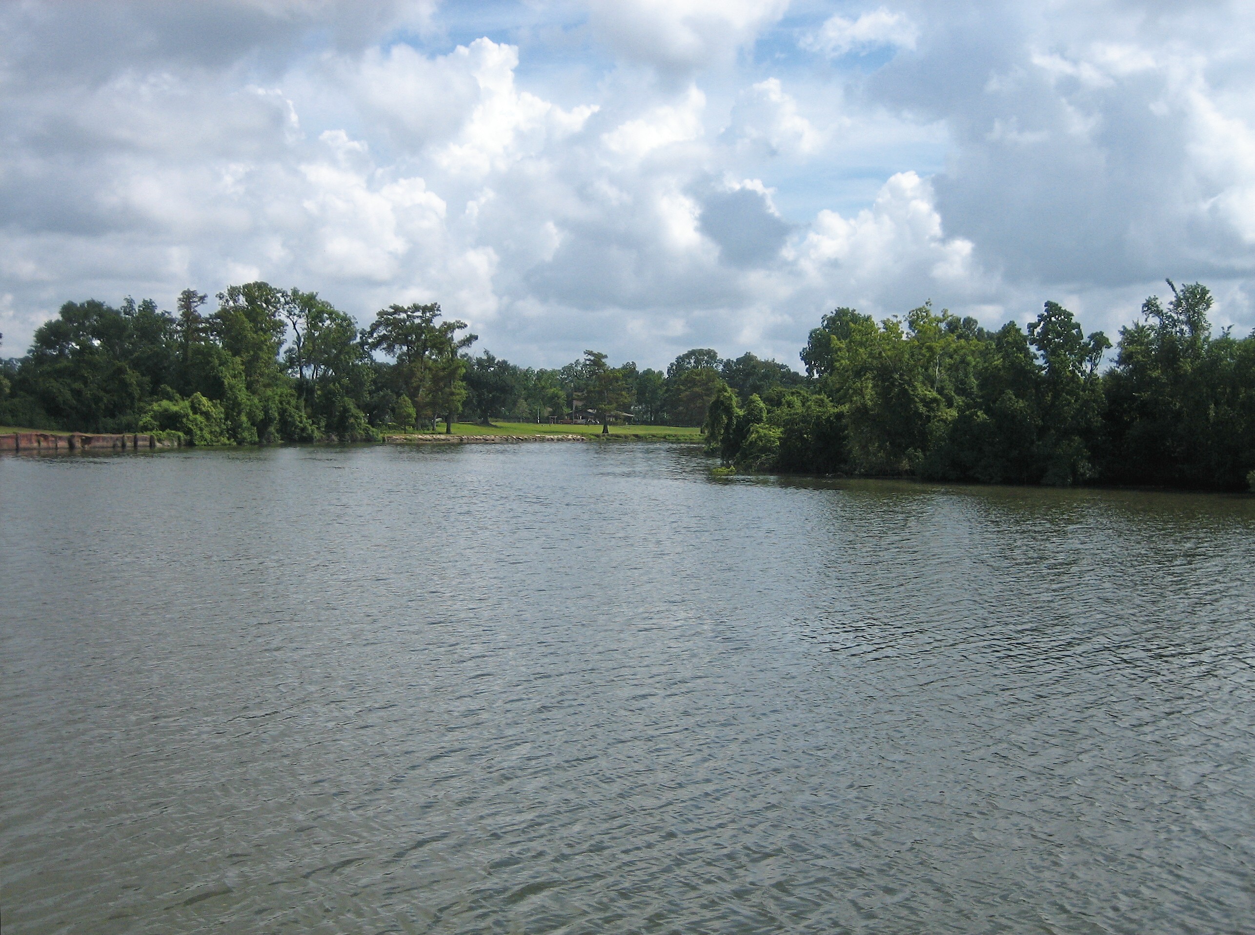
image_caption = Vermilion River in Abbeville.
country =United States
state =Louisiana
city = Lafayette, LA
length_imperial = 72
source_name = Confluence of bayous
source_location =Saint Landry Parish
source_state = LA
source_country = United States
mouth_name =Gulf Of Mexico
mouth_location = Intracoastal
mouth_region = Vermilion Parish
mouth_state = LA
mouth_country = United States
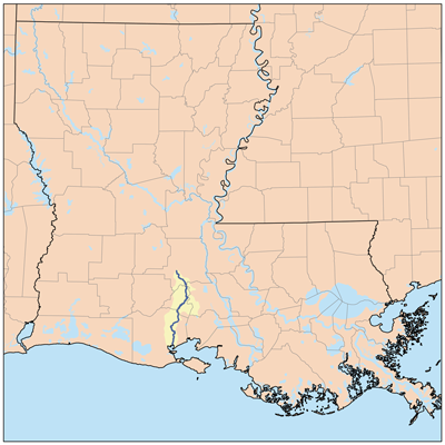
map_size =
map_caption = Vermilion River watershedThe Vermilion River (or The Bayou Vermilion) is a
river , 72 mi (116 km) long, in southernLouisiana in theUnited States . It is formed on the common boundary of Lafayette and St. Martin Parishes by a confluence of smallbayou s flowing from St. Landry Parish, and flows generally southward through Lafayette and Vermilion Parishes, past the cities of Lafayette and Abbeville. At the port of Intracoastal City it is crossed by theGulf Intracoastal Waterway before flowing into Vermilion Bay, an inlet of theGulf of Mexico . The river originates atBayou Fusilier , which is fed byBayou Teche , winds its way through Lafayette Parish, and drains into the Vermilion Bay below Vermilion Parish.The river is a "consequent stream" or a "
tidal river ", which means that the Vermilion was formed from the bottom up. The river began life inVermilion Bay . Tides and other natural actions in the bay slowly eroded away the marshes and other features of the landscape as the river crept northward. This process brought the channel that would one day become the Vermilion River as far north asLafayette, Louisiana . Much later a distributary ofBayou Teche made its way south and eventually linked up with the consequent stream forming a true north-south flowing river. During times of heavy rain events, parts of the Vermilion will reverse itself and flow north. [ [http://bayouvermilion.org bayouvermilion.org "RIVER HISTORY"] ] The reverse flow phenomenon occurs because of the highly developed watershed areas in the City of Lafayette. Rainfall runoff from this urban area enters the Vermion River with larger volumes and at a faster rate. This raises the water level in the Vermilion River along the southern areas of the City of Lafayette. This rise in water levels sometimes exceeds the water level in reaches upstream of the City of Lafayette, thus causing the reverse flow effect. Also when water levels in the Vermilion River exceed certain stages, water begins to enter the Bayou Tortue Swamp Area. This swamp has a very large capacity to hold water, which also contributes to the reverse flow effect. The water from the Vermilion River enters Bayou Tortue Swamp through two Coulees. Coulee Crow and Bayou Tortue are located upstream of the Surrey Street bridge on the Vermilion River.In its early stage of development, the only point in the city where water transportation could be secured was at the site of the Pinhook Bridge. Consequently, property owners and businesses located there. In later years, steamboats ran on the bayou. However, low water levels and submerged logs hampered their ability to travel.
The importance of the Vermilion as a means of transportation and commerce declined with the introduction of the railroad and the paving of all highways leading into Lafayette in
1936 . TheArmy Corps of Engineers also had a significant impact on Bayou Vermilion. Dredging, completed in1944 , gave the bayou a depth of nine feet and a bottom width of 100 feet.A pumping station was built on the
Atchafalaya River nearKrotz Springs with the capacity to pump up to 1,040 cubic feet of fresh water per second intoBayou Courtableu and eventually into the Vermilion River. The Teche-Vermilion Freshwater Project began in1976 and was completed in1982 .Towns Along The River
*
Lafayette Parish
**Stekey, Louisiana
**Pont des Mouton, Louisiana
**Anse La Butte, Louisiana
**Long Bridge, Louisiana
**Lafayette, Louisiana
**Milton, Louisiana *
Vermillion Parish
**Abbeville, Louisiana
**Perry, Louisiana
**Rose Hill, Louisiana
**Banker, Louisiana ee also
*
List of Louisiana rivers References
* [http://reference.allrefer.com/gazetteer/V/V01635-vermilion-river.html Columbia Gazetteer of North America entry]
*DeLorme (2003). "Louisiana Atlas & Gazetteer". Yarmouth, Maine: DeLorme. ISBN 0-89933-286-2.
*Gnis|1628426|Vermilion River, retrieved6 February 2006
Wikimedia Foundation. 2010.