- Nullarbor Regional Reserve
-
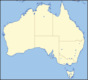
Nullarbor Regional Reserve IUCN Category VI (Managed Resource Protected Area)Nearest town/city Ceduna Coordinates 30°53′27″S 130°33′11″E / 30.89083°S 130.55306°ECoordinates: 30°53′27″S 130°33′11″E / 30.89083°S 130.55306°E Area 2,281,244 ha [1] Established 1989 Managing authorities Department for Environment and Heritage Official site Nullarbor Regional Reserve Nullarbor Regional Reserve is located in South Australia, 300 km west of Ceduna.
Its boundaries are defined by the Trans-Australian Railway to the north and the Nullarbor National Park to the south. Its western boundary is with the Western Australia - South Australian state border. It adjoins Yellabinna Regional Reserve to the east.
The northeastern corner of the reserve is the locations of Ooldea, and central north Cook on the railway line, and the northern boundary is adjacent to the Maralinga Tjarutja Aboriginal lands.
The northern boundary has the abandoned railway locations of Hughes, Denman, Fisher, O'Malley and Watson, as well as being the section of line that is the known as the longest railway straight.
Nullarbor National Park and Nullarbor Regional Reserve protect the world's largest semi-arid cave landscape, which is associated with many Aboriginal cultural sites.[citation needed] Wildlife inhabiting in the park includes the Southern Hairy-nosed Wombat
References
- ^ "List of Protected Areas in South Australia". South Australian National Parks and Reserves. Government of South Australia - Department for Environment and Heritage. 27 June 2008. http://www.environment.sa.gov.au/parks/pdfs/PARKS_PDFS_PROTECTED_AREAS.PDF. Retrieved 4 December 2008.
External links
- A Review of Nullarbor Regional Reserve 1989 - 1999 (pdf) - Department for Environment and Heritage
Protected areas of South Australia National Parks Conservation Parks Acraman Creek · Billiatt · Black Hill · Cape Gantheaume · Cleland · Cox Scrub · Danggali · Deep Creek · Fairview · Finniss · Fort Glanville · Gum Laqoon · Kelly Hill · Hacks Lagoon · Hallett Cove · Horsnell Gully · Kaiserstuhl · Lake Gilles · Mamungari · Marino · Monarto · Morialta · Mount Magnificent · Naracoorte Caves · Ngarkat · Peebinga · Piccaninnie Ponds · Scott Creek · Seal Bay · Simpson Desert · Spring Gully · Talisker
Recreation Parks Regional Reserves Innamincka · Lake Frome · Nullarbor · Simpson Desert · Strzelecki
Conservation Reserves Wilderness Protection Areas Game Reserves Categories:- IUCN Category VI
- Conservation parks of South Australia
- Nullarbor Plain
- Protected areas established in 1989
- 1989 establishments in Australia
- South Australia geography stubs
- South Australia protected area stubs
Wikimedia Foundation. 2010.

