- Mount Greylock
-
Mount Greylock 
Greylock from the West Mountain RoadElevation 3,489 ft (1,063 m) [1] Prominence 2,464 ft (751 m) [2] Listing U.S. State High Points, New England Fifty Finest Location Berkshire County, Massachusetts, United States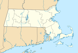
 Mount Greylock
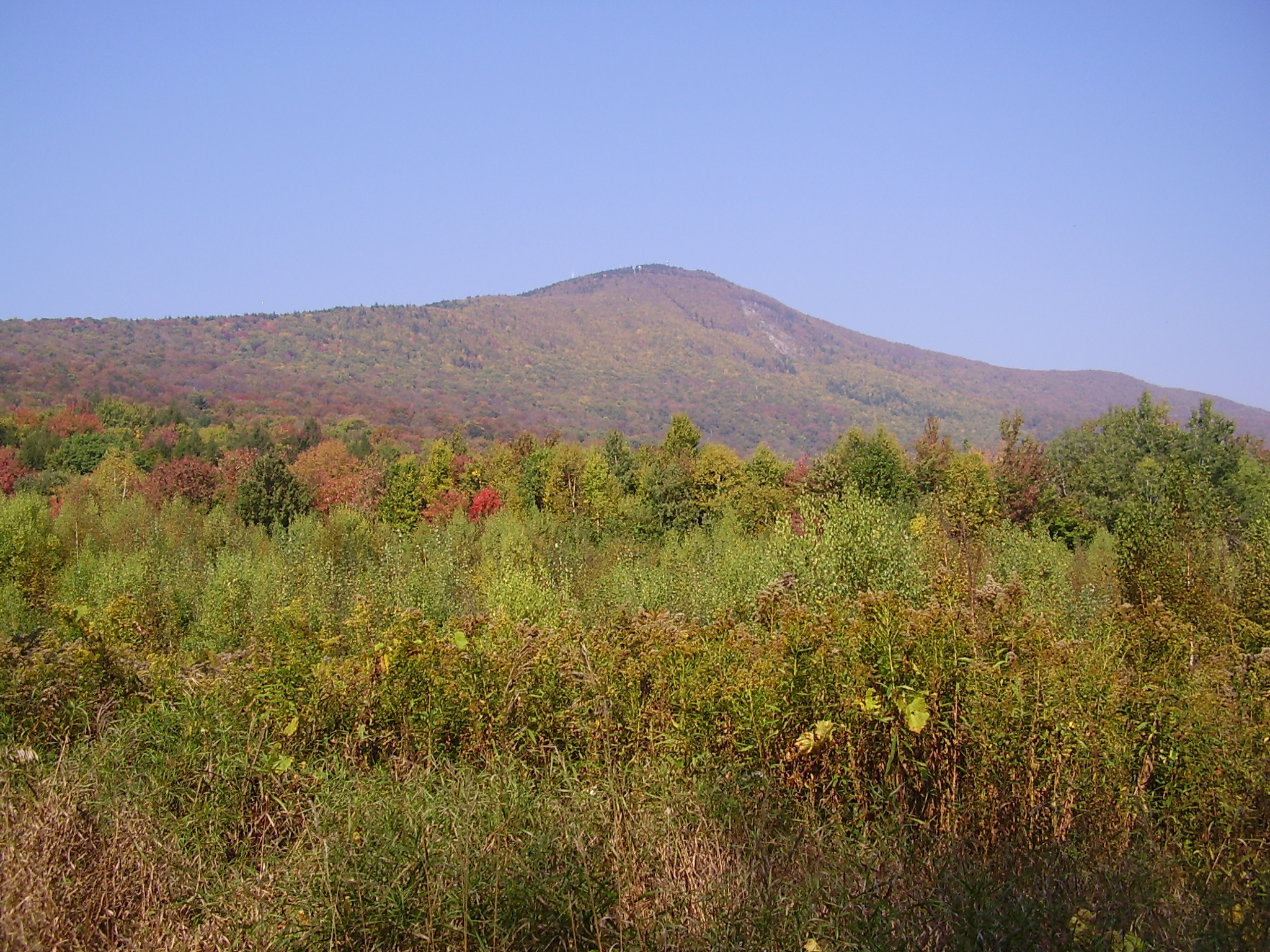
Range Taconic Mountains Coordinates 42°38′13.3″N 73°9′57.3″W / 42.637028°N 73.165917°WCoordinates: 42°38′13.3″N 73°9′57.3″W / 42.637028°N 73.165917°W Geology Type thrust fault Age of rock Ordovician, Taconic orogeny Climbing Easiest route Cheshire Harbor Trail Mount Greylock Summit Historic DistrictLocation: Jct. of Notch, Rockwell, and Summit Rds., Adams, Massachusetts Area: 1,200 acres (4.9 km2)[4] Built: 1830 Architect: Maginnis and Walsh; Vance, Joseph MacArthur, et al. Architectural style: Bungalow/Craftsman, Classical Revival Governing body: State NRHP Reference#: 98000349[3] Added to NRHP: April 20, 1998 Mount Greylock is the highest natural point in Massachusetts at 3,489 feet (1,063 m). Its peak is located in the northwest corner of the state in the western part of the town of Adams (near its border with Williamstown) in Berkshire County. Although geologically part of the Taconic Mountains, Mount Greylock is commonly associated with the abutting Berkshire Hills to the east. The mountain is known for its expansive views encompassing five states and the only taiga-boreal forest in the state. A seasonal automobile road (open annually from late May through November 1) climbs to the summit, where stands the iconic 93-foot-high (28 m) lighthouse-like Massachusetts Veterans War Memorial Tower. A network of hiking trails traverse the mountain, including the 2,179-mile (3,507 km) Appalachian Trail. Mount Greylock State Reservation was created in 1898 as Massachusetts' first public land for the purpose of forest preservation.
Contents
Geography
Geographically, Mount Greylock is part of a 11-mile-long (18 km) by 4.5-mile-wide (7.2 km) island-like range that runs north-south between the Hoosac Range to the east, the Green Mountains to the north, the Berkshires to both the south and east, and the Taconic Mountains to the west with which it is geologically associated; all ranges are associated with the Appalachian mountain chain. The summit of Mount Greylock is located in Adams, Massachusetts, but the mountain also extends into Cheshire, Lanesborough, New Ashford, North Adams and Williamstown. The range includes peaks with elevation less than Greylock, such as Saddle Ball Mountain and Mount Fitch.
On average, Mount Greylock rises 2,000 ft (610 m) above surrounding river valleys and 1,000 ft (300 m) above the Berkshires and Taconic Mountains. From the summit, views of up to 70–135 mi (110–217 km) are possible into five different states: Massachusetts, New York, Connecticut, Vermont, and New Hampshire.[5][6]
The northwest side of Mount Greylock drains into the Green River, then into the Hoosic River, Hudson River, and New York Harbor. The south side of the mountain drains into Town Brook, then into the Housatonic River and Long Island Sound. The rest of the mountain drains into the Hoosic River.[7]
Geology and ecosystem
 Red Spruce
Mount Greylock and the neighboring Taconic Mountains are comprised predominately of Ordovician phyllite, a metamorphic rock, overlain on younger layers of metamorphized sedimentary rock, especially marble. Mount Greylock is the product of thrust faulting, a tectonic process by which older rock is thrust up and above younger rock during periods of intense mountain building. The younger, underlying marble bedrock layers have been quarried in the lower foothills of the mountain in nearby Adams and North Adams, Massachusetts. During the Pleistocene, 18,000 years ago, Mount Greylock and the surrounding region were covered by ice sheets up to 1-kilometer (0.62 mi) in thickness. Glaciation rounded and wore down the mountain, carving out U-shaped valleys and leaving glacial erratics such as the balanced rock on the west side of Greylock. The Hopper, a cirque, also located on the west side of Greylock, is the southernmost such glacial feature in New England.[5][8]
Forests and old growth
During the 19th century, much of the mountain was denuded by logging, fires, and grazing. Forests have since reclaimed the mountain. Several forest communities exist on Mount Greylock. Lower slopes are inhabited by northern hardwood forest species while upper summits are dominated by boreal balsam fir and red spruce. The ridgeline of Greylock, between Mount Fitch on the north and Saddle Ball on the south, is the only place in Massachusetts where a taiga-boreal or sub-alpine forest flourishes. Researchers have identified 555 acres (2.25 km2) of old growth forest on the mountain. The steep western slopes (which include The Hopper) contain northern hardwood forest biome species up to 350 years old, including a 120-foot-tall (37 m) red spruce. Because of its extensive stands of red spruce old growth, The Hopper has been designated a National Natural Landmark.[9][10]
History
Early history and naming
Prior to the arrival of Europeans the Mahican people were closely associated with this region. The traditional trade route connecting the tribes of the Hudson and Connecticut River valleys (today, Route 2, known as the Mohawk Trail) passes beneath the northern flank of Mount Greylock.
The mountain was known to 18th century English settlers as Grand Hoosuc(k). In the early 19th century it was called Saddleback Mountain because of its appearance (Saddle Ball, the name of the peak to the south, still reflects this).[11]
The origin of the present name of Greylock and its association with the mountain is unclear. It first appeared in print about 1819, and came into popular use by the 1830s. It may be in reference to its appearance, as it often has a gray cloud, or lock of gray mist upon his head, or in tribute to a legendary Native American chief, Gray Lock.[11] Gray Lock (c. 1670-1750) was a Western Abenaki Missisquoi chief of Woronoco-Pocomtuc ancestry, born near Westfield, Massachusetts. Gray Lock distinguished himself by conducting guerrilla raids into Vermont and western Massachusetts.[12]
The 1800s
Timothy Dwight IV, President of Yale University, along with Williams College President Ebenezer Fitch, climbed Greylock in 1799, probably over a rough route cut by a local pioneer farmer Jeremiah Wilbur (in that time more land had been cleared on the slopes for farming than today). His account in Travels in New England and New York describes the experience, although he noted the summit vegetation was so thick he and Fitch had to climb a balsam fir tree to get a better view:
“ (Saddle Back) is the highest land in the state […] Its southeastern front is extensively visible throughout Berkshire, and from high elevations in the states of New Hampshire, New York, Vermont, and Connecticut at very great distances […] During a great part of the year, it is either embosomed or capped by clouds, and indicates to the surrounding inhabitants the changes of weather with not a little exactness.[13] ” Williams College, founded in 1793 in nearby Williamstown, has always been closely associated with Greylock and the study of its natural history. On May 12, 1830, a group of students directed by college President Edward Dorr Griffin improved and further cut a trail from the end of the Hopper Road to the summit. Today this route is the Hopper Trail, traditionally climbed by students once a year on Mountain Day.[14]
In May 1831 the first wooden meteorological observatory, "Griffin's Tower", was built on the summit by students. Nine years later, it was replaced by a more substantial 60-foot (20 m) tall wooden observatory tower, from which Donati's Comet was photographed in 1858. In 1863 the first organized hiking and nature study club in the United States, the Alpine Club, was founded by Professor Albert Hopkins. The club frequently camped on the mountain.[15]
By the mid-19th century improved transportation into the region attracted many visitors to Greylock. Among them were writers and artists inspired by the mountain scene: Nathaniel Hawthorne, William Cullen Bryant, Oliver Wendell Holmes, Herman Melville, and Henry David Thoreau.[16]
In the summer of 1838, Hawthorne had visited North Adams, Massachusetts and climbed Mount Greylock several times. His experiences there, specifically a walk he took at midnight where he saw a burning lime kiln, inspired his story, originally titled "The Unpardonable Sin".[17] Hawthorne had not written tales since 1844 when he wrote "Ethan Brand" in the winter of 1848–1849.[18]
Melville is said to have taken part of his inspiration for Moby-Dick from the view of the mountain from his house Arrowhead in Pittsfield, since its snow-covered profile reminded him of a great white Sperm Whale's back breaking the ocean's surface.[19] Melville dedicated his next novel, Pierre, to "Greylock's Most Excellent Majesty", calling the mountain "my own... sovereign lord and king". Thoreau summited and spent a night in July 1844. His account of this event in A Week on the Concord and Merrimack Rivers described his approach up what is today the Bellows Pipe Trail. Scholars contend that this Greylock experience transformed him, affirming his ability to do these excursions on his own, following his brother John's death; and served as a prelude to his experiment of rugged individualism at Walden Pond the following year in 1845.[20]
By the late 19th century, clear-cutting logging practices had stripped much of the mountain for local industries that produced wood products, paper and charcoal. Along with this came devastating forest fires and landslides. Following a fire on the summit,[21] a group of local businessmen concerned about the mountain incorporated the Greylock Park Association (GPA) on July 20, 1885,[22][23] and purchased 400 acres (1.6 km2) on the summit. The GPA also undertook long-needed repairs to the Notch Road so that carriages could access the top. Aside from shares to fund its operation, the GPA charged a 25-cent toll for the carriage road and a 10-cent fee to ascend the iron observation tower (built 1889).[16] These fees are equivalent to $8.53 in present day dollars.[24]
By early 1897, with the GPA venture in debt, conservation interests in the state sought to protect the mountain through other means. Legislation was filed by William H. Chase, editor of the Berkshire Sunday Democrat of North Adams, under the auspices of the Board of Trade of North Adams to transfer the GPA land holdings on the mountain to the Commonwealth of Massachusetts for a state reservation. This included supporting testimony from Williams College geology professor T. Nelson Dale, and a $25,000 appropriation bill filed through Judge Arthur M. Robinson.[25][26] Additional support came from the Massachusetts Forestry Association's initiative to advocate for the establishment of a state park system, and to make the case point, fight inappropriate development of the state's highest peak, Mount Greylock. The principal argument for making the mountain a public reservation was to protect the Hoosic and Housatonic River watersheds from erosion due to recent trends of deforestation (particularly noted on the Adams side). Another concern was to preserve it for the public rather than private and exclusive enjoyment. On June 20, 1898 Mount Greylock State Reservation was created, with the stipulation that the state add to the original land (to ultimately total 10,000 acres (40 km2)). With this acquisition the first public land in Massachusetts for the purpose of forest preservation was created, later to become the state park system. A three-person, governor-appointed Greylock Reservation Commission, a body of Berkshire County government, was entrusted with the care and maintenance of the reservation. The title "Reservation" refers to county management of state land, since there was only one state forester and a handful of state fire wardens in service at the time; similarly other early State Reservation properties in Massachusetts were previously managed and operated by county commissions for the state.[27]
The 1900s
 Veterans War Memorial Tower
In 1906, Berkshire County began survey and construction of another approach, the first direct route from the south to the summit.[28] It was opened to the public on September 16, 1907, running "through six farms ... passing Round’s Rock, a fine view point, and throughout its entire distance affords unsurpassed views of Berkshire hills and valleys lying to the south and west of the reservation".[29] Afterwards the Commission turned its attention to the foot trail development, and by 1913 it was able to boast that 17 trails existed on the mountain.
By 1929, the Appalachian Trail route up Mount Greylock was first cut, and most of the Massachusetts section route was complete by 1931. Due to disputes between the local Berkshire Hills Conference trail group and both the Appalachian Trail Conference and the Appalachian Mountain Club Berkshire Chapter, the trail was in jeopardy of growing back in until the local Mount Greylock Ski Club assumed maintenance in 1937.[30]
The greatest period of development on Mount Greylock occurred in the 1930s. The Massachusetts (Veterans) War Memorial Tower on the summit was constructed (1931–32).[31][32] The Civilian Conservation Corps (CCC) 107th Company, MA camp SP-7, from 1933-1941 made extensive improvements on roads, trails, scenic vistas, firebreaks, forest health improvement, and recreation area development. Some of the more significant CCC features included development of the road system (gravel surfaced) to accommodate automobiles, Adirondack lean-to shelters, the Thunderbolt Ski Shelter, and completion of Bascom Lodge. As a result of increased popularity of winter recreation and downhill skiing, the Mount Greylock Ski Club initiated a plan to create a challenging ski run on Mount Greylock. The planning skills of Dwight J. Francis and Western Massachusetts Winter Sports Council, including input from Williams, Amherst, Smith, Mount Holyoke, and Massachusetts State Colleges, Greenfield Outing Club, and the Green Mountain Club, resulted in the CCC building the Thunderbolt Ski Trail in 1934 (named for its resemblance to a Revere Beach, MA, roller coaster).[33] The lower section of the Thunderbolt Trail was relocated in 1936 by Charles L. Parker.[34][35][36] This ski trail was rated Expert-Class A by the United States Eastern Amateur Ski Association (USEASA, today the United States Ski and Snowboard Association) and later host site for the USEASA Championship Races in 1938[37] and 1940.[38] The trail was used for numerous competitive downhill ski races up until 1959.[39]
Based on the popular response to winter recreation at Mount Greylock, a New York-based group expressed interest to the Greylock Commission to develop a cable tramway and downhill ski area on southwest portion of mountain in 1941.[40] The proposal, though defeated, initiated an ongoing debate between the use of Mount Greylock (State) Reservation for commercial development and open hunting versus conservation purposes.[41][42][43]
In October 1966, following years of legal disputes over the Greylock Commission's perceived abuses of allowing public land for commercial use, a conservation group called the Mount Greylock Protective Association led a campaign that transferred ultimate responsibility for management and operation the mountain from Berkshire County to the state park system.[44][45][46][47]
 The entrance to Rockwell Road, which extends from Lanesborough to the summit of Mount Greylock in Adams.
Structures on the mountain
Today, the 12,500 acres (51 km2) is managed and operated by the Massachusetts Department of Conservation and Recreation, Division of State Parks and Recreation.[48] The staffed Visitors Center in Lanesborough is open year-round (1.5 miles off Route 7) and provides orientation, trail maps, informational brochures, exhibits, and accessible rest rooms. Five lean-to shelters and Mount Greylock Campground are available for backpacking. About 70 mi (110 km) of trails are located on the mountain, including the Appalachian Trail.[9]
 The War Memorial Tower atop Mount Greylock
Prominent features on the summit are the Massachusetts Veterans War Memorial Tower, Bascom Lodge, the Thunderbolt Ski Shelter, and a television and radio tower. Because of the cultural significance of the mountain and excellent examples CCC period park structures, the Mount Greylock Summit Historic District was added to the National Register of Historic Places in on April 20, 1998, reference number 98000349.[3]
The Veterans War Memorial Tower was approved by the state legislature in October 1930, supported by Senator Theodore Plunkett of Adams and Governor Frank G. Allen. The memorial was originally intended to be erected in Boston's Charles River Basin, before plans were changed to build it on Mount Greylock. It was designed by Boston-based architects Maginnis & Walsh, and built by contractors John G. Roy & Son of Springfield in 1931-32 at a cost of $200,000.[49] It takes the form of a perpetually lighted beacon to honor the state's dead from World War I (and subsequent conflicts). The light used to be the strongest beacon in Massachusetts, with a nighttime visible range of up to 70 miles.[50]
The architectural design of the tower, a 93-foot (28 m) tall shaft with eight frieze-framed observation openings, was intended to have no suggestion of Utilitarianism but instead to display classic austerity. It includes some minor Art Deco details such as the decorative eagle on the base which were designed in part by John Bizzozero of Quincy, Massachusetts [Bizzozero also designed details on the Vermont Capitol building]. Inside it is a domed chamber for a reverential shine that was intended to store tablets and war relicts from wartime units in the state's history.[51]
Although local legislators and residents advocated for local stone to be used, it was ultimately quarried from Quincy Granite. In part, it bears the inscription "they were faithful even unto death." One of the inscriptions inside the monument is, "Of those immortal dead who live again in the minds made better by their presence", which is a line from a poem by George Eliot. The translucent globe of light on top, originally illuminated by twelve 1,500 watt lights (now six), is said to be visible at night for 70 mi (110 km). The formal dedication ceremony on June 30, 1933 by Governor Joseph B. Ely was attended by about 1,500 and broadcast nationally over NBC radio.[52]
 Bascom Lodge and Saddle Ball Mtn. looking southwest from the War Memorial Tower.
Bascom Lodge was built between 1932-1938 using native materials of Greylock schist and red spruce.[53] Designed by Pittsfield architect, Joseph McArthur Vance, it displays the rustic architectural design of period park structures. The Greylock Commission had desired to rebuild a more substantial shelter for visitors and hikers to the summit after the previous summit house (built c.1902) burned down in 1929. The initial west wing was constructed in 1932 by Jules Emil Deloye, Jr. The main-central and east wings were completed later 1935-38 by the CCC, supervised by Deloye. The lodge was named in honor of John Bascom, a Greylock Reservation Commissioner and Williams College professor, who had a strong association with the mountain during his lifetime.[54][55]
Today, Bascom Lodge is run by the Bascom Lodge Group, in partnership with the Massachusetts Department of Conservation and Recreation's Historic Curatorship Program.
The Thunderbolt Ski Shelter, also designed by Joseph McArthur Vance, was built in 1940 by the CCC to principally serve as a warming hut for skiers using the Thunderbolt Trail.[56] Also rustic in design and built of stone and wood beams, the interior has four wooden benches built into a large four hearth fireplace in the center.
Greylock Glen, site of a former proposed tramway/ski/resort development from 1953–1977, is a 1,063-acre (4.30 km2) state park located in the town of Adams, adjoining Mount Greylock State Reservation. It was acquired by the state in 1985 to create a regional economic facility in the form of a joint public-private development.[57]
Three radio and television stations transmit from a broadcast tower below the summit on the west side: WAMC (90.3 Albany, New York); WCDC-TV (19/36 Adams, Massachusetts); and W38DL (38 Adams, Massachusetts (Repeater of WNYT-TV). A NOAA Weather Radio station (WWF-48, 162.525 MHz) broadcasts from a different tower on the mountain.[58]
See also
- List of old growth forests in Massachusetts
References
- ^ "Greylock RM 1 Reset". NGS data sheet. U.S. National Geodetic Survey. http://www.ngs.noaa.gov/cgi-bin/ds_mark.prl?PidBox=MZ1957.
- ^ "Mount Greylock, Massachusetts". Peakbagger.com. http://www.peakbagger.com/peak.aspx?pid=7065.
- ^ a b "National Register Information System". National Register of Historic Places. National Park Service. 2009-03-13. http://nrhp.focus.nps.gov/natreg/docs/All_Data.html.
- ^ "MASSACHUSETTS - Berkshire County - Historic Districts". National Register of Historic Places. http://www.nationalregisterofhistoricplaces.com/MA/Berkshire/districts.html. Retrieved 2011-01-06.
- ^ a b Raymo, Chet; Raymo, Maureen E. (1989). "Written in Stone: A Geologic History of the Northeastern United States". Chester, Connecticut: Globe Pequot.
- ^ Massachusetts Trail Guide. Boston: Appalachian Mountain Club. 2004.
- ^ DeLorme (2004). DeLorme Topo 6.0 (Map).
- ^ "Natural History of the Berkshires". Williams College. http://drm.williams.edu/nhb/. Retrieved 2008-03-09.
- ^ a b "Nature and Science". Mount Greylock Reservation. Massachusetts DCR. http://www.mass.gov/dcr/parks/mtGreylock/nature.htm. Retrieved 2008-03-08.
- ^ Mary Byrd Davis (23 January 2008). "Old Growth in the East: A Survey". http://www.primalnature.org/ogeast/survey.html. Retrieved 2008-12-31.
- ^ a b "Mount Greylock State Reservation". Berkshire web.com. http://www.berkshireweb.com/mohawktrail/mtgreylock.html. Retrieved 2008-03-06.
- ^ Calloway, Colin G. (1990). The Western Abenakis of Vermont, 1600-1800: War, Migration, and the survival of an Indian people. University of Oklahoma Press.
- ^ Dwight, Timothy IV (Reprinted 1969) Travels in New England and New York Ed. Barbara Miller Solomon. Cambridge, Massachusetts: The Belknap Press of Harvard University Press.
- ^ "Williams College Traditions". Williams College. http://web.williams.edu/home/traditions/. Retrieved 2008-03-06.
- ^ Fanto, Clarence (2007-08-07). The Berkshire Eagle. http://www.cablemills.com/home/news/the_berkshire_eagle090707.html. Retrieved 2008-03-06.
- ^ a b "The Romantic Period". Mount Greylock Reservation. Massachusetts DCR. http://www.mass.gov/dcr/parks/mtGreylock/romantic.htm. Retrieved 2008-03-09.
- ^ Ehrlich, Eugene; Carruth, Gorton (1982). The Oxford Illustrated Literary Guide to the United States. New York: Oxford University Press. p. 54. ISBN 0195031865.
- ^ Miller, Edwin Haviland (1991). Salem is my Dwelling Place: A Life of Nathaniel Hawthorne. Iowa City: University of Iowa Press. p. 263. ISBN 0877453322.
- ^ "Welcome to Herman Melville's Arrowhead". Mobydick.org. http://www.mobydick.org/hm.html. Retrieved 2008-03-09.
- ^ Thoreau, Henry David; Howarth, William L. (1983). Thoreau In The Mountains: Writings By Henry David Thoreau. New York: Farrar, Straus, Giroux. ISBN 0374276439.
- ^ Hoosac Valley News. 1884-07-19.
- ^ Massachusetts (1885). "Chapter 166". Acts and resolves passed by the General Court. ISBN 0543931773. http://www.archive.org/details/actsresolvespass1885mass.
- ^ Bascom, John (1907). Greylock Reservation. Press of the Sun. pp. 14–15.
- ^ Consumer Price Index (estimate) 1800–2008. Federal Reserve Bank of Minneapolis. Retrieved December 7, 2010.
- ^ Springfield Sunday Republican. 1898-02-20.
- ^ Springfield Republican. 1898-03-03.
- ^ "Massachusetts' First State Park". Mount Greylock Reservation. Massachusetts DCR. http://www.mass.gov/dcr/parks/mtGreylock/firstStatePark.htm. Retrieved 2008-03-09.
- ^ Massachusetts (1906). "Chapter 419". Acts and resolves passed by the General Court. ISBN 0543931773. http://www.archive.org/details/actsresolvespass1906mass.
- ^ Berkshire County Eagle. 1907-09-17.
- ^ Waterman, Laura; Waterman, Guy (1986-08-01). "Trail Builders". Berkshire Week.
- ^ Massachusetts (1930). "Chapter 411". Acts and resolves passed by the General Court. ISBN 0543931773. http://www.archive.org/details/actsresolvespass1930mass.
- ^ Boston Evening Transcript. 1930-10-02.
- ^ North Adams Transcript. 1934-10-11.
- ^ Berkshire Eagle. 1936-08-27.
- ^ Berkshire Eagle. 1936-09-10.
- ^ Berkshire Eagle. 1961-07-12.
- ^ Berkshire Eagle. 1938-02-07.
- ^ Berkshire Eagle. 1942-03-02.
- ^ Journal of the New England Ski Museum (61): 7–12. autumn 2004.
- ^ Berkshire Eagle. 1941-05-29.
- ^ Berkshire Eagle. 1949-02-18.
- ^ Berkshire Eagle. 1949-03-04.
- ^ Berkshire Eagle. 1949-03-09.
- ^ Tague, William H. (1967). "The Rise and Evaporation of the Greylock Tramway Authority". Berkshire Review (Williams College,) III (1).
- ^ Massachusetts (1966). "Act 415 Chap. 0444 An Act abolishing the greylock reservation commission And Transferring The Care And Maintenance Of The Greylock State Reservation To The Department Of Natural Resources.". Acts and resolves passed by the General Court. http://archives.lib.state.ma.us/handle/2452/15812.
- ^ Berkshire Eagle. 1966-06-29.
- ^ Berkshire Eagle. 1966-07-26.
- ^ "Mount Greylock State Reservation". Massachusetts Department of Conservation and Recreation. http://www.mass.gov/dcr/parks/mtGreylock/. Retrieved 2011-01-14.
- ^ Massachusetts (1933). "Chapter 336, Section 2". Acts and resolves passed by the General Court. http://www.archive.org/details/actsresolvespass1933mass.
- ^ Harris, Pat; Lyon, David (2006). You Know You're in Massachusetts When.... New York: Globe Pequot. http://books.google.com/books?id=y6_RiAL3Lg8C&pg=PA68&lpg=PA68&dq=%22Veterans+War+Memorial+Tower%22+%2B+lighthouse.
- ^ Massachusetts Department of Environmental Management (1997-09-04). "Section 7". Mount Greylock Summit National Register Nomination.
- ^ "Mount Greylock Memorial is Dedicated Today". North Adams Transcript. 1933-06-30.
- ^ "Bascom Lodge". http://www.bascomlodge.net.
- ^ Springfield Sunday Union & Republican. 1938-03-27.
- ^ Berkshire Evening Eagle. 1938-08-11.
- ^ Greylock State Reservation Commission Report for 1940
- ^ Comm. of MA, Chap. 676, Acts of 1985
- ^ "NWR Station Listings for Massachusetts". NOAA. 2009-10-03. http://www.nws.noaa.gov/nwr/stations.php?State=MA.
External links
- Mount Greylock Expeditionary Force, Amateur Radio Club
- Bascom Lodge, Operated by Bascom Lodge Group
- Hiking Trail Mileages, Mount Greylock State Reservation
- Birds of Mount Greylock
- Wildflowers of Mount Greylock
- Thunderbolt Ski Run, an alpine racing trail from the 1930s still used recreationally today
- Mount Greylock Scenic Byway
- Mt. Greylock - New England Lost Ski Areas Project - Details on abandoned ski area on east face
U.S. State Highest Natural Points Alabama • Alaska • Arizona • Arkansas • California • Colorado • Connecticut • Delaware • Florida • Georgia • Hawaii • Idaho • Illinois • Indiana • Iowa • Kansas • Kentucky • Louisiana • Maine • Maryland • Massachusetts • Michigan • Minnesota • Mississippi • Missouri • Montana • Nebraska • Nevada • New Hampshire • New Jersey • New Mexico • New York • North Carolina • North Dakota • Ohio • Oklahoma • Oregon • Pennsylvania • Rhode Island • South Carolina • South Dakota • Tennessee • Texas • Utah • Vermont • Virginia • Washington • West Virginia • Wisconsin • Wyoming
U.S. National Register of Historic Places Topics Lists by states Alabama • Alaska • Arizona • Arkansas • California • Colorado • Connecticut • Delaware • Florida • Georgia • Hawaii • Idaho • Illinois • Indiana • Iowa • Kansas • Kentucky • Louisiana • Maine • Maryland • Massachusetts • Michigan • Minnesota • Mississippi • Missouri • Montana • Nebraska • Nevada • New Hampshire • New Jersey • New Mexico • New York • North Carolina • North Dakota • Ohio • Oklahoma • Oregon • Pennsylvania • Rhode Island • South Carolina • South Dakota • Tennessee • Texas • Utah • Vermont • Virginia • Washington • West Virginia • Wisconsin • WyomingLists by territories Lists by associated states Other  Category:National Register of Historic Places •
  Portal:National Register of Historic PlacesCategories:
- Historic districts in the United States
- Taconic Mountains
- Mountains of Berkshire County, Massachusetts
- Highest points of U.S. states
- National Natural Landmarks in Massachusetts
- Mountains on the Appalachian Trail
- Defunct ski areas and resorts in Massachusetts
- North Adams, Massachusetts
- Historic districts in Massachusetts
- Civilian Conservation Corps in Massachusetts


Wikimedia Foundation. 2010.