- Gooseberry Hill, Western Australia
-
Gooseberry Hill
Perth, Western Australia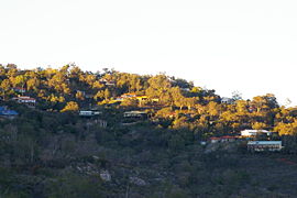
Gooseberry Hill viewed from the Kalamunda Zig Zag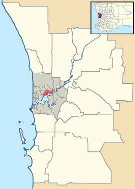
 Gooseberry Hill
Population: 3210 (2006 census)[1] Postcode: 6076 Location: 25 km (16 mi) from Perth, Western Australia LGA: Shire of Kalamunda State District: Kalamunda Federal Division: Hasluck Suburbs around Gooseberry Hill: Hazlemere Helena Valley Darlington Maida Vale Gooseberry Hill Piesse Brook Forrestfield Kalamunda Kalamunda Coordinates: 31°57′14″S 116°02′56″E / 31.954°S 116.049°E
Gooseberry Hill is a suburb of Perth, Western Australia, located within the Shire of Kalamunda. It is the site of Gooseberry Hill National Park.
It is located at the highest point south of the departure of the Helena River from the Darling Scarp on to the Swan Coastal Plain. It is often associated with the railway formation of the Kalamunda Zig Zag, and the northern most high feature of Statham's Quarry which lie on the north west of the locality within national park land.
Gooseberry Hill was the location of a war-time tragedy when a United States Navy C-47 Skytrain (DC-3) plane crashed in heavy fog on 19 April 1945 after taking off from Guildford Airport (later Perth Airport).[2] All of the ten US servicemen and three US Red Cross women on board were killed.[3][4] The plane crashed between Gooseberry Hill Road and Lansdown Road, 4.5 miles (7.2 km) from the end of the take-off runway, having travelled in an almost straight course to the point of impact.[2]
References
- ^ Australian Bureau of Statistics (25 October 2007). "Gooseberry Hill (State Suburb)". 2006 Census QuickStats. http://www.censusdata.abs.gov.au/ABSNavigation/prenav/LocationSearch?collection=Census&period=2006&areacode=SSC51536&producttype=QuickStats&breadcrumb=PL&action=401. Retrieved 2008-10-05.
- ^ a b "Crash of a US Navy R4D-5 (DC-3), "Blue Goose" at Gooseberry Hill, Kalamunda near Perth, WA on 19 April 1945". ozcrashes. http://home.st.net.au/~dunn/ozcrashes/wa27.htm.
- ^ Thirteen dead : U.S.N. transport plane crashes at Gooseberry Hill. (19 April 1945, a United States Navy C47 transport airplane crashed at Gooseberry Hill. Killed US servicemen, 1 officer of the Royal Navy and 3 U.S. Red Cross workers).The West Australian, 20 April 1945, p.6f
- ^ Crash victims, burial yesterday The funeral for the victims of the crash of the C47 transport airplane at Gooseberry Hill, 19 April 1945. The U.S. servicemen and the Royal Navy officer buried at Karrakatta, the 3 Red Cross workers repatriated to Sydney. The West Australian, 24 April 1945, p.4e
Suburbs of the Shire of Kalamunda | Perth | Western Australia Bickley · Canning Mills · Carmel · Forrestfield · Gooseberry Hill · Hacketts Gully · High Wycombe · Kalamunda · Lesmurdie · Maida Vale · Paulls Valley · Pickering Brook · Piesse Brook · Reservoir · Walliston · Wattle Grove
Categories:- Suburbs of Perth, Western Australia
- Darling Range
- Perth, Western Australia geography stubs


Wikimedia Foundation. 2010.