- Makah Reservation
-
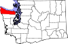
Makah Reservation is an Indian reservation for the Makah located on the most northwestern tip of the Olympic Peninsula in Clallam County, Washington, USA. The northern boundary of the reservation is the Strait of Juan de Fuca. The western boundary is the Pacific Ocean. It has a land area of 121.451 square kilometres (46.892 sq mi) and a 2000 census resident population of 1,356 persons. Its largest community is Neah Bay.
The Makah are native North Americans who in the early 19th century inhabited Cape Flattery, Washington. According to Lewis and Clark, they then numbered some 2,000. The Makah are the southernmost of the Wakashan group, being the only member of the Wakashan group within the United States. Makah culture was fundamentally that of the Pacific Northwest Coast area. In 1855 they ceded all their lands to the United States except a small area on Cape Flattery that was set aside as a reservation. Today most of the 1,600 Makah in the United States live on the Makah Reservation; their main tribal income is from forestry.
Non-tribal members visiting the reservation are required to purchase a pass upon entering the reservation. Guests on official business are given a free pass.
See also
References
- Makah Reservation, Washington United States Census Bureau
External links
- makah.com - The official site of the Makah Tribe.
- The Makah Tribe: People of the Sea and the Forest
- Makah Tribal Profile
- Makah Prepare to Hunt Whales
- Makah Tribe's trail eases access to a wild stretch of coastline, Andrew Engelson, Seattle Post-Intelligencer, 20 November 2003
- Forks Guide - S.R. 112 to Neah Bay
Coordinates: 48°19′20″N 124°37′57″W / 48.32222°N 124.6325°W
Municipalities and communities of Clallam County, Washington Cities Forks | Port Angeles | Sequim
CDPs Bell Hill | Blyn | Carlsborg | Neah Bay | Port Angeles East | River Road
Unincorporated
communitiesAgnew | Beaver | Clallam Bay | Diamond Point | Dungeness | Elwha | Fairholm | Joyce | La Push | Ozette | Piedmont | Sappho | Schoolhouse Point | Sekiu
Indian reservations Lower Elwah Reservation | Makah Reservation
Categories:- Geography of Clallam County, Washington
- American Indian reservations in Washington (state)
- Indigenous peoples of North America stubs

Wikimedia Foundation. 2010.