Gürgentepe

Gürgentepe

Infobox Settlement

settlement_type = Town
subdivision_type = Country
subdivision_name = TUR
timezone=EET
utc_offset=+2
map_caption =Location of PAGENAME within Turkey.
timezone_DST=EEST
utc_offset_DST=+3

official_name = Gürgentepe


image_caption =
image_blank_emblem =
blank_emblem_type =


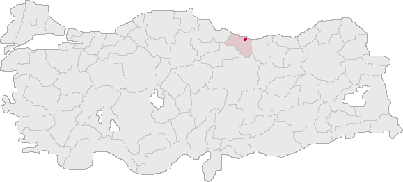
subdivision_type1=Region
subdivision_name1 = Black Sea
subdivision_type2=Province
subdivision_name2 = Ordu| population_total = 39884|population_footnotes=
population_as_of =| 2003
population_footnotes =
population_density_km2 =
area_total_km2 = 221|elevation_m = 1120|latd = 40
latm = 47
latNS = N
longd = 37
longm = 36
longEW = E
postal_code_type=Postal code
postal_code = 52
area_code = 0452
blank_info = 52|blank_name=Licence plate
leader_title=Mayor
leader_name = Selim Ölmez
website =

Gürgentepe is a small town and a mountainous district of Ordu Province in the Black Sea region of Turkey, convert|48|km|mi|0|abbr=on inland from the city of Ordu.

Gürgentepe is a district of steep mountain valleys on the road between the cities of Ordu and Sivas, both transportation and agriculture are very difficult. The climate is typical of the Black Sea region with the north winds bringing humidity and much rain off the sea, although the inland side of the mountains have a dry climate. Most of the district is mountainside covered with forest and shrubs, trees including oak, chestnut and alder. The soil is volcanic, fertile and watered by mountain streams but most of the land is too steep for planting.


Wikimedia Foundation. 2010.

Игры ⚽ Нужно сделать НИР?

Look at other dictionaries:

  • Gürgentepe — Administration Pays …   Wikipédia en Français

  • Gurgentepe — Original name in latin Grgentepe Name in other language Akmescit, Gurgentepe, Grgentepe State code TR Continent/City Europe/Istanbul longitude 40.78833 latitude 37.60167 altitude 1250 Population 18771 Date 2012 01 18 …   Cities with a population over 1000 database

  • Gürgentepe — is., öz. Ordu iline bağlı ilçelerden biri …   Çağatay Osmanlı Sözlük

  • Ordu Province — Ordu ili   Province of Turkey   Location of Ordu Province in Turkey …   Wikipedia

  • Ordu (Provinz) — Ordu Nummer der Provinz: 52 Landkreise …   Deutsch Wikipedia

  • List of cities in Turkey — The National Flag of Turkey This list is incomplete; you can help by expanding it. This is a list of cities in Turkey by population. Included are cities that are provincial capitals or have a population of at least 7,000 …   Wikipedia

  • Ordu — Not to be confused with Urdu language. Ordu   Town   View of Ordu from Boztepe hill …   Wikipedia

  • Ünye —   Town   …   Wikipedia

  • Districts of Turkey — Republic of Turkey This article is part of the series: Politics and government of the Republic of Turkey …   Wikipedia

  • Districts de Turquie — Les 81 provinces de Turquie sont divisées en 923 districts (ilçeler; singulier: ilçe). Aux débuts de la République Turque comme dans l Empire ottoman, l unité correspondante était le kaza. Le district porte usuellement le même nom que la capitale …   Wikipédia en Français

Share the article and excerpts

Direct link
Do a right-click on the link above
and select “Copy Link”