- Derinkuyu
-
Derinkuyu — District — Derinkuyu Underground City Location of Derinkuyu within Turkey.
Coordinates: 38°22′N 34°44′E / 38.367°N 34.733°E Country  Turkey
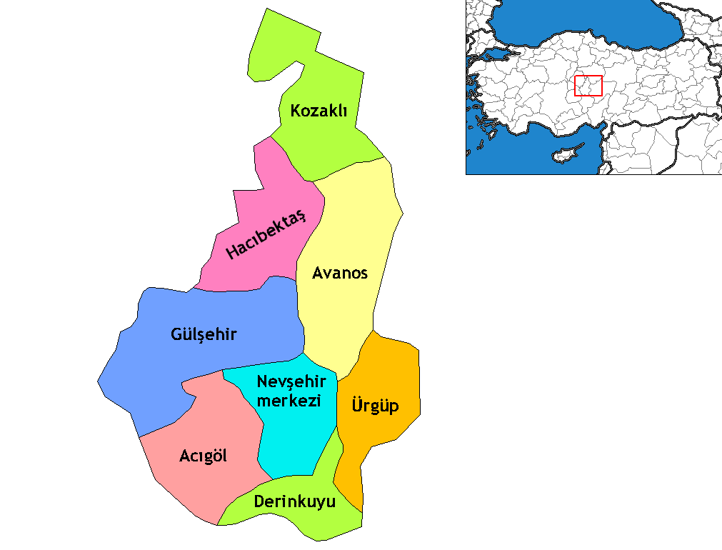
Region Central Anatolia Province Nevşehir Government – Governor Murat Duru – Mayor Ahmet Balcı (MHP) Area – District 445 km2 (171.8 sq mi) Elevation 1,300 m (4,265 ft) Population (2010)[1] – Density 55.35/km2 (143.4/sq mi) – Urban 10,679 Time zone EET (UTC+2) – Summer (DST) EEST (UTC+3) Postal code 50xxx Area code(s) 0384 Licence plate 50 Website www.derinkuyu.gov.tr Derinkuyu is a town and district of Nevşehir Province in the Central Anatolia region of Turkey. According to 2010 census, population of the district is 22,114 of which 10,679 live in the town of Derinkuyu.[1][2] The district covers an area of 445 km2 (172 sq mi),[3] and the average elevation is 1,300 m (4,265 ft), with the highest point being Mt. Ertaş at 1,988 m (6,522 ft).
Located in Cappadocia, Derinkuyu is notable for its large multi-level underground city (Derinkuyu Underground City), which is a major tourist attraction. The historical region of Cappadocia, where Derinkuyu is situated, contains several historical underground cities, carved out of a unique geological formation, and were largely used by early Christians as hiding places. They are not generally occupied. Over 200 underground cities at least two levels deep have been discovered in the area between Kayseri and Nevşehir, with around 40 of those having at least three levels. The troglodyte cities at Derinkuyu and Kaymaklı are two of the best examples of underground dwellings.
Contents
History
The oldest written source about underground cities is the writings of Xenophon. In his Anabasis he writes that the people living in Anatolia had excavated their houses underground, living well in accommodations large enough for the family, domestic animals, and supplies of stored food.[4]
Derinkuyu Underground City provided a refuge for the region's inhabitants such as Christians through the ages, for early Christians as well as possibly earlier dwellers, to Greeks hiding from the raids of the Umayyad Arab and Abbasid armies. The cities contained food stores, kitchens, stalls, churches, wine and oil presses, ventilation shafts, wells, and a religious school. The Derinkuyu underground city has at least eight levels and depth of 85 m and could have sheltered thousands of persons.
See also
- Avanos
- Churches of Göreme, Turkey
- Eskigümüş Monastery
- Ihlara Valley
- Mokissos
- Özkonak Underground City
- Zelve Monastery
Notes
- ^ a b Statistical Institute
- ^ GeoHive. "Statistical information on Turkey's administrative units" (in English). http://www.xist.org/cntry/turkey.aspx?levels=Ic%20Anadolu. Retrieved 2008-04-14.
- ^ Statoids. "Statistical information on districts of Turkey" (in English). http://www.statoids.com/ytr.html. Retrieved 2008-04-14.
- ^ Xen. An. 4.5.24-7.
References
- Falling Rain Genomics, Inc. "Geographical information on Derinkuyu, Turkey" (in English). http://www.fallingrain.com/world/TU/50/Derinkuyu.html. Retrieved 2008-04-14.
- Governorship of Derinkuyu, Turkey. "General information on Derinkuyu, Nevşehir" (in Turkish). http://www.derinkuyu.gov.tr/index.php?sayfa=cografya. Retrieved 2008-04-14.
External links
- District governor's official website (Turkish)
- District municipality's official website (Turkish)
- The Underground City Of Derinkuyu
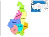
 Derinkuyu in Nevşehir Province (in the Central Anatolia region) of Turkey
Urban districts 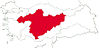
Rural districts RegionsAegean Black Sea Central Anatolia Eastern Anatolia Marmara Mediterranean Southeastern Anatolia Coordinates: 38°22′25″N 34°44′05″E / 38.37361°N 34.73472°E
Categories:- Districts of Nevşehir
- Central Anatolia Region
- Nevşehir
- Towns in Turkey
- Cappadocia
- Populated places in Nevşehir Province

Wikimedia Foundation. 2010.