- Yusufeli
Infobox Settlement
settlement_type = Town
subdivision_type = Country
subdivision_name = TUR
timezone=EET
utc_offset=+2
map_caption =Location of PAGENAME within Turkey.
timezone_DST=EEST
utc_offset_DST=+3official_name = Yusufeli
image_caption =
image_blank_emblem =
blank_emblem_type =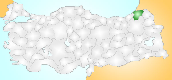
subdivision_type1=Region
subdivision_name1 = Black Sea
population_total = 29133|population_footnotes=
urban population| =
population_as_of = 2000
population_footnotes =
population_density_km2 =
area_total_km2 = 2327|elevation_m = 696|postal_code_type=Postal code
postal_code = 08
blank_info = 08|blank_name=Licence plate
area_code = 466
leader_title=Mayor
leader_name = YUSUF SAĞLAM (Milliyetçi Hareket Partisi - MHP)
website = http://www.yusufeli.bel.tr/
leader_title1=Governor
leader_name1 = CAHİT ÇELİK
gwebsite = http://www.yusufeli.gov.trYusufeli is a town and district of
Artvin Province in the Black Sea region ofTurkey . It is located on the bank of Çoruh River 104 km south-west of the city ofArtvin , on the road toErzurum .The town of Yusufeli (population 6,364) sits in a valley where the
Çoruh River is joined by the Barhal, the surrounding countryside is a range of mountains running east to west, with villages in other valleys between the mountains; little of Yusufeli is flat and this is a beautiful landscape, with streams, lakes and excellent views.The micro climate allows the cultivation of olives, grapes, and citrus fruits, the driving forces of the economy in addition to tourism. The town can be reached by air via
Erzurum Airport , convert|135|km|mi|0|abbr=on away from Yusufeli or by road from Artvin, Erzurum andTrabzon (viaİspir inErzurum Province ).With many kind of tourism facilities like rafting and many other water sports, tracking, mountain climbing, hunting, camping, photography, floristry, historical castles and churches and natural beauties Yusufeli is an excellent tourism location.
There is a widely-criticised plan to dam the Çoruh at Yusufeli, which would submerge 15,000 homes. [ [http://www.rivernet.org/turquie/yusufeli.htm The Yusufeli dam project ] ] [ [http://www.foe.co.uk/campaigns/corporates/success_stories/amec_pull_out.html Friends of the Earth: Campaigns: Corporates: AMEC and Spie pull out of Yusufeli Dam ] ] [ [http://www.ilisu.org.uk/news28.html Balfour Beatty withdraws support for the Ilisu Dam ] ]
History
The history of Yusufeli, formerly Perterek or Pertarek, is traced to 3000 BC, the Bronze Age. The area has since been inhabited by
Hurri ,Urartu ,Persian s,Ancient Roman s,Byzantine s,Georgians andArmenians . In the Turkish era the area has been settled bySeljuks ,Saltuk s,Ilkhanate s,Tamerlan ,Akkoyunlu ,Safevids and theOttoman Empire . In 1879 the area was the district of Kiksim in the county of Çıldır. Then following the war between the Ottoman Empire and Russia it became a county of Erzurum.Because of the rocky geography it was difficult for people from all villages to reach the city center, so a local district was established centred on Ögdem, but this was still inaccessible so Kılıçkaya (Ersis) became the center of county. (Ersis means "a place where no boys live", so-called because so many sons of the district were lost in the
Russo-Turkish War of 1878 andFirst World War . In the year 1912 the county name became Yusuf İli, i.e. "province of Yusuf" so the name Kiskim should not be confused with the name Keskin which was a county of Ankara at that time.Culture
The folk music and culture is typical of the
Black Sea region featuring the clarinet typezurna , a drum and bagpipes; much of the population is of Turkish ethnicity.There are a number of historical Georgian churches in the valleys of Yusufeli, including the ruins of four churches ("dört kilise') in a village off the road to
İspir . [ [http://www.yusufeli.gov.tr/mesafeler_e.html see; map]Places of interest
There are many medieval forts and Georgian churches in the valleys of Yusufeli. Some of them [ [http://www.karalahana.com/karadeniz/yusufeli-tarihi-eserler.htm Yusuefli forts and monasteries (Turkish)] ] :
*
Armashen fortress
*Ersis fortress
*Nihak fortres
*Oshnak fortress
*Ishan monastery
*Ogdem fortress
*Peterek fortress
*Parhal momnastery
*Savangin pre-historical cave with a aninscription written unknown or unsolvedalphabet [ [http://www.karalahana.net/fotograf/displayimage.php?album=5&pos=29 picture of Savagin cave's inscription] ]Notable natives
* The singer and politician
Zülfü Livaneli was born into a family from Yusufeli.
* The mayor ofIstanbul ,Kadir Topbaş was born in Yusufeli.References
External links
* [http://www.yusufeli.gov.tr Governor's Office]
* [http://www.yusufeli.gov.tr/turkcetanitim/video1.html Yusufeli-video]
* [http://www.yusufeli.bel.tr/ the Municipality]
* [http://www.yusufelim.com Local information website with a photo gallery]
* [http://www.yerelnet.org.tr/iller/ilce.php?il_adi=ARTV%DDN&ilce_adi=%DEAV%DEAT local information] tr icon
Wikimedia Foundation. 2010.