- Dabie Mountains
-
Dabie Mountains Location in China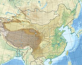
 Dabie Mountains
Elevation 1,774 m (5,820 ft) Location Location China Coordinates 31°15′N 115°00′E / 31.25°N 115°ECoordinates: 31°15′N 115°00′E / 31.25°N 115°E The Dabie Mountains (Chinese: 大别山; Pinyin: Dàbié Shān) are a major mountain range located in central China. Running northwest-to-southeast, they form the main watershed between the Huai and Yangtze rivers. The range also marks the boundary between Hubei Province and its neighbors of Henan (to the north) and Anhui (to the east).
The western part of Dabie Mountains has a low elevation of only 1,000–1,300 feet (300–400 meters), though there are a few peaks rising to 3,000 feet (900 meters). The eastern part is higher, averaging more than 3,300 feet (1,000 meters). The highest peak is Mount Huo at 5,820 feet (1,774 meters), with several others topping 5,000 feet (1,500 meters) including the 1,729.13 metres (5,673.0 ft) high Tiantangzhai.
Contents
Landscape
 Dabie Mountains in Jinzhai County, Anhui, seen from the Hewu Railway
The range is heavily forested (about 85% coverage) and yields valuable bamboo as well as oak, particularly cork oak, making it China's chief cork-producing area. The region is very poor, and subsistence agriculture is the heart of its economy with rice and tea predominating.
The main transportation route across the higher range is from Macheng in Hubei to Huangchuan in Hunan, through the Huai River valley. The main rail and road crossings go north from Wuhan, through the lower elevations.
In 2009, the high-speed Hewu Passenger Railway opened, connecting Hefei (capital of Anhui) with Wuhan (capital of Hubei) along a short direct route. It uses a number of tunnels when crossing the Dabie range.
Geology
Geologically, the range is a complex, stressed structure, making it and the surrounding area subject to earthquakes. In late 2005, a 5.7 magnitude earthquake centered in the northwest corner of Jiangxi province, just south of Jiujiang on the Yangtze killed at least 15 people, injured hundreds, and left several thousand people homeless. It caused tremors in Qichun County in Hubei province and beyond, even reaching as far as the provincial capital of Wuhan.
International Forest Park
This scenic park centered around Tiantangzhai is a key tourist attraction in the highest part of the Dabie mountain range. Total area of the park is 300 square kilometers. Located in Hubei province's Luotian County and close to the border with Anhui Province, the park is about 68 kilometers from Luotian town, 140 kilometers from Macheng, 150 kilometers from Huangshi, and 210 kilometers from the Hubei provincial capital, Wuhan.
References
- Dabeishan International Forest Park website (with many photographs), in Chinese.
- Huanggang Government website page on Dabie Mountains (in Chinese)
Mountain ranges of China Geography of China Ailao Mountains · Altai Mountains · Argu Tagh · Changbai Mountains · Daba Mountains · Dabie Mountains · Dalou Mountains · Daxue Mountains · Dzungarian Alatau · Greater Khingan · Helan Mountains · Hengduan Mountains · Himalayas · Jiuling Mountains · Jiuyi Mountains · Karakoram · Kunlun Mountains · Lesser Khingan · Luoxiao Mountains · Lüliang Mountains · Huangshan · Jingshan Mountains · Mount Lang · Min Mountains · Mufu Mountains · Nanling Mountains · Pamir Mountains · Qian Mountains · Qinling Mountains · Qionglai Mountains · Taihang Mountains · Tarbagatai Mountains · Tian Shan · Tanggula Mountains · Wanda Mountains · Wudang Mountains · Wuling Mountains · Wuyi Mountains · Xuefeng Mountains · Yengisogat · Yin Mountains · Yunling Mountains · Zhongtiao Mountains Landforms of China
Henan topics Zhengzhou (capital) General Geography Cities • North China Plain • Taihang Mountains • Loess Plateau • Dabie Mountains • Yellow River • Nanyang Basin • Huai RiverEducation Culture Cuisine Visitor attractions Gaocheng Astronomical Observatory • Mount Song • Shaolin Temple • Longmen Grottoes • Songyue Pagoda • Youguo Temple • White Horse TempleHubei topics Wuhan (capital) General Geography Cities • Wudang Mountains • Jingshan Mountains • Daba Mountains • Shennongjia • Wu Mountains • Dabie Mountains • Mufu Mountains • Yangtze River • Han River • Three GorgesEducation Culture Cuisine Visitor attractions Jingzhou • Xianling Tomb (in Zhongxiang) • Yellow Crane Tower • Hubei Provincial Museum • Underground Project 131Categories:- Mountains of China
- Geography of Hubei
- Geography of Henan
- Geography of Anhui


Wikimedia Foundation. 2010.