- Oughter Ard
-
Not to be confused with Oughterard Co Galway.
Oughter Ard
Uachtar Árd— Town — Location in Ireland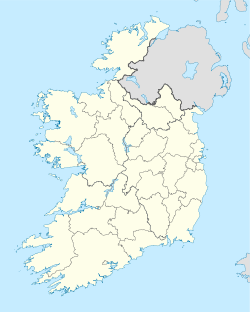
 Oughter Ard
Coordinates: 53°16′40″N 6°33′55″W / 53.27789°N 6.56528°WCoordinates: 53°16′40″N 6°33′55″W / 53.27789°N 6.56528°W Country Ireland Province Leinster County County Kildare Elevation 121 m (397 ft) Time zone WET (UTC+0) – Summer (DST) IST (WEST) (UTC-1) Irish Grid Reference Uachtar Árd (Oughterard or Oughter Ard in the English language) is an ecclesiastical site, graveyard, townland, and formerly a parish, borough and royal manor in County Kildare, nowadays part of the community of Ardclough, close to the Dublin border. It is the burial place and probable birthplace of Arthur Guinness.
Contents
Foundation
The round tower and ancient monastery is associated with a nunnery established circa 600 AD by foundress Saint Briga (feast day January 21) [1][2]. Briga is not to be confused with Brigit of Kildare whose feast day was February 1.[3]The site is also associated also with Saint Tarcairteann (feast day December 18).[4]
This monastery was under the patronage of a local branch of the Uí Dúnlainge dynasty which rotated the kingship of Leinster between 750-1050. In that period ten Uí Dúnchada Kings of Leinster established their base at nearby Lyons Hill. Their cousins patronised the monastery of Kildare and Glendalough.
Royal Manor
Ougherard became a Royal Manor and Borough in the 12th century and a ruined castle nearby dates to 1300. Plough headlands from medieval times can still be seen in fields adjoining the churchyard.
Medieval Landmarks
Recent research by archaeological historian Mike O'Neill has established the ruined church on the site dates to c. 1350 and not, as previously thought, 1609. The ruined church is now entered through one of the windows, as both original doorways serve as mausoleums. The 8th century round tower, one of five in County Kildare, is in a good state of repair, but it is topless and only the first 8 metres remain. A small ruined castle tower stands about 300 metres south-east of the graveyard.
Destruction and Restoration
The hilltop monastery and round tower were burned by the Dublin Vikings under Sigtrygg Silkbeard in 995. During the Norman invasion of Ireland in 1169-71 the parish was a part of the large estates given as a dowry by Dermot McMurrough on the marriage of his daughter Eva (Aoife) to Strongbow in 1170. Next it was owned by Adam de Hereford, who willed all his lands to St Thomas monastery in Thomas Street, Dublin, and died in 1210. For several centuries the monastery rented the land to tenant farmers until the Dissolution of the Monasteries in 1536-41. The 1303 Papal taxation listed it as 'Outherard' and it was also spelled as 'Wochtred' before 1500. The parish of Oughterard was eventually united with Lyons in 1541. The calendar rolls reference which in 1609 (which led to its mistakenly being cited as a foundation date by Walter Fitzgerald in 1898) was followed by another which described the church as being "in ruins" by 1620. It is not clear when the church fell into disuse.
Civil Survey 1654-56
Following the Cromwellian conquest of Ireland in 1649-53, land had to be surveyed and then often confiscated from parliament's opponents to pay its debts under the 1642 Adventurers Act. The survey listed four townlands in Oughterard parish; Oughterard, Bishopscourt, Hutton Read and Castlewarden. Oughterard was valued at £82 p.a. rental value and it belonged to four men. Its 410 acres were under arable crops except for 10 acres (40,000 m2) of pasture and meadow; today it is mostly grassland.[5]
Historical populations Year Pop. ±% 1821 550 — 1831 223 −59.5% 1841 460 +106.3% 1851 440 −4.3% 1861 433 −1.6% 1871 409 −5.5% 1881 347 −15.2% 1891 278 −19.9% 1901 313 +12.6% 1911 305 −2.6% 1926 235 −23.0% 1936 251 +6.8% 1946 357 +42.2% 1951 394 +10.4% 1956 419 +6.3% 1996 593 +41.5% 2002 668 +12.6% 2006 690 +3.3% [6] Arthur Guinness and Other Notable Burials
Until the construction of the turnpike road in the adjoining valley in 1729, Oughterard was situated on the main road from Dublin to Limerick and Cork. According to "Arthur's Round" (see below) Arthur Guinness's grandfather William Read, a local farmer, started selling home-brewed ale from a roadside stall in 1690 to troops en route to the battles in the Jacobite wars. Guinness was taken back to Oughterard to be buried in the Read family plot in January 1803. Local tradition holds that Guinness was born at the Read household, where his mother returned to her childhood home, in the tradition of the time, to give birth. Three prospective birth sites have been identified, imost likely at Oughterard 53°16′35″N 6°33′41″W / 53.27626°N 6.56126°W.[7], but also possibly at Read homesteads the adjoining townlands of Boston 53°15′58″N 6°30′21″W / 53.26611°N 6.50584°W.[7], Castlewarden 53°15′56″N 6°32′41″W / 53.26561°N 6.54465°W.[7] and Huttonread53°17′03″N 6°33′41″W / 53.28413°N 6.56126°W.[7] which takes its name form the Read family.[8], all within Oughterard parish.
Later in 1803 Arthur Wolfe, Lord Kilwarden who lived at Newlands, Co Dublin—the most famous victim of Robert Emmet's 1803 rebellion—was buried here in the Wolfe mausoleum, a grave that dates to 1650. James Phipps, "A Captain of Insurgents" who took part in the Battle of Ovidstown in 1798, and then moved to America where he died in 1826, is commemorated. William Kennedy from nearby Bishopscourt, who was posthumously decorated for bravery having lost his life in the Battle of the Bulge during World War II.
Duel
Daniel O'Connell (1775–1847) fought a duel with John D'Esterre on February 1, 1815 in an adjoining field, then a part of the Ponsonbys' Bishopscourt estate, now owned by the King family. O’Connell described a Dublin Corporation provision for the poor as “beggarly” on Jan 24 and was issued the challenge from John D’Esterre, a champion of the conservative and Protestant cause at the time. D'Esterre died as a result of his wounds. A detachment of cavalry sent out from Dublin arrived too late to prevent the duel taking place. A commemorative boulder having been removed, the exact site was re-established in 2007 after consultations with local people.
Trivia
In the film Mission: Impossible , Tom Cruise's character is told that the American President is unavailable "because he is fishing in Oughter Ard Co Kildare." The Grand Canal holds fish and runs about 1 km to the north. There is no river in Oughter Ard, although the nearby Morell and Liffey rivers are known for their fishing, and the absence of a water source has been commented on as unusual by historical geographer Tadhg O’Keefe and others for such an important medieval manor and borough.
Bibliography
- Eoghan Corry and Jim Tancred; Annals of Ardclough (2004).
- DN Hall M Hennessy and Tadhg O’Keefe; Medieval Agriculture and Settlement in Castlewarden and Oughterard. Irish Geography, Vol 18 (1985) pp16–25.
- Kildare Archaeological Society Journal. Volume I : pp84–86. Volume II : pp179, 183, 395. Volume III : pp361, 364, 456. Volume IV : pp255. Volume XII : pp339–341
- P Guinness; Arthur's Round: The Life and Times of brewing legend Arthur Guinness. Peter Owen, London 2008; pp. 17–20, 218.
Notes
- ^ Eoghan Corry and Jim Tancred; Annals of Ardclough (2004)..
- ^ Martyrology of Tallaght see also the The Martyrology of Óengus mac Óengobann the Culdee
- ^ Kildare Archaeological Society Journal. Volume I: p84.
- ^ The Martyrology of Óengus mac Óengobann the Culdee
- ^ Civil Survey Vol. 8, County Kildare; Irish Manuscripts Commission 1952, pp.30-33.
- ^ and www.histpop.org
- ^ a b c d "US Gazetteer files: 2010, 2000, and 1990". United States Census Bureau. 2011-02-12. http://www.census.gov/geo/www/gazetteer/gazette.html. Retrieved 2011-04-23.
- ^ Arthur's Round: The Life and Times of Arthur Guinness by Patrick Guinness.
External links
Categories:- Buildings and structures in County Kildare
- Religion in County Kildare
- Cemeteries in the Republic of Ireland
- Townlands of County Kildare

Wikimedia Foundation. 2010.