- Bourtange
Dutch town locator maps
mun_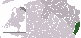
town_
caption = The town centre (dark green) and the statistical district (light green) of Bourtange in the municipality of Vlagtwedde.Bourtange (coord|53|1|N|7|11|E|type:city(267)|display=inline,title) is a
star fort and village in theWesterwolde region of the Dutch province of Groningen. It is a part of the municipality ofVlagtwedde , and lies about 32 km northeast of Emmen.The
fortification s were initially built during the Eighty Years' War (c. 1568–1648) when William I of Orange wanted to control the only road betweenGermany and the city of Groningen which was controlled by the Spaniards. This road followed a sandy ridge ("tange") through themarsh es.Later, around
1594 , Bourtange became part of the fortifications on the border between the northern provinces (Groningen,Friesland ,Drenthe ) and Germany.Bourtange was a separate municipality until 1822, when it was merged with
Vlagtwedde . [Ad van der Meer and Onno Boonstra, [http://www.knaw.nl/cfdata/publicaties/detail.cfm?boeken__ordernr=20061061 "Repertorium van Nederlandse gemeenten"] , KNAW, 2006.]In
1851 the fort was given up and Bourtange became a normal village.Around
1960 living conditions in the village deteriorated and it was decided that Bourtange would be rebuilt to its state of1742 . Today it is an open airmuseum .In 2001, the town of Bourtange had 267 inhabitants. The built-up area of the town was 0.21 km², and contained 133 residences.Statistics Netherlands (CBS), [http://www.cbs.nl/nl-NL/menu/themas/milieu-natuur-ruimte/ruimte/publicaties/cartografie-geografie/geografische-data/2001-bevolkingskernen-in-nederland.htm "Bevolkingskernen in Nederland 2001"] . (Statistics are for the continuous built-up area).] The statistical area "Bourtange", which also can include the surrounding countryside, has a population of around 530.Statistics Netherlands (CBS), [http://statline.cbs.nl/ "Statline: Kerncijfers wijken en buurten 2003-2005"] . As of
January 1 ,2005 .]References
External links
* [http://www.bourtange.nl/ Official site of Bourtange]
Wikimedia Foundation. 2010.