- Rutland (city), Vermont
-
City of Rutland City 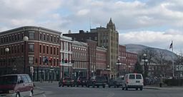 Downtown Historic District
Nickname: Marble City Country United States State Vermont City Rutland Elevation 541 ft (165 m) Coordinates 43°36′32″N 72°58′47″W / 43.60889°N 72.97972°W Area 7.68 sq mi (19.89 km2) - land 7.64 sq mi (20 km2) - water 0.04 sq mi (0 km2), 0.52% Population 16,495 (2010) Density 2,147.8 / sq mi (829.3 / km2) Incorporated 1892 Mayor Chris Louras Timezone EST (UTC-5) - summer (DST) EDT (UTC-4) ZIP codes 05701, 05702 Area code 802 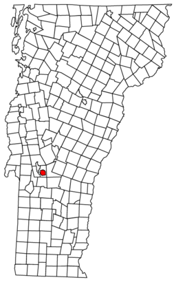 Rutland City, Vermont
 Location of Vermont in the United States
Website: http://rutland.govoffice.com/ Rutland is a city in and the shire town[1] (county seat)[2] of Rutland County, Vermont, United States. As of the 2010 census, the city had a total population of 16,495.[3] Rutland is located approximately 65 miles (105 km) north of Massachusetts and 20 miles (32 km) east of New York state. Rutland is the third largest city in Vermont. It is completely surrounded by the town of Rutland, which is a separate municipality. The downtown area of the city is listed as a historic district on the National Register of Historic Places.
Contents
History
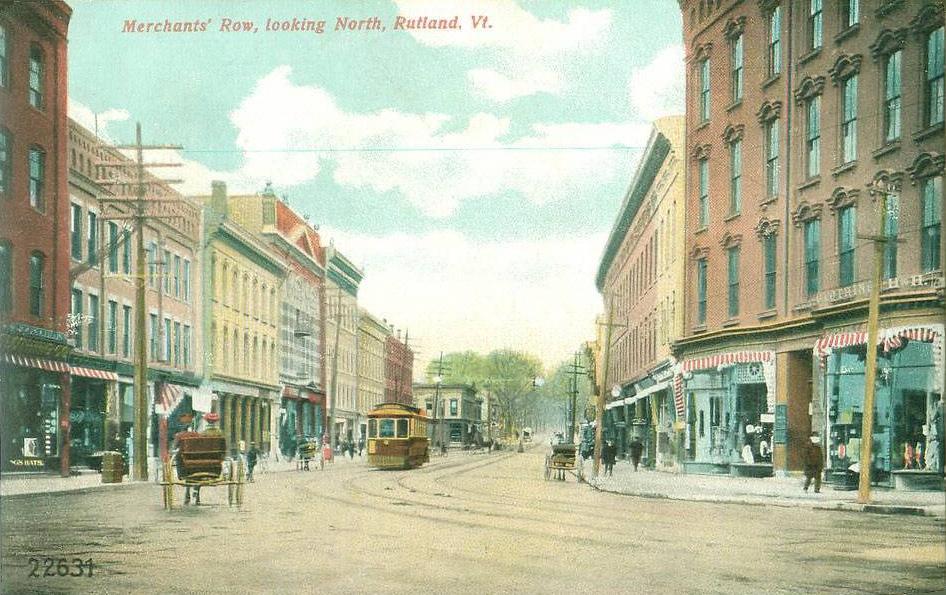
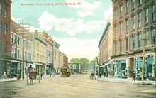 Merchants' Row in 1907
It began on Otter Creek in the early 19th century as a small hamlet called Mill Village in Rutland, the surrounding town named by Governor Benning Wentworth in 1761 after John Manners, 3rd Duke of Rutland.[4] In the early 19th century, small high-quality marble deposits were discovered in Rutland, and in the 1830s a large deposit of nearly solid marble was found in what is now West Rutland. By the 1840s, small firms had begun excavations, but marble quarries proved profitable only after the railroad arrived in 1851. At the same time, the famous quarries of Carrara in Tuscany, Italy, grew largely unworkable because of their extreme depth, allowing Rutland to become one of the world's leading marble producers.[4]
This fueled enough growth and investment that in 1886 the center of town incorporated as Rutland village. Most of the town was split off as West Rutland and Proctor, which contained the bulk of the marble quarries. Rutland City was incorporated as Vermont's third city on November 18, 1892. The new city's first mayor was John A. Mead, who served only one term in 1893.[5]
In 1894, the nation's first polio outbreak was identified in the Rutland area. 132 people from the Rutland area were affected. Seven died. 110 others suffered some paralysis for life. 55 were from the city itself.[6]
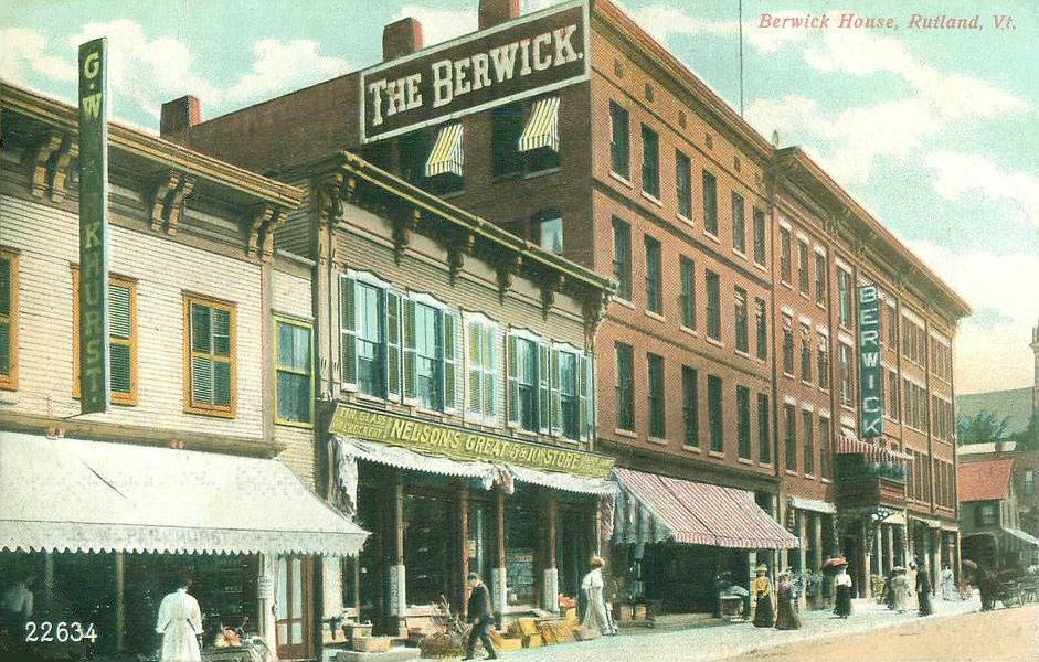
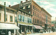 The Berwick House in 1907
In 1903, a Rutland City ordinance restricting the carrying of firearms led to the Vermont Supreme Court's decision in State v. Rosenthal, thereby establishing protection for the carrying of firearms without permit or license, what has become known as "Vermont Carry".[7] Nonetheless, Rutland had a similar ordinance in place as late as 1998,[8] at which point it was challenged and eventually removed, and there have been reports from residents of police harassment over openly carrying firearms as recently as June 2008.[9]
The closing of the marble quarries in the area in the 1980s and 1990s cost the area jobs.
Geography
Rutland is located at 43°36′32″N 72°58′47″W / 43.60889°N 72.97972°W (43.60889, -72.97972).[10]
According to the United States Census Bureau, the city has a total area of 7.67 square miles (19.9 km2), of which 7.6 square miles (20 km2) is land and 0.04 square miles (0.10 km2), or 0.52%, is water. Rutland is drained by Otter Creek, Moon Brook, Tenney Brook, East Creek and Mussey Brook.
Transportation
Rutland is the terminal city for Amtrak's Ethan Allen Express, which provides daily service to and from New York City.[11]
Rutland has "The Bus", run by Marble Valley Regional Transit District, an inter-city bus system costing 50 cents per person, with other expenses covered largely by taxpayers. "The Bus" was free prior to 2007, when the 50 cents fare was added to control the added gas expenses. MVRTD is housed in the downtown Transit Center.
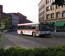 The Bus, downtown Rutland
The Rutland Southern Vermont Regional Airport is located just south of the city, in North Clarendon. The airport offers daily flights to Boston operated by Cape Air.
Rutland is the largest city in Vermont that is not located on, or near, either of the state's two major Interstate highways. U.S. Route 4 and U.S. Route 7 intersect in Rutland and are the two main routes into the city. U.S. 7 connects Rutland with Manchester and Bennington to the south, and with Middlebury and Burlington to the north. To the east of Rutland, U.S. 4 travels through Killington and Woodstock on its way toward New Hampshire. To the west, U.S. 4 has been rebuilt as a 4-lane freeway to the New York state line, a distance of just over 18 miles (29 km). It is currently the only limited-access freeway to serve Rutland. The former route of U.S. 4, which runs parallel to the freeway portion, is now signed as Vermont Route 4A.
Demographics
Historical populations Census Pop. %± 1800 2,125 — 1810 2,379 12.0% 1820 2,586 8.7% 1830 2,753 6.5% 1840 2,708 −1.6% 1850 3,715 37.2% 1860 7,577 104.0% 1870 9,834 29.8% 1880 12,140 23.4% 1890 11,760 −3.1% 1900 11,499 −2.2% 1910 13,456 17.0% 1920 14,954 11.1% 1930 17,315 15.8% 1940 17,082 −1.3% 1950 17,659 3.4% 1960 18,325 3.8% 1970 19,293 5.3% 1980 18,436 −4.4% 1990 18,230 −1.1% 2000 17,292 −5.1% 2010 16,495 −4.6% As of the census[12] of 2000, there were 17,292 people, 7,452 households, and 4209 families residing in the city. The population density was 2254.5 people per square mile (870.3/km2). There were 7,452 housing units at an average density of 94.49/sq mi (289.0/km2). The racial makeup of the city was 98.6% White, 0.7% African American, 0.7% Native American, 0.6% Asian, 0.1% Pacific Islander, 0.3% from other races, and 0.9% from two or more races. Hispanic or Latino of any race were 0.9% of the population.
There were 7,452 households out of which 21.1% had children under the age of 18 living with them, 39.8% were married couples living together, 12.5% had a female householder with no husband present, and 43.5% were non-families. 36.1% of all households were made up of individuals and 13.9% had someone living alone who was 65 years of age or older. The average household size was 2.22 and the average family size was 2.80.
In the city the population was spread out with 22.7% under the age of 18, 7.8% from 18 to 24, 28.9% from 25 to 44, 22.4% from 45 to 64, and 18.2% who were 65 years of age or older. The median age was 39.3 years. For every 100 females there were 89.8 males. For every 100 females age 18 and over, there were 86.5 males.
Economy
One measure of economic activity is retail sales. Rutland stood third in the state in 2007 with $321.6 million.[13]
Personal income
The median income for a household in the city was $30,478, and the median income for a family was $41,561. Males had a median income of $29,457 versus $23,688 for females. The per capita income for the city was $17,075. 15.4% of the population and 10.3% of families were below the poverty line. Out of the total people living in poverty, 30.1% are under the age of 18 and 10.5% are 65 or older.
Industry
Major area employers are General Electric (GE), OMYA Central Vermont Public Service and Carris Reels. GE employed 975 workers in 2010.[14] Casella Waste Systems is the second largest private employer (behind GE Aircraft), employing 583 employees at their headquarters on Green Hill Lane.[15]
Recently, a 1-acre (4,000 m2) area of land downtown, known as "the pit", is slated for development. The new office building is planned to hold offices, education and civic space.
A judge on the United States Court of Appeals for the Second Circuit holds the Vermont seat here.
Culture
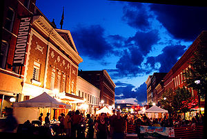 Ethnic Festival in 2008
The downtown section contains the Rutland Free Library,[16] the Paramount Theater[17] and Merchant's Row, a restored street dating back to the mid-19th century. 108 buildings in downtown Rutland are listed in the National Register of Historic Places. Rutland also has the 275-acre (111 ha) Pine Hill Park[18] offering mountain biking, hiking, and other outdoor recreation. At the park's entrance is the Flip Side Skatepark,[19] municipally operated in an open-sided closed roof arena at the Giorgetti Athletic Complex. Nearby in the town of Rutland is the Diamond Run Mall, a shopping mall anchored by Kmart, Sears, and JCPenney, with other stores including American Eagle Outfitters, RadioShack and many others.[20] At 525,000 square feet, it is the second biggest mall in Vermont, boasting over 55 shops. The Spartan Arena, home to the Castleton State College hockey team, is also at the Diamond Run Mall.[21]
Rutland is host to summer events: Art in the Park and Friday Night Live, the Ethnic Festival, a Farmer's Market in downtown Rutland's Depot Park, and the Summer Concert Series.
The Rutland Halloween Parade has taken place annually since 1960. In the early 1970s, the Rutland Halloween Parade was used as the setting of a number of superhero comic books, including Batman #237, Justice League of America #103, Freedom Fighters #6, Amazing Adventures #16, Avengers #83, and The Mighty Thor #207. The parade celebrated its 50th anniversary in 2009.[22]
The Vermont State Fair has been an annual event every September at the state fairgrounds.
Education
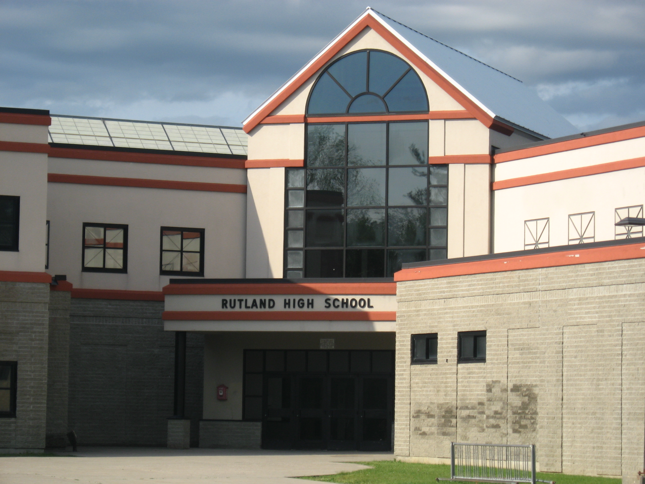
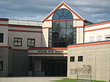 Rutland High School
Public schools are managed by Rutland City School District. These are Rutland High School, Rutland Middle School, Rutland Intermediate School, Northwest Primary School, and Northeast Primary School. The district also runs the Stafford Technical Center.
Private schools include the Catholic Christ the King School (elementary) and Mount Saint Joseph Academy (secondary), and the Rutland Area Christian School. The city is also home to two colleges, The College of St. Joseph in Vermont (formerly called College of Saint Joseph the Provider), and Community College of Vermont (CCV).
Media
The city's print news comes from the Pulitzer Prize-winning Rutland Herald.
There are five radio stations licensed to Rutland: 94.5 WDVT, 97.1 WZRT, 98.1 WJJR, 105.3 WJEN, 1380 AM WSYB, and 90.5 WFTF.
Hospital
Rutland Regional Medical Center is Vermont's second-largest health care facility, with 188 inpatient beds and 120 physicians.
Sister city
Since 1986, Rutland hosts an annual exchange called the Rutland Ishidoriya Student Exchange (R.I.S.E), selecting students from grades 9-11 to send to Ishidoriya, Japan. All of the money used to support the exchange is from fundraising. In exchange, 5 students from Ishidoriya come to Rutland the January after the Rutland ambassadors return each year.
Historic sites
(Date indicates inclusion on the National Register of Historic Places)
- Arthur Perkins House — 242 South Main Street (added October 27, 1988)
- Chaffee-Moloney Houses — 194 & 196-98 Columbian Avenue (added December 19, 2001)
- Clementwood — Clement Road (added October 27, 1980)
- H. H. Baxter Memorial Library — 96 Grove Street (added September 24, 1978)
- Longfellow School — 6 Church Street (added 1976)
- Proctor-Clement House — Field Avenue (added July 17, 1982)
- Rutland Courthouse Historic District — U.S. 7 (added October 8, 1976)
- Rutland Downtown Historic District — roughly bounded by Strong Avenue, State, Wales, Washington, Pine and Cottage streets (added September 22, 1980)
- Rutland Free Library, the 1859 former post office and courthouse designed by Ammi B. Young
- St. Peter's Church and Mount St. Joseph Convent Complex — Convent Avenue, Meadow and River streets (added November 3, 1980)
Notable people
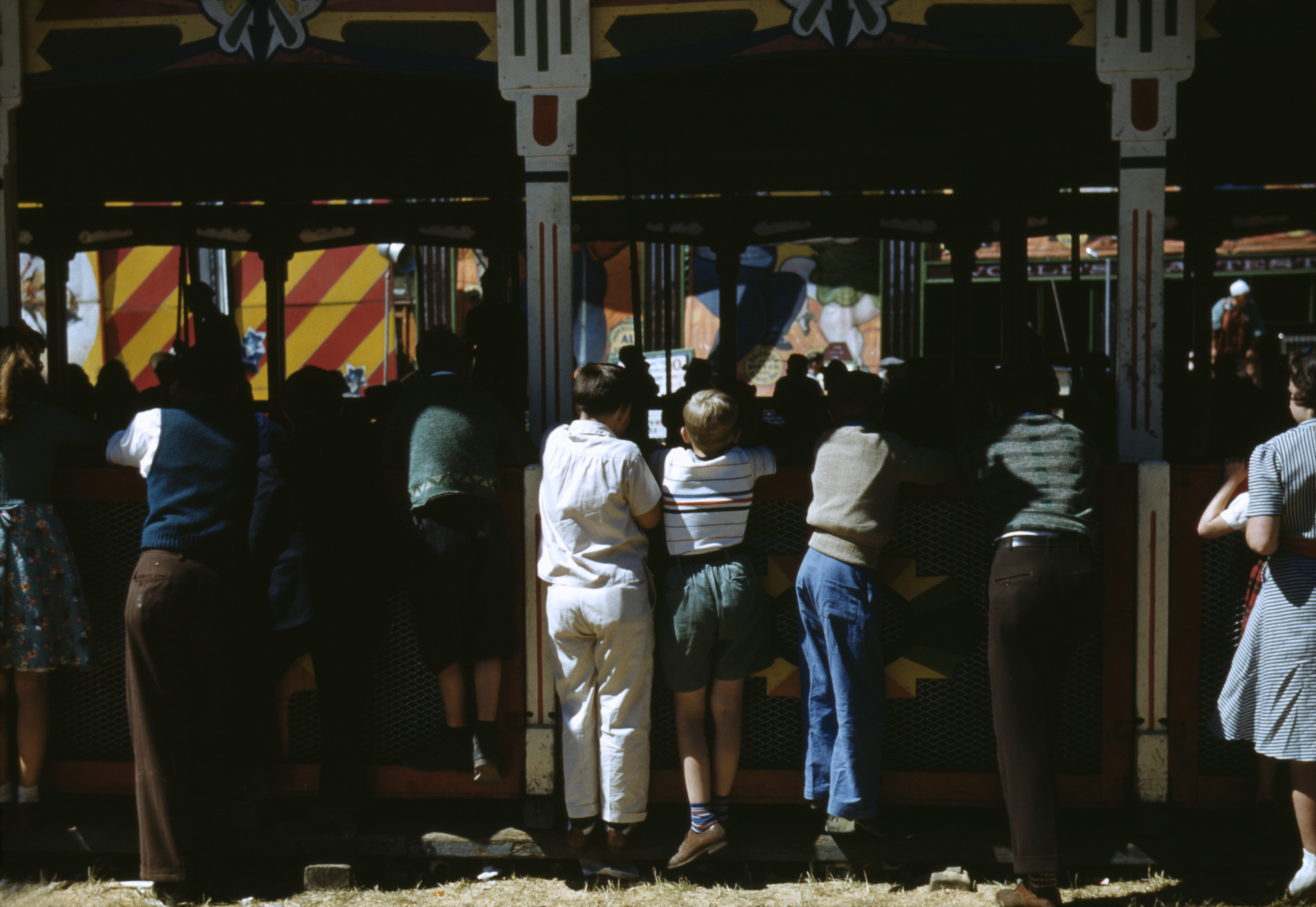
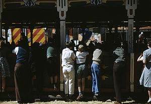 At the Vermont State Fair, Rutland, 1941, by Jack Delano
- James E. Burke, former CEO Johnson & Johnson
- Suzy Chaffee, Olympic skier and actress
- Barry M. Costello, vice admiral in the Navy
- Thomas W. Costello, politician
- John Deere, industrialist
- Julia Dorr, author
- Merritt A. Edson, general
- Mia Farrow, actress[citation needed]
- David Franzoni, Oscar-winning author/producer of film Gladiator
- David Giancola, filmmaker
- Joy Hakim, history writer
- George Tisdale Hodges, congressman
- Steven Howard, politician
- Jim Jeffords, senator
- Carlene King Johnson, Miss USA 1955
- Aaron Lewis, lead singer of the band Staind
- Andrea Mead-Lawrence, first American to win two gold Olympic skiing medals
- Mary McGarry Morris, novelist
- Arlie Pond, baseball player
- George E. Royce, pioneer of marble quarrying industry & state senator
- Robert Stafford, governor, congressman and senator
- Cherilee Taylor, TV and movie actress
- John Martin Thomas, president of Rutgers University
- Charles E. Tuttle, publisher
- Dan Tyminski, bluegrass composer, vocalist and instrumentalist
- Steve Wisniewski, football player
Fictional residents
- Master Pandemonium, comic book villain
- Snow Job, G.I. Joe character
See also
- Rutland City School District
- Rutland Railway
- Rutland (Amtrak station)
- List of Rutland, Vermont Mayors
References
- ^ Title 24, Part I, Chapter 1, §12, Vermont Statutes. Accessed November 1, 2007.
- ^ "Find a County". National Association of Counties. http://www.naco.org/Counties/Pages/FindACounty.aspx. Retrieved 2011-06-07.
- ^ "Race, Hispanic or Latino, Age, and Housing Occupancy: 2010 Census Redistricting Data (Public Law 94-171) Summary File (QT-PL), Rutland city, Vermont". U.S. Census Bureau, American FactFinder 2. http://factfinder2.census.gov. Retrieved November 1, 2011.
- ^ a b A. J. Coolidge & J. B. Mansfield, A History and Description of New England; Boston, Massachusetts 1859
- ^ 109th Annual Report Fiscal Year July 1, 2000 to June 30, 2001 City of Rutland, Vermont
- ^ Remsen, Nancy (September 29, 2007). Polio marker moved to public spot. Burlington Free Press.
- ^ http://www.guncite.com/court/state/55a610.html
- ^ http://www.vtlp.org/main/media/news/pr980622-RutlandGunRights.html
- ^ http://opencarry.mywowbb.com/forum53/11480.html
- ^ "US Gazetteer files: 2010, 2000, and 1990". United States Census Bureau. 2011-02-12. http://www.census.gov/geo/www/gazetteer/gazette.html. Retrieved 2011-04-23.
- ^ http://www.amtrak.com/timetable/june07/P55.pdf accessed October 15, 2007
- ^ "American FactFinder". United States Census Bureau. http://factfinder.census.gov. Retrieved 2008-01-31.
- ^ McLean, Dan (July 13, 2008). Retail Sales by the numbers. Burlington Free Press.
- ^ Briggs, John (23 August 2010). "Sky's the limit". Burlington, Vermont: Burlington Free Press. pp. 1B,12B. http://www.burlingtonfreepress.com/article/20100823/NEWS01/100821005/Sky-s-the-limit-for-Vermont-s-aerospace-industry.
- ^ "REDC Major Employers". Rutland Economic Development Corporation. http://www.rutlandeconomy.com/workmajoremployees.php. Retrieved 17 April 2011.
- ^ Rutland Free Library
- ^ Paramount Theater
- ^ Pine Hill Park
- ^ Flipside Skate Park
- ^ Diamond Run Mall directory
- ^ Diamond Run Mall about page
- ^ "Rutland scares up pride with 50-year Halloween Parade," Rutland Herald (Oct. 24, 2009).
External links
- City of Rutland, Vermont
- Rutland Free Library
- Rutland Historical Society & Museum
- Rutland (city), Vermont at the Open Directory Project
- Curran, John, "Vermont town's blood drive, film draw notice", Associated Press via MercuryNews.com, 06/26/2011 10:47:37 am PDT updated 10:53:49 am PDT. About documentary "The Blood in This Town" about local Red Cross blood drive and, more broadly, home-grown civic development efforts in a city "past its prime."
Municipalities and communities of Rutland County, Vermont Shire town: RutlandCity Rutland

Towns Benson | Brandon | Castleton | Chittenden | Clarendon | Danby | Fair Haven | Hubbardton | Ira | Killington | Mendon | Middletown Springs | Mount Holly | Mount Tabor | Pawlet | Pittsfield | Pittsford | Poultney | Proctor | Rutland | Shrewsbury | Sudbury | Tinmouth | Wallingford | Wells | West Haven | West Rutland
Village CDPs Other
communitiesBelmont | Florence
 State of Vermont
Regions Counties Addison · Bennington · Caledonia · Chittenden · Essex · Franklin · Grand Isle · Lamoille · Orange · Orleans · Rutland · Washington · Windham · Windsor
Metropolitan areas Burlington-South Burlington metropolitan area
Cities Barre · Burlington · Montpelier · Newport · Rutland · St. Albans · South Burlington · Vergennes · Winooski
Festivals Vermont State Fair · Green Mountain Film Festival
Topics Delegations · Constitution · Culture · Geography · Government · History · Images · People · Politics · Towns · Villages · Visitor Attractions
Categories:- Cities in Vermont
- Micropolitan areas of Vermont
- Rutland, Vermont
- Rutland (city), Vermont
- County seats in Vermont
- Populated places in Rutland County, Vermont


Wikimedia Foundation. 2010.