- Neath Port Talbot
-
Neath Port Talbot County Borough
Bwrdeisdref Sirol Castell-nedd Port Talbot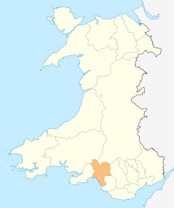
Area
- Total
- % WaterRanked 11th
442 km²
? %Admin HQ Port Talbot ISO 3166-2 GB-NTL ONS code 00NZ Demographics Population:
- Total (2010 est.)
- Density
Ranked 8th
137,400
Ranked 12th
311 / km²Ethnicity 97.9% White
1.0% South Asian
0.8% Oriental
0.3% Other .Welsh language
- Any skillsRanked 9th
28.8%Politics 
Neath Port Talbot County Borough Council
http://www.neath-porttalbot.gov.uk/Control Labour MPs Neath Port Talbot (Welsh: Castell-nedd Port Talbot) is a county borough and one of the unitary authority areas of Wales. Neath Port Talbot is the 8th most populous county in Wales and the third most populous county borough.
The county borough borders the other principal areas of Bridgend and Rhondda Cynon Taff to the east, Powys and Carmarthenshire to the north and Swansea to the west. Its principal towns are Neath, Port Talbot and Pontardawe.
Contents
Geography
The local authority area stretches from the coast to the borders of the Brecon Beacons National Park. The majority of land is upland or semi-upland in character, and 43% is covered by forestry with major conifer plantations in upland areas. Most of the lower lying flat land is near the coast around Port Talbot. An extensive dune system stretches along much of the coast, broken by river mouths and areas of development.[1] The upland areas are cut by five valleys: Vale of Neath, Dulais Valley, Afan Valley, Swansea Valley, Upper Amman Valley.[2]
Modern settlement patterns reflect the industrial history of the area, with urban development along the flatter areas of the valleys and some parts of the coast. The largest town is Neath with a population of 47,020, followed by Port Talbot (35,633), Briton Ferry (7,186), Pontardawe (5,035), and Glynneath (4,368). The majority of the population live in the coastal plane around Port Talbot and the land around the River Neath in the vicinity of Neath.
Demographics
The population in the region reached its peak in the 1930s. Census figures show a population of 151,563 in 1931. The population has shown a steady decline throughout the rest of the 20th century. The population stood at 134,471 in 2001.[3] In the 1990s, most areas within the region showed a fall or little change in population with the notable exception of Bryncoch South and Margam where the population grew by 47.29% and 41.36% respectively. [4] Local council estimates show the population to have grown during the 2000s.
Government and politics
Neath Port Talbot was created from the former districts of Neath, Port Talbot and part of Lliw Valley on 1 April 1996 as Neath and Port Talbot; it changed its name on the following day, 2 April 1996. At the time of the reorganization, many local people expected that Neath and Port Talbot districts would become separate unitary authorities, and there were protests when the new authority was announced.[5]
Local Government
The whole of the Neath Port Talbot area was once part of the county of West Glamorgan, which in turn was part of the historic county of Glamorgan. Since local government re-organisation in 1996, Neath Port Talbot is governed by Neath Port Talbot County Borough Council.
Neath Port Talbot is a staunch Labour stronghold, who have been in power since the authority's formation in 1996.
Welsh politics
The unitary authority is contains two whole constituencies which are:
- Aberavon, current AM is David Rees, Labour since 2011
- Neath, current AM is Gwenda Thomas, Labour since 1999
United Kingdom politics
- Aberavon, current MP is Hywel Francis, Labour since 2001
- Neath, current MP is Peter Hain, Labour since 1991
Economy and Industry
In 1991 Neath & Port Talbot was a distinct Travel to Work Area (albeit with different boundaries to the current county borough), but the 2001-based revision has merged the locality into a wider Swansea Bay Travel to Work Area.[6]
In June 2008, the economic activity and employment rates in Neath Port Talbot were below the Welsh average.[7] However, earnings for full-time workers were higher than either the Welsh or British average.[7]
Manufacturing accounts for over 22% of jobs in the county borough compared to under than 14% in Wales as a whole; just under 70% of local jobs are in services compared to a Welsh average of nearly 80%.[7] Tata is the largest employer with approximately 3,000 staff (although in 1979 its predecessor employed 12,600); other large employers include General Electric, Hi-Lex Cable Systems Ltd, TRW Steering Systems recently closed, Envases (UK) Ltd, Crown Food UK & Ireland, Toyoda Koki Automotive, Borg Warner Automotive recently closed, Cornelius Electronics, Excel Electronics Assemblies, and Tedeco.[8]
Port Talbot is also the site for NPT General Hospital, which houses a psychiatric ward and drug rehabilitation centre, including a Juvenile wing which provides temporary emergency care for 15-18 year olds lasting up to 7 days before being placed in a secure Psychiatric unit.
Media
A separate daily edition of the South Wales Evening Post is published for the Neath Port Talbot area. The paper's publisher, South West Wales Publications, also produces a free weekly paper, the Neath & Port Talbot Tribune.[9] The local council publishes a quarterly, Community Spirit, produced and funded in conjunction with seven other public sector partners.[10]
Community radio station is XS broadcasts to both Neath (97.4) and Port Talbot (107.9). Nation Radio broadcasts to the wider South Wales region from studios in Neath. The county borough is within the local commercial radio licence areas for 102.1 Bay Radio, Swansea Sound and The Wave.[11]
Twinning
The sister cities of Neath Port Talbot county borough are [1]:
- Albacete
 Spain
Spain - Bagneux,
 France
 - Esslingen am Neckar,
 Germany
 - Heilbronn, Germany
- Piotrków Trybunalski,
 Poland
 - Schiedam,
 Netherlands
 - Udine,
 Italy
Italy - Velenje,
 Slovenia
 - Vienne, France
Places of interest
- Afan Forest Park, formerly known as Afan Argoed is a predominantly forest country park for walking and recreation. In recent times, it has become a mecca for mountain biking with the development of a number of demanding mountain biking trails.
- Margam Country Park is a frequent destination for the World Rally Championships and is very popular with tourists all year round.
- Aberdulais Falls are on the River Dulais and were portrayed in Turner's painting, The Watermill
- Aberavon Beach is a large blue flag beach resort, popular with surfers and Kite boarders.
- Gnoll Country Park is a large country park with lakes, cascading waterfalls and the ruins of the historic Gnoll mansion, the former home of the Mackworth family.
- Crymlyn Bog a site of special scientific interest,in Skewen near Neath.
See also
- List of places in Neath Port Talbot for a list of settlements
References
- ^ Neath Port Talbot Supplementary Planning Guidance - Landscape
- ^ Visit Neath Port Talbot: Valleys and Vales
- ^ "Neath Port Talbot District: Total Population". A Vision of Britain Through Time. University of Portsmouth - Department of Geography. 2004-2008. http://vision.edina.ac.uk/data_cube_table_page.jsp?data_theme=T_POP&data_cube=N_TPop&u_id=10056615&c_id=10001043&add=N. Retrieved 2008-08-07.
- ^ "Population Change". 2001 Census. Neath Port Talbot county Borough Council. 2003. http://www.neath-porttalbot.gov.uk/default.aspx?page=2930. Retrieved 2008-08-07.
- ^ The Welsh Academy Encyclopedia of Wales. Cardiff: University of Wales Press 2008
- ^ National Statistics, Introduction to the 2001-based Travel-to-Work Areas
- ^ a b c Neath Port Talbot County Borough Council - Labour Market Statistics
- ^ Neath Port Talbot County Borough Council - Facts and Figures
- ^ Culture, Welsh Language and Sport Committee, Thursday, 16 February 2006: South West Wales Publications Limited
- ^ Neath Port Talbot Council - Community Spirit newspaper
- ^ Radio Station Licence Areas | Ofcom
External links
- Neath Port Talbot at the Open Directory Project
- Freecycle Neath Port Talbot
- Neath Port Talbot Council Site
- Neath Port Talbot Council Adult Learning Portal
- Neath Port Talbot Community News & Chat
Electoral wards of Neath Port Talbot county borough Aberavon Neath Aberdulais · Allt-Wen · Blaengwrach · Bryncoch North · Bryncoch South · Cadoxton · Cimla · Crynant · Cwmllynfell · Dyffryn · Glynneath · Godre'r Graig · Gwaun-Cae-Gurwen · Lower Brynamman · Neath East · Neath North · Neath South · Onllwyn · Pelenna · Pontardawe · Resolven · Rhos · Seven Sisters · Tonna · Trebanos · Ystalyfera
Communities of Neath Port Talbot county borough Aberavon · Baglan · Baglan Bay · Blaengwrach · Blaenhonddan · Briton Ferry · Bryn · Cilybebyll · Clyne and Melincourt · Coedffranc · Crynant · Cwmafan · Cwmllynfell · Dyffryn Clydach · Glyncorrwg · Glynneath · Gwaun-Cae-Gurwen · Margam · Margam Moors · Neath · Onllwyn · Pelenna · Pontardawe · Port Talbot · Resolven · Sandfields East · Sandfields West · Seven Sisters · Taibach · Tonna · Ystalyfera
Transport in Neath Port Talbot county borough Road M4 motorway · European route E30 · A48 road · A465 road · A474 road · A483 road · A4063 road · A4107 road · A4067 road · A4069 road · A4109 road · A4221 road · A4230 road · A4241 road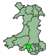
Bus First Cymru · National Express · Neath bus station · Neath railway station · Port Talbot bus stationNational Cycle Network Railway lines Railway stations Sea Canals Principal areas of Wales Anglesey • Blaenau Gwent • Bridgend • Caerphilly • Cardiff • Carmarthenshire • Ceredigion • Conwy • Denbighshire • Flintshire • Gwynedd • Merthyr Tydfil • Monmouthshire • Neath Port Talbot • Newport • Pembrokeshire • Powys • Rhondda Cynon Taf • Swansea • Torfaen • Vale of Glamorgan • Wrexham
Categories:- Neath Port Talbot
- Counties of Wales
- Glamorgan
- Principal areas of Wales


Wikimedia Foundation. 2010.