Matamata-Piako District

Matamata-Piako District
Matamata-Piako Territorial Authority.png
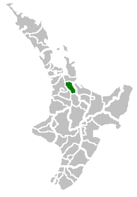
Name Matamata-Piako
Population 30,483
Land area 1,754.02 km² (677.23 sq mi)
Extent Te Aroha to Tirau;

Cambridge to Kaimai Range

Mayor Hugh Vercoe
Deputy Mayor Jan Barnes

The Matamata-Piako District is a local government area in the Waikato region of New Zealand. It lies to the east of the city of Hamilton.

The district encompasses the southern end of the Hauraki Plains and much of the Thames Valley, and is bounded in the east by the Kaimai Range. The rivers Piako and Waihou run through the district.

The towns of Matamata, Morrinsville and Te Aroha are all within the district, with the Council's head office based in Te Aroha. The main industry in the region is dairy farming and Thoroughbred breeding and training.

The 2006 population was 30,483 of whom 6,606 lived in Morrinsville, 6,309 in Matamata, and 3,768 in Te Aroha.

Twin cities

Matamata-Piako is twinned with:

Australia New South Wales Ballina, New South Wales, Australia[1]

References

External links

Coordinates: 37°42′18″S 175°39′43″E / 37.705°S 175.662°E / -37.705; 175.662


Wikimedia Foundation. 2010.

Игры ⚽ Нужна курсовая?

Look at other dictionaries:

  • Matamata-Piako District — District de Matamata Piako Localisation du district de Matamata Piako sur une carte de l île du Nord Le district de Matamata Piako est situé dans la région de Waikato, dans l île du Nord de la Nouvelle Zélande. S étendant sur 1 754,02 km2, il est …   Wikipédia en Français

  • Matamata-Piako District — Admin ASC 2 Code Orig. name Matamata Piako District Country and Admin Code NZ.G1.015 NZ …   World countries Adminstrative division ASC I-II

  • Matamata-Piako-Distrikt — Matamata Piako District Council Karte Basisdaten Region …   Deutsch Wikipedia

  • District de Matamata-Piako — 37° 42′ 18″ S 175° 39′ 43″ E / 37.705, 175.662 …   Wikipédia en Français

  • District Health Board — District Health Boards (DHBs) in New Zealand are organisations established by the New Zealand Public Health and Disability Act 2000, responsible for ensuring the provision of health and disability services to populations within a defined… …   Wikipedia

  • Matamata — For the village in Tunisia, see Matmâta. For the turtle, see Mata mata. Matamata …   Wikipedia

  • Matamata (Nouvelle-Zélande) — Pour les articles homonymes, voir Matamata (homonymie). Matamata …   Wikipédia en Français

  • District de Opotiki — District d Opotiki Le district d Opotiki est situé dans la région de Bay of Plenty, sur l île du Nord de la Nouvelle Zélande. Le siège du conseil du district est situé dans la ville éponyme d Opotiki. Sommaire 1 Géographie 1.1 Climat 1.2 Géologie …   Wikipédia en Français

  • District De Franklin — Pour les articles homonymes, voir District de Franklin (homonymie). Localisation du district sur une carte de l île du Nord …   Wikipédia en Français

  • District Far North — District du Far North Localisation du district sur une carte de l île du Nord Le district du Far North (en anglais, Far North District) est, comme son nom l indique, le district le plus septentrional de la Nouvelle Zélande, occupant la pointe… …   Wikipédia en Français

Share the article and excerpts

Direct link
Do a right-click on the link above
and select “Copy Link”