- Corpach railway station
-
Corpach 
A' Chorpaich 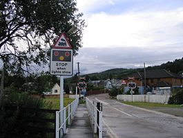
Corpach level crossing Location Place Corpach Local authority Highland Coordinates 56°50′35″N 5°07′19″W / 56.843°N 5.122°WCoordinates: 56°50′35″N 5°07′19″W / 56.843°N 5.122°W Operations Station code CPA Managed by First ScotRail Number of platforms 1 Live arrivals/departures and station information
from National Rail EnquiriesAnnual rail passenger usage 2002/03 * 1,964 2004/05 * 2,213 2005/06 * 2,091 2006/07 * 2,494 2007/08 * 2,433 2008/09 * 2,420 History Original company Mallaig Extension Railway of West Highland Railway Pre-grouping North British Railway Post-grouping LNER 1 April 1901 Station opened[1] National Rail - UK railway stations A B C D E F G H I J K L M N O P Q R S T U V W X Y Z * Annual passenger usage based on sales of tickets in stated financial year(s) which end or originate at Corpach from Office of Rail Regulation statistics. Please note: methodology may vary year on year. Corpach railway station is a railway station serving the village of Corpach in the Highland region of Scotland. This station is on the West Highland Line.
Contents
History
Corpach station opened on 1 April 1901.[1] It has one platform, on the north side of the railway.
Services
Preceding station  National Rail
Following station Banavie First ScotRail
West Highland LineLoch Eil Outward Bound Historical railways Banavie
Line and Station openNorth British Railway
Locheilside
Line and Station openReferences
Notes
Sources
- Butt, R. V. J. (1995). The Directory of Railway Stations: details every public and private passenger station, halt, platform and stopping place, past and present (1st ed.). Sparkford: Patrick Stephens Ltd. ISBN 1-8526-0508-1. OCLC 60251199.
- Jowett, Alan (March 1989). Jowett's Railway Atlas of Great Britain and Ireland: From Pre-Grouping to the Present Day (1st ed.). Sparkford: Patrick Stephens Ltd. ISBN 1-8526-0086-1. OCLC 22311137.
- Jowett, Alan (2000). Jowett's Nationalised Railway Atlas (1st ed.). Penryn, Cornwall: Atlantic Transport Publishers. ISBN 0-9068-9999-0. OCLC 228266687.
- RAILSCOT on Mallaig Extension Railway
Categories:- Railway stations in Highland (council area)
- Former North British Railway stations
- Railway stations opened in 1901
- Railway stations served by First ScotRail
- Scotland railway station stubs

Wikimedia Foundation. 2010.