- City Road tube station
-
City Road 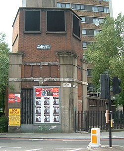
Location Place City Road Local authority Islington History Opened by City & South London Railway Platforms 2 Key dates Opened 1901
Closed 1922City Road is a disused London Underground station in Islington. It was one of the stations built when the City & South London Railway (C&SLR) (now part of the Northern line) opened its extension from Moorgate to Angel on 17 November 1901. It is located between Old Street and Angel.
Contents
History
 How City Road tube station might have appeared on the London Underground Map if it were still open to passengers today
From the start, City Road station was little used, and discussions of its closure took place as early as 1908.[1] However, the station remained open until 8 August 1922 when the C&SLR's northern section between Euston and Moorgate was closed to enable the diameter of the tunnels to be increased from 3.2 m (10 ft 6 in) to the Underground's standard diameter of 3.56 m (11 ft 8¼ in), so that larger and longer Standard Stock trains could be operated.
The low number of passengers using the station meant that the extension of the platform tunnels could not be justified on financial grounds, and the station remained closed when the line was reopened in 1924. The platforms were removed and the lift shaft was converted for use as a ventilation shaft. City Road was the only twin tunnel station of the C&SLR not to be reconstructed. During World War II, the station was converted for use as an air-raid shelter.[1]
 The rear entrance to the remains of City Road tube station.
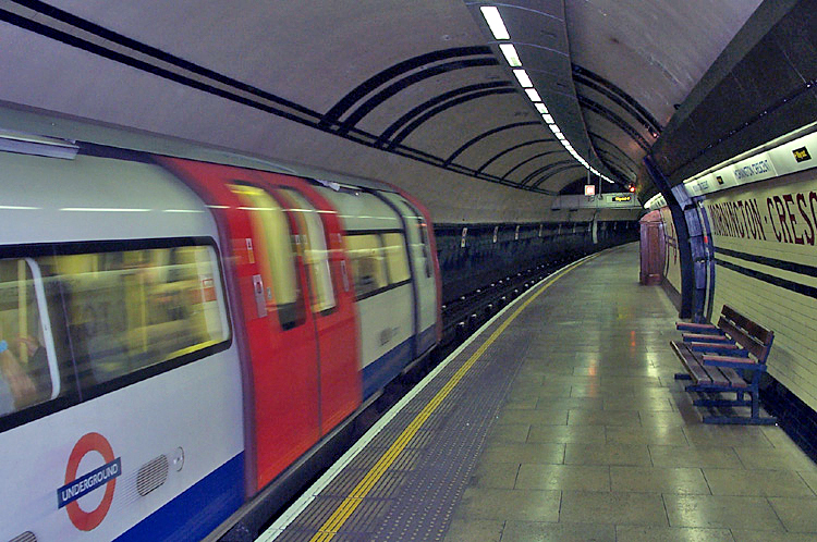
The station building remained until the 1960s, when all but the structure immediately around the original lift shaft was demolished.[1] Today little remains to indicate the site of the former station. At track level the short station tunnels remain visible from trains passing through.
See also
References
External links
- London's Abandoned Tube Stations - City Road Includes underground photos.
- London Transport Museum Photographic Archive City Road station in 1915.
Former Route (1901-22) Preceding station  London Underground
Following station Northern line towards MordenCoordinates: 51°31′47″N 0°05′51″W / 51.52972°N 0.0975°W
Northern line Stations High Barnet branchEdgware branchBelsize Park · Brent Cross · Burnt Oak · Camden Town · Chalk Farm · Colindale · Edgware · Golders Green · Hampstead · Hendon CentralCharing Cross branchBank branchAngel · Bank · Borough · Camden Town · Elephant & Castle
  (100m) · Euston
  · King's Cross St. Pancras · London Bridge · Moorgate · Old Street Morden lineBalham · Clapham Common · Clapham North · Clapham South · Colliers Wood · Kennington · Morden · Oval · South Wimbledon · Stockwell · Tooting Bec · Tooting BroadwayFuture

Click to enlargeRolling stock Present stockHistory Former companiesFormer linesFormer stationsFormer rolling stock1906 Stock · 1938 Stock · 1949 Stock · 1956 Stock · 1959 Stock · 1962 Stock · 1972 Stock · Standard StockAbandoned plansLondon Underground · Transport for London
Categories:- Former buildings and structures of Islington
- Disused London Underground stations
- Disused railway stations in Islington
- Tube stations in Islington
- Former City and South London Railway stations
- Railway stations opened in 1901
- Railway stations closed in 1922


Wikimedia Foundation. 2010.