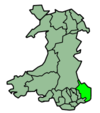
- Monmouthshire
-
For other uses, see Monmouthshire (disambiguation).
County of Monmouthshire
Sir Fynwy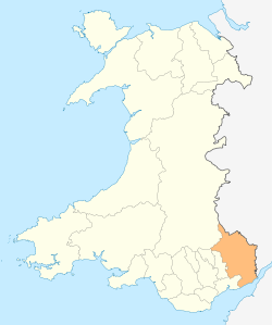
Geography Area
- Total
- % WaterRanked 7th
850 km2
? %Admin HQ Cwmbran ISO 3166-2 GB-MON ONS code 00PP Demographics Population:
- Total (2010 est.)
- Density
Ranked 18th
88,100
Ranked 15th
104 / km2Ethnicity 97.5% White Welsh language
- Any skillsRanked 22nd
12.9%MP AM Monmouthshire (Welsh: Sir Fynwy) is a county in south east Wales. The name derives from the historic county of Monmouthshire which covered a much larger area. The largest town is Abergavenny. There are many castles in Monmouthshire (see Places of Interest).
Contents
Historic county
Main article: Monmouthshire (historic)The historic county of Monmouthshire was formed from the Welsh Marches by the Laws in Wales Act 1535. It bordered Gloucestershire to the east, Herefordshire to the northeast, Brecknockshire to the north, and Glamorgan to the west. These Acts of Union nowhere state that the area is removed from Wales and added to England, but between the 16th and 20th centuries some considered that there was ambiguity as to whether the county was part of Wales or England. Since 1974 the area has been placed definitively in Wales. The eastern and southern boundaries of the historic county and the current principal area are the same, along the River Wye and Severn estuary; however, the western two-fifths of the historic county are now administered by the other unitary authorities of Blaenau Gwent, Torfaen, Caerphilly and Newport. The administrative county of Monmouthshire, and associated lieutenancy were abolished in 1974 under the Local Government Act 1972. The area largely became part of the new local government and ceremonial county of Gwent.
Principal area
Main article: Monmouthshire CouncilThe current unitary authority was created on 1 April 1996 as a successor to the district of Monmouth along with the Llanelly community from Blaenau Gwent, both of which were districts of Gwent. The use of the name "Monmouthshire" rather than "Monmouth" for the area was mildly controversial, being supported by the MP for Monmouth, Roger Evans, but being opposed by Paul Murphy, MP for Torfaen (inside the historic county of Monmouthshire but being reconstituted as a separate unitary authority). [1] By area it covers some 60% of the historic county, but only 20% of the population. The council's administrative headquarters are at the former Gwent County Hall at Croesyceiliog, Cwmbran — outside of its own jurisdiction in the neighbouring borough of Torfaen. It is the only principal area in Wales administered from outside its boundaries; however there are plans to move the council headquarters to offices at Coleg Gwent, Usk.[2] Planning permission for a new office building at Usk, to provide the authority's central facilities, was granted in September 2011.[3] Some council functions moved in 2011 to offices at Magor.[4]
In comparison to the pre-1974 areas it covers:
- the former boroughs of Abergavenny and Monmouth
- the former urban districts of Chepstow and Usk
- the former rural districts of Abergavenny, Chepstow and Monmouth
- the former rural district of Pontypool, except the community of Llanfrechfa Lower
- the parish of Llanelly from the former Crickhowell Rural District in Brecknockshire
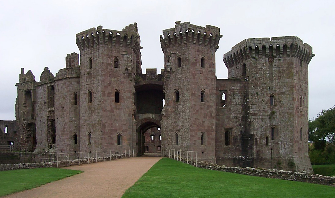
Places of interest
 Raglan Castle
- See List of places in Monmouthshire for a list of settlements in the principal area.
- Chepstow Castle [5]
- Raglan Castle [6]
- Monmouth[7]
- Trellech[8]
- Abergavenny Castle [9]
- Wye Valley [10]
- Black Mountains [11]
- Brecon Beacons National Park [12]
- White Castle [13]
- Skenfrith Castle [14]
- Grosmont Castle [15]
- Three Castles Walk [16]
- Offa's Dyke [17]
- Llanthony Priory [18]
- Tintern Abbey [19]
- Usk[20]
- Usk Valley Walk [21]
- Abergavenny [22]
- Monmouthshire & Brecon Canal [23]
- Marches Way [24]
- Monnow Valley Walk [25]
- Caldicot Castle [26]
- The Kymin[27]
References
- ^ Department of the Official Report (Hansard), House of Commons, Westminster. "Hansard, House of Commons, March 15, 1994, Column 782". Parliament.the-stationery-office.co.uk. http://www.parliament.the-stationery-office.co.uk/pa/cm199394/cmhansrd/1994-03-15/Debate-4.html. Retrieved 2011-05-21.
- ^ "Monmouthshire County Council press release, "This council is coming home", 12 January 2010". Monmouthshire.gov.uk. 2010-01-12. http://www.monmouthshire.gov.uk/site/scripts/news_article.php?newsID=225. Retrieved 2011-05-21.
- ^ Free Press, Plans for new Monmouthshire council HQ in Usk are approved, 29 September 2011
- ^ Monmouthshire Council, Monmouthshire’s student finance team to move to Magor, 26 September 2011
- ^ "Chepstow Castle from the 1816 Bridge:: OS grid ST5394 :: Geograph Britain and Ireland - photograph every grid square!". Geograph.org.uk. http://www.geograph.org.uk/photo/203742. Retrieved 2011-05-21.
- ^ "Raglan Castle:: OS grid SO4108 :: Geograph Britain and Ireland - photograph every grid square!". Geograph.org.uk. http://www.geograph.org.uk/photo/286951. Retrieved 2011-05-21.
- ^ "Monnow Bridge, Monmouth:: OS grid SO5012 :: Geograph Britain and Ireland - photograph every grid square!". Geograph.org.uk. http://www.geograph.org.uk/photo/11200. Retrieved 2011-05-21.
- ^ "Harold's Stones, Trellech:: OS grid SO4905 :: Geograph Britain and Ireland - photograph every grid square!". Geograph.org.uk. http://www.geograph.org.uk/photo/262365. Retrieved 2011-05-21.
- ^ "Abergavenny Castle:: OS grid SO2913 :: Geograph Britain and Ireland - photograph every grid square!". Geograph.org.uk. http://www.geograph.org.uk/photo/23974. Retrieved 2011-05-21.
- ^ "Wye Valley View from Eagle's Nest on Wynd Cliff:: OS grid ST5296 :: Geograph Britain and Ireland - photograph every grid square!". Geograph.org.uk. http://www.geograph.org.uk/photo/543505. Retrieved 2011-05-21.
- ^ "The Sugar Loaf, near Abergavenny:: OS grid SO2718 :: Geograph Britain and Ireland - photograph every grid square!". Geograph.org.uk. http://www.geograph.org.uk/photo/129254. Retrieved 2011-05-21.
- ^ "Looking NNE from the Sugar Loaf:: OS grid SO2620 :: Geograph Britain and Ireland - photograph every grid square!". Geograph.org.uk. http://www.geograph.org.uk/photo/355915. Retrieved 2011-05-21.
- ^ "White Castle:: OS grid SO3716 :: Geograph Britain and Ireland - photograph every grid square!". Geograph.org.uk. http://www.geograph.org.uk/photo/168047. Retrieved 2011-05-21.
- ^ "Skenfrith Castle:: OS grid SO4520 :: Geograph Britain and Ireland - photograph every grid square!". Geograph.org.uk. http://www.geograph.org.uk/photo/288937. Retrieved 2011-05-21.
- ^ "Grosmont Castle:: OS grid SO4024 :: Geograph Britain and Ireland - photograph every grid square!". Geograph.org.uk. http://www.geograph.org.uk/photo/213768. Retrieved 2011-05-21.
- ^ "The Three Castles Walk:: OS grid SO4421 :: Geograph Britain and Ireland - photograph every grid square!". Geograph.org.uk. http://www.geograph.org.uk/photo/568727. Retrieved 2011-05-21.
- ^ "Devil's Pulpit:: OS grid ST5499 :: Geograph Britain and Ireland - photograph every grid square!". Geograph.org.uk. http://www.geograph.org.uk/photo/124773. Retrieved 2011-05-21.
- ^ "Llanthony Priory:: OS grid SO2827 :: Geograph Britain and Ireland - photograph every grid square!". Geograph.org.uk. http://www.geograph.org.uk/photo/145095. Retrieved 2011-05-21.
- ^ "Tintern Abbey:: OS grid SO5300 :: Geograph Britain and Ireland - photograph every grid square!". Geograph.org.uk. 2005-03-30. http://www.geograph.org.uk/photo/1001. Retrieved 2011-05-21.
- ^ "View from Usk Castle:: OS grid SO3700 :: Geograph Britain and Ireland - photograph every grid square!". Geograph.org.uk. http://www.geograph.org.uk/photo/199442. Retrieved 2011-05-21.
- ^ "Clytha Castle:: OS grid SO3608 :: Geograph Britain and Ireland - photograph every grid square!". Geograph.org.uk. http://www.geograph.org.uk/photo/70264. Retrieved 2011-05-21.
- ^ "Market Hall clock tower, Abergavenny:: OS grid SO2914 :: Geograph Britain and Ireland - photograph every grid square!". Geograph.org.uk. http://www.geograph.org.uk/photo/23648. Retrieved 2011-05-21.
- ^ "Monmouthshire & Brecon Canal, Govilon:: OS grid SO2713 :: Geograph Britain and Ireland - photograph every grid square!". Geograph.org.uk. http://www.geograph.org.uk/photo/142259. Retrieved 2011-05-21.
- ^ "Stream at Dolydd y Castell, Abergavenny:: OS grid SO3013 :: Geograph Britain and Ireland - photograph every grid square!". Geograph.org.uk. 2007-04-01. http://www.geograph.org.uk/photo/384710. Retrieved 2011-05-21.
- ^ "The Monnow Valley:: OS grid SO4323 :: Geograph Britain and Ireland - photograph every grid square!". Geograph.org.uk. http://www.geograph.org.uk/photo/350159. Retrieved 2011-05-21.
- ^ "Caldicot Castle:: OS grid ST4888 :: Geograph Britain and Ireland - photograph every grid square!". Geograph.org.uk. http://www.geograph.org.uk/photo/289963. Retrieved 2011-05-21.
- ^ "The Round House, The Kymin, Monmouth:: OS grid SO5212 :: Geograph Britain and Ireland - photograph every grid square!". Geograph.org.uk. http://www.geograph.org.uk/photo/606059. Retrieved 2011-05-21.
External links
- Monmouthshire County Council
- Monmouthshire at the Open Directory Project
- The Original Monmouthshire website Monmouthshire.co.uk
- BBC Wales on Monmouthshire
- Genuki National Gazetteer of 1868
Principal areas of Wales Anglesey • Blaenau Gwent • Bridgend • Caerphilly • Cardiff • Carmarthenshire • Ceredigion • Conwy • Denbighshire • Flintshire • Gwynedd • Merthyr Tydfil • Monmouthshire • Neath Port Talbot • Newport • Pembrokeshire • Powys • Rhondda Cynon Taf • Swansea • Torfaen • Vale of Glamorgan • Wrexham
Bus National Cycle Network Railway lines Railway stations Waterways Categories:- Monmouthshire
- Counties of Wales
- Principal areas of Wales


Wikimedia Foundation. 2010.