- Crosland Moor
-
Coordinates: 53°37′58″N 1°48′54″W / 53.632912°N 1.814863°W
Crosland Moor 
View of the Blackmoorfoot Road/Park Road junction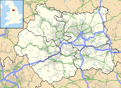
 Crosland Moor
Crosland Moor shown within West YorkshireOS grid reference SE1234015170 Metropolitan borough Kirklees Metropolitan county West Yorkshire Region Yorkshire and the Humber Country England Sovereign state United Kingdom Post town HUDDERSFIELD Postcode district HD4 Dialling code 01484 Police West Yorkshire Fire West Yorkshire Ambulance Yorkshire EU Parliament Yorkshire and the Humber UK Parliament Colne Valley List of places: UK • England • Yorkshire Crosland Moor is a district of the town of Huddersfield, West Yorkshire, England.
It begins 1 mile (1.5 km) to the south west of Huddersfield town centre. The electoral ward of Crosland Moor and Netherton, in the Colne Valley constituency. The area of Crosland Moor includes Beaumont Park, Crosland Hill and Walpole and has a population of 9,085 according to the 2001 census.
The name may have derived from the local landowners the Crosland family who owned much of the area in 15th and 16th centuries.
Crosland Moor begins at the junction of the Manchester Road A62 and Blackmoorfoot Road the main thoroughfare. The area rises up the hillside to overlook the areas of Milnsbridge and Golcar in the Colne Valley.
St. Luke's Hospital is situated along Blackmoorfoot Road. It was originally a workhouse for the poor and needy of the area in the 19th century. This is the headquarters for the Calderdale & Huddersfield NHS Trust and also provides other services such as physiotherapy.
The Walpole and Balmoral Avenue housing estates are also a part of Crosland Moor. Moor End Technology College, Crosland Moor's secondary school together with the Crosland Moor Junior and Infants schools are along Dryclough Road.
At the end of Dryclough Road, Beaumont Park begins. Huddersfield's first park opened in 1883, consists mainly of woodland and is on a hillside that looks over the Holme Valley and the Lockwood railway viaduct. It is currently being restored to its former glory by the Friends of Beaumont Park. Housing around the park is some of the most expensive in Huddersfield.
Along Blackmoorfoot Road beyond the junction with Dryclough Road was the spot where in April 1812 mill owner William Horsfall was shot and killed by the Luddites. They objected to the introduction of machinery Horsfall's mill in Marsden. A side street where the incident occurred was named after Horsfall (William Horsfall Street).
Just off Blackmoorfoot Road beyond the Crosland Heath Golf Course is the Crosland Moor airfield which was established by the David Brown Engineering Works based in Lockwood. Even further up the road is Huddersfield's Observatory which is situated high over Huddersfield for good views of the sky at night.
Before the airfield is the Wellfield quarry where Crosland Hill Sandstone comes from. According to the Building Research Establishment it is a durable stone not affected by acid rain or air pollution.
External links
Categories:- Geography of Huddersfield
- Kirklees
- Colne Valley


Wikimedia Foundation. 2010.