- Tydavnet
Infobox Irish Place
name = Tydavnet
gaeilge = Tigh Damhnata
crest
motto =
map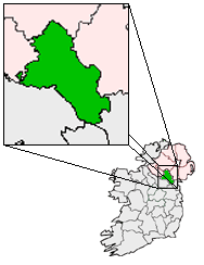
pin coords = left: 40px; top: 40px
north coord = | west coord = | irish grid =
area = | elevation =
province =Ulster
county =County Monaghan
population = | town pop = | rural pop =
census yr =
web = |Tydavnet or sometimes Tedavnet ("Derived from the
Irish Gaelic name of Tigh Damhnata, meaning House of Dymphna") is a small village in the north ofCounty Monaghan , in Ireland, and also the name of theparish in which the village is located. Both theChurch of Ireland andCatholic church have Tydavnet named as a parish and in both cases, the geographical area is almost identical.Origins
The origin of the name is from that of a 6th century Irish Saint,
Saint Dympna , who is thought to have founded a church in the area (generally considered to have been located in thegraveyard of the current village Catholic church). The village contains one of the three existingcatholic churches in the parish, the others located in Urbleshanny, nearScotstown and inCorlat . The Tydavnet Catholic church having originally been erected in 1730, then rebuilt in the early 1900s.The village is linked with
Gheel inBelgium which also has a strong Saint Dymphna connection.Amenities
Tydavnet has two
pubs - 'Jacks' and 'The Rock Inn'.Community Work
Tydavnet has also won Monaghan County Council's "Tidy Towns" competition, a competition aimed at promoting environmental cleanliness. The main school in the village is St. Dympna's N.S.
Wikimedia Foundation. 2010.