- Makrai
-
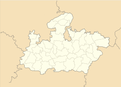
Makrai — town — Coordinates 25°50′18″N 78°20′35″E / 25.83833°N 78.34306°ECoordinates: 25°50′18″N 78°20′35″E / 25.83833°N 78.34306°E Country India State Madhya Pradesh District(s) Harda Nearest city Harda, District headquarter Time zone IST (UTC+05:30) Makrai was a princely state of India from the 16th century, later coming under the administrative authority of the Central Provinces and Berar until 1933, when it was transferred to the Bhopal Agency subdivision of the Central India Agency. In 1892, it covered an area of 401 square kilometres (155 sq mi) and had a population of 16,784. The state's rulers bore the title "Raja". The modern place of Makrai falls in the Harda District of the Madhya Pradesh state.
Description
Makrai stands on a hill near the Sayani Nadi River and is noted for its dense forests. One well-known location is Nagjhiri and Devjhiri, a small natural well in the bank of the river through which water flows throughout the year. Other notable places include Mankameshwar Mahadev (situated in a cave), Sule Baba Ki tekri (hill Of Sule Baba), known for its tribal God and as the highest, coolest place in Makrai, the Bunred Palace (Mahal), Kaidi Ki Babdi, from where prisoners carry water from the river to the top of hill to supply the state. Here, Nathji used to worship the gods Bhilat Dev and Shiv Ji.[clarification needed]
There were two noted melas, where villagers and local tribes gathered to celebrate Shivratri and the eve of Holi. Another well-known mela, the month-long Bhilat Dev is organised every year near Sirali in Malapur. Before the mela starts, the Nathji (Pandit) go barefoot and carry tippara (made from bamboo and used to keep the cloth of God[clarification needed]) on their heads from Khudia (the new provincial Village) to the Tapti River Bank Betul district - a distance of about 200 kilometres (120 mi), to wash their worshipping cloths then return the same way over a fixed period of seven days. In a tradition that has existed for hundreds of years, during the journey people from the villages wait for the tippara on a fixed day and thereafter organize a mela.
The principality was founded by Rajgond Raja Karkat Rai in the 16th century . After Indian independence in 1947, the rulers of Makrai acceded to the Union of India, and the principality was incorporated into the state of Madhya Pradesh, which in turn was created from the former Central Provinces and Berar.
The current Maharaja of Makrai is Raja Ajay Shah, born 21 January 1956 and crowned in 1987.
Former Princely States in Madhya Pradesh States Agar • Ajaigarh • Alipura • Alirajpur • Barwani • Bhopal • Bijawar • Chhatarpur • Datia • Dewas • Dhar • Gwalior • Indore • Jaora • Jobat • Khaniyadhana • Khilchipur • Kurwai • Maihar • Makrai • Narsighgarh • Orchha • Panna • Pathari • Piploda • Rajgarh • Ratlam • Rewa • Sailana • SitamauRelated topics Central India Agency • Bhopal Agency • Bhopawar Agency • Bundelkhand Agency • Saugor and Nerbudda Territories • Gwalior Residency • List of Indian princely states • List of Indian princely states (alphabetical) • Salute stateCategories:- Indian Princely States
- States and territories established in the 1850s
- Madhya Pradesh geography stubs
Wikimedia Foundation. 2010.


