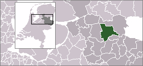
Vilsteren — 52°30′41″N 6°21′11″E / 52.51139, 6.35306 … Wikipédia en Français
Ommen — Municipality The Sahara near Ommen … Wikipedia
De Klomp Charme Hotel & Restaurant — (Vilsteren,Нидерланды) Категория отеля: 3 звездочный отель Адрес: Vilster … Каталог отелей
Grut (Bierwürze) — Grut (auch Gruit) ist eine in ihrer Zusammensetzung variable Kräutermischung, die zum Würzen von Bier eingesetzt wird. Klassisch mit Grut gebraute Biere werden auch als Grutbiere bezeichnet und waren über Jahrhunderte vor allem entlang der… … Deutsch Wikipedia
Laarne — Infobox Belgium Municipality name=Laarne picture= picture width=260px picture map Laarne in East Flanders arms=Laarne wapen.gif region=BE REG FLE community=BE NL province=BE PROV OV arrondissement=Dendermonde nis=42010 pyramid date=01/01/2006 0… … Wikipedia
Kinderdijk — Coordinates: 51°53′N 4°38′E / 51.883°N 4.633°E / 51.883; 4.633 … Wikipedia
List of places in the Netherlands — This is an alphabetical list of places (cities, towns, villages) in the Netherlands. Lists per province can be found at:* List of towns in Groningen * List of towns in Friesland * List of towns in Drente * List of towns in Overijssel * List of… … Wikipedia
De Adriaan, Haarlem — Windmill De Adriaan De Adriaan is a windmill in the Netherlands that burnt down in 1932 and was rebuilt in 2002. The original windmill dates from 1779 and the mill has been a distinctive part of the skyline of Haarlem for centuries. Contents … Wikipedia
FC Emmen — Football club infobox clubname = FC Emmen fullname = Football Club Emmen nickname = Emmen , The Kannibals founded = August 21, 1925 ground = Univé Stadion Emmen capacity = 8,600 manager = Gerry Hamstra league = Eerste Divisie season = 2007 08… … Wikipedia
Mädchen von Yde — Fundstelle des Mädchens von Yde Das Mädchen von Yde (niederländisch Meisje van Yde) ist eine Moorleiche, die 1897 in dem Moor Stijfveen in der Nähe des niederländischen Ortes Yde in der Provinz Drenthe gefunden wurde. Die Moorleiche wird im… … Deutsch Wikipedia