- National Register of Historic Places listings in Chenango County, New York
-
 Location of Chenango County in New York
List of the National Register of Historic Places listings in Chenango County, New York
This is intended to be a complete list of properties and districts listed on the National Register of Historic Places in Chenango County, New York. The locations of National Register properties and districts for which the latitude and longitude coordinates are included below, may be seen in a Google map.[1]
-
- This National Park Service list is complete through NPS recent listings posted November 18, 2011.[2]
Contents: Counties in New York Albany (Albany) – Allegany – Bronx – Broome – Cattaraugus – Cayuga – Chautauqua – Chemung – Chenango – Clinton – Columbia – Cortland – Delaware – Dutchess – Erie (Buffalo) – Essex – Franklin – Fulton – Genesee – Greene – Hamilton – Herkimer – Jefferson – Kings (Brooklyn) – Lewis – Livingston – Madison – Monroe (Rochester) – Montgomery – Nassau – New York (Manhattan – Below 14th Street, 14th to 59th Streets, 59th to 110th Streets, Above 110th Street, Islands) – Niagara – Oneida – Onondaga (Syracuse) – Ontario – Orange – Orleans – Oswego – Otsego – Putnam – Queens – Rensselaer – Richmond (Staten Island) – Rockland – Saratoga – Schenectady – Schoharie – Schuyler – Seneca – St. Lawrence – Steuben – Suffolk – Sullivan – Tioga – Tompkins – Ulster – Warren – Washington – Wayne – Westchester (New Rochelle, Peekskill, Yonkers) – Wyoming – Yates Current listings
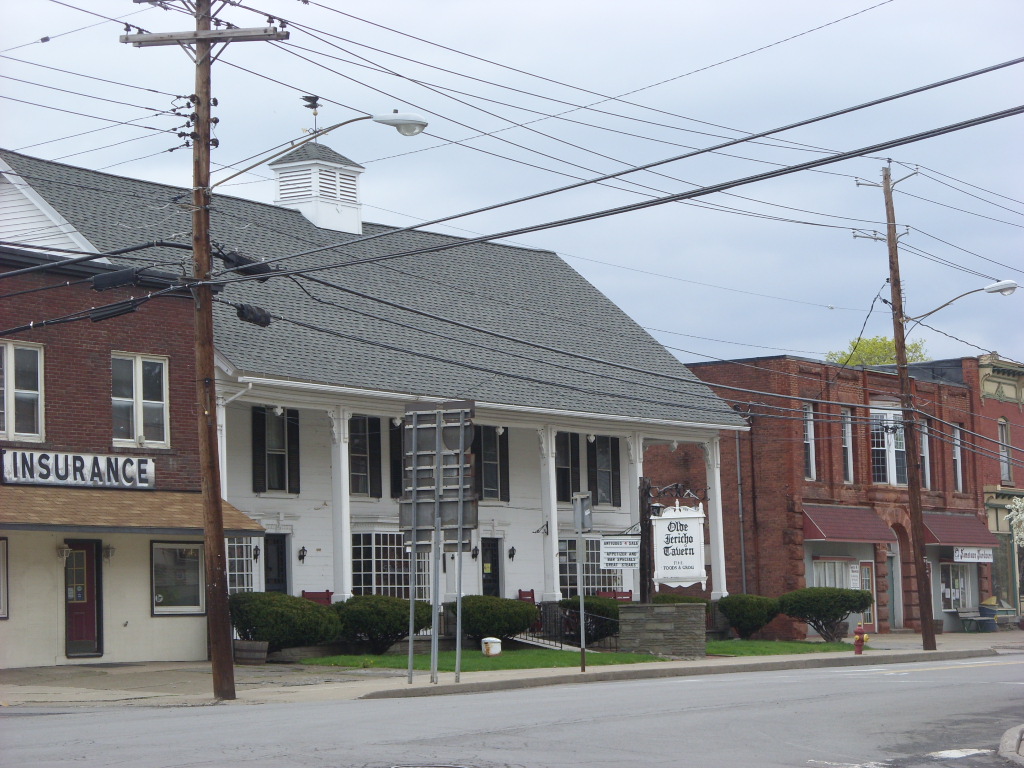
[3] Landmark name Image Date listed Location City or town Summary 1 Bainbridge Historic District 
November 9, 1982 E. Main, Juliand, N. Main, Pearl, S. Main, and W. Main Sts., Park Pl. and Railroad Ave.
42°17′41″N 75°28′46″W / 42.294722°N 75.479444°WBainbridge 2 Bates Round Barn September 29, 1984 NY 12
42°18′10″N 75°48′07″W / 42.302778°N 75.801944°WGreene 3 Theodore Burr House September 11, 1981 Fort Hill Sq.
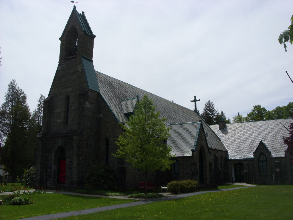
42°26′27″N 75°35′48″W / 42.440833°N 75.596667°WOxford 4 Calvary Episcopal Church February 20, 1998 North St., W of Moon Hill Rd.
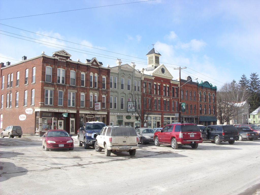
42°29′58″N 75°46′05″W / 42.499444°N 75.768056°WMcDonough 5 Chenango County Courthouse District 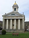
June 10, 1975 Irregular pattern between Hayes and Mechanic Sts. and Maple Ave. and City Hall
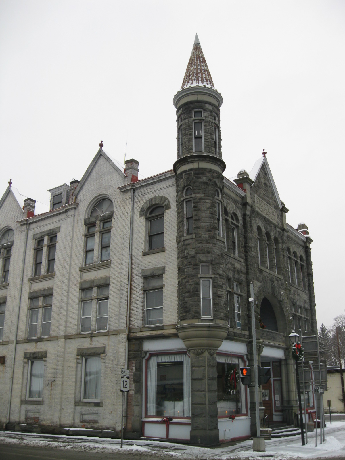
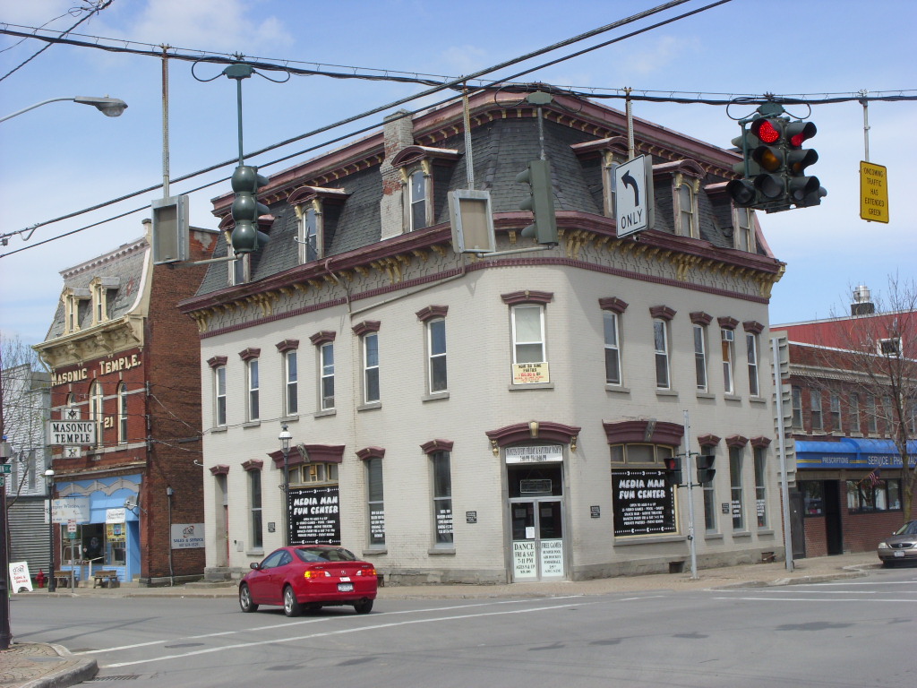
42°31′53″N 75°31′27″W / 42.531389°N 75.524167°WNorwich 6 Clinton-Rosekrans Law Building July 27, 1979 62 Genesee St
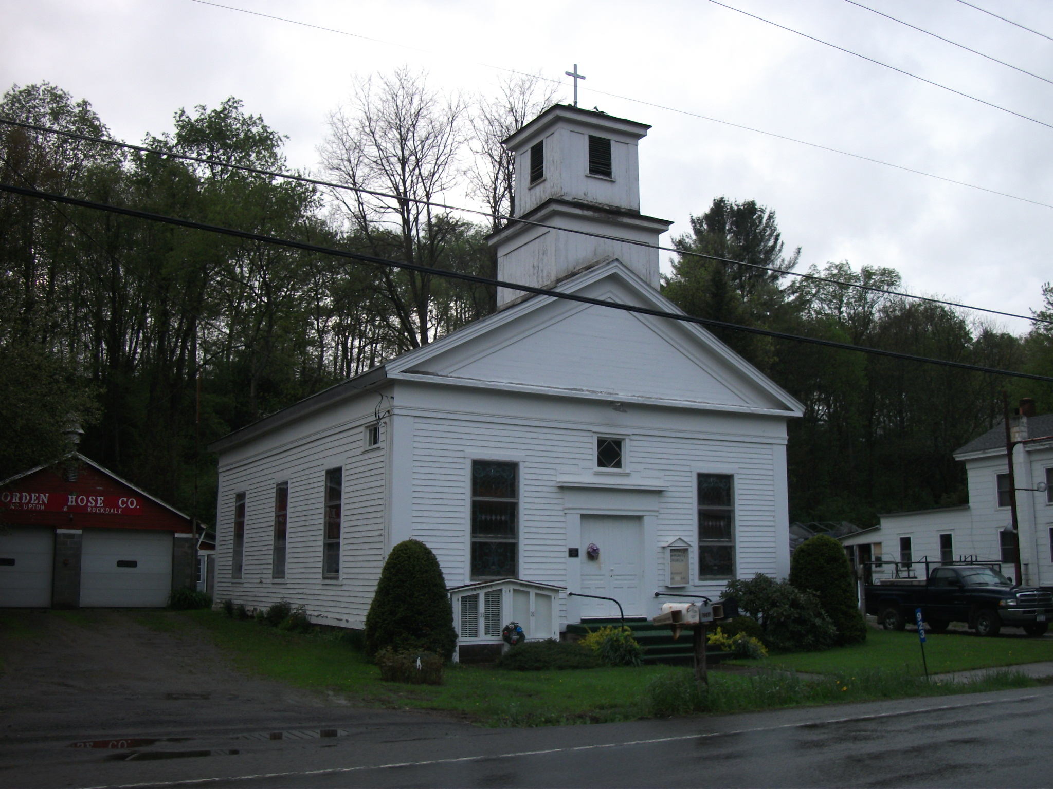
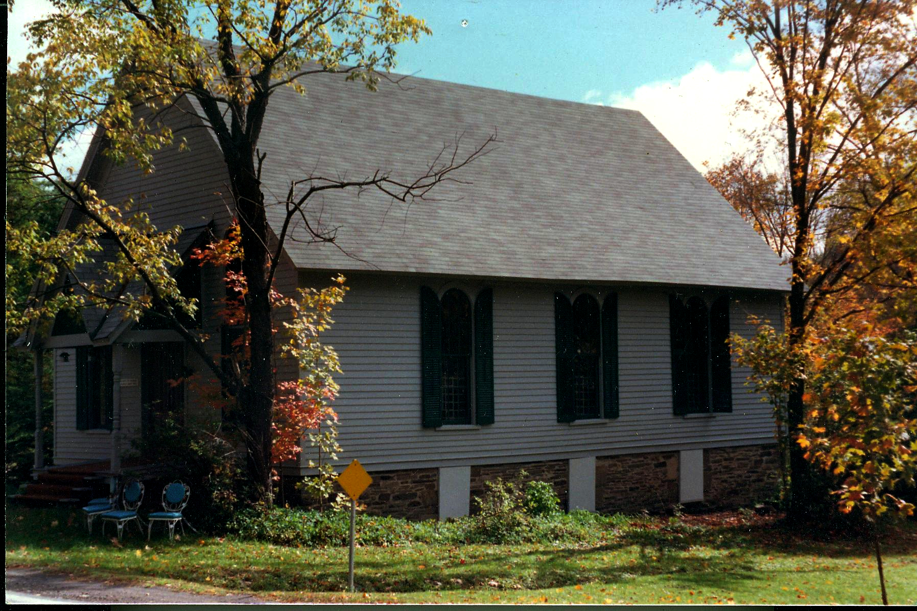
42°19′47″N 75°46′15″W / 42.329722°N 75.770833°WGreene 7 Columbus Community Church 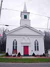
March 20, 1986 NY 80
42°41′01″N 75°22′24″W / 42.683611°N 75.373333°WColumbus 8 District School 2 February 25, 2004 Cty Rte 27
42°18′53″N 75°35′54″W / 42.314722°N 75.598333°WCoventryville 9 District School 4 April 21, 2004 NY 235
42°18′53″N 75°38′22″W / 42.314722°N 75.639444°WCoventry 10 Earlville Historic District 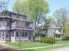
October 29, 1982 Fayette, N., S., E., and W. Main Sts.
42°44′25″N 75°32′42″W / 42.740278°N 75.545°WEarlville 11 Eaton Family Residence — Jewish Center of Norwich Eaton Family Residence — Jewish Center of NorwichJune 4, 2009 72 S. Broad St.
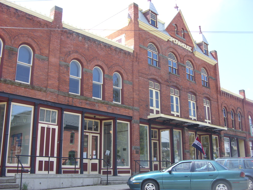
42°31′38″N 75°31′24″W / 42.527339°N 75.523472°WNorwich New listing; refnum# 09000375 12 Earlville Opera House 
January 22, 1973 12-20 E. Main St.
42°44′22″N 75°32′41″W / 42.739444°N 75.544722°WEarlville 13 Emmanuel Episcopal Church Complex Emmanuel Episcopal Church ComplexAugust 26, 2009 37 W. Main St.
42°31′50″N 75°31′38″W / 42.530478°N 75.527261°WNorwich New listing; refnum 09000654 14 Greene Historic District 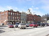
September 9, 1982 Chenango, Genesee, and Jackson Sts.
42°19′44″N 75°46′18″W / 42.328889°N 75.771667°WGreene 15 Guildford Center Presbyterian Church September 24, 2004 Cty Rd. 36
42°24′23″N 75°27′53″W / 42.406389°N 75.464722°WGuilford Center 16 Guilford Center Cemetery October 5, 2005 Cty Rte. 36
42°24′29″N 75°27′57″W / 42.408056°N 75.465833°WGuilford Center 17 Charles C. Hovey House and Strong Leather Company Mill December 6, 1996 53 W. Main St. and 10 Bixby St.
42°17′45″N 75°29′00″W / 42.295833°N 75.483333°WBainbridge 18 Main Street Historic District June 30, 1983 169-191 and 158-180 Main St.
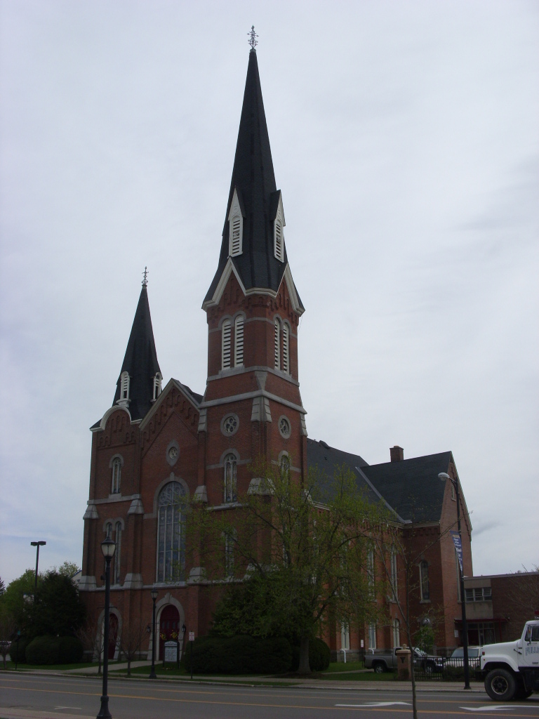
42°13′41″N 75°31′36″W / 42.228056°N 75.526667°WAfton 19 Holden B. Mathewson House Holden B. Mathewson HouseOctober 23, 2009 1567 NY 26
42°13′41″N 75°31′36″W / 42.228056°N 75.526667°WSouth Otselic New listing; refnum 09000860 20 Methodist-Episcopal Church of Norwich 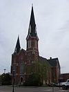
August 28, 2003 74 N. Broad St.
42°32′01″N 75°31′26″W / 42.533611°N 75.523889°WNorwich 21 Horace O. Moss House 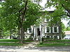
May 17, 1974 45 S. Main St.
42°37′16″N 75°19′55″W / 42.621111°N 75.331944°WNew Berlin 22 New Berlin Historic District 
August 12, 1982 Roughly along Main, West and Genesee Sts.
42°37′21″N 75°19′56″W / 42.6225°N 75.332222°WNew Berlin 23 Newton Homestead June 3, 1982 Ridge Rd.
42°39′04″N 75°47′08″W / 42.651111°N 75.785556°WSouth Otselic Octagon house built in 1860 24 North Broad Street Historic District November 21, 1978 Broad St.
42°32′14″N 75°31′30″W / 42.537222°N 75.525°WNorwich 25 Oxford Village Historic District 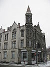
September 17, 1985 Roughly Washington Ave., State St., Chenango River, Merchant & Green Sts., Washington Park, Albany & Pleasant Sts.
42°26′27″N 75°35′40″W / 42.440833°N 75.594444°WOxford 26 Rockdale Community Church 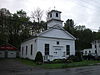
October 5, 2005 NY 8
42°22′39″N 75°24′30″W / 42.3775°N 75.408333°WRockdale 27 Rockwells Mills Historic District Rockwells Mills Historic DistrictAugust 30, 2010 NY 8 and Crandall Road
42°26′56″N 75°23′24″W / 42.448889°N 75.39°WGuilford New listing; refnum 10000610 28 Sannick Family Farm April 18, 2007 129 Jordan Ln. South Oxford 29 Sherburne High School November 3, 1988 16 Chapel St.
42°40′33″N 75°29′39″W / 42.675833°N 75.494167°WSherburne 30 Sherburne Historic District 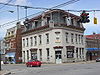
October 29, 1982 N. and S. Main, E. and W. State, Classic, Summit and Church Sts. and Park Ave.
42°40′37″N 75°29′38″W / 42.676944°N 75.493889°WSherburne 31 Smithville Valley Grange No. 1397 August 6, 1998 NY 41
42°23′57″N 75°48′33″W / 42.399167°N 75.809167°WSmithville Flats 32 Smyrna Elementary School December 16, 1996 School St., SE of NY 80
42°41′10″N 75°34′12″W / 42.686111°N 75.57°WSmyrna 33 Smyrna Town Hall-Opera House Smyrna Town Hall-Opera HouseJuly 25, 2008 Academy Street
42°41′14″N 75°34′14″W / 42.687222°N 75.570556°WSmyrna (new listing, refnum 08000699) 34 South Otselic Historic District 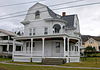
September 8, 1983 Gladding, N. and S. Main Sts., Clarence Church and Plank Rds., and Potter Ave.
42°38′48″N 75°46′52″W / 42.646667°N 75.781111°WSouth Otselic 35 Upperville Meeting House 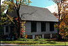
April 1, 2002 NY 80
42°42′00″N 75°36′58″W / 42.7°N 75.616111°WUpperville 36 US Post Office-Norwich May 11, 1989 20-22 E. Main St.
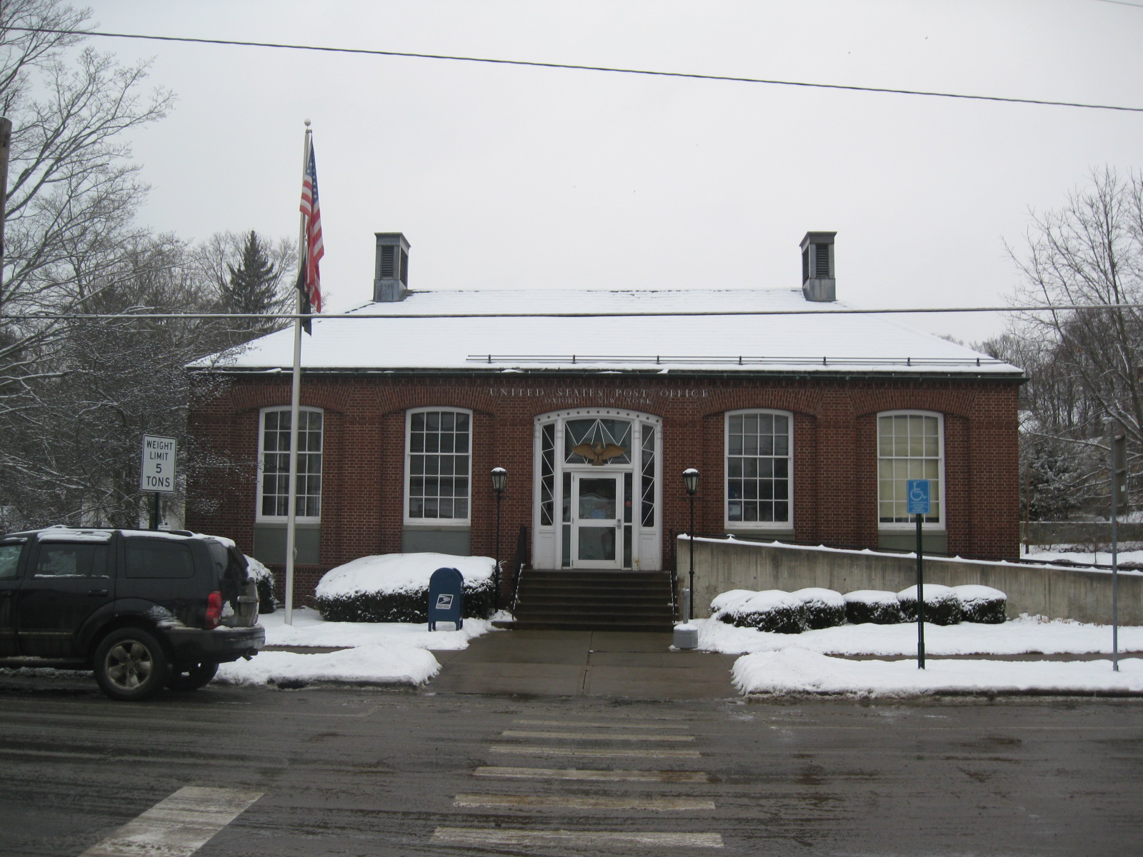
42°31′51″N 75°31′20″W / 42.530833°N 75.522222°WNorwich 37 US Post Office-Oxford 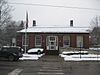
May 11, 1989 S. Washington Ave.
42°26′32″N 75°35′56″W / 42.442222°N 75.598889°WOxford 38 West Hill Cemetery January 18, 2006 NY 80
42°41′39″N 75°31′56″W / 42.694167°N 75.532222°WSherburne 39 White Store Church and Evergreen Cemetery February 10, 1995 Jct. of NY 8 and White Store Rd., 4 mi. S of South New Berlin
42°29′01″N 75°24′23″W / 42.483611°N 75.406389°WNorwich 40 Young Round Barn September 29, 1984 NY 12
42°17′39″N 75°48′28″W / 42.294167°N 75.807778°WGreene See also
References
- ^ The latitude and longitude information provided is primarily from the National Register Information System, and has been found to be fairly accurate for about 99% of listings. For 1%, the location info may be way off. We seek to correct the coordinate information wherever it is found to be erroneous. Please leave a note in the Discussion page for this article if you believe any specific location is incorrect.
- ^ "National Register of Historic Places: Weekly List Actions". National Park Service, United States Department of the Interior. Retrieved on November 18, 2011.
- ^ Numbers represent an ordering by significant words. Various colorings, defined here, differentiate National Historic Landmark sites and National Register of Historic Places Districts from other NRHP buildings, structures, sites or objects.
External links
A useful list of the above sites, with street addresses and other information, is available at Chenango County, New York, listing, at National Register of Historic Places.Com, a private site serving up public domain information on NRHPs.
Categories:- National Register of Historic Places in New York by county
- Chenango County, New York
-


Wikimedia Foundation. 2010.