- National Register of Historic Places listings in Delaware County, New York
-
 Location of Delaware County in New York
List of the National Register of Historic Places listings in Delaware County, New York
This is intended to be a complete list of properties and districts listed on the National Register of Historic Places in Delaware County, New York. The locations of National Register properties and districts (at least for all showing latitude and longitude coordinates below) may be seen in a Google map by clicking on "Map of all coordinates".[1] There is just one property in the county which is further designated a National Historic Landmark, the John Burroughs Home.
-
- This National Park Service list is complete through NPS recent listings posted November 18, 2011.[2]
Contents: Counties in New York Albany (Albany) – Allegany – Bronx – Broome – Cattaraugus – Cayuga – Chautauqua – Chemung – Chenango – Clinton – Columbia – Cortland – Delaware – Dutchess – Erie (Buffalo) – Essex – Franklin – Fulton – Genesee – Greene – Hamilton – Herkimer – Jefferson – Kings (Brooklyn) – Lewis – Livingston – Madison – Monroe (Rochester) – Montgomery – Nassau – New York (Manhattan – Below 14th Street, 14th to 59th Streets, 59th to 110th Streets, Above 110th Street, Islands) – Niagara – Oneida – Onondaga (Syracuse) – Ontario – Orange – Orleans – Oswego – Otsego – Putnam – Queens – Rensselaer – Richmond (Staten Island) – Rockland – Saratoga – Schenectady – Schoharie – Schuyler – Seneca – St. Lawrence – Steuben – Suffolk – Sullivan – Tioga – Tompkins – Ulster – Warren – Washington – Wayne – Westchester (New Rochelle, Peekskill, Yonkers) – Wyoming – Yates Current listings
[3] Landmark name Image Date listed Location City or town Summary 1 Andes Historic District June 28, 1984 Delaware Ave., Main and High Sts., and Tremperskill Rd.
42°11′22″N 74°46′51″W / 42.189444°N 74.780833°WAndes 2 Bloomville Methodist Epicopal Church November 29, 2006 35 Church St.
42°19′59″N 74°48′36″W / 42.333056°N 74.81°WBloomville 3 Bovina Center Historic District June 2, 2000 Roughly Co. Rt. 6, Creamery Rd., Maple and Pink Sts.
42°15′34″N 74°47′20″W / 42.259444°N 74.788889°WBovina Center 4 Amos Bristol Tavern December 13, 2000 Cty Rte 14
42°20′55″N 75°00′51″W / 42.348611°N 75.014167°WWest Meredith 5 Burns Family Farm May 30, 2007 Crescent Valley Rd.
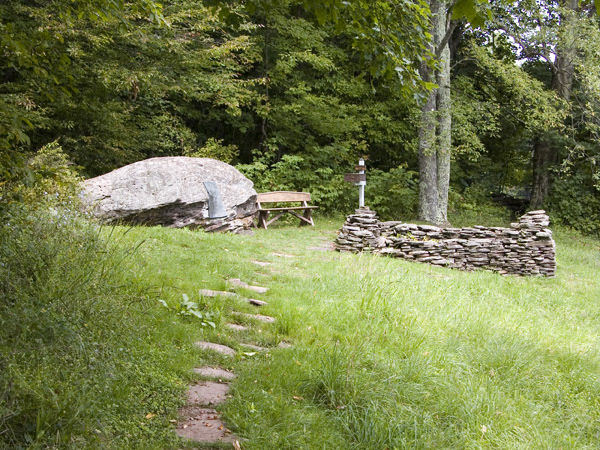
42°17′59″N 74°40′48″W / 42.299794°N 74.680056°WBovina 6 John Burroughs Home 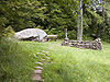
October 15, 1966 2 mi. from Roxbury on Roxbury Rd.
42°17′47″N 74°35′03″W / 42.296389°N 74.584167°WRoxbury A home of naturalist John Burroughs 7 Christ Episcopal Church 
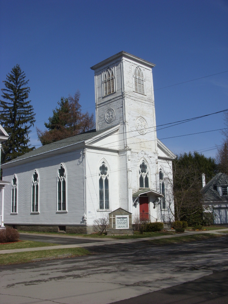
May 18, 1999 41 Gardiner Pl.
42°10′11″N 75°07′45″W / 42.169722°N 75.129167°WWalton 8 Christian Church March 12, 2001 NY 10
42°17′56″N 74°52′45″W / 42.298889°N 74.879167°WEast Delhi 9 Churchill Park Historic District November 17, 1980 NY 10 and NY 23 and W. Main St.
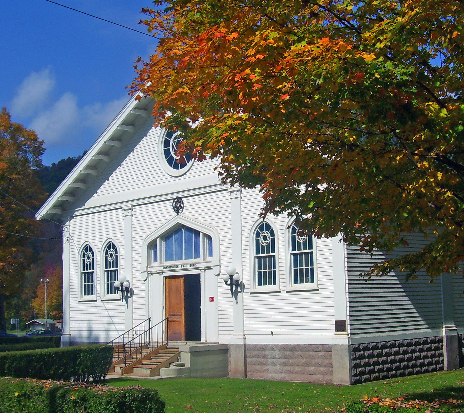
42°24′52″N 74°37′30″W / 42.414444°N 74.625°WStamford 10 Congregation Bnai Israel Synagogue 
November 21, 2002 Wagner Ave.
42°09′19″N 74°31′59″W / 42.155278°N 74.533056°WFleischmanns 1920 synagogue is only one listed in county and only one in Catskills with exposed truss roof 11 Delaware and Northern Railroad Station August 20, 2004 Cabin Hill Rd.
42°11′14″N 74°47′21″W / 42.187222°N 74.789167°WAndes 12 Delaware County Courthouse Square District 
July 16, 1973 Roughly bounded by 2nd, Church, Main, and Court Sts.
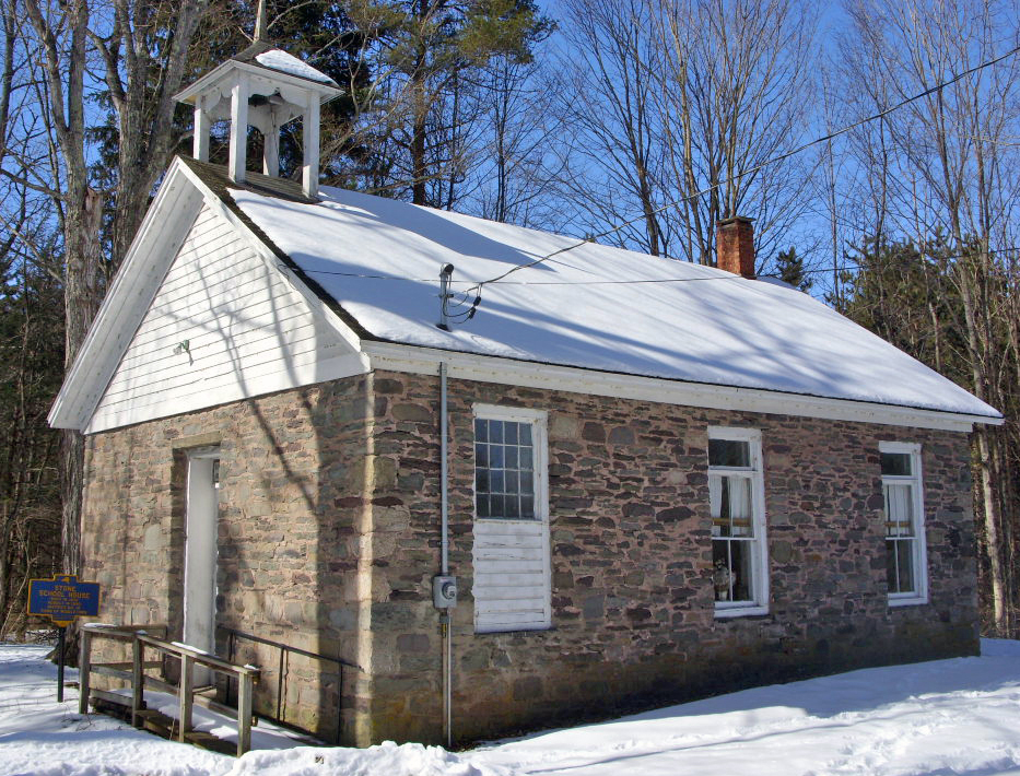
42°16′42″N 74°55′01″W / 42.278333°N 74.916944°WDelhi 13 District 10 School 
February 20, 1998 NY 28, 2 mi SW of Margaretville
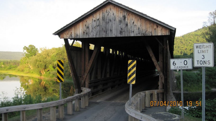
42°07′20″N 74°40′32″W / 42.122222°N 74.675556°WMargaretville 1820s school demolished in 1850s, reassembled in 1860. Only building left standing in Pepacton Reservoir area 14 Downsville Covered Bridge 
April 29, 1999 Bridge St.
42°04′34″N 74°59′28″W / 42.076111°N 74.991111°WDownsville 15 First Old School Baptist Church of Roxbury and Vega Cemetery April 12, 1996 Near Jct. of Co. Rt. 36 and Cartwright Rd.
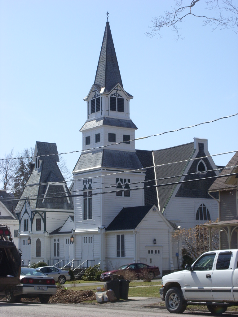
42°14′58″N 74°32′10″W / 42.249444°N 74.536111°WRoxbury 16 First Presbyterian Church 
February 1, 2006 Clinton St.
42°16′28″N 74°55′21″W / 42.274444°N 74.9225°WDelhi 17 First Presbyterian Church of Margaretville 
April 21, 2004 169 Orchard Ave.
42°08′58″N 74°39′07″W / 42.149444°N 74.651944°WMargaretville Intact 1894 late Victorian church 18 Fitches Covered Bridge 
April 29, 1999 Fitches Bridge Rd.
42°17′53″N 74°52′47″W / 42.298056°N 74.879722°WEast Delhi 19 Franklin Village Historic District 
September 7, 1984 Wakeman and Institute Aves., Main, Center, Maple, Water, 2nd, 3rd, and West Sts.
42°20′24″N 75°09′58″W / 42.34°N 75.166111°WFranklin 20 Judge Gideon Frisbee House December 12, 1976 NE of Delhi on NY 10
42°17′57″N 74°53′29″W / 42.299167°N 74.891389°WDelhi 21 Amelita Galli-Curci Estate Amelita Galli-Curci EstateAugust 19, 2010 352 and 374 Galli-Curci Road Fleischmanns vicinity New listing; refnum 10000556 22 Galli-Curci Theatre 
April 12, 2006 801 Main St.
42°08′56″N 74°38′56″W / 42.148889°N 74.648889°WMargaretville 1922 movie theatre was also one of region's first car dealerships 23 Gardiner Place Historic District 
May 24, 1984 Gardiner Place
42°10′08″N 75°07′43″W / 42.168889°N 75.128611°WWalton 24 Hamden Covered Bridge 
April 29, 1999 Basin Clove Rd.
42°11′44″N 74°59′19″W / 42.195556°N 74.988611°WHamden 25 Hanford Mill March 26, 1973 On CR 12
42°25′47″N 74°52′16″W / 42.429744°N 74.871097°WEast Meredith 26 Isaac Hardenbergh House December 12, 1994 NY 23 N of jct. with William Lutz Rd.
42°20′14″N 74°27′11″W / 42.337222°N 74.453056°WRoxbury 27 Hobart Masonic Hall December 28, 2001 6 Cornell Ave.
42°22′22″N 74°40′02″W / 42.372778°N 74.667222°WHobart 28 Hotel Delaware December 6, 2004 391 Main St.
41°59′17″N 75°08′04″W / 41.988056°N 75.134444°WEast Branch 29 Hubbell Family Farm and Kelly's Corners Cemetery August 17, 2001 NY 30
42°11′25″N 74°35′40″W / 42.190278°N 74.594444°WKelly's Corners 30 Jackson-Aitken Farm February 20, 2003 3240 Fall Clove Rd.
42°09′28″N 74°52′10″W / 42.157778°N 74.869444°WAndes 31 Kelly Round Barn September 29, 1984 NY 30
42°12′01″N 74°35′48″W / 42.200278°N 74.596667°WHalcottsville 32 Lordville Presbyterian Church 
February 4, 2000 Lordville Rd.
41°52′11″N 75°12′57″W / 41.869722°N 75.215833°WLordville 33 Lower Shavertown Covered Bridge April 29, 1999 682 Methol Rd.
41°55′24″N 75°00′49″W / 41.923333°N 75.013611°WMethol 34 MacDonald Farm April 3, 1973 Elk Creek and Monroe Rds.
42°21′14″N 74°51′44″W / 42.353889°N 74.862222°WMeredith 35 Main Street Historic District 
February 29, 1988 Main St.
42°17′22″N 74°33′44″W / 42.289444°N 74.562222°WRoxbury 36 McArthur-Martin Hexadecagon Barn September 29, 1984 McArthur Hill Rd.
42°22′18″N 74°46′51″W / 42.371667°N 74.780833°WBloomville 37 Murray Hill June 3, 1982 Murray Hill Rd.
42°16′35″N 74°54′16″W / 42.276389°N 74.904444°WDelhi 38 New Kingston Historic District February 19, 2008 Co. Rd. 6
42°12′52″N 74°40′53″W / 42.214556°N 74.681433°WNew Kingston 39 New Kingston Presbyterian Church May 22, 2002 CR 6
42°12′48″N 74°40′57″W / 42.213333°N 74.6825°WNew Kingston 40 New Stone Hall 
May 6, 1980 Center St.
42°20′20″N 75°10′06″W / 42.338889°N 75.168333°WFranklin 41 Old School Baptist Church of Halcottsville July 8, 1999 Old NY 30
42°12′25″N 74°36′05″W / 42.206944°N 74.601389°WHalcottsville 42 Pakatakan Artists Colony Historic District February 21, 1989 NY 28 at jct. with Dry Brook Rd.
42°08′33″N 74°37′30″W / 42.1425°N 74.625°WArkville 43 Pioneer Cemetery July 24, 2007 Main St.
42°18′59″N 75°23′39″W / 42.316389°N 75.394167°WSidney 44 Ravina February 4, 2000 Bouchouxville
41°52′16″N 75°12′28″W / 41.871111°N 75.207778°WLordville 45 Rock Valley School May 12, 2008 9598 Rock Valley Rd.
41°53′33″N 75°05′04″W / 41.892364°N 75.084436°WRock Valley (new listing; refnum 08000406) 46 St. John's Church Complex July 21, 1995 136 Main St.
42°16′45″N 74°55′00″W / 42.279167°N 74.916667°WDelhi 47 St. Peter's Episcopal Church Complex July 31, 1998 Jct. of Pine and Church Sts.
42°22′13″N 74°40′13″W / 42.370278°N 74.670278°WHobart 48 Schoolhouse No. 5 Schoolhouse No. 5June 1, 2011 5942 Dunk Hill Rd.
42°16′05″N 75°05′08″W / 42.268056°N 75.085556°WHamden vicinity New listing; refnum 11000326 49 Second Old School Baptist Church of Roxbury 
July 28, 1999 Cty. Rd. 41
42°15′53″N 74°35′43″W / 42.264722°N 74.595278°WRoxbury 50 Erskine L. Seeley House Erskine L. Seeley HouseAugust 30, 2010 46 Main St.
42°24′28″N 74°36′48″W / 42.407778°N 74.613333°WStamford New listing; refnum 10000593 51 Sherwood Family Estate December 31, 2002 484 Sherwood Rd.
42°15′50″N 74°56′03″W / 42.263889°N 74.934167°WDelhi 52 Skene Memorial Library 
May 30, 2001 Main St.-Old NY 28
42°09′19″N 74°31′46″W / 42.155278°N 74.529444°WFleischmanns Queen Anne/Shingle Style Carnegie library built by Alexander Skene's widow in his memory in 1901 53 Walter Stratton House December 31, 2002 New Kingston Mountain Rd.
42°15′21″N 74°37′00″W / 42.255833°N 74.616667°WRoxbury 54 Thomson Family Farm September 15, 2004 Thomson Hollow Rd.
42°16′03″N 74°38′03″W / 42.2675°N 74.634167°WNew Kingston 55 Ulster and Delaware Railroad Depot and Mill Complex April 18, 2003 Depot St.
42°17′04″N 74°34′11″W / 42.284444°N 74.569722°WRoxbury 56 Union Free School December 6, 2004 218 NY 206
42°04′59″N 74°59′53″W / 42.083056°N 74.998056°WDownsville 57 US Post Office-Delhi November 17, 1988 10 Court St.
42°16′40″N 74°55′07″W / 42.277778°N 74.918611°WDelhi 58 US Post Office-Walton May 11, 1989 34-36 Gardner Pl.
42°10′09″N 75°07′42″W / 42.169167°N 75.128333°WWalton 59 Van Benschoten House and Guest House April 1, 2002 Margaretville Mountain Rd.
42°10′02″N 74°40′08″W / 42.167222°N 74.668889°WMargaretville 60 Walton Grange 1454-Former Armory June 22, 1998 57 Stockton Ave.
42°09′56″N 75°07′50″W / 42.165556°N 75.130556°WWalton 61 West Delhi Presbyterian Church, Manse, and Cemetery November 7, 2008 18 and 45 Sutherland Rd.
42°18′00″N 75°00′25″W / 42.300114°N 75.007025°WWest Delhi New listing; refnum#08001032 62 West Kortright Presbyterian Church November 15, 2002 49 W. Kortright Church Rd.
42°24′08″N 74°51′08″W / 42.402222°N 74.852222°WWest Kortright 63 West Meredith Cemetery November 7, 2003 Cty Rte. 14
42°20′48″N 75°01′36″W / 42.346667°N 75.026667°WWest Meredith See also
References
- ^ The latitude and longitude information provided in this table was derived originally from the National Register Information System, which has been found to be fairly accurate for about 99% of listings. For about 1% of NRIS original coordinates, experience has shown that one or both coordinates are typos or otherwise extremely far off; some corrections may have been made. A more subtle problem causes many locations to be off by up to 150 yards, depending on location in the country: most NRIS coordinates were derived from tracing out latitude and longitudes off of USGS topographical quadrant maps created under the North American Datum of 1927, which differs from the current, highly accurate WGS84 GPS system used by Google maps. Chicago is about right, but NRIS longitudes in Washington are higher by about 4.5 seconds, and are lower by about 2.0 seconds in Maine. Latitudes differ by about 1.0 second in Florida. Some locations in this table may have been corrected to current GPS standards.
- ^ "National Register of Historic Places: Weekly List Actions". National Park Service, United States Department of the Interior. Retrieved on November 18, 2011.
- ^ Numbers represent an ordering by significant words. Various colorings, defined here, differentiate National Historic Landmark sites and National Register of Historic Places Districts from other NRHP buildings, structures, sites or objects.
Categories:- National Register of Historic Places in New York by county
- National Register of Historic Places in Delaware County, New York
-


Wikimedia Foundation. 2010.