- National Register of Historic Places listings in Genesee County, New York
-
 Location of Genesee County in New York
List of the National Register of Historic Places listings in Genesee County, New York
This is intended to be a complete list of properties and districts listed on the National Register of Historic Places in Genesee County, New York. The locations of National Register properties and districts (at least for all showing latitude and longitude coordinates below) may be seen in a Google map by clicking on "Map of all coordinates".[1] One property, the Holland Land Office, is further designated a National Historic Landmark.
-
- This National Park Service list is complete through NPS recent listings posted November 18, 2011.[2]
Contents: Counties in New York Albany (Albany) – Allegany – Bronx – Broome – Cattaraugus – Cayuga – Chautauqua – Chemung – Chenango – Clinton – Columbia – Cortland – Delaware – Dutchess – Erie (Buffalo) – Essex – Franklin – Fulton – Genesee – Greene – Hamilton – Herkimer – Jefferson – Kings (Brooklyn) – Lewis – Livingston – Madison – Monroe (Rochester) – Montgomery – Nassau – New York (Manhattan – Below 14th Street, 14th to 59th Streets, 59th to 110th Streets, Above 110th Street, Islands) – Niagara – Oneida – Onondaga (Syracuse) – Ontario – Orange – Orleans – Oswego – Otsego – Putnam – Queens – Rensselaer – Richmond (Staten Island) – Rockland – Saratoga – Schenectady – Schoharie – Schuyler – Seneca – St. Lawrence – Steuben – Suffolk – Sullivan – Tioga – Tompkins – Ulster – Warren – Washington – Wayne – Westchester (New Rochelle, Peekskill, Yonkers) – Wyoming – Yates Listings county-wide
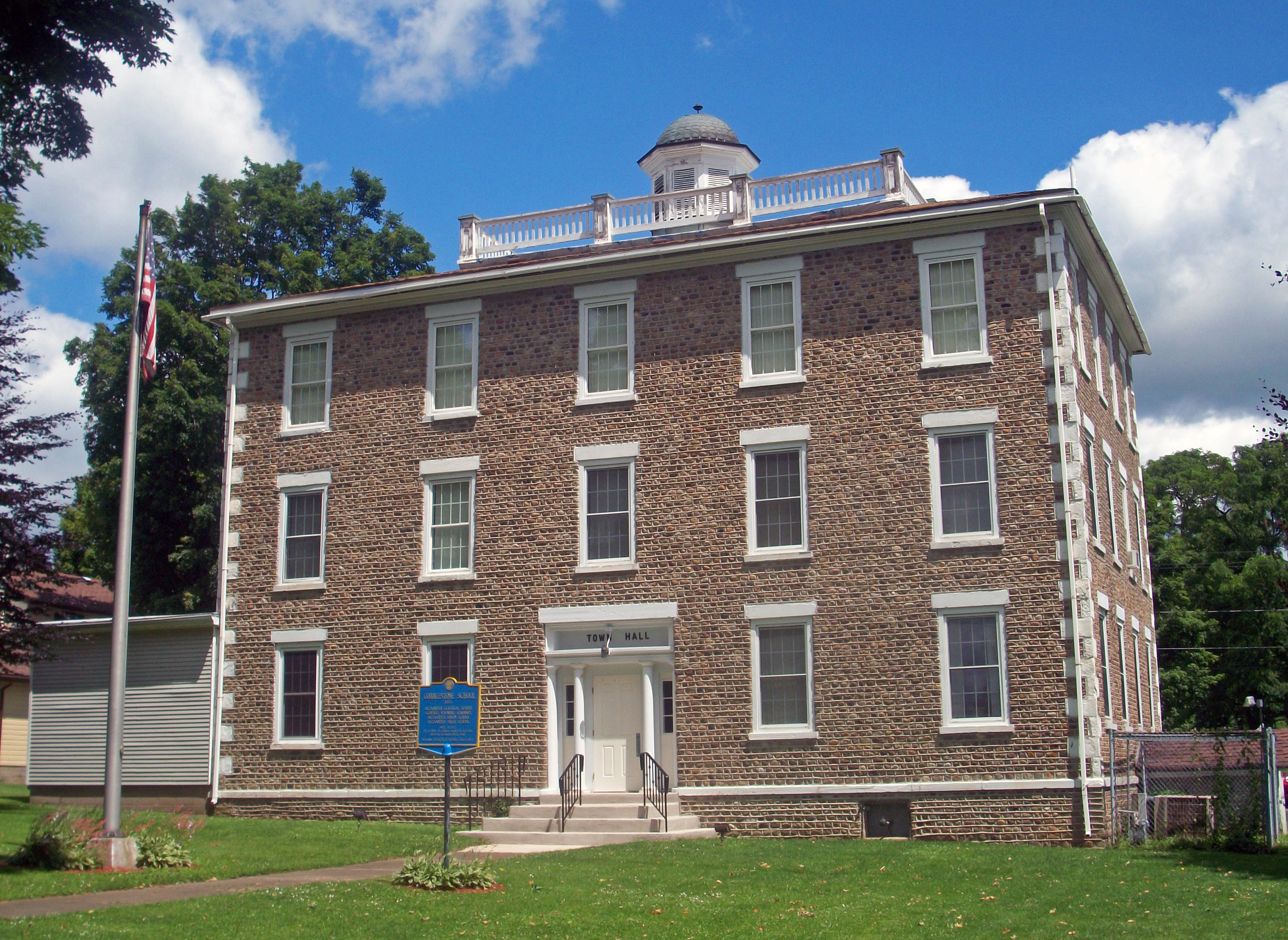
[3] Landmark name Image Date listed Location City or town Summary 1 Alexander Classical School 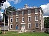
October 25, 1973 Buffalo St.
42°54′08″N 78°15′34″W / 42.902222°N 78.259444°WAlexander Rare three-story-tall cobblestone structure, only one listed in county, was built as boarding school in 1837. Later it became a public school, and then town hall. 2 Batavia Cemetery 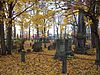
April 8, 2002 Harvester Ave.
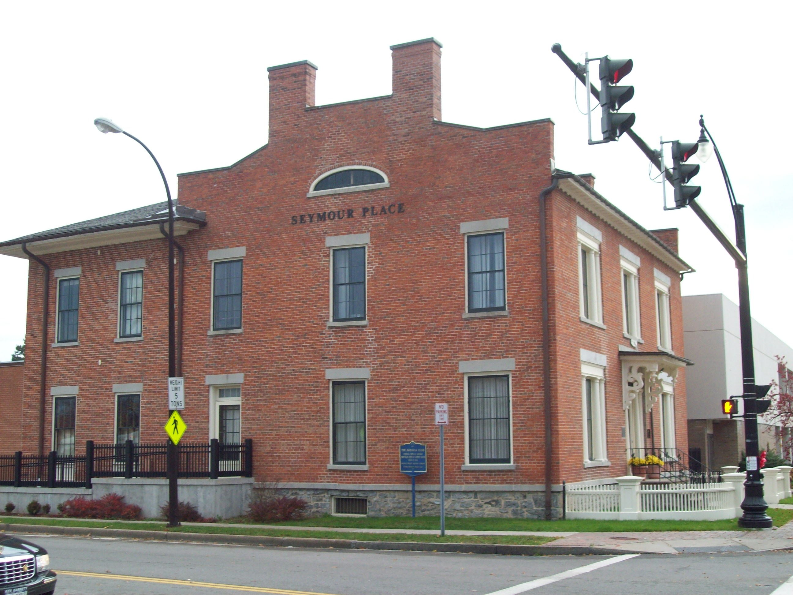
42°59′36″N 78°10′17″W / 42.993333°N 78.171389°WBatavia Burials since 1823 include Joseph Ellicott, Albert and Arthur Brisbane, and large mausoleum of Dean Richmond. Tall monument near south side commemorates disappearance of Anti-Mason William Morgan in 1824. 3 Batavia Club 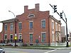
June 19, 1973 Main and Bank Sts.
42°59′51″N 78°10′55″W / 42.9975°N 78.181944°WBatavia 1831 Federal style brick building, originally a bank and now an arts center, is one of only two extant Hezekiah Eldredge buildings in New York 4 First Presbyterian Church 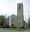
December 6, 2004 300 E. Main St.
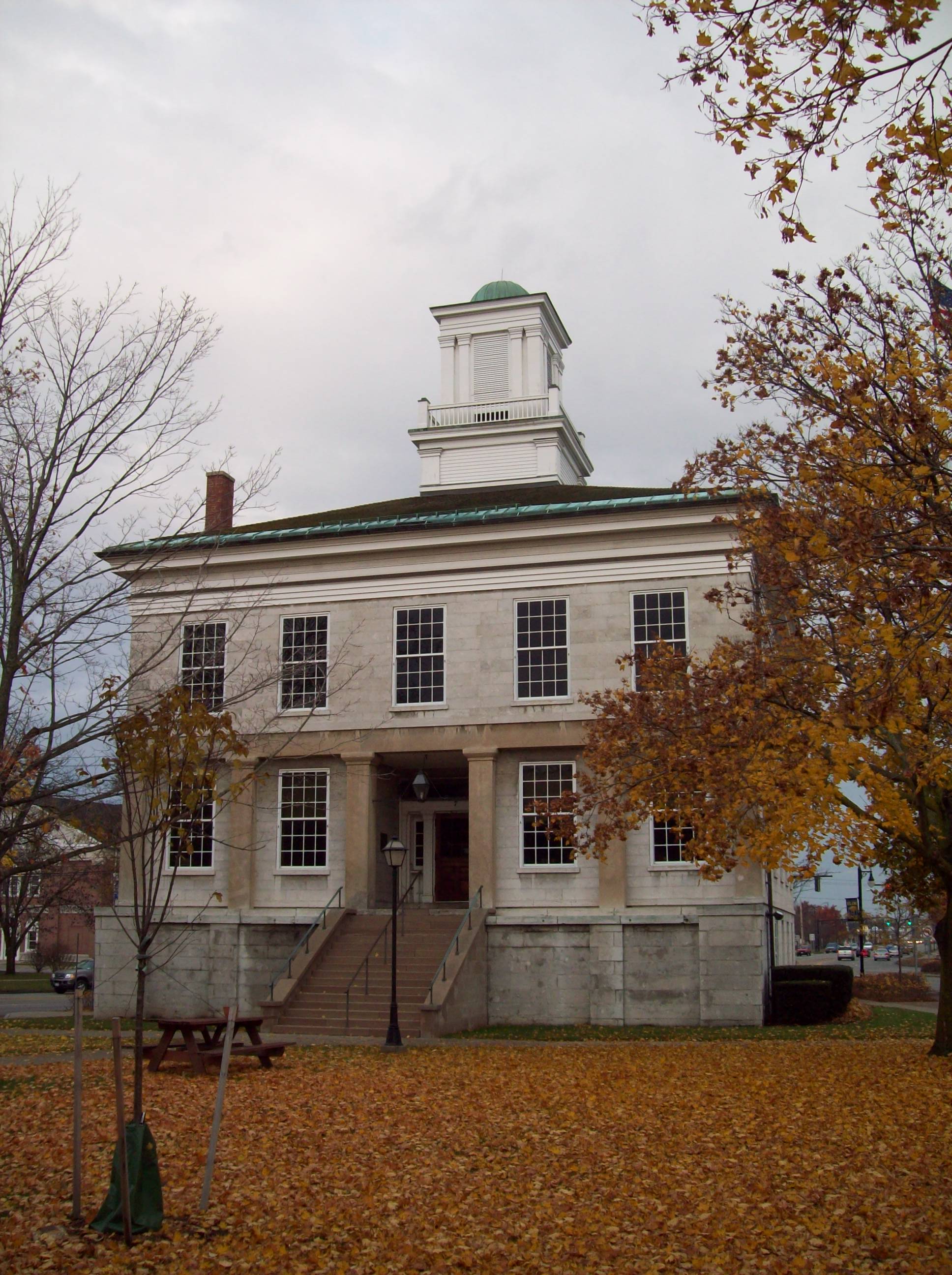
42°59′55″N 78°10′46″W / 42.998611°N 78.179444°WBatavia Church complex built from 1854–1919 reflects changing styles of American Protestant worship 5 Genesee County Courthouse 
June 18, 1973 Main and Ellicott Sts.
42°59′52″N 78°11′14″W / 42.997778°N 78.187222°WBatavia Greek Revival limestone building from 1843 replaced original courthouse thad at one point had served entire Holland Purchase. Local materials used in construction; serves as focal point of courthouse historic district and western gateway to downtown 6 Genesee County Courthouse Historic District 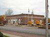
December 10, 1982 Bounded by Porter and Jefferson Aves., and Main, Court, and Ellicott Sts.
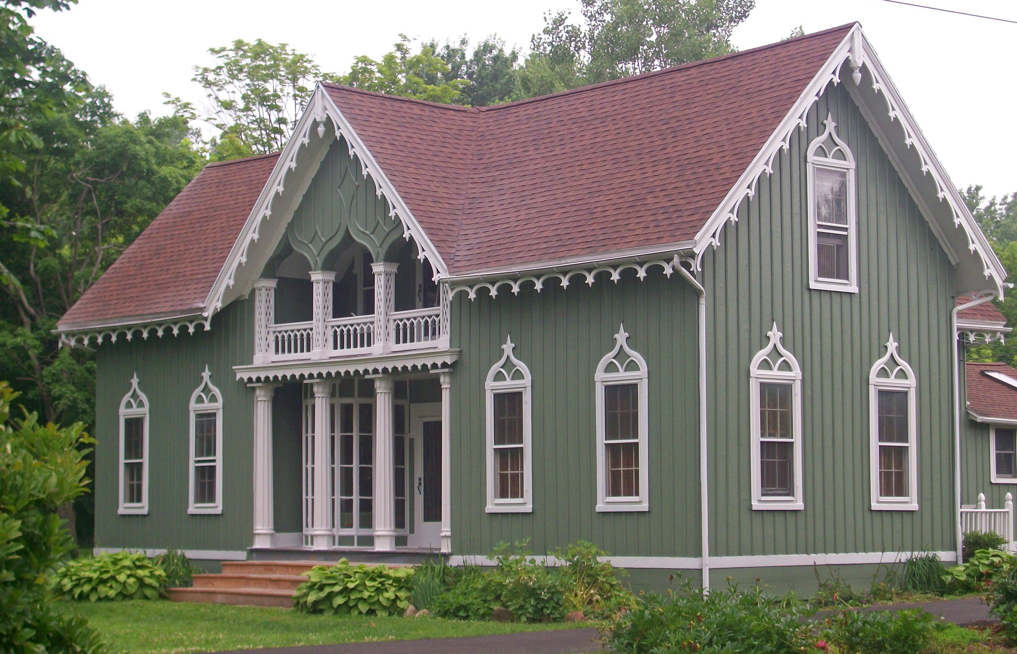
42°59′53″N 78°11′14″W / 42.998056°N 78.187222°WBatavia Civic core of Batavia, with five government buildings at fork of old Iroquois trails, built from 1840s to 1920s. 7 Gifford-Walker Farm 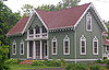
January 10, 1980 7083 N. Bergen Rd.
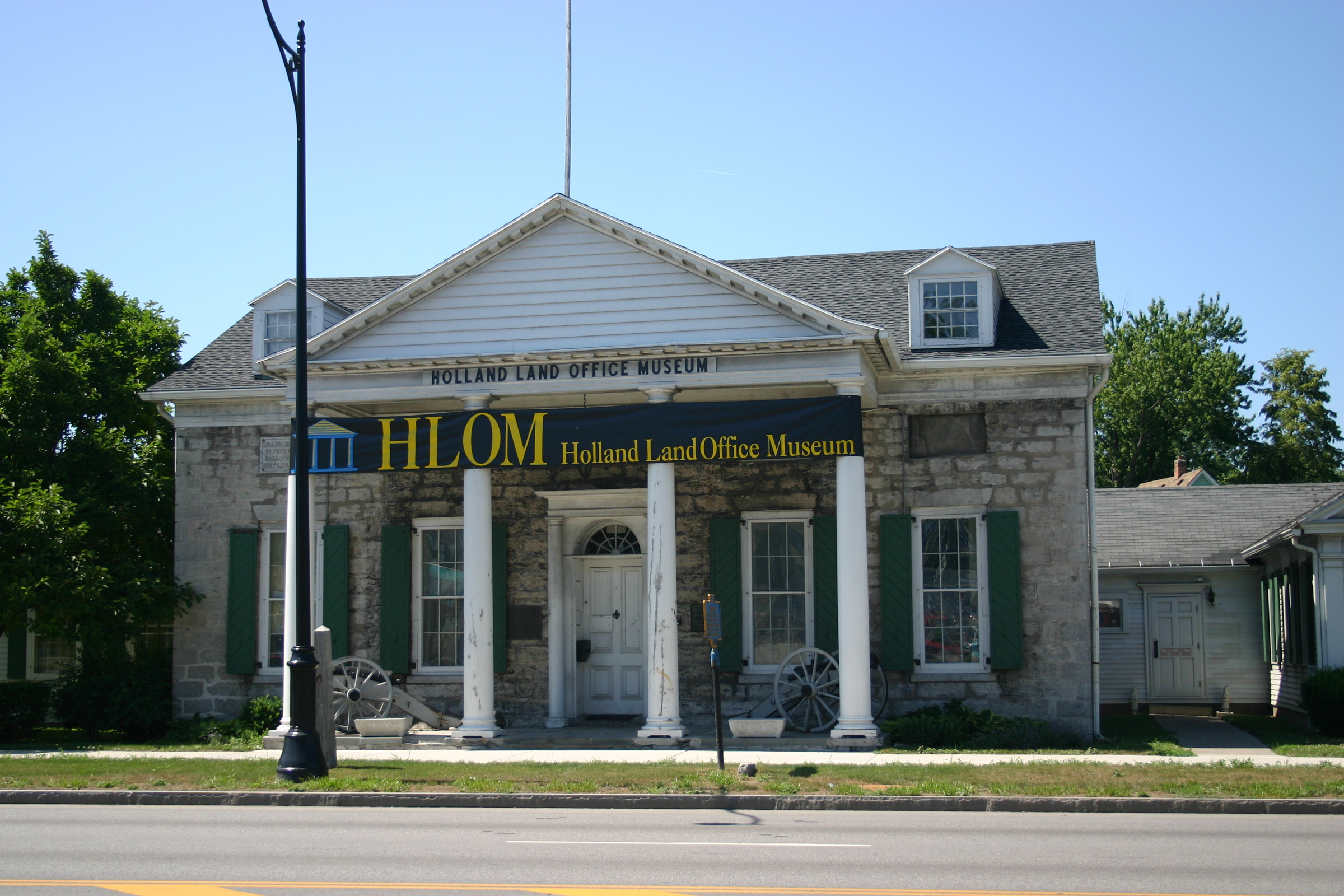
43°07′51″N 78°00′54″W / 43.130833°N 78.015°WNorth Bergen Intact 1870 Carpenter Gothic farmhouse 8 Holland Land Office 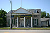
October 15, 1966 W. Main St.
42°59′55″N 78°11′21″W / 42.99861°N 78.18917°WBatavia 1815 Greek Revival building was headquarters for original owners of Western New York 9 Keeney House 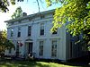
September 11, 1979 13 W. Main St
42°58′38″N 77°59′35″W / 42.977222°N 77.993056°WLe Roy 1820s Federal style house, later home to inventor of stringless bean. Later Greek Revival embellishments removed in early 20th century renovation. 10 Lake Street Historic District 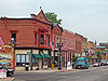
September 5, 1985 10 and 12 S. Lake St. & 11-27 N. Lake St.
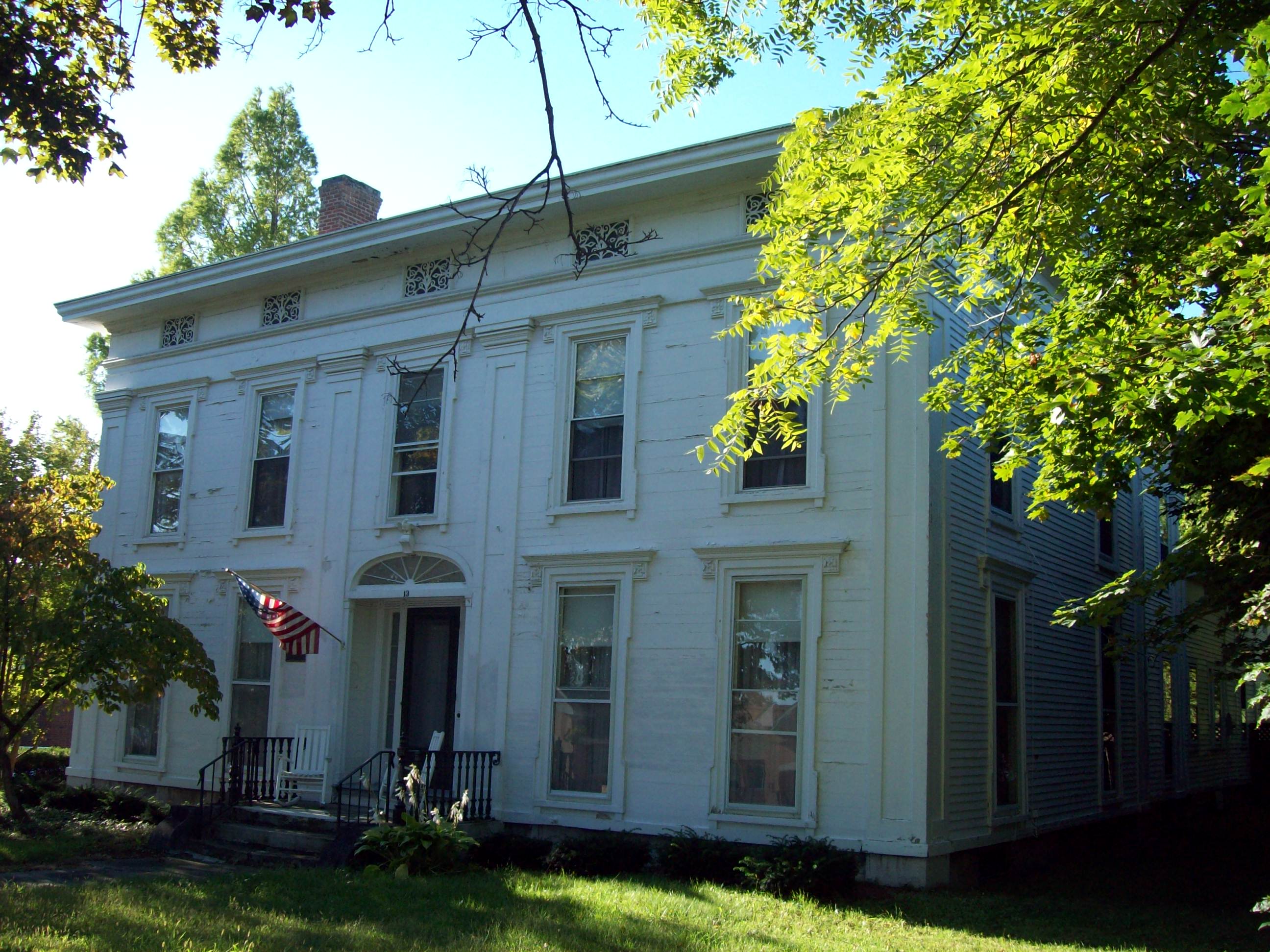
43°05′07″N 77°56′33″W / 43.085278°N 77.9425°WBergen Small group of late 19th-early 20th century downtown buildings, many with cast iron storefronts 11 Le Roy House and Union Free School 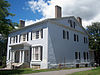
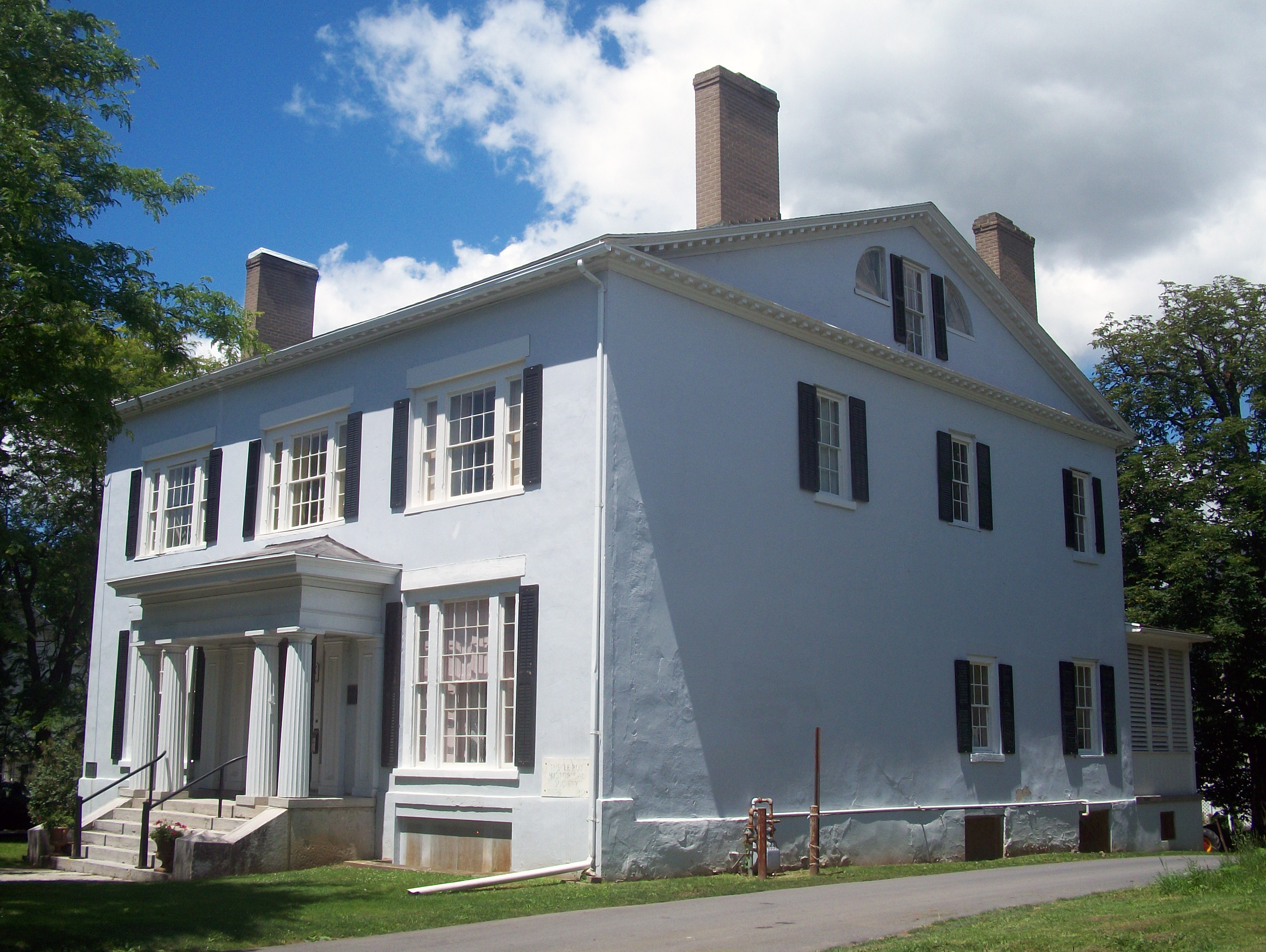
November 7, 1997 23 E. Main St.
42°58′42″N 77°59′11″W / 42.978333°N 77.986389°WLe Roy Land office expanded into ornate Greek Revival House, now local historical museum, in three stages by Jacob Le Roy starting in 1823. 1898 school building in rear was first built by present Le Roy school district; now used as Jell-O museum. 12 Machpelah Cemetery 
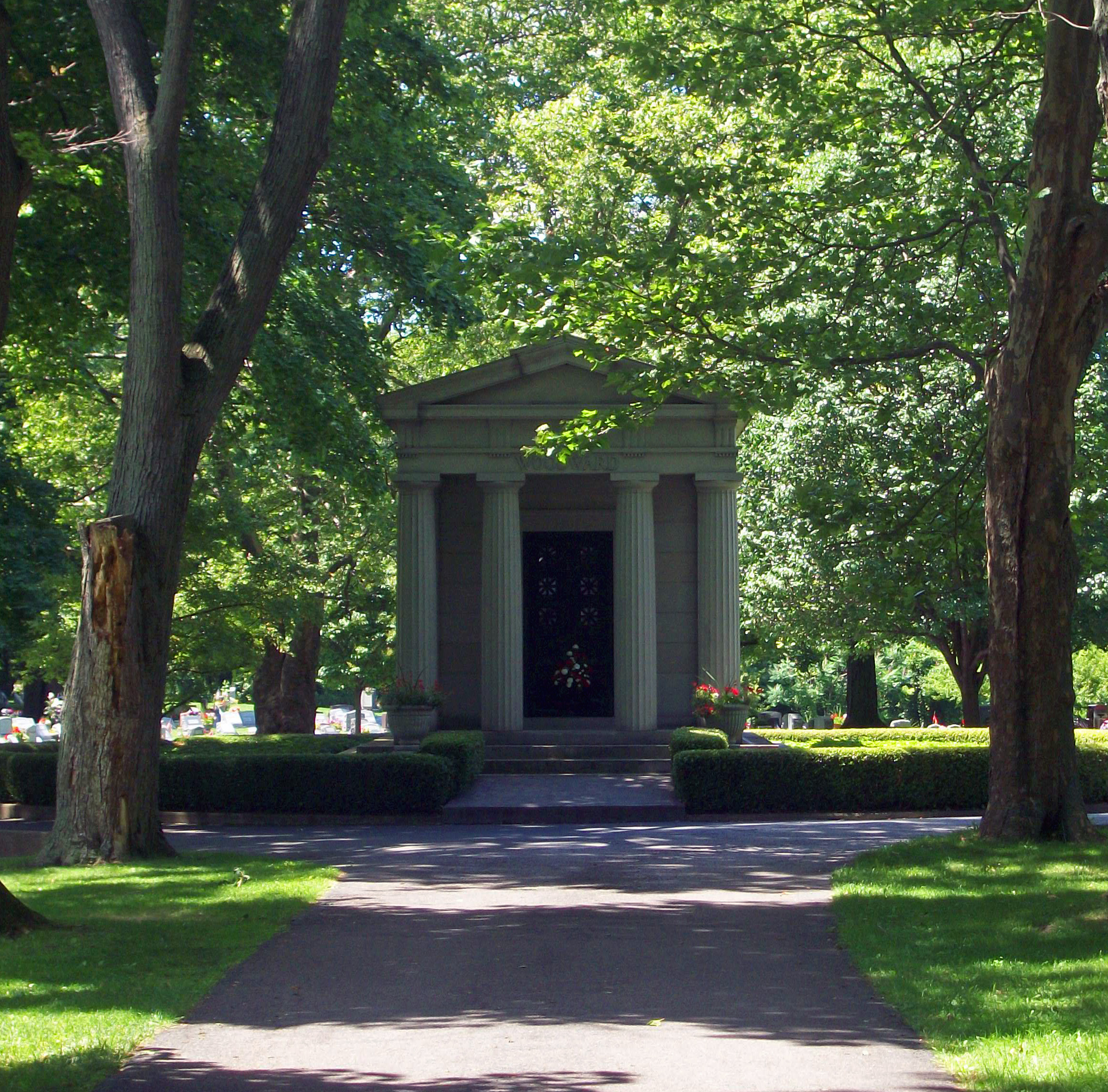
November 19, 2007 North St.
42°59′10″N 77°59′01″W / 42.986239°N 77.9835°WLe Roy Rural cemetery opened in 1858 and gradually expanded since then. Grave markers reflect many different trends in funerary art to present. Jell-O tycoon Orator Francis Woodward buried in prominent Classical Revival mausoleum. 13 Marion Steam Shovel 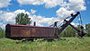
February 22, 2008 Gulf Rd.
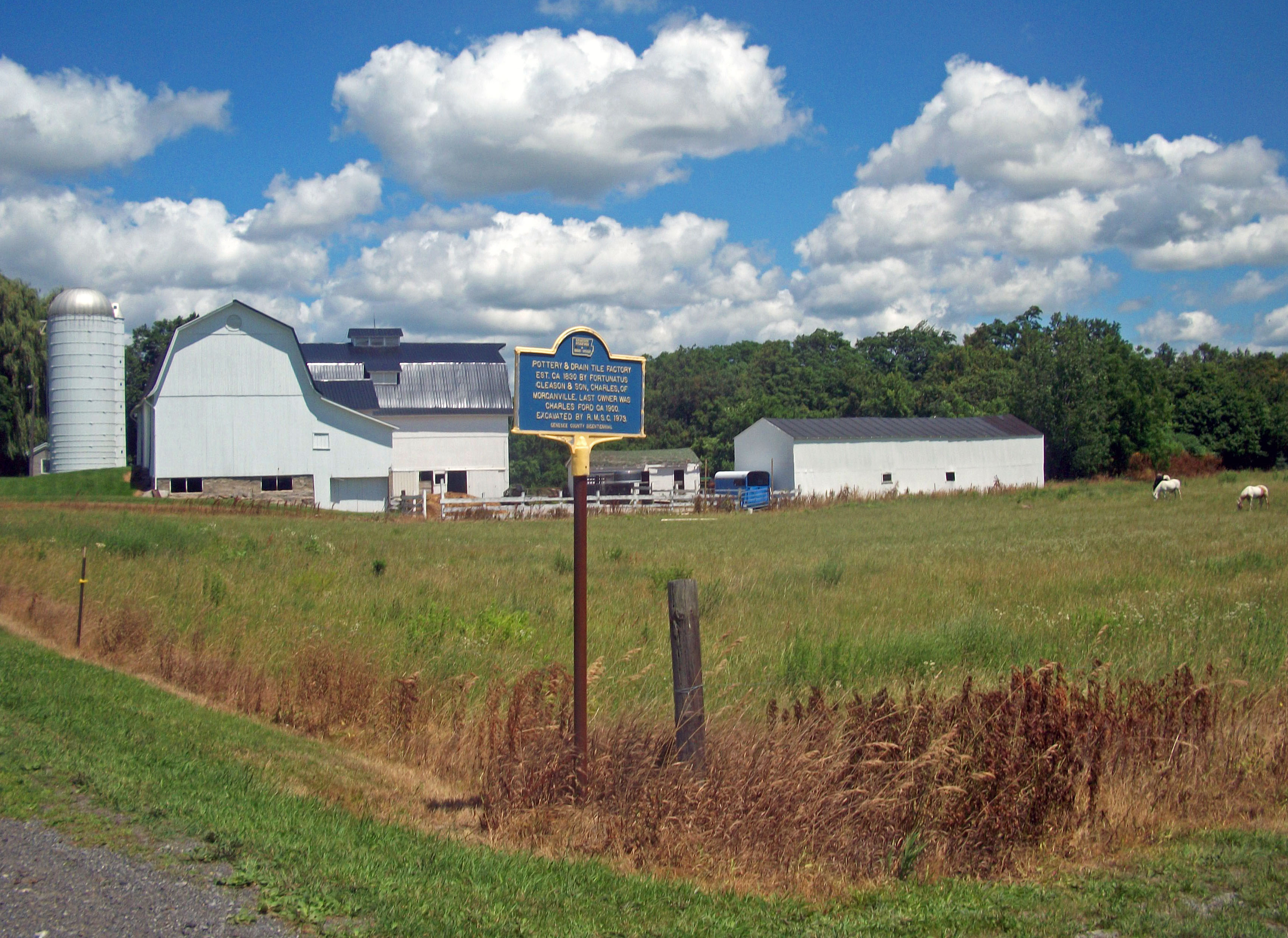
42°59′33″N 77°56′17″W / 42.992514°N 77.938083°WLeRoy Only remaining Marion Model 91 steamshovel; possibly largest extant steamshovel in world. May have been used in excavation of Panama Canal 14 Morganville Pottery Factory Site 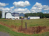
February 15, 1974 Address Restricted Morganville Site of factory in existence for much of 19th century making drain and ceramic tiles. Excavated by Rochester Museum and Science Center in 1973; may yet yield more artifacts. 15 Mount Pleasant 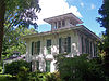
August 9, 1984 2032 Indian Falls Rd.
43°00′45″N 78°20′35″W / 43.0125°N 78.343056°WIndian Falls Sophisticated 1861 Italianate farmhouse 16 Richmond Memorial Library 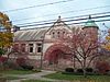
July 24, 1974 19 Ross St.
42°59′52″N 78°10′38″W / 42.997778°N 78.177222°WBatavia 1887 Richardsonian Romanesque library emulating several of Richardson's libraries in the Boston suburbs 17 Saint James' Episcopal Church 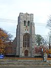
September 24, 2004 405 E. Main St.
42°59′59″N 78°10′32″W / 42.999722°N 78.175556°WBatavia 1908 Neo-Gothic church was first of many in Western New York designed by Robert North 18 Stafford Village Four Corners Historic District 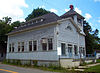
October 8, 1976 Jct. NY 5 and NY 237
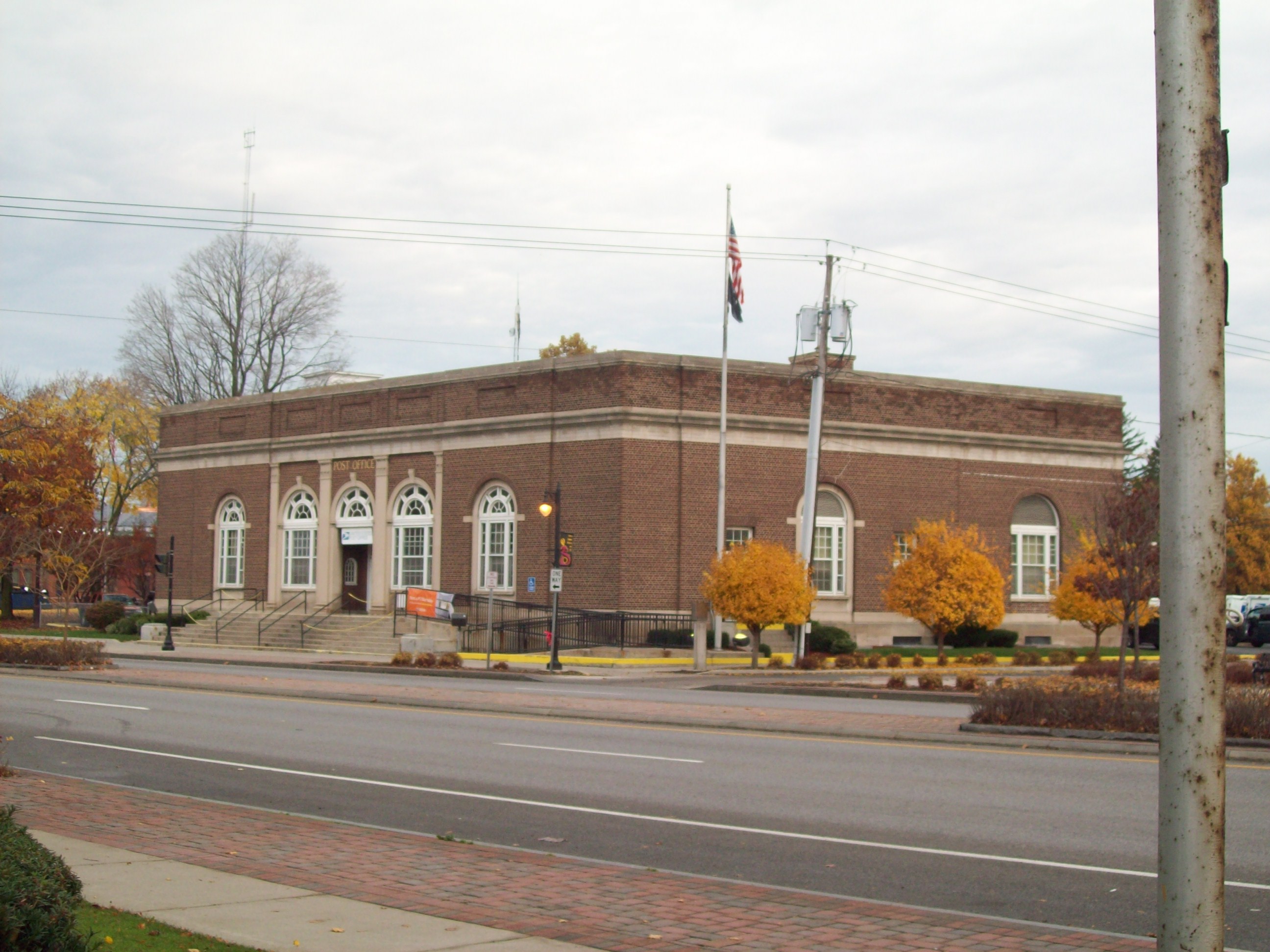
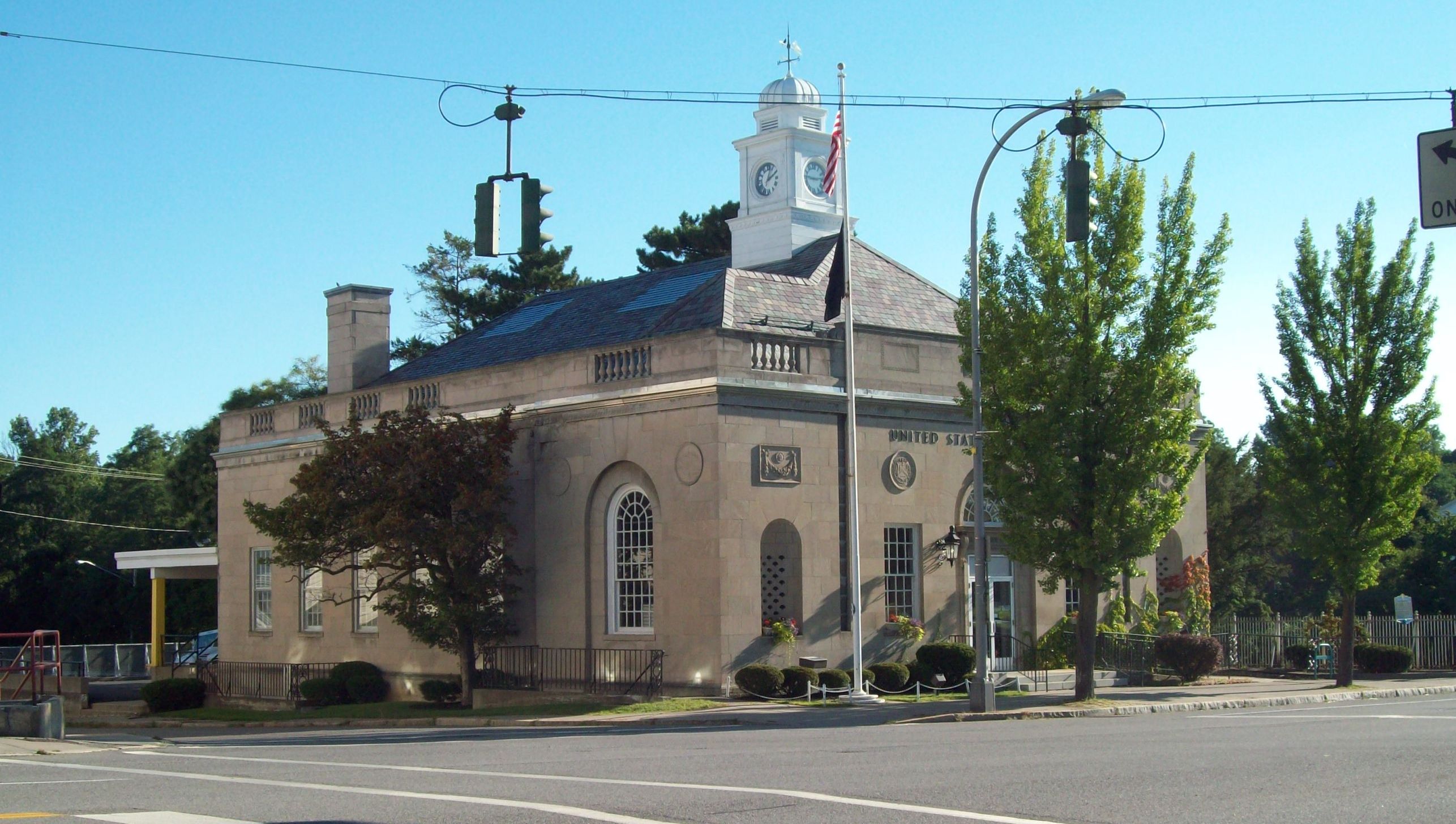
42°58′54″N 78°04′25″W / 42.981667°N 78.073611°WStafford 19th-century buildings from first permanent settlement on Holland Purchase, continuously in existence since 1798. Includes one of oldest houses in county and eclectic former town hall. 19 US Post Office-Le Roy 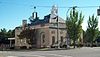
May 11, 1989 2 Main St.
42°58′39″N 77°59′22″W / 42.9775°N 77.989444°WLe Roy Local benefactor paid for stone to face late 1930s building with unique design among state post offices See also
References
- ^ The latitude and longitude information provided in this table was derived originally from the National Register Information System, which has been found to be fairly accurate for about 99% of listings. For about 1% of NRIS original coordinates, experience has shown that one or both coordinates are typos or otherwise extremely far off; some corrections may have been made. A more subtle problem causes many locations to be off by up to 150 yards, depending on location in the country: most NRIS coordinates were derived from tracing out latitude and longitudes off of USGS topographical quadrant maps created under the North American Datum of 1927, which differs from the current, highly accurate WGS84 GPS system used by Google maps. Chicago is about right, but NRIS longitudes in Washington are higher by about 4.5 seconds, and are lower by about 2.0 seconds in Maine. Latitudes differ by about 1.0 second in Florida. Some locations in this table may have been corrected to current GPS standards.
- ^ "National Register of Historic Places: Weekly List Actions". National Park Service, United States Department of the Interior. Retrieved on November 18, 2011.
- ^ Numbers represent an ordering by significant words. Various colorings, defined here, differentiate National Historic Landmark sites and National Register of Historic Places Districts from other NRHP buildings, structures, sites or objects.
Categories:- Genesee County, New York
- National Register of Historic Places in New York by county
-


Wikimedia Foundation. 2010.