- National Register of Historic Places listings in Lewis County, New York
-
 Location of Lewis County in New York
List of the National Register of Historic Places listings in Lewis County, New York
This is intended to be a complete list of properties and districts listed on the National Register of Historic Places in Lewis County, New York. The locations of National Register properties and districts (at least for all showing latitude and longitude coordinates below) may be seen in a Google map by clicking on "Map of all coordinates".[1] One property, the Franklin B. Hough House, is further designated a National Historic Landmark.
-
- This National Park Service list is complete through NPS recent listings posted November 18, 2011.[2]
Contents: Counties in New York Albany (Albany) – Allegany – Bronx – Broome – Cattaraugus – Cayuga – Chautauqua – Chemung – Chenango – Clinton – Columbia – Cortland – Delaware – Dutchess – Erie (Buffalo) – Essex – Franklin – Fulton – Genesee – Greene – Hamilton – Herkimer – Jefferson – Kings (Brooklyn) – Lewis – Livingston – Madison – Monroe (Rochester) – Montgomery – Nassau – New York (Manhattan – Below 14th Street, 14th to 59th Streets, 59th to 110th Streets, Above 110th Street, Islands) – Niagara – Oneida – Onondaga (Syracuse) – Ontario – Orange – Orleans – Oswego – Otsego – Putnam – Queens – Rensselaer – Richmond (Staten Island) – Rockland – Saratoga – Schenectady – Schoharie – Schuyler – Seneca – St. Lawrence – Steuben – Suffolk – Sullivan – Tioga – Tompkins – Ulster – Warren – Washington – Wayne – Westchester (New Rochelle, Peekskill, Yonkers) – Wyoming – Yates Listings county-wide
[3] Landmark name Image Date listed Location City or town Summary 1 Alpina Archeological District 
November 2, 1995 Address Restricted Diana 2 Bateman Hotel 
February 18, 1994 7574 S. State St.
43°47′10″N 75°29′31″W / 43.786111°N 75.491944°WLowville 3 Jonathan C. Collins House and Cemetery November 9, 1988 West Rd.
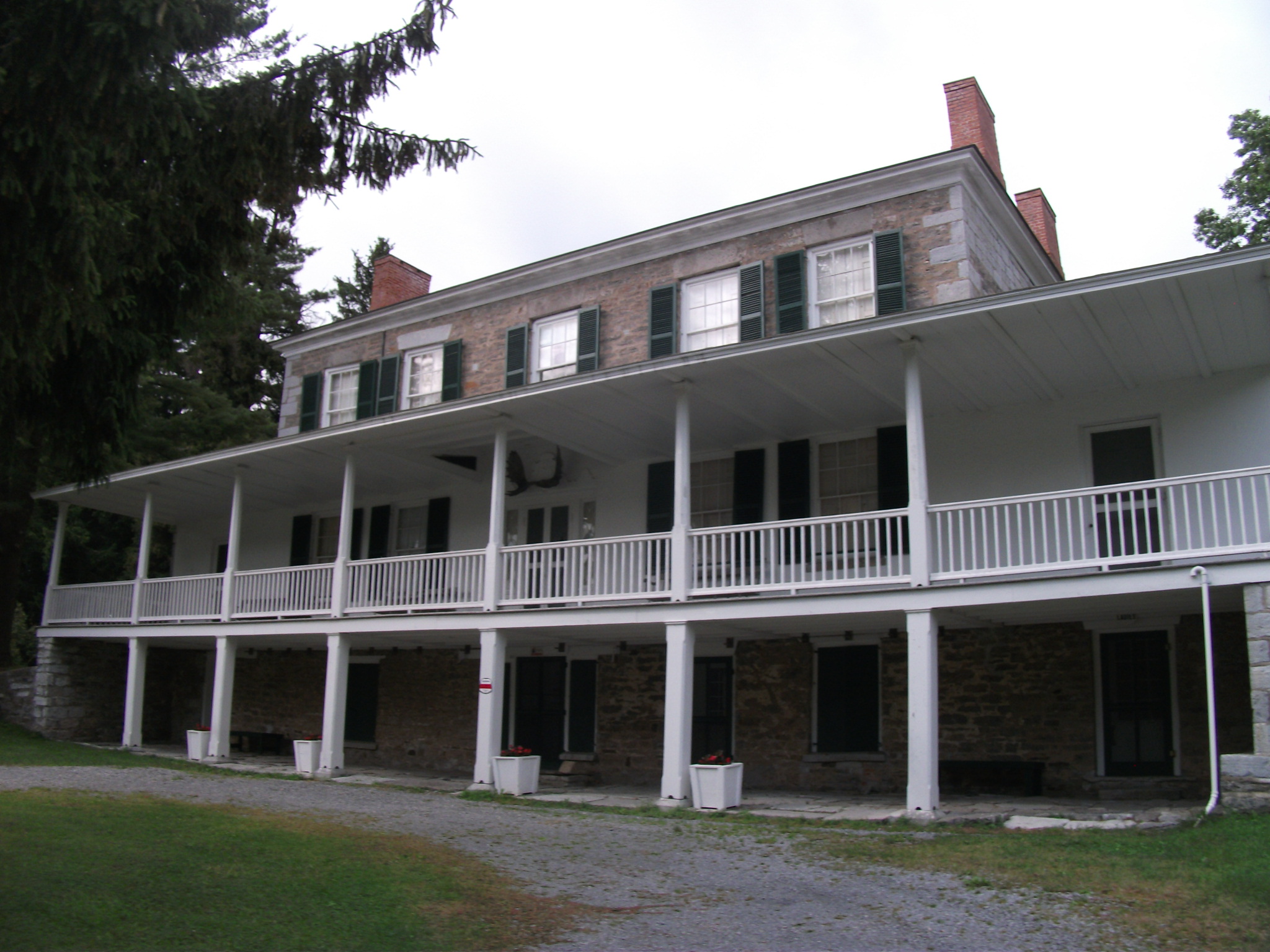
43°34′07″N 75°25′14″W / 43.568611°N 75.420556°WConstableville 4 Constable Hall 
March 7, 1973 Off NY 26
43°33′43″N 75°25′24″W / 43.561944°N 75.423333°WConstableville 5 Constableville Village Historic District 
September 15, 1983 Roughly bounded by Sugar River, Main, N. Main, W. Main, Church, High, West and James Sts.
43°33′51″N 75°25′50″W / 43.564167°N 75.430556°WConstableville 6 Croghan Island Mill Croghan Island MillJuly 30, 2010 9897 S. Bridge St.
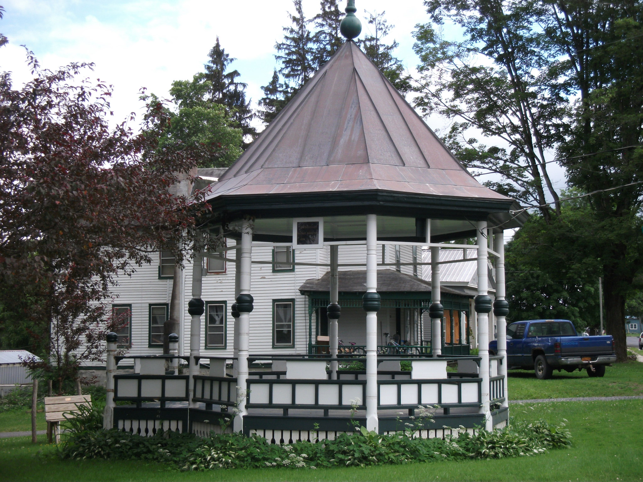
43°53′52″N 75°23′37″W / 43.897778°N 75.393611°WCroghan vicinity New listing; refnum 10000515 7 Forest Presbyterian Church September 24, 2004 4109 Center St.
43°37′05″N 75°21′41″W / 43.618056°N 75.361389°WLyons Falls 8 Gould Mansion Complex April 19, 1978 Main St.
43°37′05″N 75°21′38″W / 43.618056°N 75.360556°WLyons Falls 9 Franklin B. Hough House 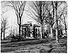
October 15, 1966 Collins St.
43°47′22″N 75°29′50″W / 43.78944°N 75.49722°WLowville 10 Lewis County Fairgrounds February 14, 2002 Bostwick St.
43°47′43″N 75°29′25″W / 43.795278°N 75.490278°WLowville 11 Lewis County Soldiers' and Sailors' Monument July 29, 2009 Village Green, NY 26 and Bostwick Sts.
43°47′27″N 75°29′44″W / 43.790925°N 75.495592°WLowville New listing; refnum 09000575 12 Lewisburg Archeological District November 2, 1995 Address Restricted Diana 13 Lowville Presbyterian Church 
June 27, 2007 7707 North State St.
43°47′28″N 75°29′47″W / 43.791111°N 75.496389°WLowville 14 Gen. Walter Martin House July 24, 2008 6575 Main St.
43°44′16″N 75°28′09″W / 43.737778°N 75.469167°WMartinsburg (new listing; refnum 08000698) 15 Martinsburg Town Hall March 21, 2001 NY 26 Main St., E
43°44′14″N 75°28′08″W / 43.737222°N 75.468889°WMartinsburg 16 Methodist Episcopal Church of West Martinsburg 
September 15, 1983 W. Martinsburg Rd.
43°45′35″N 75°31′00″W / 43.759722°N 75.516667°WWest Martinsburg 17 Moser Farm Moser FarmJuly 30, 2010 8778 Erie Canal Rd.
43°53′32″N 75°20′06″W / 43.892222°N 75.335°WKirschnerville vicinity New listing; refnum 10000516 18 Osceola Town Hall December 22, 2005 N. Ocseola Rd.
43°30′11″N 75°43′21″W / 43.503056°N 75.7225°WOsceola 19 Pine Grove Community Church Pine Grove Community ChurchAugust 20, 2009 Austin Rd. & Pine Grove Rd.
43°45′07″N 75°22′39″W / 43.751833°N 75.377372°WPine Grove New listing; refnum 09000633 20 The Pines June 27, 2007 3998-4000 Lyons Falls Rd.
43°37′23″N 75°21′32″W / 43.623056°N 75.358889°WLyons Falls 21 St. Mark's Church August 6, 1998 Jct. of West Main and Elm Sts.
43°34′52″N 75°20′59″W / 43.581111°N 75.349722°WPort Leyden 22 Stoddard–O'Connor House Stoddard–O'Connor HouseJune 23, 2011 5431 Shady Ave.
43°47′14″N 75°29′20″W / 43.787222°N 75.488889°WLowville vicinity New listing; refnum 11000402 23 Wildwood Cemetery and Mary Lyon Fisher Memorial Chapel Wildwood Cemetery and Mary Lyon Fisher Memorial ChapelJune 27, 2011 River Rd.
43°36′30″N 75°20′43″W / 43.608333°N 75.345278°WLyons Falls New listing; refnum 11000403 24 Edmund Wilson House November 26, 1973 S of Port Leyden off NY 12 on Talcottville Rd.
43°32′05″N 75°21′59″W / 43.534722°N 75.366389°WPort Leyden Additional
The Lowville Masonic Temple in Lowville, New York was nominated for NRHP listing in 2008. In 2009, the National Register Information System showed it having "DR" status; it is unclear whether this place has been listed.
See also
References
- ^ The latitude and longitude information provided in this table was derived originally from the National Register Information System, which has been found to be fairly accurate for about 99% of listings. For about 1% of NRIS original coordinates, experience has shown that one or both coordinates are typos or otherwise extremely far off; some corrections may have been made. A more subtle problem causes many locations to be off by up to 150 yards, depending on location in the country: most NRIS coordinates were derived from tracing out latitude and longitudes off of USGS topographical quadrant maps created under the North American Datum of 1927, which differs from the current, highly accurate WGS84 GPS system used by Google maps. Chicago is about right, but NRIS longitudes in Washington are higher by about 4.5 seconds, and are lower by about 2.0 seconds in Maine. Latitudes differ by about 1.0 second in Florida. Some locations in this table may have been corrected to current GPS standards.
- ^ "National Register of Historic Places: Weekly List Actions". National Park Service, United States Department of the Interior. Retrieved on November 18, 2011.
- ^ Numbers represent an ordering by significant words. Various colorings, defined here, differentiate National Historic Landmark sites and National Register of Historic Places Districts from other NRHP buildings, structures, sites or objects.
Categories:- National Register of Historic Places in New York by county
- Lewis County, New York
-


Wikimedia Foundation. 2010.