- National Register of Historic Places listings in Schuyler County, New York
-
 Location of Schuyler County in New York
List of the National Register of Historic Places listings in Schuyler County, New York
This is intended to be a complete list of properties and districts listed on the National Register of Historic Places in Schuyler County, New York. The locations of National Register properties and districts (at least for all showing latitude and longitude coordinates below) may be seen in a Google map by clicking on "Map of all coordinates".[1] One site, Lamoka, is further designated a U.S. National Historic Landmark.
-
- This National Park Service list is complete through NPS recent listings posted November 18, 2011.[2]
Contents: Counties in New York Albany (Albany) – Allegany – Bronx – Broome – Cattaraugus – Cayuga – Chautauqua – Chemung – Chenango – Clinton – Columbia – Cortland – Delaware – Dutchess – Erie (Buffalo) – Essex – Franklin – Fulton – Genesee – Greene – Hamilton – Herkimer – Jefferson – Kings (Brooklyn) – Lewis – Livingston – Madison – Monroe (Rochester) – Montgomery – Nassau – New York (Manhattan – Below 14th Street, 14th to 59th Streets, 59th to 110th Streets, Above 110th Street, Islands) – Niagara – Oneida – Onondaga (Syracuse) – Ontario – Orange – Orleans – Oswego – Otsego – Putnam – Queens – Rensselaer – Richmond (Staten Island) – Rockland – Saratoga – Schenectady – Schoharie – Schuyler – Seneca – St. Lawrence – Steuben – Suffolk – Sullivan – Tioga – Tompkins – Ulster – Warren – Washington – Wayne – Westchester (New Rochelle, Peekskill, Yonkers) – Wyoming – Yates Listings county-wide
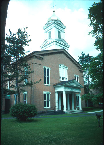
[3] Landmark name Image Date listed Location City or town Summary 1 Brick Tavern Stand November 4, 1994 108 Catharine St.
42°20′51″N 76°50′43″W / 42.3475°N 76.845278°WMontour Falls 2 A. F. Chapman House December 8, 1997 115 S. Monroe St.
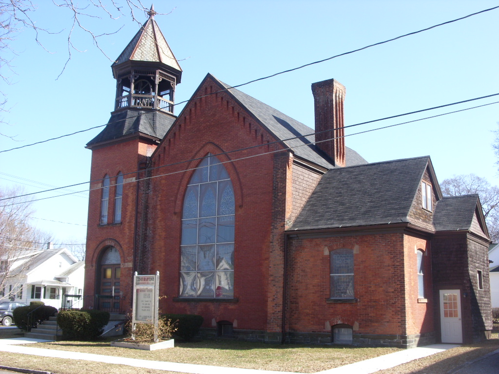
42°22′53″N 76°52′29″W / 42.381389°N 76.874722°WWatkins Glen 3 First Baptist Church of Watkins Glen 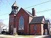
September 13, 2001 Fifth St. and Porter St.
42°22′50″N 76°52′12″W / 42.380556°N 76.87°WWatkins Glen 4 First Presbyterian Church of Hector May 25, 2001 5519 NY 414
42°30′01″N 76°52′23″W / 42.500278°N 76.873056°WHector 5 Lamoka 
October 15, 1966 Address Restricted Tyrone 6 Lattin-Crandall Octagon Barn September 29, 1984 E of Catherine
42°18′43″N 76°46′04″W / 42.311944°N 76.767778°WCatharine 7 Lee School May 20, 1998 NY 14
42°19′40″N 76°50′28″W / 42.327778°N 76.841111°WMontour 8 Logan Methodist Church January 26, 2001 Jct. of Cty. Rts. 4 and 2
42°29′15″N 76°49′43″W / 42.4875°N 76.828611°WLogan 9 Montour Falls Historic District 
August 31, 1978 Main and Genesee Sts.
42°20′41″N 76°50′58″W / 42.344722°N 76.849444°WMontour Falls 10 Schuyler County Courthouse Complex 
June 5, 1974 Franklin St.
42°22′36″N 76°52′16″W / 42.376667°N 76.871111°WWatkins Glen 11 US Post Office-Watkins Glen May 11, 1989 600 N. Franklin St.
42°22′45″N 76°52′21″W / 42.379167°N 76.8725°WWatkins Glen 12 Watkins Glen Grand Prix Course, 1948-1952 December 4, 2002 Franklin St., NY 329, NY 409
42°22′15″N 76°53′26″W / 42.370833°N 76.890556°WWatkins Glen 13 Weston Schoolhouse October 8, 1998 463 Cty Rte 23
42°25′19″N 77°04′38″W / 42.421944°N 77.077222°WWeston See also
References
- ^ The latitude and longitude information provided in this table was derived originally from the National Register Information System, which has been found to be fairly accurate for about 99% of listings. For about 1% of NRIS original coordinates, experience has shown that one or both coordinates are typos or otherwise extremely far off; some corrections may have been made. A more subtle problem causes many locations to be off by up to 150 yards, depending on location in the country: most NRIS coordinates were derived from tracing out latitude and longitudes off of USGS topographical quadrant maps created under the North American Datum of 1927, which differs from the current, highly accurate WGS84 GPS system used by Google maps. Chicago is about right, but NRIS longitudes in Washington are higher by about 4.5 seconds, and are lower by about 2.0 seconds in Maine. Latitudes differ by about 1.0 second in Florida. Some locations in this table may have been corrected to current GPS standards.
- ^ "National Register of Historic Places: Weekly List Actions". National Park Service, United States Department of the Interior. Retrieved on November 18, 2011.
- ^ Numbers represent an ordering by significant words. Various colorings, defined here, differentiate National Historic Landmark sites and National Register of Historic Places Districts from other NRHP buildings, structures, sites or objects.
Categories:- National Register of Historic Places in New York by county
- Buildings and structures in Schuyler County, New York
-


Wikimedia Foundation. 2010.