- National Register of Historic Places listings in Washington County, New York
-
 Location of Washington County in New York
List of the National Register of Historic Places listings in Washington County, New York
This is intended to be a complete list of properties and districts listed on the National Register of Historic Places in Washington County, New York. The locations of National Register properties and districts (at least for all showing latitude and longitude coordinates below) may be seen in a Google map by clicking on "Map of all coordinates".[1] One property, the Lemuel Haynes House, is further designated a U.S. National Historic Landmark.
-
- This National Park Service list is complete through NPS recent listings posted November 18, 2011.[2]
Contents: Counties in New York Albany (Albany) – Allegany – Bronx – Broome – Cattaraugus – Cayuga – Chautauqua – Chemung – Chenango – Clinton – Columbia – Cortland – Delaware – Dutchess – Erie (Buffalo) – Essex – Franklin – Fulton – Genesee – Greene – Hamilton – Herkimer – Jefferson – Kings (Brooklyn) – Lewis – Livingston – Madison – Monroe (Rochester) – Montgomery – Nassau – New York (Manhattan – Below 14th Street, 14th to 59th Streets, 59th to 110th Streets, Above 110th Street, Islands) – Niagara – Oneida – Onondaga (Syracuse) – Ontario – Orange – Orleans – Oswego – Otsego – Putnam – Queens – Rensselaer – Richmond (Staten Island) – Rockland – Saratoga – Schenectady – Schoharie – Schuyler – Seneca – St. Lawrence – Steuben – Suffolk – Sullivan – Tioga – Tompkins – Ulster – Warren – Washington – Wayne – Westchester (New Rochelle, Peekskill, Yonkers) – Wyoming – Yates County-wide listings
[3] Landmark name Image Date listed Location City or town Summary 1 Susan B. Anthony Childhood House April 13, 2007 2835 NY 29
43°06′38″N 73°25′23″W / 43.110556°N 73.423056°WBattenville 2 Baker-Merrill House July 26, 2006 38 Grove Rd.
42°59′28″N 73°33′06″W / 42.991111°N 73.551667°WEaston 3 Brown's Tavern September 22, 2000 7755 NY 40
43°20′41″N 73°24′35″W / 43.344722°N 73.409722°WSouth Hartford 4 Buskirk Covered Bridge 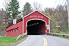
March 8, 1978 Spans Hoosic River N of NY 67
42°57′30″N 73°26′00″W / 42.958333°N 73.433333°WBuskirk 5 Cambridge Historic District 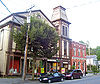
November 15, 1978 Irregular pattern along Main and S. Union Sts.
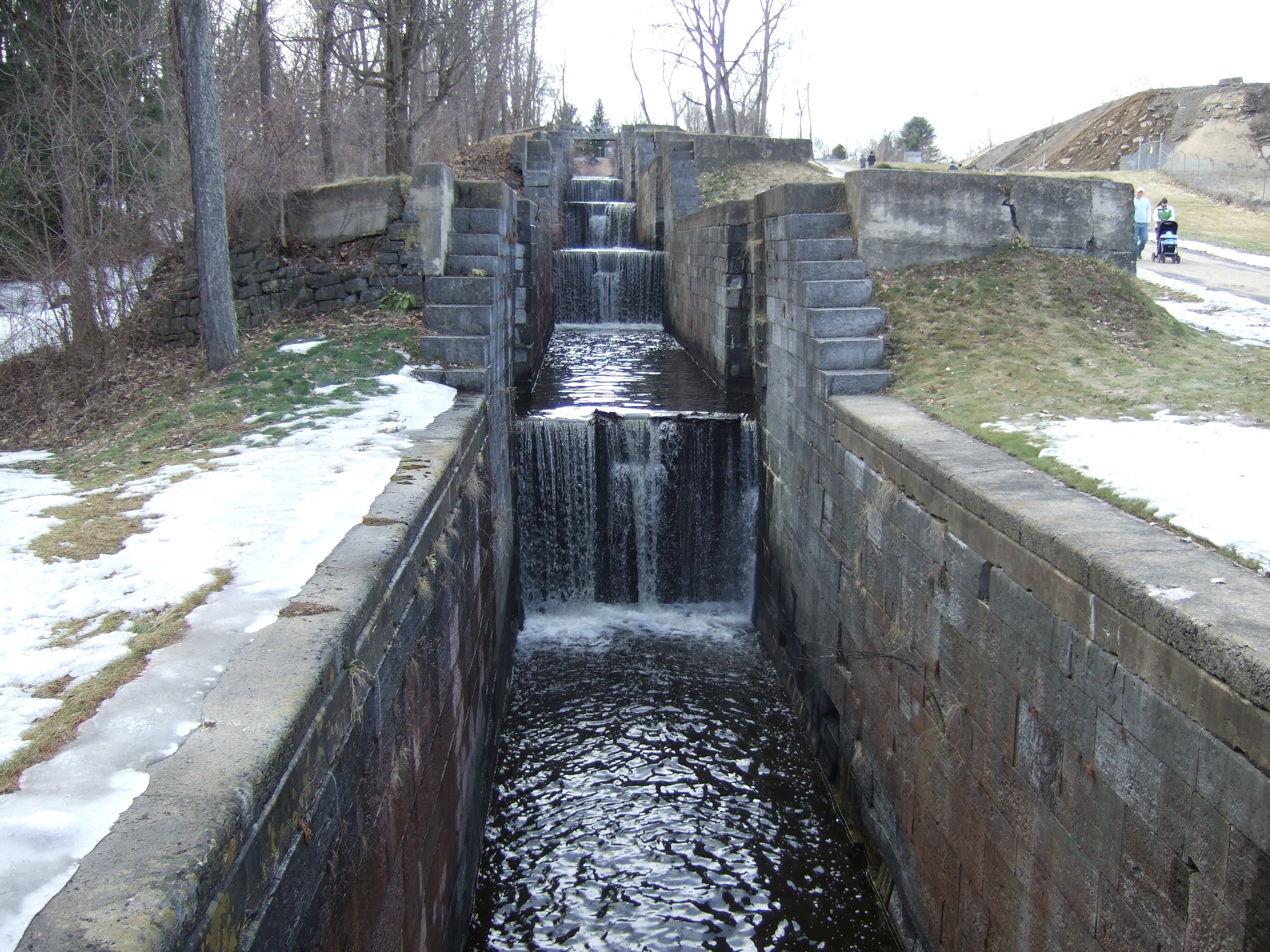
43°01′30″N 73°22′58″W / 43.025°N 73.382778°WCambridge Historic remnants of the three hamlets that merged to form Cambridge 6 Champlain Canal 
September 1, 1976 Extends N from Troy to Whitehall
43°09′34″N 73°34′48″W / 43.159364°N 73.579903°Wextends from Waterford through Fort Edward to Whitehall 7 Coffin Site July 22, 1980 Address Restricted Greenwich 8 Hiram Congdon House September 30, 1997 NE of jct. of NY 22 and B Rd.
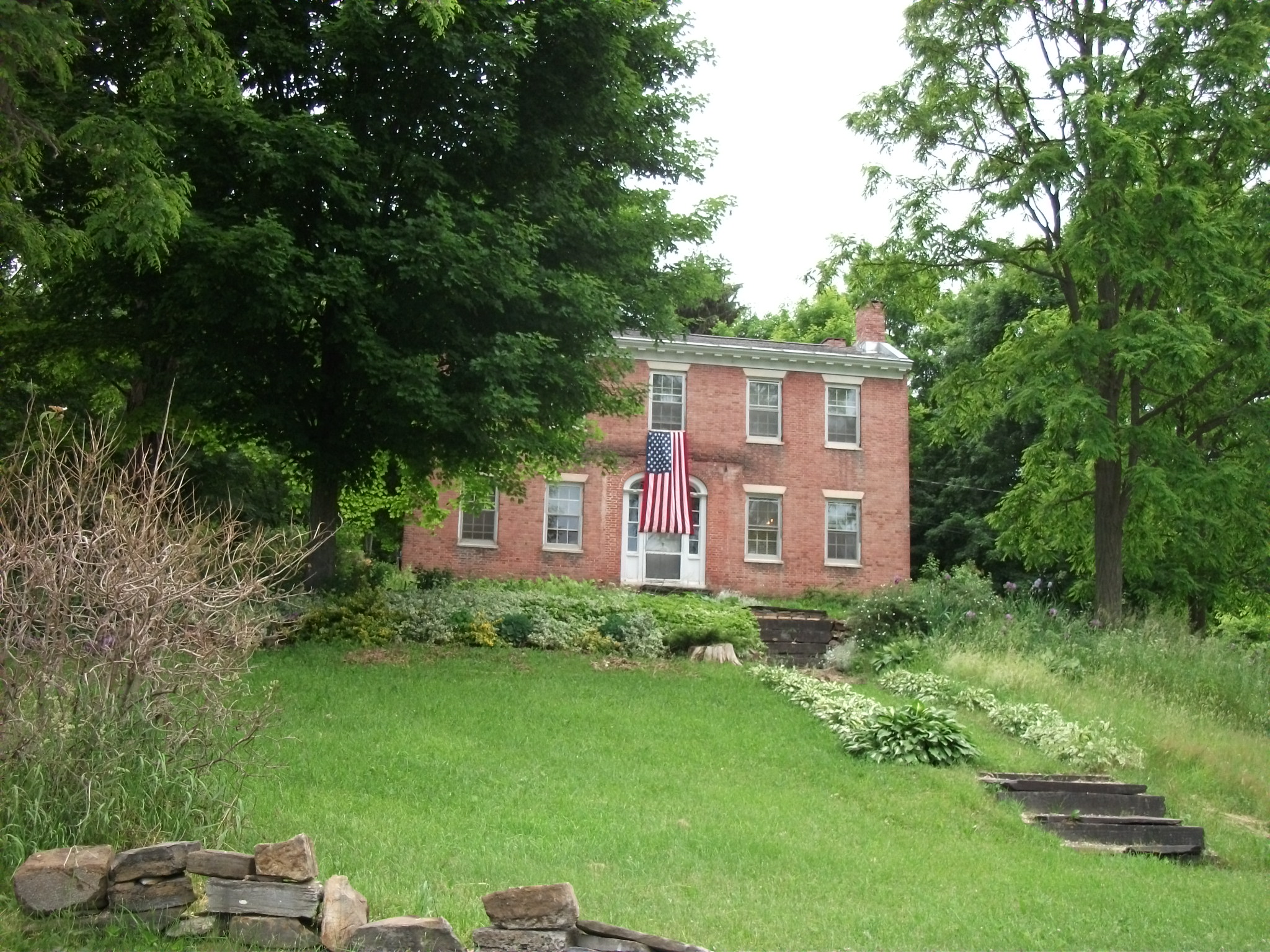
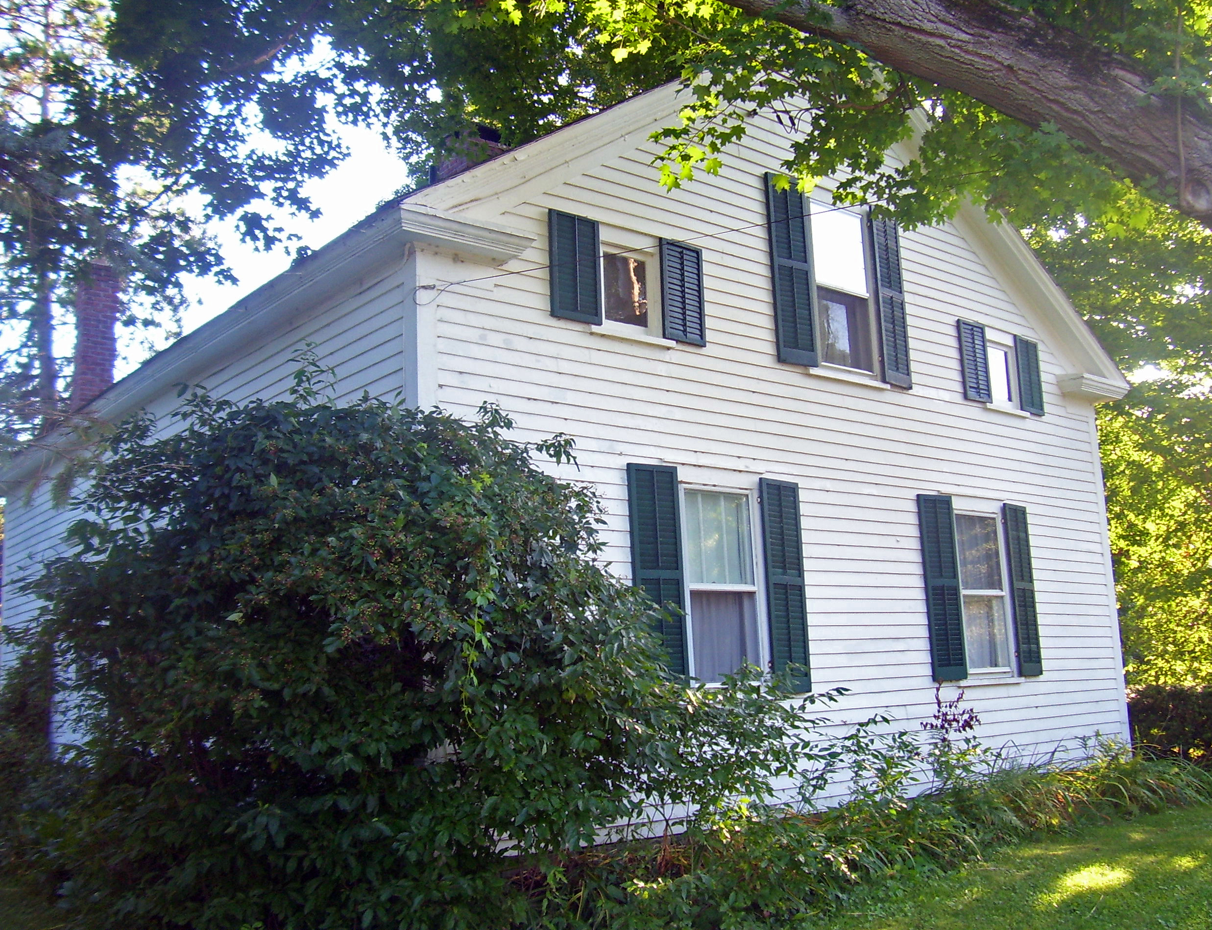
43°41′58″N 73°25′52″W / 43.699444°N 73.431111°WPutnam 9 Dayton-Williams House 
November 8, 2006 65 Dayton Hill Rd.
43°26′02″N 73°17′04″W / 43.433889°N 73.284444°WMiddle Granville 10 DeRidder Homestead March 22, 1974 E of Schuylerville off NY 29
43°05′57″N 73°34′04″W / 43.099167°N 73.567778°WSchuylerville 11 Eagleville Covered Bridge 
March 8, 1978 Spans Batten Kill off NY 313
43°05′00″N 73°18′51″W / 43.083333°N 73.314167°WEagleville in the towns of Jackson and Salem, New York 12 Easton Friends North Meetinghouse October 5, 2005 NY 40, Schaghticoke-Middle Falls Rd.
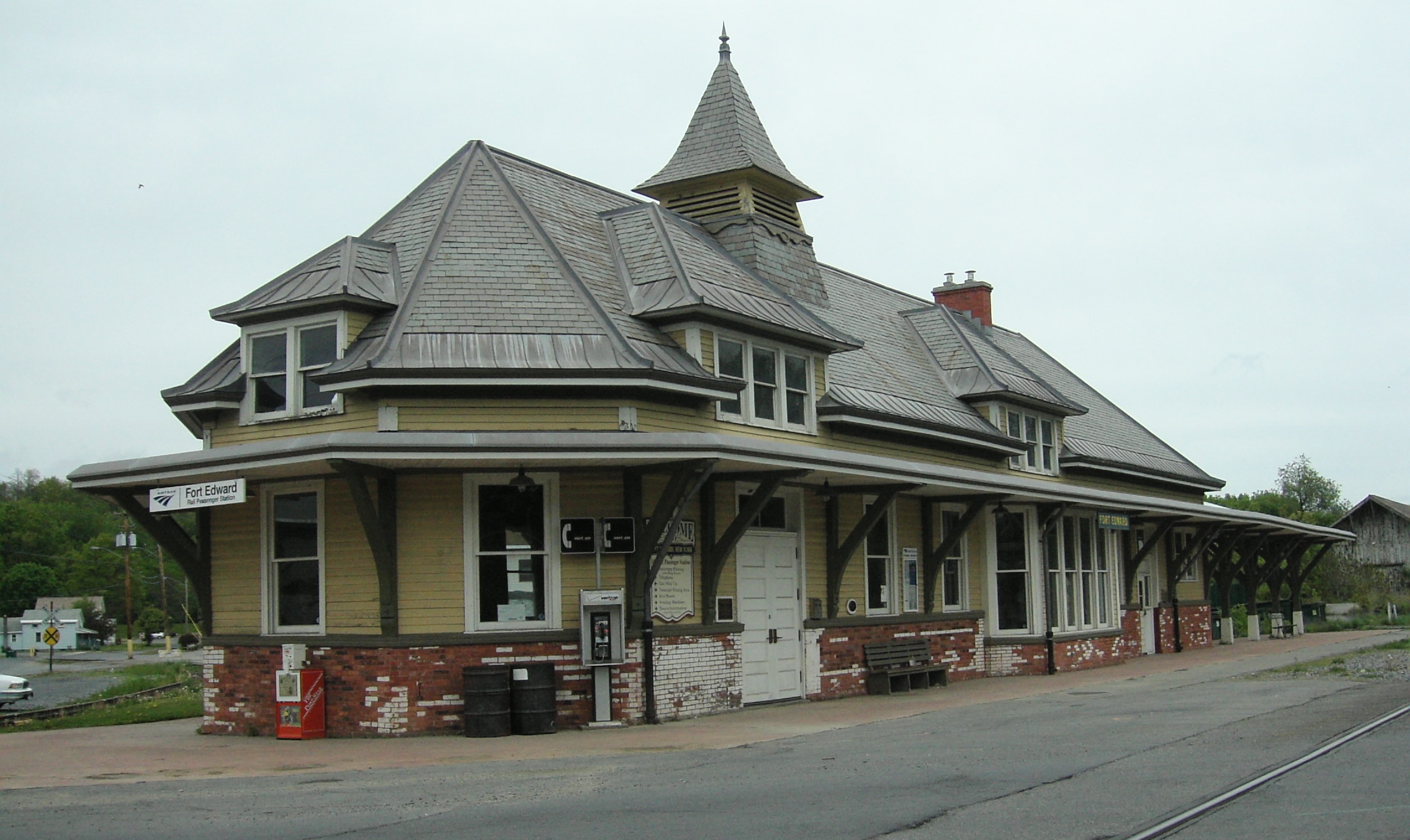
43°03′25″N 73°32′04″W / 43.056944°N 73.534444°WMiddle Falls 13 Fort Edward D&H Train Station 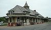
December 13, 2000 East and Wing Sts.
43°16′11″N 73°34′51″W / 43.269722°N 73.580833°WFort Edward 14 Fort Miller Reformed Church Complex 
December 6, 1996 Fort Miller Rd., W of US 4 and S of Galusha Island
43°09′49″N 73°34′55″W / 43.163611°N 73.581944°WFort Edward 15 Glens Falls Feeder Canal 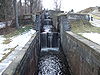
October 25, 1985 Roughly between Richardson St. and the Old Champlain Canal
43°18′07″N 73°37′53″W / 43.301944°N 73.631389°WHudson Falls 16 Hartford Baptist Church and Cemetery 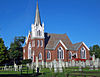
August 20, 2004 56 NY 23 (Main St.)
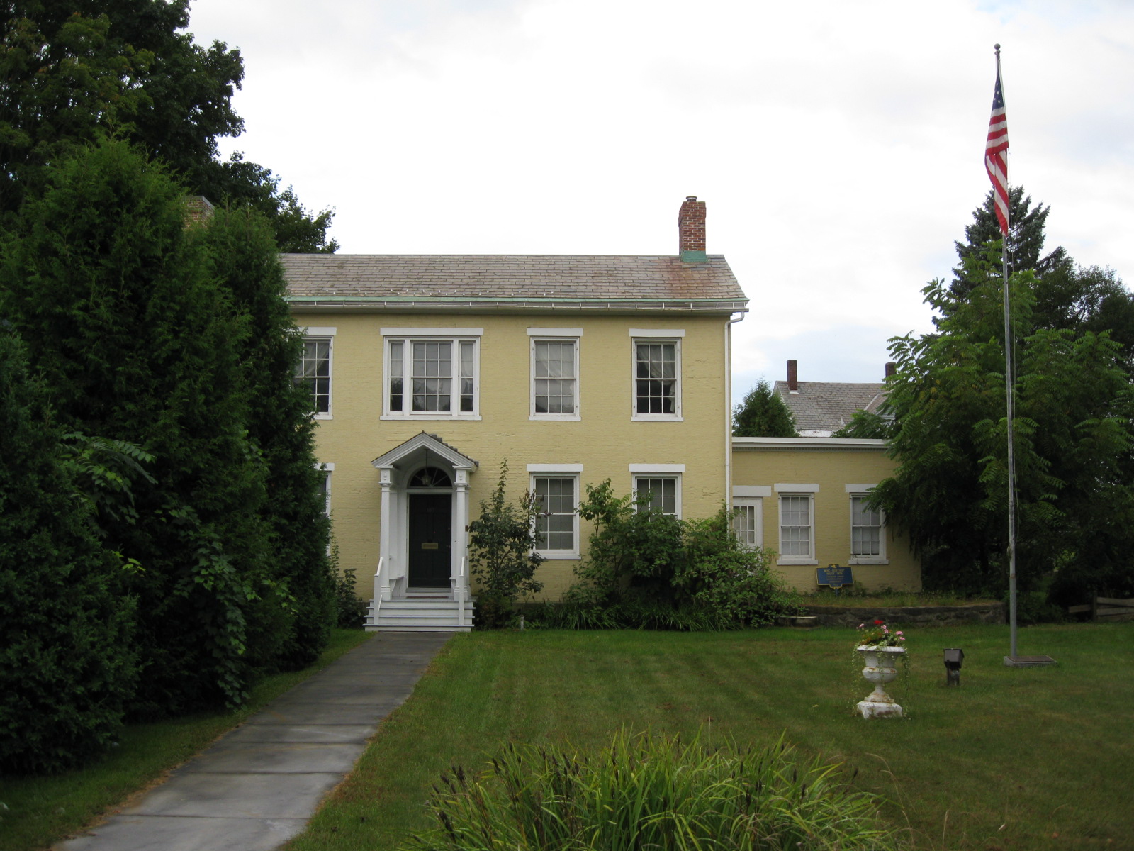
43°21′53″N 73°23′35″W / 43.364722°N 73.393056°WHartford 1891 late Victorian Gothic church built on site of congregation's first church in 1789. 17 Lemuel Haynes House 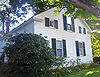
May 15, 1975 Rte. 149
43°22′16″N 73°17′00″W / 43.371111°N 73.283333°WSouth Granville Last home of first ordained African-American minister in U.S. Currently Washington County's only National Historic Landmark 18 Hebron Valley Grange No. 1103 July 28, 2006 3185 Cty Rte 30
43°13′50″N 73°22′34″W / 43.230556°N 73.376111°WWest Hebron 19 Home Farm December 5, 2008 591 Co. Rt. 18
43°32′35″N 73°21′14″W / 43.543187°N 73.354027°WEast Whitehall New listing; refnum#08001147 20 Hudson Falls Historic District 
September 15, 1983 Roughly bounded by Oak, Mechanic, River, Maple and Main Sts.
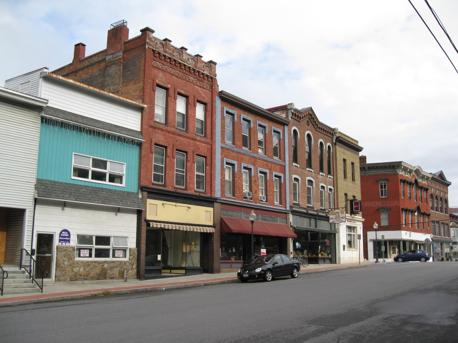
43°18′00″N 73°35′09″W / 43.3°N 73.585833°WHudson Falls 21 Main Street Historic District 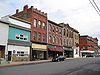
April 24, 1975 Both sides of Williams St. and both sides of Main St. Bridge to below Saunders St. Bridge
43°33′22″N 73°24′07″W / 43.556111°N 73.401944°WWhitehall 22 Thomas McLean House October 31, 2007 NY 29
43°06′47″N 73°25′20″W / 43.113056°N 73.422222°WBattenville 23 Alexander McNish House Alexander McNish HouseNovember 29, 2010 194 County Road 30
43°10′14″N 73°21′07″W / 43.170556°N 73.351944°WSalem New listing; refnum 10000959 24 William Miller Chapel and Ascension Rock July 17, 1975 W of Fair Haven on SR 11
43°35′42″N 73°18′45″W / 43.595°N 73.3125°WFair Haven Historic district, increased to include William Miller Farm as well. 25 Old Fort House September 15, 1983 29 Lower Broadway
43°15′40″N 73°34′51″W / 43.261111°N 73.580833°WFort Edward 26 Judge Joseph Potter House May 2, 1974 Mountain Ter.
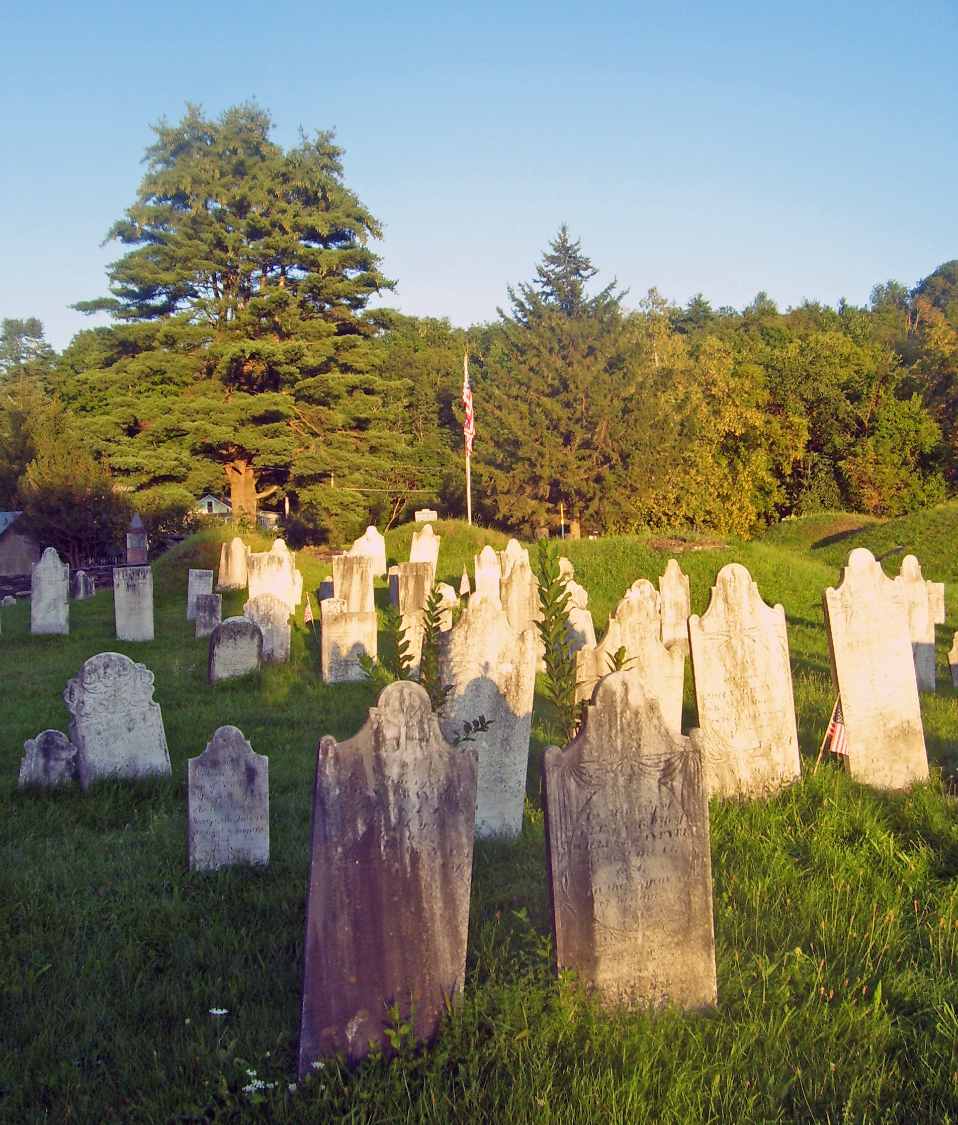
43°33′21″N 73°23′58″W / 43.555833°N 73.399444°WWhitehall 27 Revolutionary War Cemetery 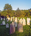
August 11, 2004 9 Archibald St.
43°10′02″N 73°19′47″W / 43.167222°N 73.329722°WSalem Oldest cemetery in town, with almost 1,100 graves, many local veterans of the war 28 Rexleigh Covered Bridge 
March 8, 1978 Off NY 22
43°11′25″N 73°20′05″W / 43.190233°N 73.3348°WJackson 29 Rogers Island July 24, 1973 Address Restricted
43°15′42″N 73°35′08″W / 43.261667°N 73.585556°WFort Edward 30 St. James Episcopal Church 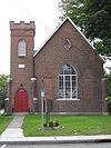
January 7, 1998 112 Broadway
43°16′02″N 73°35′06″W / 43.267222°N 73.585°WFort Edward 31 Salem Historic District 
May 28, 1975 Both sides of Broadway and Main Sts. from RR tracks on N and W to include White Creek on S and E
43°10′19″N 73°19′39″W / 43.171944°N 73.3275°WSalem Historic core of one of the oldest settlements in the region, with many intact 19th century buildings 32 Shushan Covered Bridge March 8, 1978 Spans Batten Kill off NY 22
43°05′28″N 73°20′45″W / 43.091111°N 73.345833°WShushan 33 L. C. Simonds Adirondack Cabin L. C. Simonds Adirondack CabinNovember 29, 2010 130 Cat Den Rd.
43°36′56″N 73°25′27″W / 43.615556°N 73.424167°WClemons New listing; refnum 10000941 34 South Granville Congregational Church and Parsonage 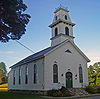
May 19, 2005 7179 NY 149
43°22′19″N 73°17′15″W / 43.371944°N 73.2875°WGranville 1840s church and parsonage; former expanded 1873 35 Stoops Hotel June 30, 2009 2839 NY 29
43°06′56″N 73°25′20″W / 43.115639°N 73.422242°WBattenville New listing; refnum 09000481 36 Elisha Straight House 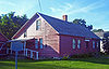
September 15, 2004 55 Main St.
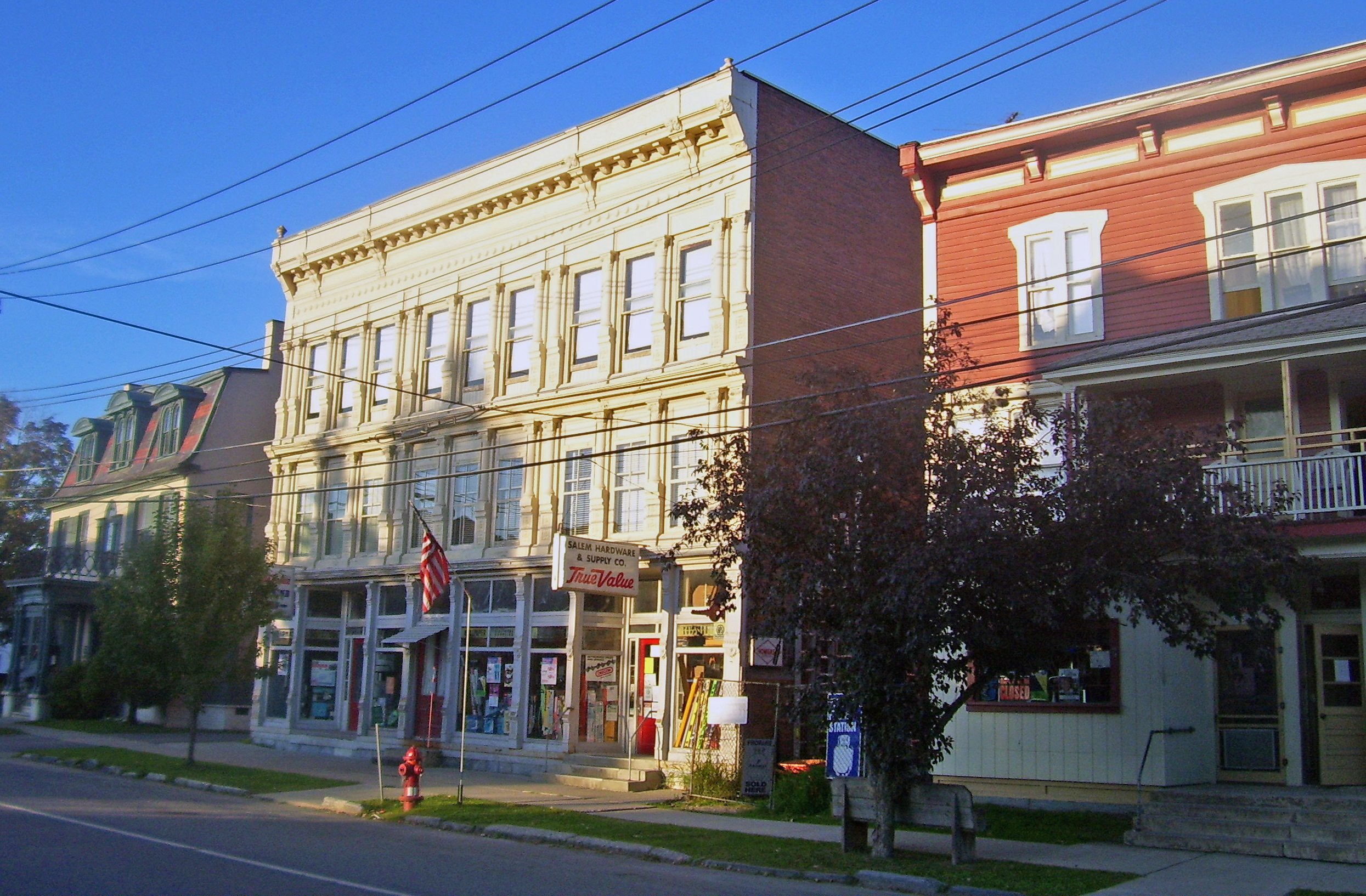
43°21′53″N 73°23′38″W / 43.364722°N 73.393889°WHartford Early home in Hartford used as recruitment center during Civil War. Now local history museum 37 Town-Hollister Farm June 13, 2008 NY 22 North Granville (new listing; refnum 08000516) 38 US Post Office-Granville 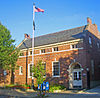
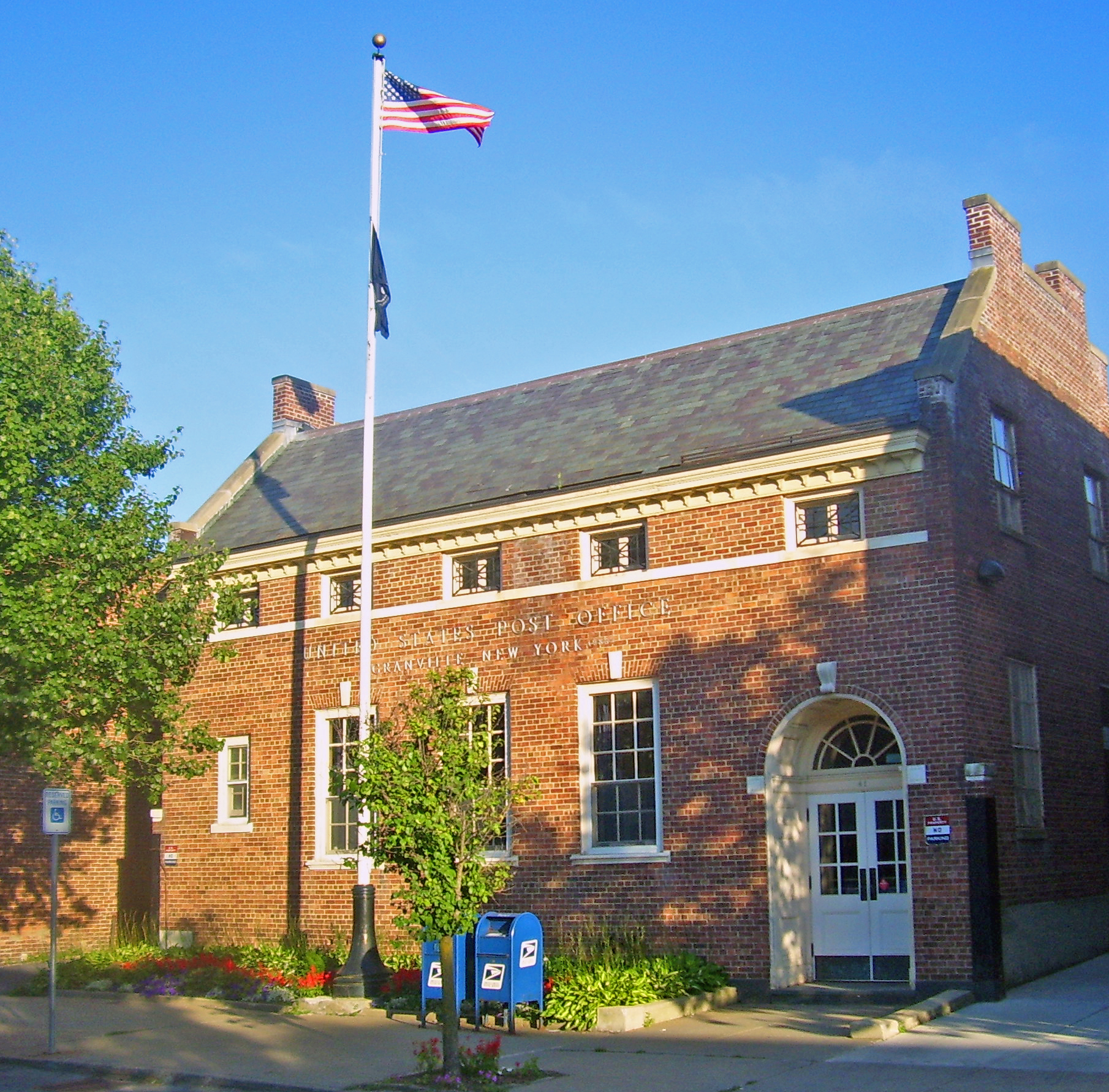
May 11, 1989 41 Main St.
43°26′03″N 73°15′35″W / 43.434167°N 73.259722°WGranville One of only three Colonial Revival post offices with a raised parapet along the gables. Asymmetrical fenestration is unusual in a Depression-era post office of that size. 39 US Post Office-Hudson Falls 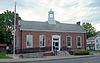
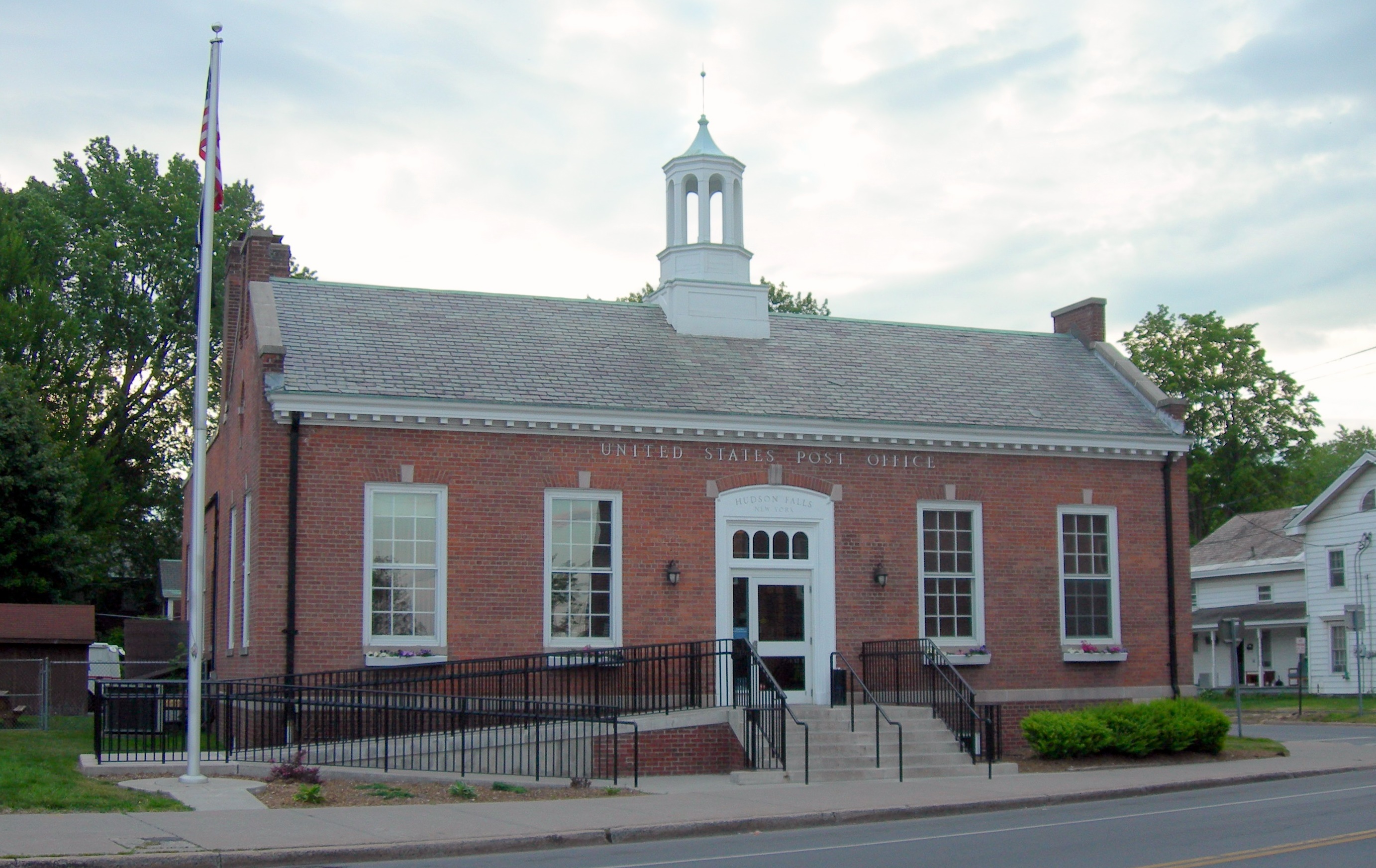
May 11, 1989 114 Main St.
43°17′59″N 73°35′08″W / 43.299722°N 73.585556°WHudson Falls 40 US Post Office-Whitehall May 11, 1989 88 Broadway
43°33′12″N 73°24′16″W / 43.553333°N 73.404444°WWhitehall 41 Village of Greenwich Historic District 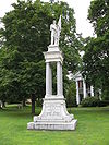
August 31, 1995 Roughly, along Academy, Church, Cottage, Gray, Main, Prospect and Salem Sts. and Washington Sq., Town of Greenwich
43°05′30″N 73°29′55″W / 43.091667°N 73.498611°WGreenwich 42 White Creek Historic District 
April 26, 1979 SR 68, Byars and Niles Rds.
42°58′18″N 73°17′22″W / 42.971667°N 73.289444°WWhite Creek 43 Whitehall Armory 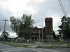
March 2, 1995 62 Poultney St.
43°32′59″N 73°23′48″W / 43.549722°N 73.396667°WWhitehall 44 Wing-Northup House 
September 12, 2008 167 Broadway
43°16′10″N 73°35′14″W / 43.269528°N 73.587342°WFort Edward See also
References
- ^ The latitude and longitude information provided in this table was derived originally from the National Register Information System, which has been found to be fairly accurate for about 99% of listings. For about 1% of NRIS original coordinates, experience has shown that one or both coordinates are typos or otherwise extremely far off; some corrections may have been made. A more subtle problem causes many locations to be off by up to 150 yards, depending on location in the country: most NRIS coordinates were derived from tracing out latitude and longitudes off of USGS topographical quadrant maps created under North American Datum of 1927, which differs from the current, highly accurate GPS system used by Google maps. Chicago is about right, but NRIS longitudes in Washington are higher by about 4.5 seconds, and are lower by about 2.0 seconds in Maine. Latitudes differ by about 1.0 second in Florida. Some locations in this table may have been corrected to current GPS standards.
- ^ "National Register of Historic Places: Weekly List Actions". National Park Service, United States Department of the Interior. Retrieved on November 18, 2011.
- ^ Numbers represent an ordering by significant words. Various colorings, defined here, differentiate National Historic Landmark sites and National Register of Historic Places Districts from other NRHP buildings, structures, sites or objects.
Categories:- National Register of Historic Places in New York by county
- Buildings and structures in Washington County, New York
-


Wikimedia Foundation. 2010.