- National Register of Historic Places listings in Sullivan County, New York
-
 Location of Sullivan County in New York
List of the National Register of Historic Places listings in Sullivan County, New York
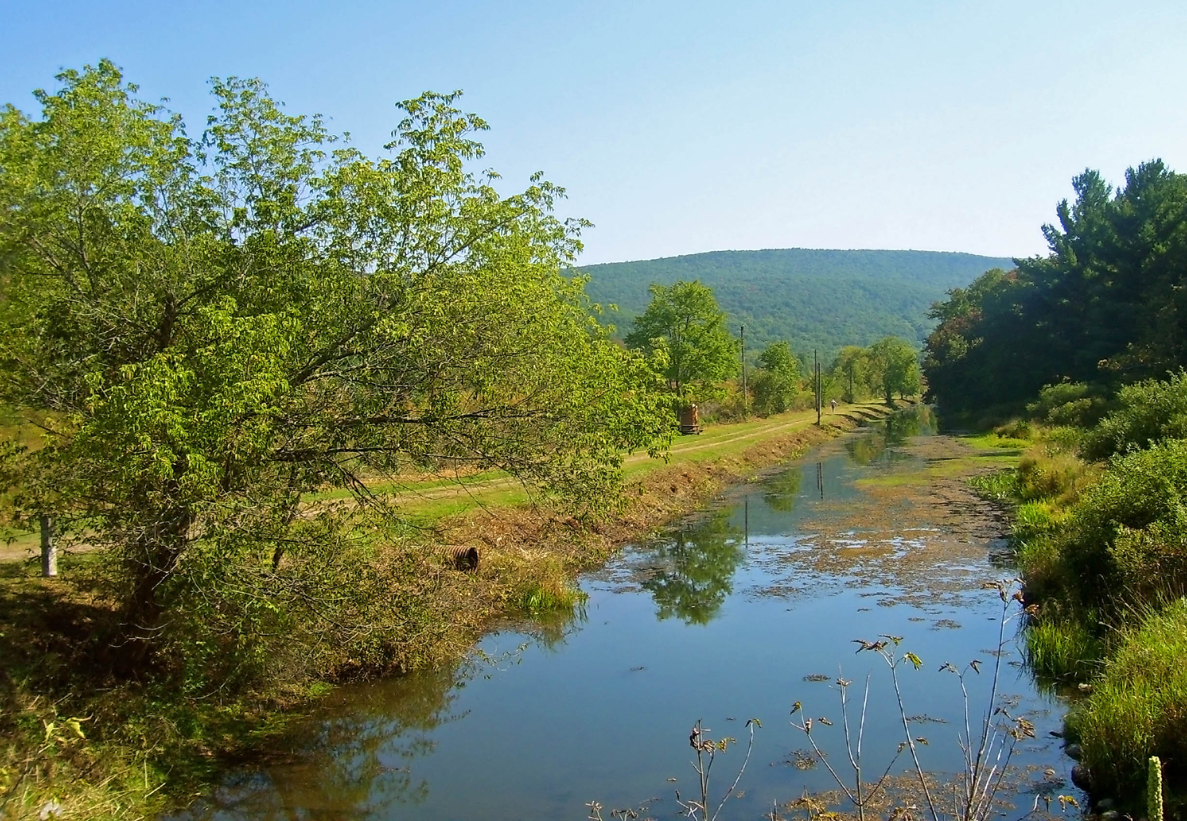
This is intended to be a complete list of properties and districts listed on the National Register of Historic Places in Sullivan County, New York. The locations of National Register properties and districts showing latitude and longitude coordinates may be seen in a Google map by clicking on "Map of all coordinates".[1] The Delaware and Hudson Canal, which runs through this and other counties, is further designated a U.S. National Historic Landmark.
-
- This National Park Service list is complete through NPS recent listings posted November 18, 2011.[2]
Contents: Counties in New York Albany (Albany) – Allegany – Bronx – Broome – Cattaraugus – Cayuga – Chautauqua – Chemung – Chenango – Clinton – Columbia – Cortland – Delaware – Dutchess – Erie (Buffalo) – Essex – Franklin – Fulton – Genesee – Greene – Hamilton – Herkimer – Jefferson – Kings (Brooklyn) – Lewis – Livingston – Madison – Monroe (Rochester) – Montgomery – Nassau – New York (Manhattan – Below 14th Street, 14th to 59th Streets, 59th to 110th Streets, Above 110th Street, Islands) – Niagara – Oneida – Onondaga (Syracuse) – Ontario – Orange – Orleans – Oswego – Otsego – Putnam – Queens – Rensselaer – Richmond (Staten Island) – Rockland – Saratoga – Schenectady – Schoharie – Schuyler – Seneca – St. Lawrence – Steuben – Suffolk – Sullivan – Tioga – Tompkins – Ulster – Warren – Washington – Wayne – Westchester (New Rochelle, Peekskill, Yonkers) – Wyoming – Yates Listings county-wide
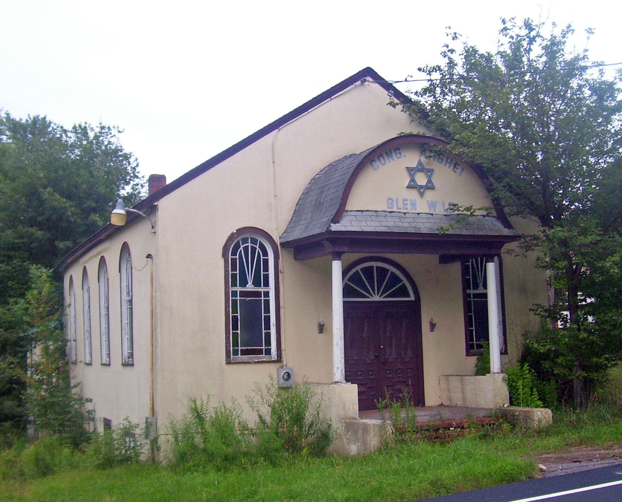
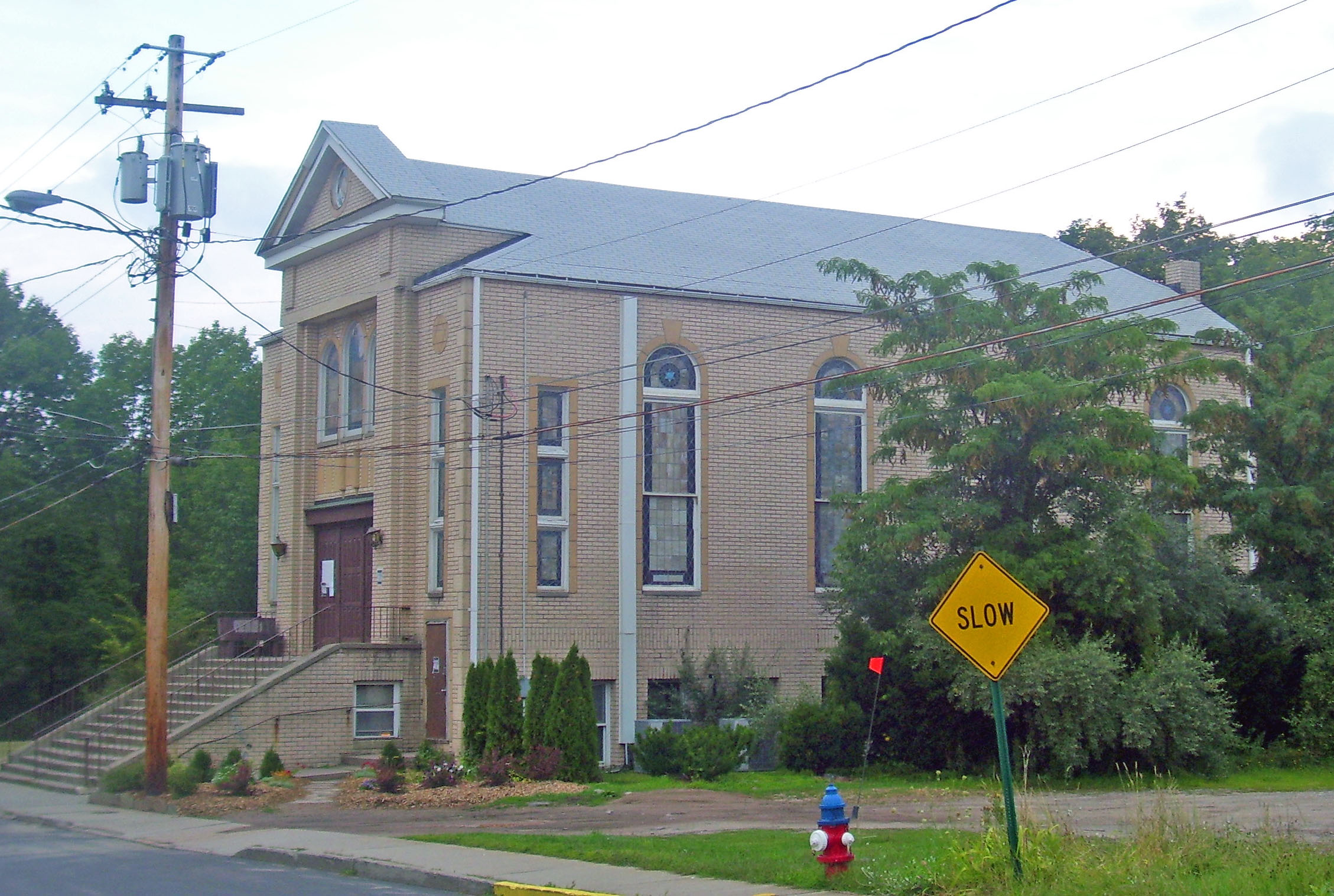
[3] Landmark name Image Date listed Location City or town Summary 1 Anshei Glen Wild Synagogue 
January 15, 1999 Glen Wild Road
41°39′00″N 74°35′20″W / 41.65°N 74.588889°WGlen Wild 1923 synagogue built and still owned by local family. Has never had its own rabbi. 2 Agudas Achim Synagogue 
November 19, 1998 Rock Ave.
41°54′03″N 74°49′28″W / 41.900833°N 74.824444°WLivingston Manor 1924 synagogue built at unusual angle, shows influence of local churches with lancet arch windows 3 Arlington Hotel 
March 31, 1983 Main St.
41°36′30″N 75°03′40″W / 41.608333°N 75.061111°WNarrowsburg 4 B'nai Israel Synagogue January 15, 1999 NY 52 Woodbourne 5 Beaverkill Covered Bridge 
October 3, 2007 CR 30 over Beaverkill Cr.
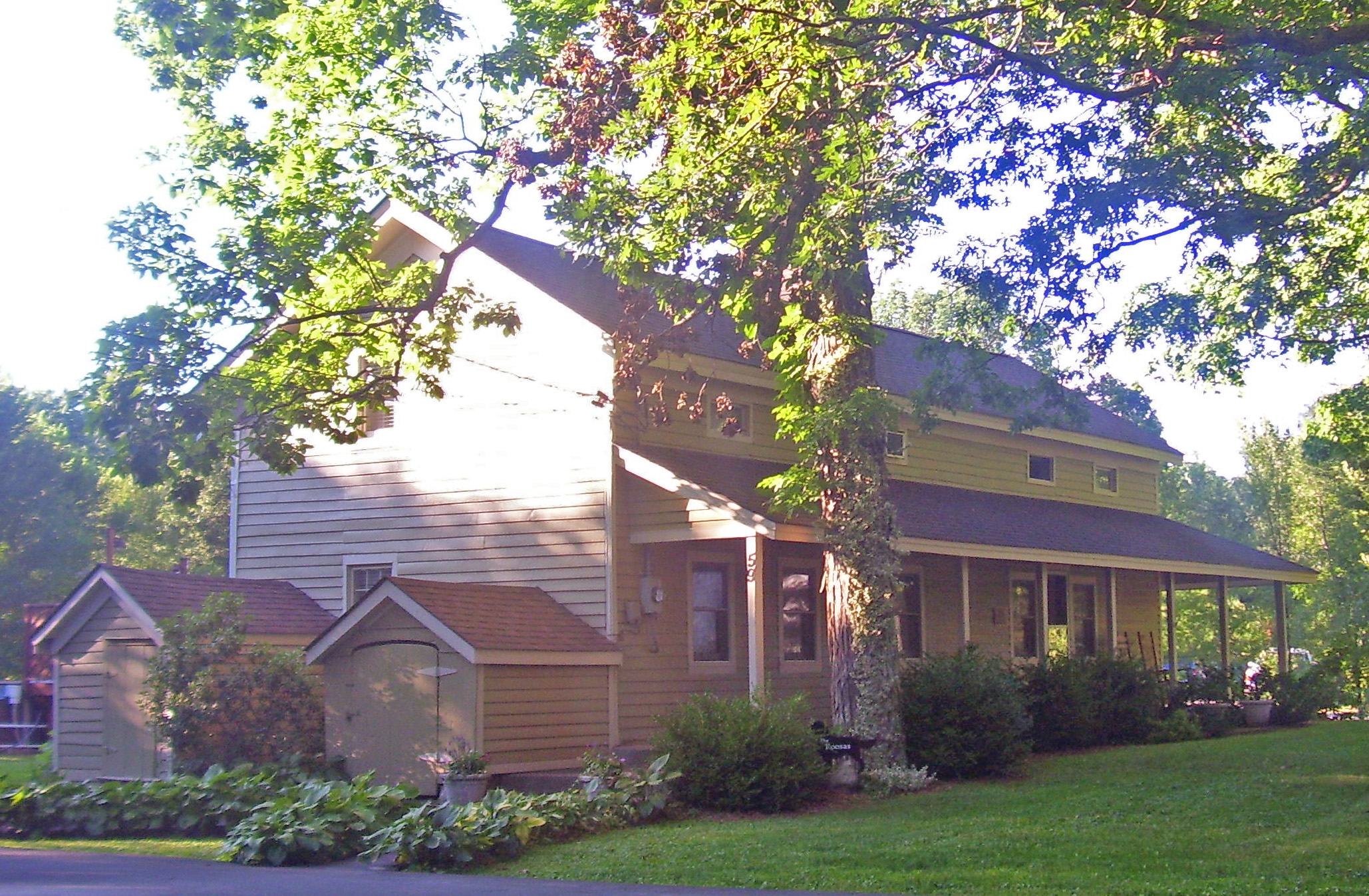
41°58′53″N 74°50′12″W / 41.981389°N 74.836667°WBeaverkill 1865 covered bridge was one of earliest crossings of river in remote, unsettled area of Catskills. Some uncertainty as to who actually built it. Unusual variant on Ithiel Town-patented design. 6 Bennett Family House December 28, 2001 11 Hamilton Ave.
41°39′20″N 74°40′58″W / 41.655556°N 74.682778°WMonticello 7 Bikur Cholim B'nai Israel Synagogue January 15, 1999 Old White Lake Turnpike at NY 55
41°42′54″N 74°47′59″W / 41.715°N 74.799722°WSwan Lake 8 Bloomingburg Reformed Protestant Dutch Church 
January 10, 1980 NY 17M
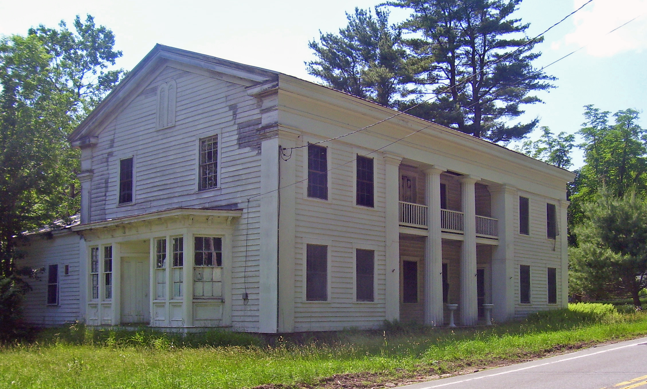
41°33′21″N 74°26′34″W / 41.555833°N 74.442778°WBloomingburg 1821 church is local landmark and one of the oldest churches in the county. Currently being prepared for use as a historical museum. 9 C. Burton Hotel 
March 16, 2005 450 Main St.
41°51′11″N 74°33′09″W / 41.853056°N 74.5525°WGrahamsville 1851 hotel is possibly the only surviving Greek Revival building in county with columns and a ballroom. 10 Ellery Calkins House 
November 27, 1992 Co. Rd. 114, E of Delaware R. Bridge
41°42′27″N 75°03′50″W / 41.7075°N 75.063889°WCochecton 11 Callicoon Methodist Church and Parsonage November 4, 1993 Church St. (NY 97) S of jct. with Seminary Rd., Town of Delaware
41°46′00″N 75°03′20″W / 41.766667°N 75.055556°WCallicoon 12 Callicoon National Bank February 18, 1994 133 Main St.
41°45′58″N 75°03′32″W / 41.766111°N 75.058889°WCallicoon 13 Center Theatre 
February 23, 2001 NY 52
41°45′30″N 74°36′08″W / 41.758333°N 74.602222°WWoodbourne 14 Chevro Ahavath Zion Synagogue January 28, 1999 Cold Spring Rd.
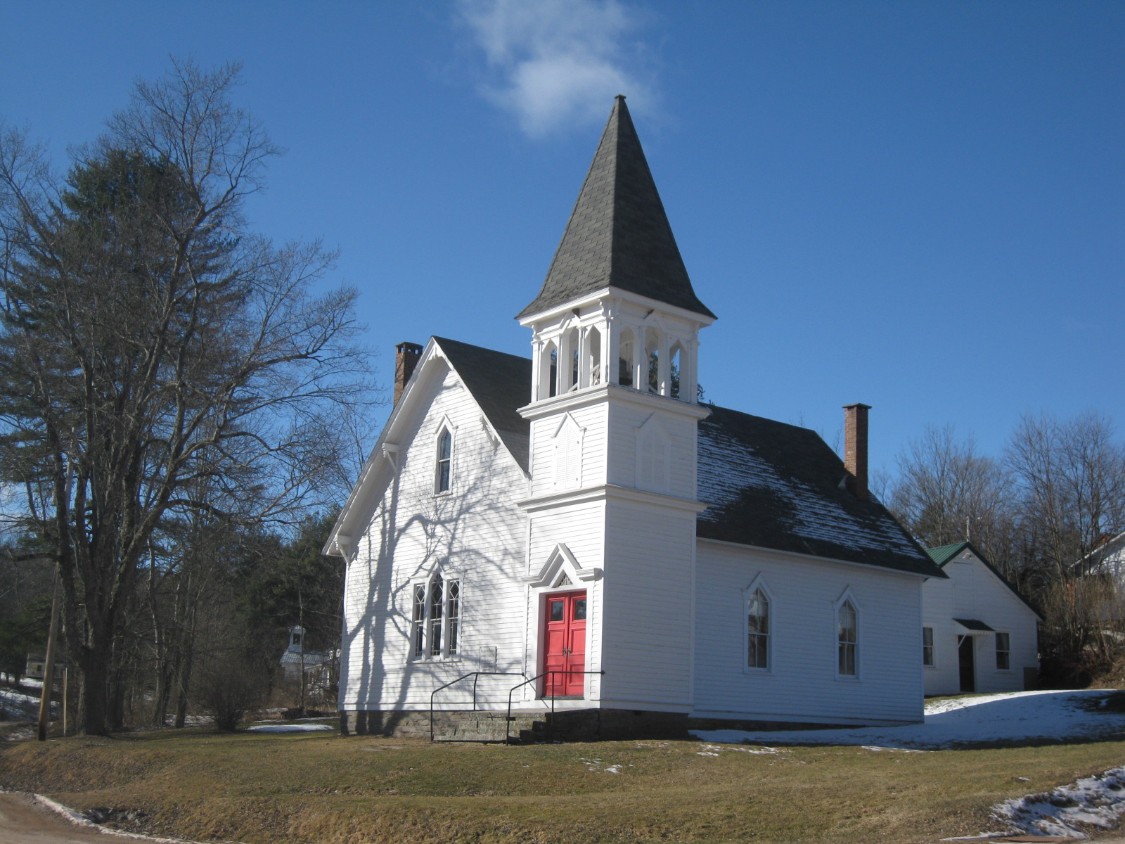
41°36′42″N 74°40′38″W / 41.611667°N 74.677222°WMonticello 15 Cochecton Center Methodist Episcopal Church 
April 21, 2000 Skipperdine Rd.
41°39′21″N 74°59′05″W / 41.655833°N 74.984722°WCochecton Center 16 Cochecton Presbyterian Church 
November 27, 1992 Co. Rd. 114, E of Delaware R. Bridge
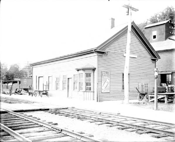
41°42′25″N 75°03′52″W / 41.706944°N 75.064444°WCochecton 17 Cochecton Railroad Station 
March 16, 2005 NY 97
41°43′04″N 75°02′46″W / 41.717778°N 75.046111°WCochecton 18 Delaware and Hudson Canal 
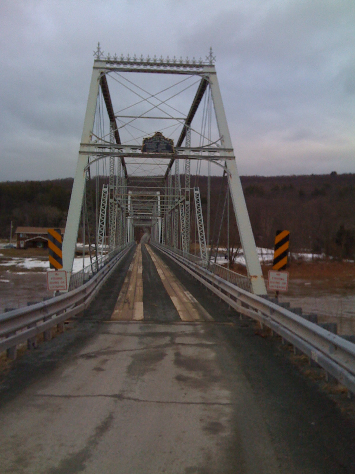
November 24, 1968 Delaware and Hudson Canal Minisink 19 Delaware Aqueduct 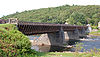
November 24, 1968 Between Minisink Ford, NY and Lackawaxen, PA
41°28′57″N 74°58′37″W / 41.4825°N 74.976944°WMinisink Ford Oldest wire suspension bridge in the U.S.; design precedent for Brooklyn Bridge 20 Drake-Curtis House April 19, 1993 Co. Rd. 114, E of NY 97
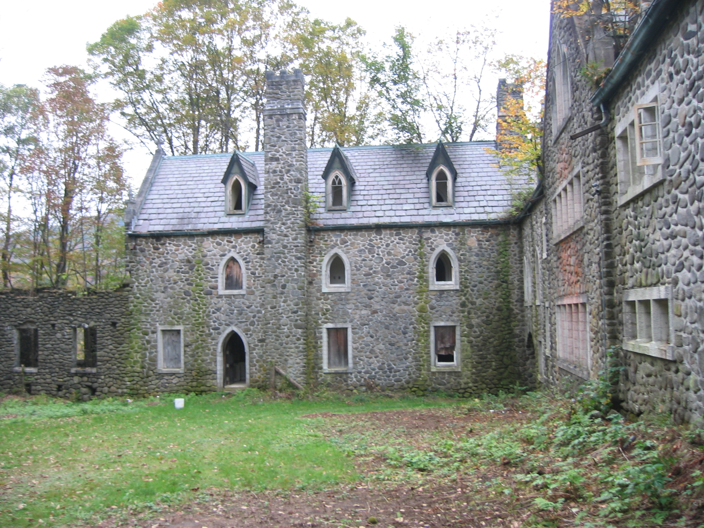
41°42′32″N 75°03′06″W / 41.708889°N 75.051667°WCochecton 21 Dundas Castle 
March 21, 2001 Berry Brook Rd.
41°58′46″N 74°52′38″W / 41.979444°N 74.877222°WRoscoe (be sure to link in article to Dundas Castle in Edinburgh, Scotland) 22 Ferndale School January 5, 2005 Uppper Ferndale Rd. and Ferndale Loomis Rd.
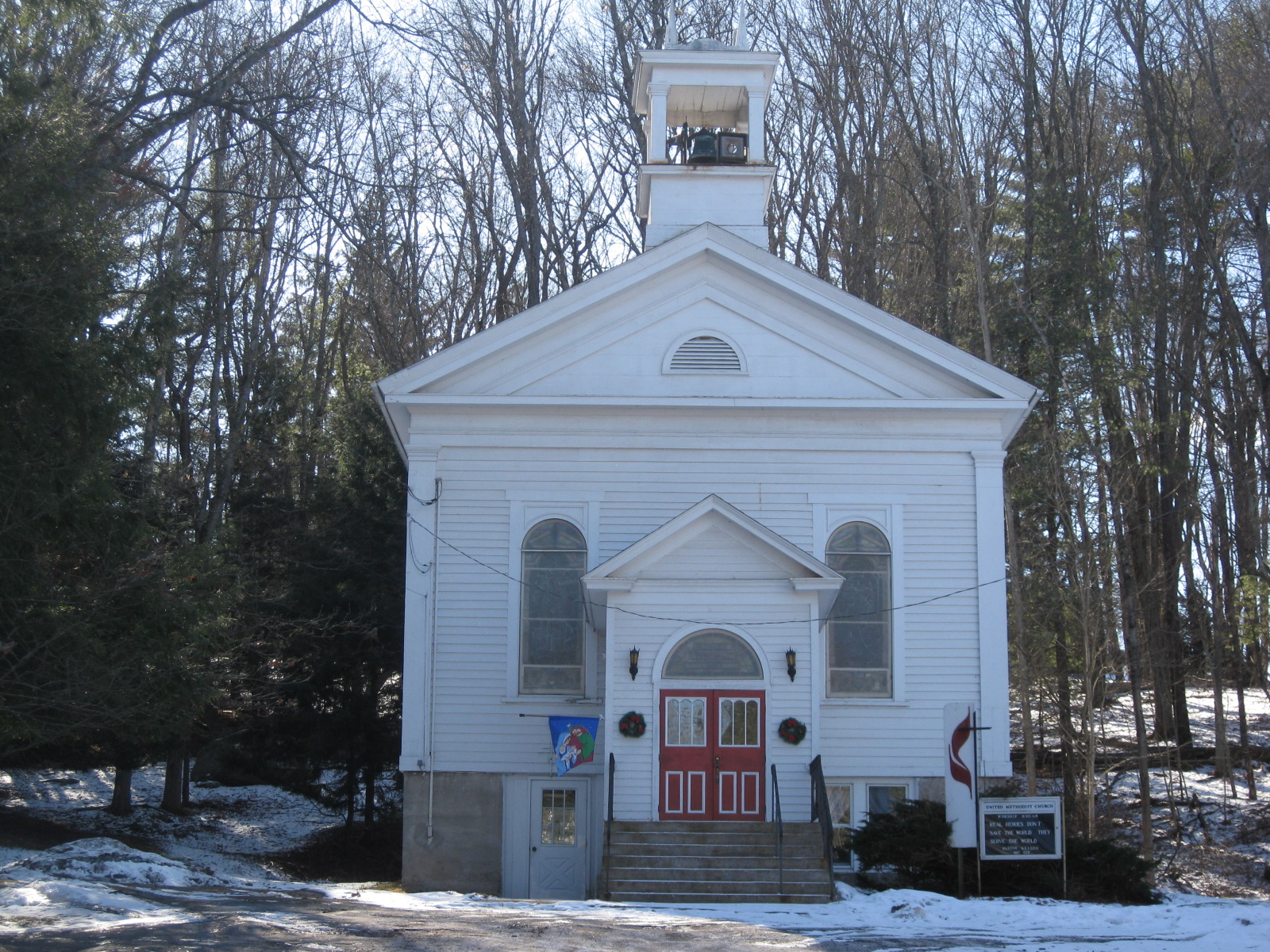
41°46′36″N 74°44′29″W / 41.776667°N 74.741389°WFerndale 23 First Methodist Episcopal Church of Parksville 
May 30, 2001 10 Short Ave.
41°51′21″N 74°45′32″W / 41.855833°N 74.758889°WParksville 24 Forestburgh Town Hall Forestburgh Town HallMay 11, 2011 305 County Road 48
41°32′28″N 74°43′30″W / 41.541111°N 74.725°WForestburgh vicinity New listing; refnum 11000278 25 German Presbyterian Church and Hortonville Cemetery January 15, 2003 CR 121 and CR 131
41°46′21″N 75°01′42″W / 41.7725°N 75.028333°WHortonville 26 Glen Wild Methodist Church May 10, 1984 Old Glen Wild Rd.
41°39′58″N 74°35′18″W / 41.666111°N 74.588333°WGlen Wild 27 Grahamsville Historic District 
December 6, 1979 NY 55
41°50′48″N 74°32′19″W / 41.846667°N 74.538611°WGrahamsville Intact core of 19th-century Grahamsville, east of present hamlet's downtown, with buildings mostly intact 28 Greenfield Preparative Meeting House Greenfield Preparative Meeting HouseNovember 29, 2010 NY 55 at Denman Mountain Road
41°51′16″N 74°33′16″W / 41.854444°N 74.554444°WGrahamsville New listing; refnum 10000956 29 Hankins District No. One Schoolhouse February 4, 2000 Sullivan Cty Rd. 132
41°48′59″N 75°04′58″W / 41.816389°N 75.082778°WHankins 30 Hankins Stone Arch Bridge 
July 27, 2000 Sullivean Cty. Rd. 94, E.
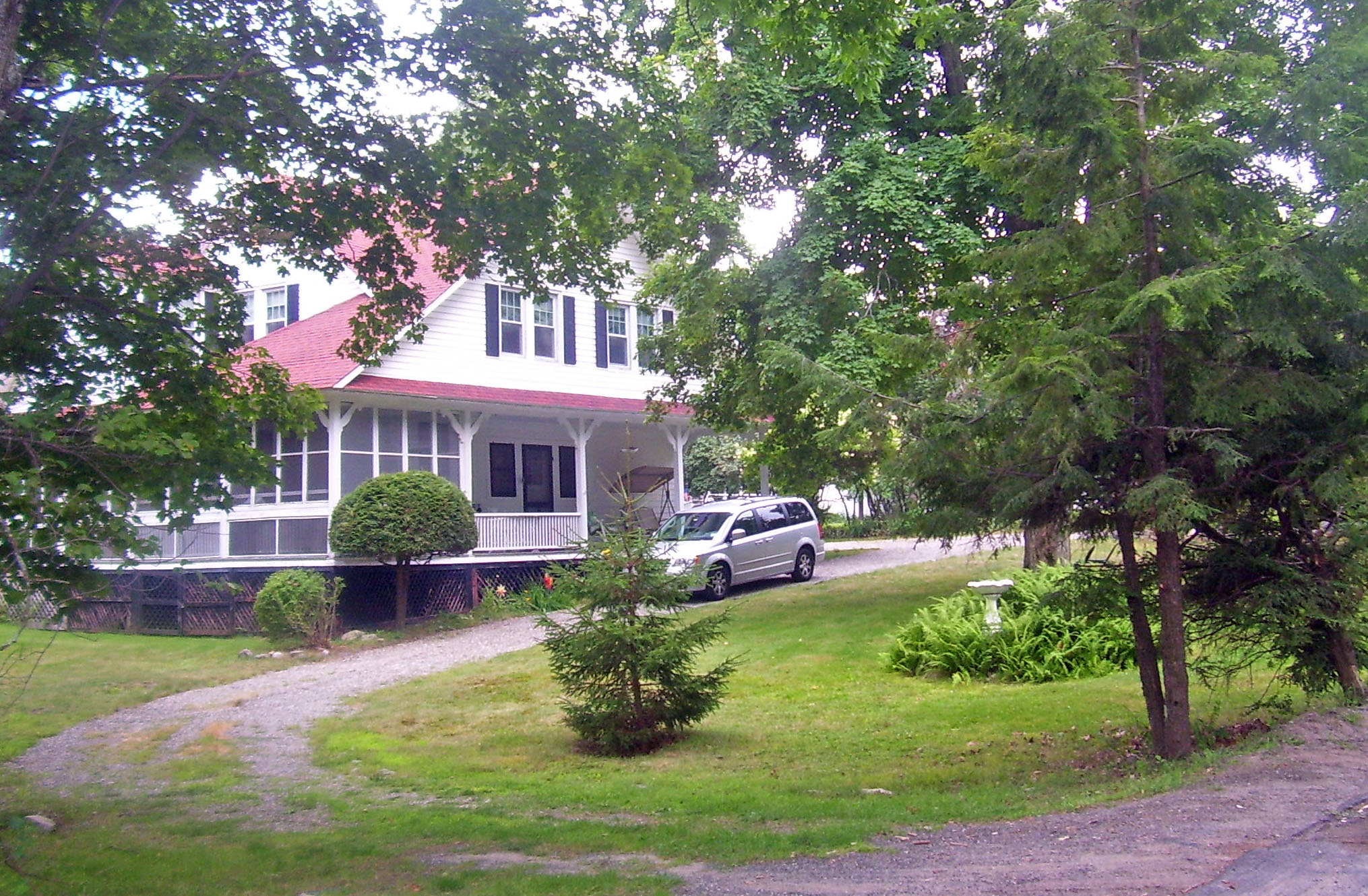
41°48′59″N 75°05′31″W / 41.816389°N 75.091944°WHankins 31 Hart House January 18, 2006 50 Hamilton St.
41°35′14″N 74°22′50″W / 41.587222°N 74.380556°WBurlingham 32 Hebrew Congregation of Mountaindale Synagogue 
May 30, 2001 NY 55
41°41′18″N 74°31′51″W / 41.688333°N 74.530833°WMountaindale 1917 synagogue is only one in county with its own mikvah 33 Hessinger Store June 2, 2000 Main St. (Co. Rd. 122)
41°50′10″N 74°56′51″W / 41.836111°N 74.9475°WCallicoon Center 34 Jeffersonville School April 28, 1988 Terrace Ave.
41°46′48″N 74°56′25″W / 41.78°N 74.940278°WJeffersonville 35 Jewish Center of Lake Huntington Jewish Center of Lake HuntingtonDecember 11, 2009 13 County Road 116
41°46′48″N 74°56′25″W / 41.78°N 74.940278°WLake Huntington New listing; refnum 09001087 36 Jewish Community Center of White Sulphur Springs August 12, 1999 Briscoe Rd.
41°47′56″N 74°49′52″W / 41.798889°N 74.831111°WWhite Sulphur Springs 37 Kirk House May 10, 1984 Kirk's Rd.
41°36′27″N 75°03′26″W / 41.6075°N 75.057222°WNarrowsburg 38 Levitz Family Farm January 24, 2002 395 Beaver Dam Rd.
41°47′51″N 74°32′00″W / 41.7975°N 74.533333°WGrahamsville 39 Liberty Downtown Historic District 
May 26, 2006 Main, Chestnut, Academy, School, Church, Maple, John, Edgar Sts., and Darbee Ln.
41°48′03″N 74°44′48″W / 41.800833°N 74.746667°WLiberty 40 Liberty Village Historic District 
April 11, 1978 N. Main, Academy, and Law Sts.
41°48′05″N 74°44′53″W / 41.801389°N 74.748056°WLiberty 41 Loch Sheldrake Synagogue August 12, 1997 NY 52, N of jct. of NY 52 and Loch Sheldrake Rd.
41°46′15″N 74°39′29″W / 41.770833°N 74.658056°WLoch Sheldrake 42 Mamakating Park Historic District 
November 19, 1998 Roughly along Park Rd, Columbian Rd., and Mamakating Ave.
41°36′45″N 74°32′12″W / 41.6125°N 74.536667°WWurtsboro 1890s Catskill ridgetop resort community, never fully realized 43 Manion's General Store April 15, 2004 52 Ferndale Rd.
41°46′26″N 74°44′22″W / 41.773889°N 74.739444°WFerndale 44 Anthony Manny House September 15, 2000 6 Hankins Rd.
41°48′53″N 75°05′15″W / 41.814722°N 75.0875°WHankins 45 Masten-Quinn House 
February 13, 2003 59 First St.
41°34′37″N 74°28′52″W / 41.576944°N 74.481111°WWurtsboro 1820s house of early farmer who took advantage of D&H Canal route through his land. Farmed until mid-20th century. 46 Milanville-Skinners Falls Bridge 
November 14, 1988 Legislative Route 63027 over the Delaware River at Milanville
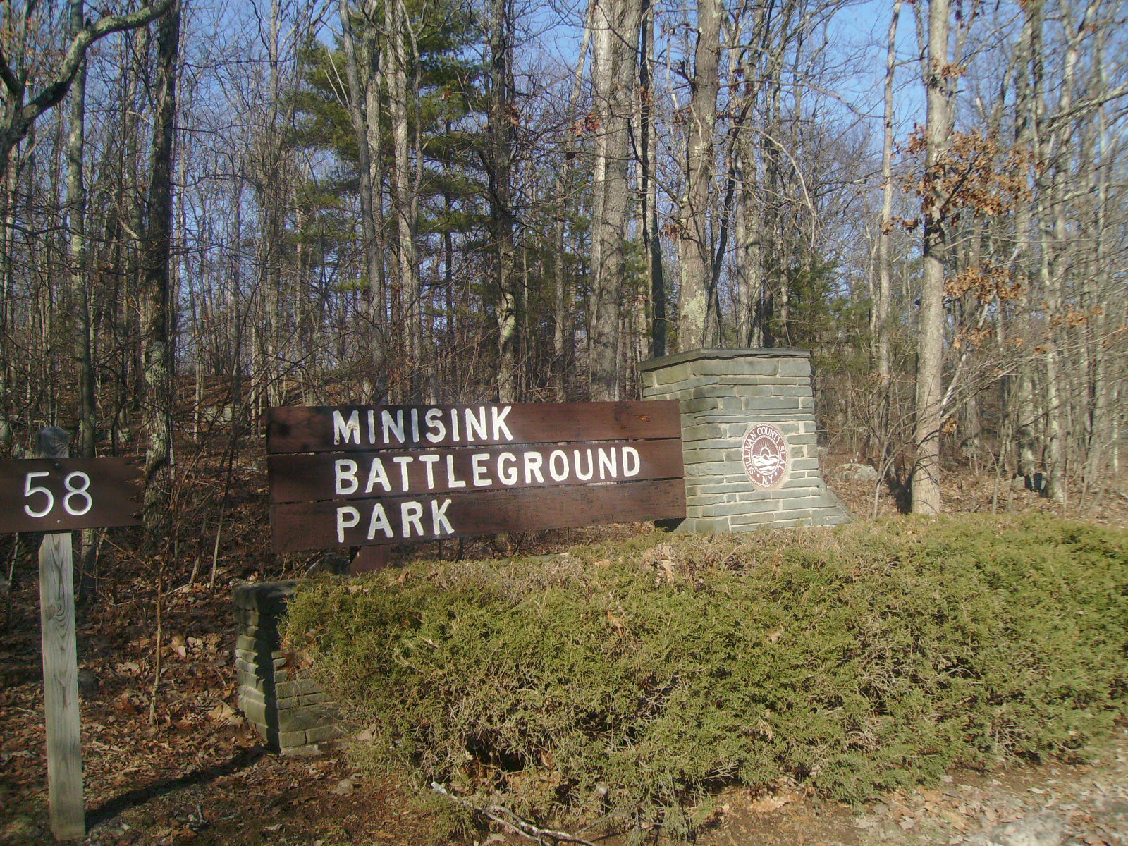
41°40′10″N 75°03′31″W / 41.669444°N 75.058611°WSkinners Falls Extends into Damascus Township in Wayne County, Pennsylvania 47 Minisink Battlefield 
September 16, 1993 Minisink Battleground Road (Co. Rd. 168) N of Minisink Ford
41°29′15″N 74°58′19″W / 41.4875°N 74.971944°WMinisink Ford Location of the Battle of Minisink during the American Revolution 48 Munson Diner April 12, 2006 Lake St. (NY 55)
41°47′47″N 74°44′46″W / 41.796389°N 74.746111°WLiberty 49 Narrowsburg Methodist Church 
February 4, 2000 Lake St.
41°36′18″N 75°03′45″W / 41.605°N 75.0625°WNarrowsburg 50 Ohave Shalom Synagogue 
November 22, 2000 Mauric Rose St.
41°42′38″N 74°34′23″W / 41.710556°N 74.573056°WWoodridge 1930 synagogue combines urban and Eastern European design traditions. Interior paintings are unique in county 51 Old Cochecton Cemetery November 27, 1992 W of NY 97, N of jct. with Co. Rd. 114
41°42′40″N 75°02′58″W / 41.711111°N 75.049444°WCochecton 52 Page House November 27, 1992 59 C. Meyer Rd.
41°41′01″N 75°02′53″W / 41.683611°N 75.048056°WCochecton 53 Parsonage Road Historic District November 27, 1992 Parsonage Rd.
41°42′31″N 75°03′40″W / 41.708611°N 75.061111°WCochecton 54 Pond Eddy Bridge 
November 14, 1988 LR 51013 over the Delaware River
41°26′21″N 74°49′13″W / 41.439167°N 74.820278°WLumberland Extends into Pike County, Pennsylvania 55 Reilly's Store November 27, 1992 Co. Rd. 114, W of jct. with NY 97
41°42′30″N 75°03′45″W / 41.708333°N 75.0625°WCochecton 56 Rialto Theatre 
February 2, 2001 Broadway
41°39′20″N 74°41′17″W / 41.655556°N 74.688056°WMonticello 57 Riverside Cemetery November 18, 1993 NY 97 SE of jct. with Church St.
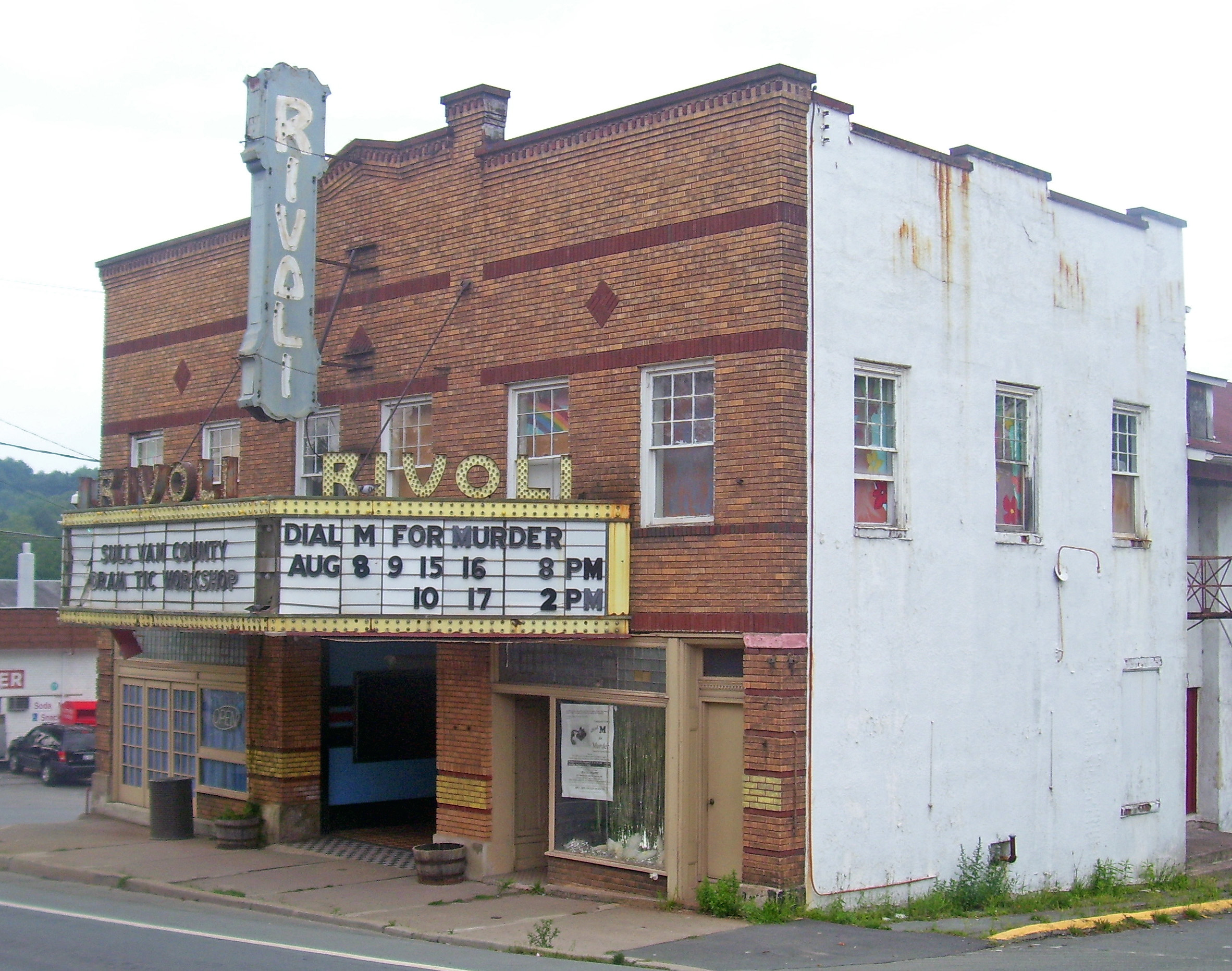
41°50′50″N 75°07′36″W / 41.847222°N 75.126667°WLong Eddy 58 Rivoli Theatre 
January 26, 2001 Jct. of NY 42 and Laurel Ave.
41°41′56″N 74°38′15″W / 41.698889°N 74.6375°WSouth Fallsburg 1923 theater, renovated in Art Deco style in 1937. Preserved nearly intact and still used by local theater group 59 Rockland Mill Complex August 23, 1984 Palen Pl.
41°56′56″N 74°54′52″W / 41.948889°N 74.914444°WRockland 60 Roscoe Presbyterian Church and Westfield Flats Cemetery June 8, 2001 Old NY 17
41°55′56″N 74°54′47″W / 41.932222°N 74.913056°WRoscoe 61 St. James Church and Rectory November 4, 1993 NY 17B N side, E of jct. with NY 97, Town of Delaware
41°45′54″N 75°03′11″W / 41.765°N 75.053056°WCallicoon 62 St. John's Episcopal Church and Rectory November 21, 2002 15 St. John's St.
41°39′12″N 74°41′12″W / 41.653333°N 74.686667°WMonticello 63 St. Joseph's Seminary July 8, 1993 Seminary Rd. W side
41°46′12″N 75°03′29″W / 41.77°N 75.058056°WCallicoon 64 St. Paul's Evangelical Lutheran Church August 15, 1997 24 Chestnut St.
41°47′56″N 74°44′50″W / 41.798889°N 74.747222°WLiberty 65 Shelburne Playhouse April 15, 2004 Upper Ferndale Rd.
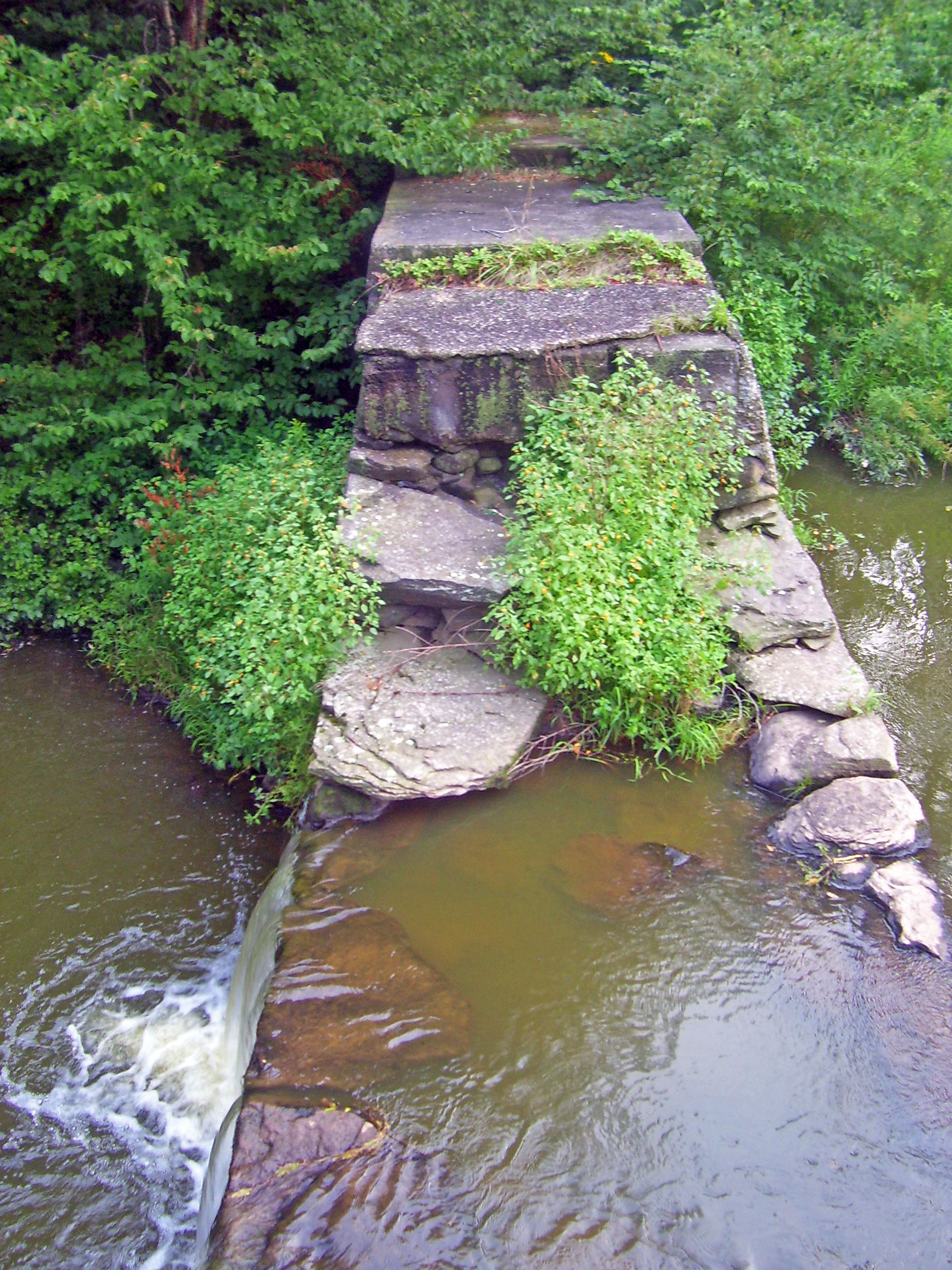
41°46′38″N 74°44′25″W / 41.777222°N 74.740278°WFerndale 66 Silver Lake Dam 
June 2, 2000 Silver Lake Rd.
41°42′06″N 74°33′03″W / 41.701667°N 74.550833°WWoodridge 1840s dam built to regulate Sandburg Creek for summit section of D&H Canal created Silver Lake, later recreational resource. 67 South Fallsburg Hebrew Association Synagogue 
November 22, 2000 North St.
41°42′25″N 74°37′51″W / 41.706944°N 74.630833°WSouth Fallsburg Originally built in 1902, is one of oldest synagogues in county. Has full sukkah in basement. 68 Spring House Spring HouseDecember 2, 2009 54 River Rd.
41°28′41″N 74°55′07″W / 41.478056°N 74.918611°WBarryville New listing; refnum 09000970 69 Stone Arch Bridge December 12, 1976 N of Kenoza Lake on NY 52
41°44′53″N 74°57′15″W / 41.748056°N 74.954167°WKenoza Lake 70 Tefereth Israel Anshei Parksville Synagogue August 12, 1999 Dead End St.
41°51′28″N 74°45′45″W / 41.857778°N 74.7625°WParksville 71 Ten Mile River Baptist Church May 9, 1997 NY 97, jct. with Cochecton Trnpk.
41°33′36″N 75°01′00″W / 41.56°N 75.016667°WTusten 72 Town and Country Building 
September 24, 2004 1 N Main St.
41°47′59″N 74°44′45″W / 41.799722°N 74.745833°WLiberty 73 Tusten Stone Arch Bridge July 27, 2000 Tusten Rd. at Ten Mile River
41°33′22″N 75°01′10″W / 41.556111°N 75.019444°WTusten 74 Valleau Tavern November 27, 1992 Jct. of Co. Rd. 114 and NY 97
41°42′37″N 75°03′16″W / 41.710278°N 75.054444°WCochecton 75 Woodbourne Reformed Church Complex November 7, 2003 NY 42
41°45′42″N 74°36′00″W / 41.761667°N 74.6°WWoodbourne References
- ^ The latitude and longitude information provided in this table was derived originally from the National Register Information System, which has been found to be fairly accurate for about 99% of listings. For about 1% of NRIS original coordinates, experience has shown that one or both coordinates are typos or otherwise extremely far off; some corrections may have been made. A more subtle problem causes many locations to be off by up to 150 yards, depending on location in the country: most NRIS coordinates were derived from tracing out latitude and longitudes off of USGS topographical quadrant maps created under the North American Datum of 1927, which differs from the current, highly accurate WGS84 GPS system used by Google maps. Chicago is about right, but NRIS longitudes in Washington are higher by about 4.5 seconds, and are lower by about 2.0 seconds in Maine. Latitudes differ by about 1.0 second in Florida. Some locations in this table may have been corrected to current GPS standards.
- ^ "National Register of Historic Places: Weekly List Actions". National Park Service, United States Department of the Interior. Retrieved on November 18, 2011.
- ^ Numbers represent an ordering by significant words. Various colorings, defined here, differentiate National Historic Landmark sites and National Register of Historic Places Districts from other NRHP buildings, structures, sites or objects.
Categories:- National Register of Historic Places in New York by county
- National Register of Historic Places in Sullivan County, New York
-


Wikimedia Foundation. 2010.