- Skidegate, British Columbia
Infobox Settlement
official_name = Community of Skidegate
other_name =
native_name =
nickname =
settlement_type = Indian Reserve
motto =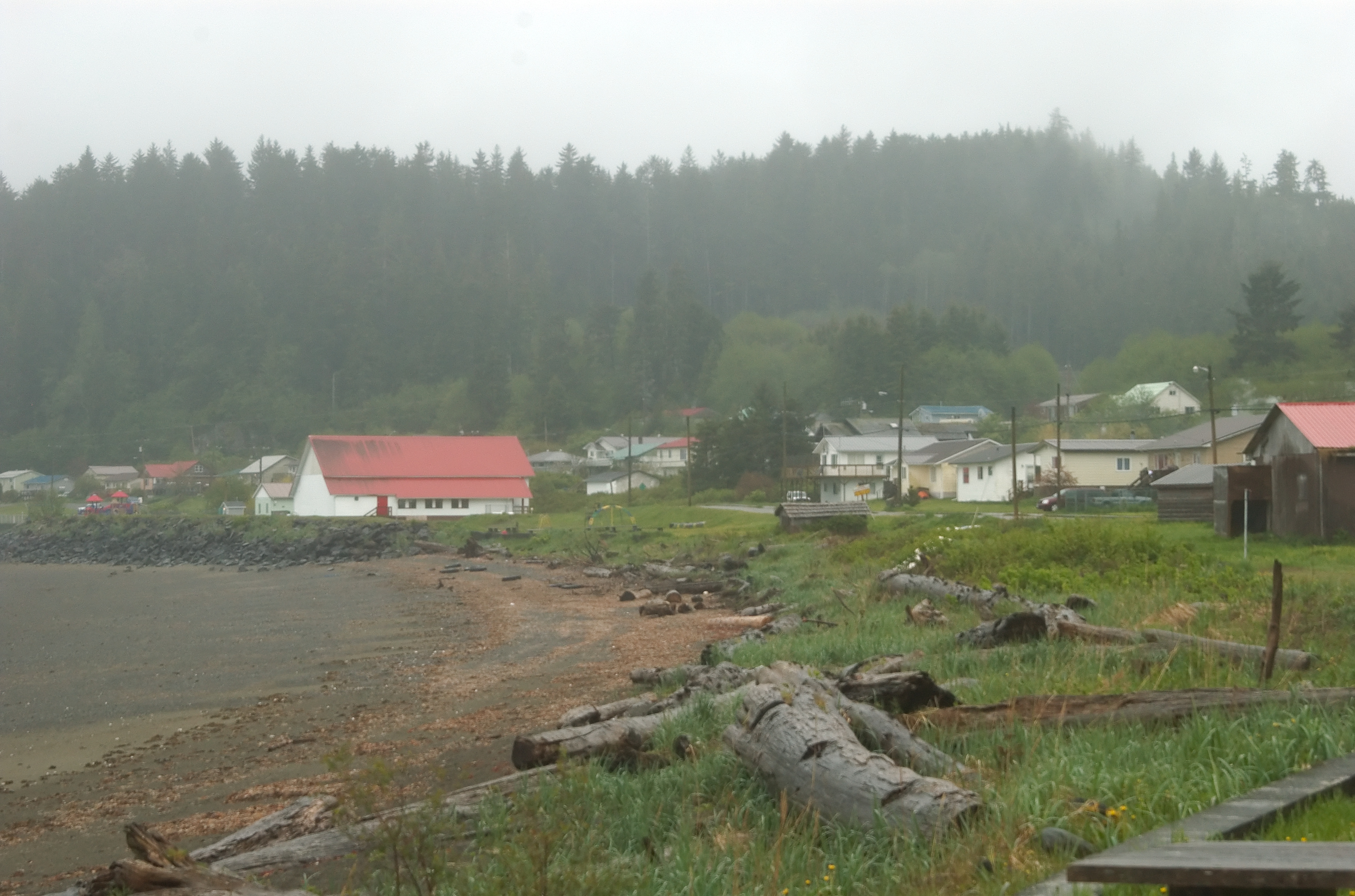
imagesize =
image_caption = View of Skidegate from outside the Haida Heritage Center.
flag_size =
image_
seal_size =
image_shield =
shield_size =
city_logo =
citylogo_size =
mapsize =
map_caption =
mapsize1 =
map_caption1 =
image_dot_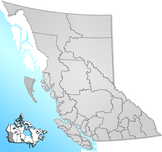
dot_mapsize = 220px
dot_map_caption = Location of Skidegate inBritish Columbia
dot_x = 36 |dot_y = 115
pushpin_
pushpin_label_position =
pushpin_map_caption =
pushpin_mapsize =
subdivision_type = Country
subdivision_name = CAN
subdivision_type1 = Province
subdivision_name1 = BC
subdivision_type2 = Region
subdivision_name2 =Queen Charlotte Islands
subdivision_type3 = Regional district
subdivision_name3 = Skeena-Queen Charlotte
subdivision_type4 =
subdivision_name4 =
government_footnotes =
government_type =
leader_title =
leader_name = Skidegate Band Council
leader_title1 = Chief Councillor
leader_name1 = Willard Wilson
leader_title2 =
leader_name2 =
leader_title3 =
leader_name3 =
leader_title4 =
leader_name4 =
established_title = Founded
established_date = 1850
established_date2 =
established_title3 =
established_date3 =
area_magnitude =
unit_pref =
area_footnotes =
area_total_km2 = 5.65
area_land_km2 =
area_water_km2 =
area_total_sq_mi =
area_land_sq_mi =
area_water_sq_mi =
area_water_percent =
area_urban_km2 =
area_urban_sq_mi =
area_metro_km2 =
area_metro_sq_mi =
area_blank1_title =
area_blank1_km2 =
area_blank1_sq_mi =
population_as_of = 2006
population_footnotes = [Statistics Canada. 2006 Census. [http://www12.statcan.ca/english/census06/data/profiles/community/Details/Page.cfm?Lang=E&Geo1=CSD&Code1=5947804&Geo2=PR&Code2=59&Data=Count&SearchText=Queen%20Charlotte%20City&SearchType=Begins&SearchPR=01&B1=All] ]
population_note =
population_total = 781
population_density_km2 = 138.3
population_density_sq_mi =
population_metro =
population_density_metro_km2 =
population_density_metro_sq_mi =
population_urban =
population_density_urban_km2 =
population_density_urban_sq_mi =
population_blank1_title =
population_blank1 =
population_density_blank1_km2 =
population_density_blank1_sq_mi =
timezone = PST
utc_offset = -8
timezone_DST =
utc_offset_DST =
latd= 53|latm= 16|lats= 02|latNS=N
longd= 131|longm= 59|longs= 26|longEW=W
elevation_footnotes =
elevation_m = 28
elevation_ft =
postal_code_type =
postal_code =
area_code =
blank_name = Highways
blank_info = 16
blank1_name = Waterways
blank1_info =Hecate Strait
website =
footnotes = Skidegate (IPA|/ˈskɪdəgət/) is aHaida community in theQueen Charlotte Islands (Haida Gwaii ) inBritish Columbia ,Canada . It is located on the southeast coast ofGraham Island , the largest island in the archipelago, and is approximately 50 kilometres (30 miles) west of mainland British Columbia acrossHecate Strait . Skidegate is also the northern terminal for theBC Ferries service between Graham Island and Alliford Bay onMoresby Island .References
ee also
*
Council of the Haida Nation
*Skidegate Tribal Council External links
* [http://www.skidegate.ca/ Skidegate website]
* [http://www.bcferries.com/schedules/inside/absk-current.html BC Ferries schedule for Skidegate-Alliford Bay]
Wikimedia Foundation. 2010.