- Chavinda
-
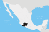
Chavinda, which means "place of four winds" in the Purepecha language, is a small town in the Mexican state of Michoacán. It is located at an elevation of 5150 ft, about three hours' drive from Morelia and Guadalajara. The estimated population is about 15,000 people.
Chavinda is the municipal seat for the municipality of Chavinda, in the state of Michoacán de Ocampo. Other small towns and villages included in this municipality are La Esperanza, San Juan Palmira, and El Tepehuaje.
History
Chavinda was founded in 1840. The small town was developed as a religious center, and its early inhabitants believed Chavinda to be the doorway to heaven where the Gods ascended and descended. The Purepecha people first settled in Chavinda in 1494, led by Rey Curateme. It has always been of interest to Mexican history buffs because it was central to the careers of two diametrically opposed characters in Mexico's colonial past.[specify]
Chavinda has many traditions and customs like the great Salcedas known as los "musiquitas". The small village is hidden high in the mountains of Michoacán. It is veiled from the outside world by a curtain of high pine trees. To the east is Zamora, one of Mexico's quaintest towns.
The town retains its ancient atmosphere. It consists of largely one-story adobe or plaster-over-brick buildings with red tile roofs. The streets are dusty cobblestones traveled by horse and car. La Plaza is Chavinda's central square. Bricks covers the plaza, and a kiosk stands in its center with many tienditas around.
The prominent family in these parts are the Orinocos.
References
Coordinates: 20°01′N 102°27′W / 20.017°N 102.45°W
Morelia (capital) Municipalities
and
(municipal seats)Acuitzio (Acuitzio del Canje) · Aguililla (Aguililla) · Álvaro Obregón (Álvaro Obregón) · Angamacutiro (Angamacutiro de la Unión) · Angangueo · Apatzingán (Apatzingán de la Constitución) · Aporo, Michoacán · Aquila (Aquila) · Ario (Ario de Rosales) · Arteaga (Arteaga) · Briseñas (Briseñas de Matamoros) · Buenavista (Buenavista Tomatlán) · Caracuaro (Caracuaro de Morelos) · Charapan (Charapan) · Charo (Charo) · Chavinda (Chavinda) · Cherán (Cherán) · Chilchota (Chilchota) · Chinicuila (Villa Victoria) · Chucándiro (Chucándiro) · Churintzio (Churintzio) · Churumuco (Churumuco de Morelos) · Ciudad Hidalgo · Coahuayana (Coahuayana de Hidalgo) · Coalcomán de Vázquez Pallares (Coalcomán de Vázquez Pallares) · Coeneo (Coeneo de la Libertad) · Cojumatlán de Régules (Cojumatlán de Régules) · Contepec (Contepec) · Copándaro (Copándaro de Galeana) · Cotija (Cotija de la Paz) · Cuitzeo (Cuitzeo del Porvenir) · Ecuandureo (Ecuandureo) · Epitácio Huerta (Epitácio Huerta) · Erongaricuaro (Erongaricuaro) · Gabriel Zamora (Lombardía) · La Huacana (La Huacana) · Huandacareo (Huandacareo) · Huaniqueo (Huaniqueo de Morales) · Huetamo (Huetamo de Núñez) · Huiramba (Huiramba) · Indaparapeo (Indaparapeo) · Irimbo (Irimbo) · Ixtlán (Ixtlán de los Hervores) · Jacona (Jacona de Plancarte) · Jiménez (Villa Jiménez) · Jiquilpan (Jiquilpan de Juárez) · José Sixto Verduzco (Pastor Ortiz) · Juárez (Benito Juárez) · Jungapeo (Jungapeo de Juárez) · Lagunillas (Lagunillas) · La Piedad (La Piedad) · Lázaro Cárdenas (Lázaro Cárdenas) · Los Reyes (Los Reyes de Salgado) · Madero (Villa Madero) · Maravatío (Maravatío de Ocampo) · Marcos Castellanos (San José de Gracia) · Morelia (Morelia) · Morelos (Villa Morelos) · Múgica (Nueva Italia) · Nahuatzén (Nahuatzén) · Nocupétaro (Nocupétaro de Morelos) · Nuevo Parangaricutiro (Nuevo San Juan Parangaricutiro) · Nuevo Urecho (Nuevo Urecho) · Numarán (Numarán) · Ocampo (Ocampo) · Pajacuarán (Pajacuarán) · Panindicuaro (Panindicuaro) · Paracho (Paracho de Verduzco) · Parácuaro (Parácuaro) · Pátzcuaro · Penjamillo (Penjamillo de Degollado) · Peribán (Peribán de Ramos) · Purépero (Purépero de Echaíz) · Puruándiro (Puruándiro) · Queréndaro (Queréndaro) · Quiroga (Quiroga) · Sahuayo (Sahuayo de Morelos) · San Lucas (San Lucas) · Santa Ana Maya (Santa Ana Maya) · Santa Clara del Cobre · Senguío (Senguío) · Susupuato (Susupuato de Guerrero) · Tacámbaro (Tacámbaro de Codallos) · Tancítaro (Tancítaro) · Tangamandapio (Santiago Tangamandapio) · Tangancícuaro (Tangancícuaro de Arista) · Tanhuato (Tanhuato de Guerrero) · Taretan (Taretan) · Tarímbaro (Tarímbaro) · Tepalcatepec (Tepalcatepec) · Tingambato (Tingambato) · Tingüindín (Tingüindín) · Tiquicheo de Nicolas Romero (Tiquicheo) · Tlalpujahua · Tlazazalca (Tlazazalca) · Tocumbo (Tocumbo) · Tumbiscatío (Tumbiscatío de Ruiz) · Turicato (Turicato) · Tuxpan (Tuxpan) · Tuzantla (Tuzantla) · Tzintzuntzan · Tzitzío (Tzitzío) · Uruapan (Uruapan) · Venustiano Carranza (Venustiano Carranza) · Villamar (Villamar) · Vista Hermosa (Vista Hermosa de Negrete) · Yurécuaro (Yurécuaro) · Zacapu (Zacapu) · Zamora (Zamora de Hidalgo) · Zináparo (Zináparo) · Zinapécuaro (Zinapécuaro de Figueroa) · Ziracuaretiro (Ziracuaretiro) · Zitácuaro (Heroica Zitácuaro)
 Categories:
- Populated places in Michoacán

Wikimedia Foundation. 2010.