- Mianwali District
-
Mianwali District
میانوالی— District — Map of Punjab with Mianwali District
میانوالی highlighted
Location of Mianwali within in Punjab.Country  Pakistan
Province Capital Mianwali Established Government - District Nazim Obaid-Ullah Khan - District Naib Nazim Malik Tariq Kund[1] Area - Total 5,840 km2 (2,254.8 sq mi) Population (2010-11) - Total 14oooo0 Time zone PST (UTC+5) Number of tehsils 3  Thal Canal
Mianwali (Urdu: ضلع میانوالی) is a district in the northwest of Punjab province, Pakistan. It borders eight districts: Attock District in the north, Chakwal District in the northeast, Khushab District in the east, and Bhakkar District in the south, while Lakki Marwat lies to the west, Kohat and Karak districts to the northwest and Dera Ismail Khan District to the southwest.
In November 1901, the North-West Frontier Province was carved out of Punjab and the present-day towns of Mianwali, Isa Khel, Kalabagh, and Kundian were separated from Bannu District (NWFP); hence a new district was made with the headquarters in Mianwali city and placed in Punjab province.
Contents
Demographics
According to the 1998 census of Pakistan, the district had a population of 1,056,620,[2] out of which 20.39%[3] (i.e., 85,000 inhabitants) lived in the district capital Mianwali. The Niazi (Pathan) tribe is the most dominant tribe of this district, with an estimated 70% of the total population. The Niazi tribe exists in all parts of the district but most notably live in Mianwali City, Shahbaz Khel,Kamar mashani, Musa Khel, Sohrabwala, GuddiKhelan Wala, Mochh, Sawans and Isakhel. Another tribe known as the Jats live mostly in Ding Khola, Uttra kalan, New Ding Sharif, Saeed Abad, Hashim Naggar/Lal Wala (Saifun Pull), KhanQah Sirrajia, Bakharra/Kacha Kalo, Kacha Paar, Khita-e-Atlas, Kacha Gujrat, Kacha Shahnawaz Wala, Phaati, Hurnoli, Alluwali, Duaba, Jaal Janub/Shumali, Piplan, Wan Bahhchran, Wichveen Bala, Kundian, Moosa Khel and Shadia.
Seraiki is the most commonly spoken dialect in the district. However, the Khattak tribes, Chapri, Bhangi Khel, Sultan Khel, Makarwal and Bani Afghan are bilingual: Pashto is their primary language but they can easily communicate in Seraiki as well. Awans living in the Salt range of Mianwali speak a dialect of Potohari called Uttraadi.
Administration
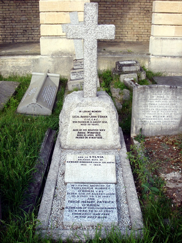
 Grave of Lt. Col. A J O'Brien, 1st Deputy Commissioner of Mianwali district, at Brompton Cemetery, London
Deputy commissioners served as the head of the district until 2004. The first deputy commissioner was Captain A. J. O'Brien and the first district judge was Sardar Balwant Singh. The system continued even after the creation of Pakistan as a sovereign nation. It was not until the year 2000 that the new local government system was introduced and three basic changes were implemented:
- Divisions which used to be the third tier of the government were abolished and more autonomy was given to the districts with the aim of decentralization of power.
- With this new status of the districts, nazims were to become the administrators of the districts, with more authoritative powers.
- The post of D.C. was abolished with the aim of putting an end to bureaucratic rule; however, the bureaucracy was offered an olive branch by creating the new post of District Coordinating Officer. The nazim remained the main elected representative and administrator while the D.C.O.s served as representatives of the government.
The district is administratively divided into three tehsils and 56 union councils:[4]
Name of tehsil No. of union councils Isakhel 14 Mianwali 28 Piplan 14 Total 56 Geography

Mianwali district covers an area of 5,840 square kilometres. The area in north is a continuation of the Pothohar Plateau and the Kohistan-e-Namak. The district consists of various towns, including Kalabagh, Isa Khel, Kundian, Paikhel, Piplan, Kamar Mushani, Mochh, Sawans, Rokhri, Harnoli, Musa Khel,((alluwali)), Wan Bhachran, Daud Khel, Uttra Kalan and the district capital, Mianwali city.
- Mianwali city is the capital of Mianwali district. It is the district's largest city, with a population of about 85,000 people. It is also the economic and commercial hub of the district.
- Kundian is the second largest town, at a distance of 15 km from the city of Mianwali. Important sites such as Chashma Nuclear Power Plant (Chashnupp), Chashma Barrage, Kundian-Jehlum or Chashma-Jehlum) Link Canal are located here.
- Piplan is another important town and tehsil headquarters located in the southern part of the district.
- Kalabagh is famous for the Kalabagh Dam, the Nawab of Kalabagh, the red hills of the salt range, and scenic views of the Indus River.
- Isa Khel is another important town and tehsil headquarters located in the west of Mianwali. It is a historical town named after Isa Khan, a famous Niazi chief. It is also a home town of famous folk singer Attaullah Khan Essa Khailwi
- Kamar Mushani is famous for its trade and minerals.
Education
Mianwali district has several educational institutions from elementary up to post-graduate level, affiliated with the University of the Punjab. A private Engineering College named as NAMAL College is affiliated with University of Bradford. There are numerous other private schools and colleges in the district.
Weather
Mianwali district has an extreme climate, with a long, hot summer season and cold, dry winters. Summer lasts from May to September and winter lasts from November till February. June is the hottest month with average temperatures of 42 °C (highest recorded temperature 52 °C); in winter, December and January monthly average temperatures can be as low as 3 to 4 °C. The average rainfall in the district is about 385 mm.
Month Jan Feb Mar Apr May Jun Jul Aug Sep Oct Nov Dec Year Avg high °C 19 21 26 33 38 42 39 37 37 33 28 21 31 Avg low temperature °C 3 6 12 17 22 27 27 26 23 16 9 4 16 Rainfall in. (cm) 1.6 2.1 4.1 2.4 1.9 1.8 7.6 11 4.5 0.7 0.1 0.9 38.5 Source: Weatherbase Brief history
Syed Mian Ali Sahib migrated from Bhagdad[IRAQ],who was a great spiritual saint laid the foundations of Mianwali. In those days it was called "Mian Ali Wali", which later was converted to Mianwali.After him,his son HAZRAT SYED SULTAN MUHAMMAD ZIKRIA remained the holly leader and saint of the PATHAN Tribes and Other Tribes of the area for a long period and settled all the disputes among the tribes successfully.He is known as SAHIB E KARAMAT wallee.His descendants are still respectable and have political influence in the area too. ===Mughal era, rule of Ghakkars and invasion of Nadir Shah===
Historically, all major rulers of South Asia governed this area in their turn. Mughal emperor Babur mentioned Isa Khel while he was fighting against the Pakhtuns as part of his campaign to conquer the Punjab during the 1520s (ref. Baburnama). Prior to the invasion of Nadir Shah in 1738, there is little to relate concerning the history of the northern part of the district. The upper half of the district was ruled by the Ghakkars, who became feudatories of the Mughal Empire, of which the district continued to form a part until the invasion of Nadir Shah. In 1738 a portion of his army entered Bannu, and by its atrocities so cowed the Bannuchis and Marwats that a heavy tribute was raised from them. Another portion of the army crossed the Darra Pezu and worked its way down to Dera Ismail Khan. Contingents raised from the neighbourhoods of Bannu and Dera Ismail Khan marched under Nadir Shah's banner to the sack of Delhi. In 1739 the area west of the Indus was surrendered by the Emperor of Delhi to Nadir Shah, and passed after his death to Ahmad Shah Abdali.
In 1748 a Durrani army under one of Ahmad Shah's generals crossed the Indus at Kalabagh, and drove out the Ghakkars, who still ruled in the cis-Indus tracts of the district, owing nominal allegiance to the Emperor at Delhi. Their stronghold, Muazzam Nagar, was razed to the ground, and with their expulsion was swept away the last vestige of authority of the Mughal Emperor in these parts. The armies of Ahmad Shah marched repeatedly through the district, the cis-Indus portion of which was, with the rest of the Punjab, incorporated in the Durrani Kingdom in 1756, and for the next sixty years a precarious hold was maintained on their eastern provinces, including this district, by Ahmad Shah and his successors to the throne of the newly created Kingdom of Kabul. Source:[1]
Sikh era and British Raj
Sikhs ruled until the annexation of Punjab in 1849 by the British. During British rule, the Indian empire was subdivided into province, divisions and districts (after the independence of Pakistan, divisions remained the third tier of government until 2000). The British had made the towns of Mianwali and Isa Khel tehsil headquarters of Bannu District then part of Dera Ismail Khan Division of Punjab province.
Modern history
The current district of Mianwali was created in November 1901, when the North West Frontier Province was carved out of Punjab and the towns of Mianwali, Isa Khel, Kalabagh, and Kundian were separated from Bannu District. A new district, named Mianwali district, was created with its headquarters in Mianwali city and placed in Punjab, and it became a part of Multan Division. Mianwali originally contained four tehsils: Mianwali, Isa Khel, Bhakkar, and Layyah. In 1909 Layyah was transferred to Muzaffargarh District. The district became a part of Sargodha Division in 1961. In 1982 Bhakkar Tehsil was removed from Mianwali and became a separate district of Sargodha Division.
Tribes and clans
The populations of the district are split into four main groups: the predominant Niazi tribes who are mainly present in riverain Mianwali Tehsil and Isakhel Tehsil, the Awans who are found mainly in the Salt Range and Kalabagh in Isakhel Tehsil. The Thal desert portion is held by Jat and Baluch tribes. The city of Mianwali and town of Wan Bhachran is also home to the Qureshi - Makhdooms and Miana tribes respectively. The district also has descendants of refugees from East Punjab and Haryana in India, who settled here after partition.
Immigration
The district has been settled by triple immigration from opposite directions: Niazis from the northwest of Pakistan, Awans from the northeast, and Jats and Balochs up the valley of the Indus from the south.
Niazi immigration
 Imran Khan Niazi, retired cricketer
Mahmud of Ghazni is said to have conquered the upper half of the district and Bannu, expelling its Hindu inhabitants. Hence there was no one left, capable of opposing the settlement of immigrant tribes from across the border.
The Niazis, who some hundred and fifty years later spread from Tank over the plain that was sparsely inhabited by pastoral Jats. The Niazi arrived into Marwat at first and occupied the hills of Salghar, until a feud with the Ghilzais compelled them to migrate elsewhere. Marching southeast, they found a temporary resting place in Tank. There the Niazais lived for several generations, occupying themselves as traders and carriers, as do their kinsmen the Lohani Pawindahs in the present day. Towards the end of the fifteenth century, numbers spread north into the plain, and squatted there as graziers and cultivators, on the banks of the Kurram and Gambila. There they lived in peace for about fifty years, when the Marwat Lohanis, a younger branch of the Lodi group, swarmed into the region after them, and drove them across the Kurram at Tang Darra, in the valley beyond which they found a final home. The most important sections of the expelled Niazais were the Isakhel, Mushanis and a portion of the Sarhangs. The first took root in the south of ther new area and shortly developed into agriculturists ; the second settled further to the north at Kamar Mushani, and seem for a time to have led a pastoral life. Some Sarhangs took up their abode at Sultan Khel, while others, after drifting permanently established themselves cis-Indus on the destruction of the Ghakkar stronghold of Muazzam Nagar in 1748 by Niazis. The Niazis after a victorious war drove ghakkars out of the area and with this the long connection of the Ghakkars with Mianwali was terminated. The remains of Muazzam Nagar, their local capital, were visible on the left high bank of the Indus about six miles south of Mianwali, until the site was eroded by the river about the year 1870.
Immigration of Awans
 Watercolour of an Awan sepoy, painted by Major A.C. Lovett, circa the early 20th century
In Mianwali, Awans are mostly known as MALIK. Awans claim themselves to be of Arab origin, a claim which is disputed by many British anthropologists and historians. Some label them as remnants of "Bactrian Greeks" while the others insist that they are the descendants of Raja Risalu of Sialkot, thus insisting on their Rajput origins. Some also relate them to the Qutab Shah who had Arab ancestry thus giving a proof to their claim. The Awans now occupy part of the district which lies east of the Dhak Spur of the Salt Range and is known as Khudri, Pakhar, or Awankari. "Men of Mianwali mostly know the name Pakhar; but residents of the Kacha and Isakhel generally speak of the tract and parts beyond as utrad. i.e., the high country.".[5]"DHAROEE" family lying in the alluwali village are also from awan family and known as a warrior family.They have been almost the sole occupants of that extensive tract for at least six hundred years and may perhaps have resided there since the Arab invasions of the seventh century.
Previous to the decilne and extinction of Ghakkar tribe in Mianwali, the Awan possessions extended westward of the Salt Range.
The Awans were among those who formed an important part of the British Indian army, serving with distinction during World Wars I and II. Along with Rajputs, Awans occupy the highest ranks of the Pakistani army.
Jat and Balouch immigration
Before the fifteenth century, the lower parts of the district were probably occupied by a few scattered tribes of Jats, depending on their cattleship. After these came the Balochis. They also came from the south direction. It is probable that the Jat immigration continued for sometime after the Balochis first came into this area. However it may have been, all the Kachha, immediately adjoining the Thal bank, seems to have been parcelled off to Jat families. Each block was accompanied with a long strip of Thal to the back. These estates are the origin of the present mauzas as far north as Kundian in the Mianwali Tehsil. They are almost all held by Jats. Here and there, shares are held by Balochis, but these have mostly been acquired in later times by purchase. In the same way the unoccupied lands towards the river were divided off into blocks, and formed into separate estates; and sometimes; where the hads first, formed had too much waste land, new hads were formed in later times by separating off outlying portions of the old estates. This division into hads extended right up to Kundian. In course of time, as the Balochis settled down in the area, individuals acquired plots of land for wells, but generally in subordination to the had proprietors or lords of manors. Here and there a small clan settled down together, but this was the exception. Balochis are still numerous all through the southern part of the Kachha, up to Darya Khan; but though they were originally the ruling race, still, as regards proprietary rights in the land they hold a position inferior to that of the Jats and Sayyads, by whom the superior proprietorship of hads is generally held. North of Darya Khan there are very few Balochis. In Thal, the population is almost entirely Jat. A few families of Balouch Pashtuns came across the Indus River from the Paniala Hills. Of these, one became dominant at Piplan, while the others moved on into the Thal and took up their abode eventually in and around Jandanwala.
Notable Personalities
- Tilok Chand Mehroom - He was a famous Urdu poet of India.
- Jagannath Azad - He was a famous Urdu-Speaking poet of Hindu academic.He was son of famous Urdu poet Tilok Chand Mehroom
- Khawaja Khurshid Anwar - He was a filmmaker, writer, director and music composer.
- Amir Mohammad Khan - Nawab of Kalabagh and Ex-Governor of West Pakistan
- Imran Khan - The former captain of Pakistan cricket team who won 1992 Cricket World Cup and Chairman of Pakistan Tehreek-e-Insaf and Chancellor of Bradford University. He also Involed Social work he had founded the Shaukat Khanum Memorial Cancer Hospital & Research Centre.Pakistan Gvernment awarded with Pride of Performance and Hilal-i-Imtiaz
- Naheed Niazi - She is a Pakistani Playback Singer
- Attaullah Khan Essa Khailwi - He is a Pride of Performance award wining musician. He has the world record on Guinness World Records for the highest number of audio albums (over 400 albums) ever released by a singer.
- Abdul Sattar Khan Niazi - He was a religious and political leader of Pakistan
- Misbah-ul-Haq - Pakistani Cricketer
- Tariq Niazi - Olympian Gold Medalist in Field hockey
- Yehya Amjad - He was a Writer
- Amanullah Khan Niazi - He was a poet and uncle of Pakistani cricketer Imran Khan
- Sher Afgan Niazi - The Ex-Minister of Law and many number of time to elected Member of Parliament
- Amir Abdullah Khan Rokhri - He was a politician and was involved in the Pakistan Movement.He was also known as "Khan Sahab", a title given by the British to him and to his father
- Reshma- She is a renowned folk singer of Pakistan, who is popular in India too.Pakistani government awarded with Sitara-e-Imtiaz.
Places of interest
 A view of Namal Lake in Mianwali Salt range
 Ruins of centuries-old Hindu temples in the Salt Range near Mari Indus (the Indus River can be seen traversing the hills)
 "Days of Yore" PR ZE. class 230 enroute to Lakki Marwat from Mari Indus in frosty winter morning circa 1987. (Mianwali was the only district in Punjab with about 80 km of narrow gauge section, which was closed in 1992.)
- Kalabagh Dam is located about 40 km north of Mianwali city. The proposed dam site is located between beautiful mountains narrowing down on the River Indus at an ancient town known as Kalabagh.
- Chahshma Barrage and Lake is located south of Mianwali city and is a beautiful lake.
- Jinnah Barrage
- Namal Lake: Namal or (Nammal) lake is a place of interest located at the foot of Namal mountain near Chakrala. It is a beautiful scenic place frequented by hikers and holiday-makers. In 2008, Namal College was established by Namal Lake at the base of the Salt Range.
- Thal Desert: It is a large area which is mostly desert and semi-arid. It is located between the Jhelum and Indus river (The Sindh-Saagar Doab). The boundaries of the old district established in 1901 included almost 70% of this great area, but after the separation of Layyah and then Bhakkar Tehsils, only about 20% remains in this district. First deputy commissioner A J O'Brien wrote in his memoirs: "In 1901 the District of Mianwali was formed out of the two Punjab halves of two older districts, and I had the good fortune to be put in charge. It was a lonely District with, as my Assistant Mr. Bolster called it, 'three white men in a wilderness of sand'."[6]
- River Indus
- Kalabagh Old Town
- Ruins at Mari Indus and Mari City: At Mari in the Mianwali Tehsil, there is a picturesque Hindu ruin, crowning the gypsum hill, locally called Maniot (from Manikot, meaning fort of jewels), on which the Kalabagh diamonds are found. The ruins themselves must once have been extensive. It appears that the very top of the hill was built over with a large palace or fort.
- Architectural objects and remains: In the southern part of the district the general absence of antiquarian remains tends to prove that it can never have been the site of a rich and populous government. In the Kachhi tract, of course, such remains could not survive the action of river floods, and this tract must, at one time, have been much wider than it is now. The Thal, however, is admirably suited for the preservation of antiquarian relics, had any such ever existed, but there are none that date from earlier than the fourteenth century.
- Ruins of Sirkapp Fort: Overlooking the village site of Namal in the Khudri is a ridge of great natural strength, cut off on three sides by hill torrents. On the top of this ridge there are extensive ruins of what is said to have been the stronghold of Sirkapp, Raja of the country, who was a contemporary of Raja Risalu of Sialkot, by whom he was vanquished. The outer wall of the fort still exists in part in a dilapidated condition, but the enclosure, which must once have contained accommodation for a fairly large garrison, is now one mass of fallen houses and piles of hewn or chiselled stones. The series of lifts, made for carrying water from the bed of the stream to the top of the hill, have left their marks.
- Other antiquities: The above, together with two sentry-box like buildings, supposed to be dolmens, midway between Namal and Sakesar, and several massive looking tombs, constructed of large blocks of dressed stones in the Salt Range, comprise all the antiquities above ground in the district. No doubt many remain concealed beneath the surface. The encroachments of the Indus and even of the Kurram near Isakhel often expose portions of ancient masonry arches and wells. The only other antiquity worth mentioning is a monster baoli at Wanbhachran, said to have been built by order of Sher Shah Suri. It is well-preserved and similar to those in Shahpur District.
See also
References
Further reading
- "Gazzeter of the Mianwali district 1915" by Sang-e-Meel Publications, Lahore, Pakistan
- "Tareekh-e-Niazi Qabail"
- "Tareekh-e-Alvi Awan"
- "Wichara Watan" By Harish Chander Nakra, New Delhi, India
- "Notes on Afghanistan and Baluchistan" by Major Henry George Raverty, Indus Publications, Karachi, Pakistan.
External links
Divisions of Pakistan Balochistan KP Punjab Bahawalpur · Dera Ghazi Khan · Faisalabad · Gujranwala · Lahore · Multan · Rawalpindi · Sahiwal · SargodhaSindh Tehsils Union councils Abbakhel · Alluwali · Ban Hafiz Jee · Chak No 7 ML AT Hafiz · Chakrala · Chapri · Chhidru · Dabb Balouchan · Daud Khel (Rural) · Daud Khel Urban (Town) · Dher Umid Ali Shah · Doaba · Gujrat · Gulmiri · Hernoli (Rural) · Hernoli Urban · Isakhel · Kalabagh · Kallur · Kamar Mushani · Kamar Mushani Pakka · Khaglan Wala · Khola At Khanqah Sirajia · Kot Chandna · Kundian -I · Kundian -Ii · Kundian Rural · Mari · Mianwali City -I · Mianwali City -Ii · Mianwali City -Iii · Mianwali City -Iv · Mochh · Musakhel · Muzafarpur Janubi · Muzafarpur Shumali · Namal · Paikhel · Piplan · Qureshian · Rokhri · Shadia · Shahbaz Khel · Sultan Khel · Swans · Tabisar · Tanikhel · Thamewali · Tibba Mehrban Shah · Tola Bhangi Khel · Trag · Vanjari · Vichvin Bala · Wan Bhachran · Watta Khel · Yaru KhelCategories:


Wikimedia Foundation. 2010.