- Oakland, Maine
-
- For other places with the same name, see Oakland.
Oakland, Maine — Town — Depot Square in 1908 Location within the state of Maine
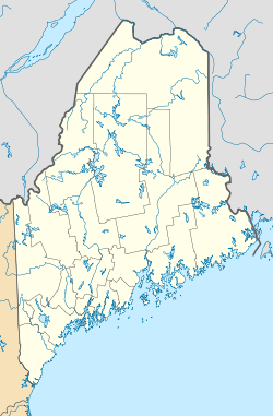
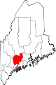
 Oakland, Maine
Coordinates: 44°32′39″N 69°43′43″W / 44.54417°N 69.72861°WCoordinates: 44°32′39″N 69°43′43″W / 44.54417°N 69.72861°W Country United States State Maine County Kennebec Incorporated 1873 Area - Total 28.2 sq mi (73.1 km2) - Land 25.7 sq mi (66.7 km2) - Water 2.5 sq mi (6.4 km2) Elevation 433 ft (132 m) Population (2010) - Total 6,240 Time zone Eastern (EST) (UTC-5) - Summer (DST) EDT (UTC-4) ZIP code 04963 Area code(s) 207 FIPS code 23-54560 GNIS feature ID 0582645 Oakland is a town in Kennebec County in the U.S. state of Maine. The population was 6,240 at the 2010 census.[1] . Gateway to the Belgrade Lakes region, Oakland is 4 miles (6 km) west of Waterville and approximately 18 miles (29 km) north of Augusta, the state capital.
Contents
History
It was first settled about 1780 by colonists of English descent from Massachusetts and New Hampshire. At that time, the region was known as Taconnet after Indian Chief Taconnet, an Abenaki sachem. It was incorporated by the Massachusetts General Court in 1771 as part of Winslow. In 1802, the area west of the Kennebec River was incorporated as Waterville. But manufacturers in the western section, who had created a separate center of industry and trade and were dissatisfied with its taxation, petitioned to have the district set off as a town. The Maine State Legislature complied, and on February 26, 1873 incorporated it as West Waterville. In 1883, it was renamed Oakland, presumably after all the oak trees in the town, though some favored the name Weldon.[2]
Farmers were attracted by the town's fertile soil for cultivation, grazing and dairy farming. Chief crops were hay, fruits and vegetables. Manufacturers were drawn because of the water power provided by the Messalonskee Stream. Before 1800, Jonathan Coombs built a sawmill and gristmill. The Androscoggin and Kennebec Railroad arrived in 1849, spurring Oakland to boom as a mill town. With several manufacturers of farm implements, it became known as the axe and scythe capital of New England. Other factories produced canned goods, tinware, carriages, furniture, tools, machinery, woolens, lumber, coffins, leather, boots and shoes. There was a granite quarry. In 1872, Oakland became the southern terminal of the Somerset Railroad, connecting first to North Anson, then to Bingham, and finally to Moosehead Lake.[3] But after economic changes, new businesses replaced the agricultural equipment industry, including Valley Distributors, Industrial Metal Recycling, Charlie's Log Cabin and Wrabacon.
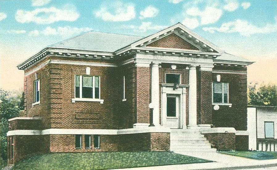
The town's ponds and lakes are home to a number of summer camps. Downtown contains some notable architecture, including Memorial Hall, built in 1870, and the Oakland Public Library, a Carnegie library built between 1913 and 1915. Both are listed on the National Register of Historic Places. Waterville and Augusta are service centers for Oakland, and many Oakland residents commute to jobs in those areas. The completion of Interstate 95 in the 1960s increased Oakland's relationship with the Augusta area, and to some extent the Greater Portland and Bangor areas.[4]
-

Messalonskee Stream c. 1906
-

Oakland Public Library c. 1920
-

Memorial Hall c. 1920
Geography
According to the United States Census Bureau, the town has a total area of 28.2 square miles (73.1 km²), of which, 25.7 square miles (66.7 km²) of it is land and 2.5 square miles (6.4 km²) of it (8.76%) is water. Oakland is drained by four major waterways: McGrath Pond, Salmon Lake, East Pond and Messalonskee Lake and Stream.
The town is crossed by Interstate 95, and state routes 11, 23, 41 and 137. It borders the towns of Belgrade to the southwest, Smithfield to the northwest, Fairfield to the north, Waterville to the southeast, and Sidney to the south.
Demographics
See also: Oakland (CDP), MaineAs of the census[5] of 2000, there were 5,959 people, 2,352 households, and 1,651 families residing in the town. The population density was 231.5 people per square mile (89.4/km²). There were 2,847 housing units at an average density of 110.6 per square mile (42.7/km²). The racial makeup of the town was 98.27% White, 0.15% Black or African American, 0.23% Native American, 0.55% Asian, 0.08% from other races, and 0.70% from two or more races. Hispanic or Latino of any race were 0.52% of the population.
There were 2,352 households out of which 35.6% had children under the age of 18 living in them, 54.9% had married couples living together, 11.1% had a female householder with no husband present, and 29.8% had non-families. 23.6% of all households were made up of individuals and 8.8% had someone living alone who was 65 years of age or older. The average household size was 2.53, and the average family size was 2.98.
In the town, the population was spread out such that 26.9% were under the age of 18, 7.5% from were between 18 and 24 years, 30.2% were between 25 and 44 years, 24.4% were between 45 to 64 years , and 11.0% were 65 years of age or older. The median age was 37 years. For every 100 females, there were 95.8 males. For every 100 females aged 18 and over, there were 92.6 males.
The median income for a household in the town was $34,934, and the median income for a family was $43,654. Males had a median income of $33,382, and females had a median income of $24,286. The per capita income for the town was $19,406. About 9.0% of families and 10.1% of the population were below the poverty line, including 11.4% of those under age 18 and 4.9% of those aged 65 or over.
Sites of interest
References
- ^ "Profile of General Population and Housing Characteristics: 2010". US Census Bureau. http://factfinder2.census.gov/faces/tableservices/jsf/pages/productview.xhtml?pid=DEC_10_DP_DPDP1&prodType=table.
- ^ George J. Varney, "History of West Waterville (Oakland), Maine" (1886)
- ^ "Historical Sketch of Oakland, Maine" (1889)
- ^ The History of Oakland, Maine
- ^ "American FactFinder". United States Census Bureau. http://factfinder.census.gov. Retrieved 2008-01-31.
External links
- Town of Oakland, Maine
- Oakland Public Library
- Oakland, Maine information
- Maine.gov -- Oakland, Maine
- Low Quality Satellite Photo of Oakland, Maine (at center)
Municipalities and communities of Kennebec County, Maine Cities Augusta | Gardiner | Hallowell | Waterville
Towns Albion | Belgrade | Benton | Chelsea | China | Clinton | Farmingdale | Fayette | Litchfield | Manchester | Monmouth | Mount Vernon | Oakland | Pittston | Randolph | Readfield | Rome | Sidney | Vassalboro | Vienna | Wayne | West Gardiner | Windsor | Winslow | Winthrop
Unorganized
territoryCDPs Clinton | Farmingdale | Oakland | Winthrop
Other
villagesCategories:- Towns in Kennebec County, Maine


Wikimedia Foundation. 2010.