- Dniester
-
Dniester, Dnister, Nistru
Дністер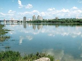
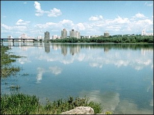
Rîbniţa and the Dniester riverOrigin Ukrainian Carpathians Mouth Black Sea Basin countries Ukraine, Moldova Length 1,362 km (846 mi) Source elevation 1,000 m (3,300 ft) Avg. discharge 310 m3/s (11,000 cu ft/s) at mouth Basin area 68,627 km2 (26,497 sq mi)[1] The Dniester (
 /ˈniːstər/ nees-tər;[2] Romanian: Nistru, Ukrainian: Дністе́р translit. Dnister) is a river in Eastern Europe. It runs through Ukraine and Moldova and separates most of Moldova's territory from the breakaway de facto state of Transnistria.
Contents
Names
The name Dniester derives from Iranic Sarmatian Dānu nazdya "the close river."[3] The Dnieper River also derives from the same Sarmatian Iranic meaning, "the river on the far side.") The older name, Tyras, is from Scythian tūra, meaning "rapid." The names of the Don and Danube are also from the same Proto Indo-European word *dānu - river.
In Russian, it is known as Днестр, translit. Dnestr, in Yiddish: Nester נעסטער; in Turkish, Turla and during antiquity, it was called Tyras in Latin and Danastris in Greek. Classical authors have also referred to it as Danaster.Geography
The Dniester rises in Ukraine, near the city of Drohobych, close to the border with Poland, and flows toward the Black Sea. Its course marks part of the border of Ukraine and Moldova, after which it flows through Moldova for 398 kilometres (247 mi), separating the bulk of Moldova's territory from Transnistria. It later forms an additional part of the Moldova-Ukraine border, then flows through Ukraine to the Black Sea, where its estuary forms the Dniester Liman.
Along the lower half of the Dniester, the western bank is high and hilly while the eastern one is low and flat. The river represents the de facto end of the Eurasian Steppe. Its most important tributaries are Răut and Bîc.
History
During the prehistoric Neolithic Era, the Dniester River was the center of one of the most advanced civilizations on earth at the time. The Cucuteni-Trypillian culture fluourished in this area from roughly 5300 to 2600 B.C., leaving behind thousands of archeological sites of settlements of up to 15,000 inhabitants, making them some of the first farming communities in history.[4]
In antiquity, the river was considered one of the principal rivers of European Sarmatia, and it was mentioned by many Classical geographers and historians. According to Herodotus (iv. 51) it rose in a large lake, whilst Ptolemy (iii. 5. § 17, 8. § 1, &c.) places its sources in Mount Carpates (the modern Carpathian Mountains), and Strabo (ii.) says that they are unknown. It ran in an easterly direction parallel with the Ister (lower Danube), and formed part of the boundary between Dacia and Sarmatia. It fell into the Pontus Euxinus to the northeast of the mouth of the Ister; the distance between them being, according to Strabo, 900 stadia (Strab. vii.), and, according to Pliny (iv. 12. s. 26), 130 miles (210 km) (from the Pseudostoma). Scymnus (Fr. 51) describes it as of easy navigation, and abounding in fish. Ovid (ex Pont. iv. 10. 50) speaks of its rapid course.
 The Dniester and Turkish fortress, Tighina
Greek authors referred to the river as Tyras (Greek: ό Τύρας, Strab. ii.). At a later period it obtained the name of Danastris or Danastus (Amm. Marc. xxxi. 3. § 3; Jornand. Get. 5; Const. Porphyr. de Adm. Imp. 8), whence its modern name of Dniester (Neister), though the Turks still called it Turla during the 19th century. (Cf. Herod. iv. 11, 47, 82; Scylax, p. 29; Strab. i. p. 14; Mela, ii. 1, etc.; also Schaffarik, Slav. Alterth. i. p. 505.) The form Τύρις is sometimes found. (Steph. B. p. 671; Suid. s. v. Σκύφαι and Ποσειδώνιος.)
Between the World Wars, the Dniester formed part of the boundary between Romania and the Soviet Union. During World War II, German and Romanian forces battled Soviet troops on the western bank of the river.
After the Republic of Moldova declared its independence in 1991, the small area to the east of the Dniester that had been part of the Moldavian SSR refused to participate and declared itself the Pridnestrovian Moldavian Republic, or Transnistria, with its capital at Tiraspol on the river.
Tributaries
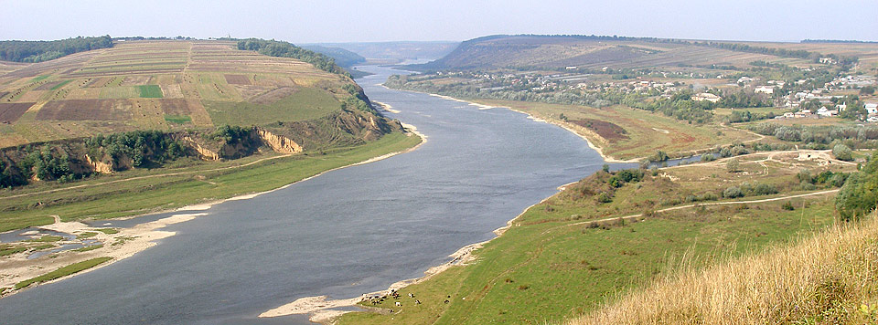
 At the confluence of the Seret and the Dniester.
The Stryi River is one of the Dniester's tributaries. Tributaries on the east side are the Răut River, the Ikel River, the Bîc River, and the Botna River. Tributaries on the west side are Zolota Lypa River (140 kilometres (87 mi)), Koropets River, Dzhuryn River, Seret River (250 kilometres (160 mi)), Zbruch River (245 kilometres (152 mi)), Smotrych River (169 kilometres (105 mi)), Ushytsia River (112 kilometres (70 mi)), Kalius River, Liadova River, Murafa River (162 kilometres (101 mi)), Rusava River, Yahorlyk River (173 kilometres (107 mi)), and the Kuchurhan River (123 kilometres (76 mi)).[5]
References
- ^ "Watersheds of Europe: E05 Dniester (Nistru)" Water Resources eAtlas World Resources Institute, p. 2
- ^ Merriam-Webster Dictionary: "Dniester"
- ^ Mallory, J.P. and Victor H. Mair. The Tarim Mummies: Ancient China and the Mystery of the Earliest Peoples from the West. London: Thames & Hudson, 2000. p. 106
- ^ http://www.iananu.kiev.ua/privatl/pages/Widejko/txt/cities.html Trypillya Culture Proto-Cities: History of Discovery and Investigations © M. Yu. Videiko Published: Відейко М. Ю. Трипільські протоміста. Історія досліджень. Київ, 2002; с.103–125: (Videiko M. Yu. Trypillya culture proto-cities. History of investigations. Kiev,2002, p.103–125)
- ^ Encyclopedia of Ukraine – Dniester River
 This article incorporates text from a publication now in the public domain: Smith, William, ed (1854–57). "article name needed". Dictionary of Greek and Roman Geography. London: John Murray.
External links
Categories:- Rivers of Ukraine
- Rivers of Moldova
- International rivers of Europe
- Moldova–Ukraine border
Wikimedia Foundation. 2010.