- Interstate 95 in Maryland
-
This article is about the section of Interstate 95 in Maryland. For the entire length of the highway, see Interstate 95.
Interstate 95
Capital Beltway
John F. Kennedy Memorial Highway
Route information Maintained by MDSHA Length: 110.01 mi[1] (177.04 km) Existed: 1957 – present Major junctions South end: 
 I-95 / I-495 in Alexandria, VA
 I-295 near Forest Heights

 I-595 / US 50 near Glenarden
 US 1 in College Park
I-495 near College Park
 MD 200 west (Intercounty Connector) in Laurel
 I-895 near Baltimore
 I-195 near Baltimore
 I-695 near Baltimore
 I-395 in Baltimore
North end: I-95 near Newark, DELocation Counties: Prince George's, Howard, Baltimore County, Baltimore City, Harford, Cecil Highway system Main route of the Interstate Highway System
Main • Auxiliary • BusinessMaryland highway system
Interstate • US • State • Minor • Former • Turnpikes←  MD 94
MD 94MD 95  →
→Interstate 95 in Maryland is a major highway that runs diagonally from northeast to southwest, from Maryland's border with Delaware, to the Woodrow Wilson Bridge, briefly entering the District of Columbia before reaching Virginia. The route is one of the most heavily traveled Interstate Highways in Maryland, especially between Baltimore and Washington, D.C., despite alternate routes along the corridor, such as the Baltimore-Washington Parkway, U.S. 1, and U.S. Route 29. Portions of the highway are tolled.
Between the Delaware state line and the Baltimore City line, I-95 is known as the John F. Kennedy Memorial Highway.
Contents
Route description
Capital Beltway
Main article: Interstate 495 (Capital Beltway)Interstate 95 enters the state of Maryland concurrent with Interstate 495, the Capital Beltway. From Alexandria, Virginia, the roadways, four lanes in either direction, travel together over the Woodrow Wilson Memorial Bridge, briefly cross the southern tip of the District of Columbia (over water), and touch down in Prince George's County west of Forest Heights. I-95/I-495 immediately encounter the southern terminus of Interstate 295, known as the Anacostia Freeway, a route that serves downtown Washington D.C. and connects to the originally planned alignment of I-95 through D.C., Interstate 395. Just beyond I-295 the two routes interchange with MD 210, a major north–south route into southern D.C.
The two Interstates continue along the Capital Beltway, interchanging with various local highways such as MD 5 (Branch Avenue) and MD 4 (Pennsylvania Avenue) on either side of Andrews Air Force Base, which the Beltway travels very close to near its northern edge. Turning north past the MD 4 interchange, the Beltway runs through Glenarden, interchanging with MD 202, US 50/secret Interstate 595, and MD 450, the latter route offering access to the New Carrollton metro station and the New Carrollton metropolitan area.
Turning northwest the Beltway enters Greenbelt Park, intersecting the Baltimore-Washington Parkway in the northeastern edge of the park. Just after the B-W Parkway the two routes interchange with MD 201, which connects to the southern terminus of the B-W Parkway at US 50 (New York Avenue) near the D.C. line. Now turned fully west, the Beltway runs through the northern edge of College Park, interchanging with the College Park metro station's access roadway and US 1.
Beyond the US 1 interchange, I-95 encounters its own route at the College Park Interchange, and separates from I-495 within this interchange. I-495 continues west, alone, on the Capital Beltway to Interstate 270, while I-95 turns north onto its own planned alignment. The interchange includes access to a Park and Ride.
Between the Beltways
 Traffic is congested on I-95 southbound in Baltimore.
Running northeast, I-95, still eight lanes wide, passes through Beltsville, interchanging with MD 212 near the community. The highway, completed in 1971, runs through undeveloped land and a long highway construction zone (as of 2008) where the new Intercounty Connector toll road (MD 200) will connect (as of 2011 or 2012) before interchanging with MD 198 just west of Laurel. Passing over the Patuxent River just south of the Rocky Gorge Dam, the route enters Howard County and promptly interchanges with MD 216. North of the MD 216 interchange, the route encounters its first rest area in the state of Maryland, with each carriageway served by its own facility. Continuing northeast, I-95 intersects MD 32 at a modified directional cloverleaf. Within this interchange, I-95 grade-separates, with the northbound carriageway passing over MD 32 and the southbound carriageway passing under MD 32, allowing left exits from both of the latter's carriageways to merge into the left lanes of I-95 without conflict.
North of this unusual interchange, I-95 encounters MD 175, the main access route into Columbia, at a less-radical directional cloverleaf interchange. After the MD 175 interchange comes the MD 100 interchange, providing access to Ellicott City, US 29, and Interstate 70 to the west, and the Baltimore-Washington Parkway and Interstate 97 to the east. Just beyond this interchange, I-95 encounters three more of its auxiliary routes within Maryland: Interstate 895, which splits at a directional wye within the Patapsco Valley State Park, just south of the Patapsco River; Interstate 195, a short spur to Baltimore-Washington International Airport, and Interstate 695, the Baltimore Beltway, a full-circle beltway around Baltimore that offers a full freeway bypass of the city and that connects to Interstate 70, Interstate 83, and Interstate 97. Traffic not authorized to make use of either of the direct (tunnel) routes through Baltimore is encouraged to use the eastern half of I-695, which crosses the Patapsco River via the Francis Scott Key Bridge.
Within Baltimore
 I-95 northbound at Washington Boulevard
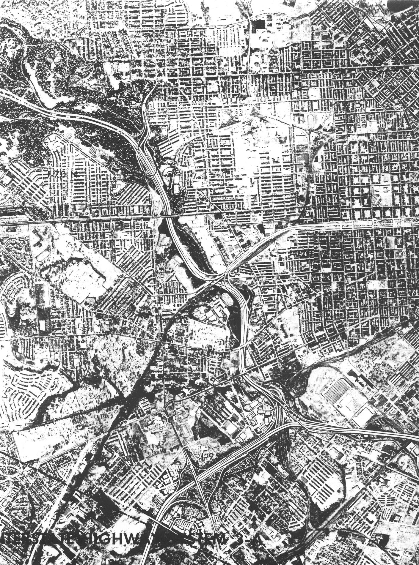
South of Baltimore, I-95 is maintained by the Maryland State Highway Administration; north of the southern Baltimore city line, I-95 changes jurisdiction to the Maryland Transportation Authority. Continuing on its northeasterly track, the route intersects US 1 Alt. just beyond the city line. I-95's interchange with US 1 Alt. incorporates stubs and unused embankments that would have been used for the planned eastern terminus of I-70 within Baltimore (later planned as the southern terminus of I-595, before that designation was moved to US 50 east of Washington). Continuing past this unbuilt interchange, I-95 intersects Washington Blvd., a local city street, before encountering the main access route into the central business district, Interstate 395. I-95 also interchanges with the northern terminus of the Baltimore-Washington Parkway within the I-395 interchange, which is almost completely elevated over the Middle Branch of the Patapsco River. After interchanging with both routes, I-95 interchanges with MD 2 and Key Highway, the latter route offering access to Fort McHenry and an escape route for hazardous material traffic.
I-95 encounters the Fort McHenry Tunnel south of Fort McHenry. The tunnel, containing eight lanes, curves underneath the Northwest Harbor and emerges in the Canton neighborhood of Baltimore, quickly encountering the toll plaza. After the toll plaza, I-95 encounters the Boston St.-O'Donnell St. interchange, which also incorporates stubs and other unused infrastructure planned to be used for the southern terminus of Interstate 83; I-95 also passes over I-895 within the interchange area, with no access between the two routes, then runs into East Baltimore, providing local access to various city streets in lieu of I-895. It interchanges with the Moravia Road freeway spur next to the Baltimore city line (where ramp stubs were once planned for an unbuilt portion of the Windlass Freeway), then connects with US 40 before narrowing to six lanes and merging with I-895 just after exiting Baltimore.
John F. Kennedy Memorial Highway
 The "North East Rising Sun" exit off I-95 in northern Maryland has been read by some drivers, including children's writer Katherine Paterson, as referring to a single exotically-named location.[2]
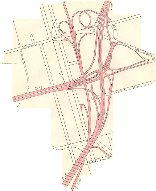
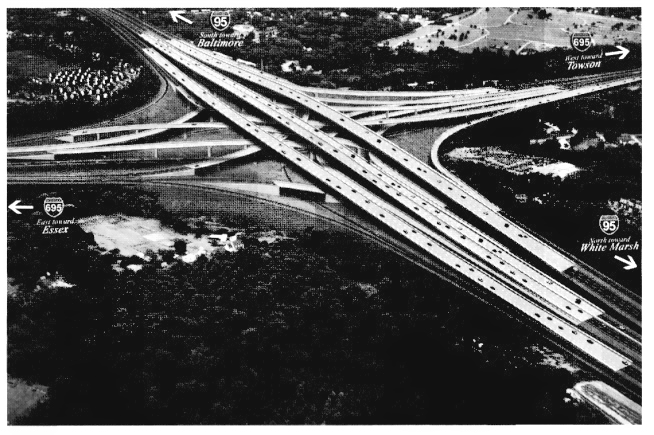
The John F. Kennedy Memorial Highway is an eight lane highway on I-95 that begins at the end of the Harbor Tunnel Thruway at the Baltimore city line. After three miles (3 km), I-95 once again intersects with Interstate 695 at what was a unique double-crossover interchange. Within this interchange, the carriageways of I-95 narrowed to six lanes and crossed over each over, thereby putting through traffic on the left within the interchange nexus, allowing left exit ramps and left entrance ramps to accommodate four of the eight movements in lieu of flyovers. Beyond the interchange, both sets of carriageways crossed over each other again and resumed right-hand running. As part of the upgrades to Interstate 95 to accommodate express toll lanes in this area, this interchange was replaced with a more conventional four-level stack; all exits are now on the right, and I-95's carriageways no longer cross over one another.
Continuing to the northeast, parallel with the Chesapeake Bay, the route encounters MD 43 near White Marsh. After passing through Gunpowder Falls State Park, the route interchanges with MD 152 north of Joppatowne, then with MD 24, providing access to Bel Air and Edgewood. Within the MD 24 interchange, I-95 narrows to six lanes and remains this wide to the Delaware border.
 Sign at Maryland House identifying the road as the John F. Kennedy Memorial Highway.
Just beyond the MD 543, I-95's carriageways split apart to provide space for Maryland House, I-95's second service area. Maryland House is a full service rest area that offers food, fuel and other amenities, and opened with the toll highway in 1963. Beyond Maryland House, the route encounters the MD 22 interchange in Aberdeen, providing access to the Aberdeen Proving Ground. South of the Susquehanna State Park, I-95 encounters the southern end of the remaining tolled portion of the highway at the MD 155 interchange, providing access to Havre de Grace and US 40.
North of this interchange, I-95 becomes a true toll route as it passes through the Susquehanna State Park before crossing the Millard E. Tydings Memorial Bridge over the Susquehanna River. The bridge crosses between bluffs high above the river valley, and is posted with warning signs: "Subject to Crosswinds". Just beyond the bridge is the JFK Highway toll plaza at Perryville; where tolls are collected in the northbound direction only. There are no southbound tolls on the highway, but southbound truck traffic may need to stop at a nearby weigh station. At the northern end of the plaza is Exit 93 for MD 222 in Perryville, before continuing to the Delaware State line.
Still paralleling the northern shore of the Chesapeake Bay, I-95's carriageways split apart again to encounter its third service area in Maryland, Chesapeake House. This service area opened in 1975 (after the highway was widened from four to six lanes in 1972), and offers the same amenities as Maryland House. Now past the northern tip of the bay, north of Elk Neck State Park, the route encounters MD 272, which provides access to the towns of North East and Rising Sun. Having turned east, the route now runs straight towards the Delaware state line, passing under MD 213 north of Elkton with no access offered. Finally, I-95's run through Maryland comes to an end after the Exit 109 interchange with MD 279, with a direct route into Elkton and Newark, Delaware, just before crossing the Delaware state line where the JFK Highway connects to the Delaware Turnpike and where Newark toll plaza is located on the Turnpike (which is not warned of by the MD 279 interchange).
Service areas
Main articles: Maryland House and Chesapeake HouseJust as in Delaware, the northern segment of I-95 in Maryland has service areas in the median that serve both directions of traffic. This dates back to its days as a two-state toll highway. Between the Delaware line and the Baltimore City line, two service areas are available—Maryland House, opened in 1963, at milepost 82 in Harford County, and Chesapeake House, opened in 1975, at milepost 97 in Cecil County. As of 2009, the MdTA is engaged in a process to identify a contractor to re-develop the two service areas, which are considered out-dated and worn.[3] The MdTA has been planning to redevelop the Maryland House and Chesapeake House service areas for some time, but a competitive process with a request for proposals (RFP) was canceled by the state in November 2010,[4] and a new RFP was issued in June 2011.[5]
There is also a rest area between Baltimore and Washington, D.C., located in Howard County. Unlike the above two rest areas, which are located in the median, this rest area is located on the shoulders, with separate facilities for each direction of travel.
Auxiliary routes
Interstate 95 in Maryland has a nearly full quiver of auxiliary routes:
- Interstate 195, a spur into Baltimore-Washington International Airport
- Interstate 295, a southern route into Washington D.C.
- Interstate 395, a spur into downtown Baltimore
- Interstate 495, the Capital Beltway
- Interstate 595, an unsigned segment of US 50 between the Capital Beltway and Annapolis
- Interstate 695, the Baltimore Beltway
- Interstate 795, a bypass of MD 140 in Reisterstown and Owings Mills
- Interstate 895, the Harbor Tunnel Thruway
History
 An older version of the I-95 shield as used in Maryland.
Northeast Freeway
Main article: Northeast Freeway (Washington, D.C.)Under the original plans for Interstate 95 in Maryland, the route would not have followed the eastern half of the Capital Beltway from the Woodrow Wilson Bridge to the College Park Interchange. Instead, it would have exited the District at New Hampshire Avenue (MD 650), following the Northeast Freeway, and after passing through Northwest Branch Park, junctioned I-495 at the College Park Interchange, integrating seamlessly with the existing segment of I-95 at that interchange. This route was canceled in 1977, and I-95 rerouted, after the District government canceled the North Central Freeway, which would have linked to the Northeast Freeway at its southern end and carried I-95 deeper into the District. The part of I-95 that was completed from downtown Washington to the Springfield Interchange in Springfield, Virginia was then re-designated as I-395.
I-95 in Baltimore
Planning
Several proposals were made during the 1940s and 1950s for an East–West Expressway through Baltimore. After nine different proposals were floated, the city's Department of Planning published a proposal of its own in 1960. The route in the proposal would have started out as Interstate 70N (as it was known then) and run due east, crossing the city to the north of the Inner Harbor on an elevated viaduct within the central business district. The route would have met two other freeways—the Jones Falls Expressway and the Southwest Expressway—at a four-way interchange in the southeast edge of the CBD; I-95 would have followed the Southwest Expressway, and met both I-70N and I-83 (on the Jones Falls Expressway) at this interchange. I-70N and I-83 would have terminated at the interchange, while I-95 would have turned east and followed the East–West Expressway out of the CBD, along the Boston Street corridor and out towards East Baltimore, intersecting the Harbor Tunnel Thruway near today's Exit 62. The Southwest Expressway would have cut through Federal Hill and crossed the Inner Harbor on a fixed bridge with 50 feet (15 m) of vertical navigational clearance. All of these proposed routes would have required extensive right-of-way acquisition and clearance.[6]
The above routings were eventually further refined and modified and eventually became part of the Baltimore 10-D Interstate System, approved in 1962. In this plan, I-95 would run east–west to the north of Fort McHenry, similarly to the above proposal, but would have run along the southern edge of the CBD, passing to the north of Federal Hill and cutting through the historic Fells Point neighborhood. After crossing the Inner Harbor on another low bridge, it would have followed the Boston Street corridor, crossing the Harbor Tunnel Thruway near to where it does today, then followed the existing I-95 alignment out of the city. The highway would have junctioned Interstate 70N a mile to the northwest of the Inner Harbor, near the eastern terminus of the now-defunct Interstate 170; it would have met Interstate 83 in the northeastern corner of the central business district. This routing was little different to the routings proposed in 1960, and was also universally disliked.[6]
By 1969, the Design Concept Team, a multi-discipline group assembled in 1966 by the city government to help design freeway routings that would not disrupt the city's fabric, the 10-D System had been replaced by the Baltimore 3-A Interstate and Boulevard System. In the 3-A system, I-95 was shifted south onto the Locust Point peninsula, and eventually constructed there. I-70N would have run through Leakin Park and Gwynns Falls Park to terminate at I-95 near Alt US 1, while I-83 was shifted to a new alignment and planned to terminate at I-95 north of the Patapsco River. Interstate 395 was also brought into existence under this plan; it was planned as a freeway spur from I-95 to the south edge of the central business district, connecting to a new route named City Boulevard (now known as Martin Luther King Jr. Boulevard). The 3-A System's result was that I-95 would act as a bypass of the central business district, with I-395 providing direct access.[6]
Construction
The first portion of I-95 in Baltimore was the southern 0.6 miles (0.97 km) of the John F. Kennedy Memorial Highway, completed in 1963. By 1971, I-95 had entered Baltimore proper when it was completed between the Capital Beltway and the Baltimore Beltway; beyond the southern I-695 interchange, the highway came to a dead halt at Alt US 1. By 1974, I-95 was under construction in East Baltimore between its current merge with I-895 south to a partial-cloverleaf interchange with MD 150 Eastern Avenue. By 1976, I-95 was under construction east of Alt US 1 and south of MD 150. By 1981, I-95 was completed as far as I-395, and by 1984, with the construction of the Fort McHenry Tunnel quite advanced, the route was open as far as MD 2 west of the Patapsco, and Boston St.-O'Donnell St. east of the Patapsco. With the final opening of the tunnel on November 23, 1985, I-95 was finally completed within the city of Baltimore.
Tolling

Originally, the toll plaza at the north end of the Fort McHenry Tunnel was to be removed after the city of Baltimore repaid its share of the construction costs of the tunnel. However, the Maryland Transportation Authority lobbied successfully to keep the toll plaza in place to prevent a traffic problem on I-95 within Baltimore.
John F. Kennedy Memorial Highway
Despite the route's inclusion in the Interstate Highway System in the mid-1950s, the construction of the Baltimore and Washington, D.C. beltways had diverted most of the state funds that would have been used to build it. To relieve traffic on U.S. Route 40, it was decided to finance construction using a bond issue. The Maryland State Roads Commission, the predecessor to the Maryland Transportation Authority (MdTA), floated $73 million in revenue bonds to provide funds to start construction of the route, which began in January 1962.
Completed in 1963, the 48 mile Northeastern Expressway and the adjoining 11 mile Delaware Turnpike were dedicated by President John F. Kennedy on Thursday, November 14, 1963, at a ceremony at the Mason-Dixon Line. In 1964, the highway was re-named the John F. Kennedy Memorial Highway after his assassination in Dallas, Texas, on November 22, 1963, eight days after President Kennedy was on hand for the opening of the two highways.
Between 1963 and 1993, the John F. Kennedy Memorial Highway was a tolled facility for the entire length of the roadway in both directions. The mainline toll plaza is situated just north of the Susqehanna River Bridge in Perryville. The southbound toll plaza was removed in 1991, but tolls are still collected for northbound traffic at this location. Additionally, ramp tolls were collected at many of the interchanges until they were abolished by an act of the legislature in 1981. The highway and bridge are maintained by the MdTA.
Exits on the John F. Kennedy Memorial Highway were originally numbered consecutively, beginning with exit 1. As a result, Interstate 95 in Maryland had multiple conflicting sequences of exit numbers. In the mid-1980s, the exits were re-numbered according to a statewide, mileage-based numbering system, so that they now range from Exit 2 (I-295 north) on the Capital Beltway to Exit 109 (MD 279) on the John F. Kennedy Memorial Highway.
Changes in jurisdiction
Originally, there were several changes in jurisdiction over maintenance of Baltimore's segment of I-95. North of the Baltimore city line as far as Exit 55 (Key Highway), the route was maintained by the city of Baltimore. Between Exit 55 and Exit 57 (Boston Street/O'Donnell Street) the route, traversing the Fort McHenry Tunnel, was maintained by the Maryland Transportation Authority. Between Exit 57 and the Baltimore city line the route was again maintained by the city of Baltimore.
Now, between the southern Baltimore city line (near Exit 49, the southern I-695 interchange) and the northern Baltimore city line, the route is maintained entirely by the Maryland Transportation Authority.[7] Maryland state highway police force and the authority's own police force share police duties on this segment. Additionally, the city of Baltimore pays the MdTA to maintain I-95 within the city limits.[7]
Unbuilt interchanges
I-95 has at least four unbuilt interchanges along its route, with three located within the city of Baltimore. Traveling northbound, the first interchange encountered is the College Park Interchange, the site of the northern crossing of I-95 and I-495 and the northern end of the Northeast Freeway. This interchange, while technically incomplete, was modified in late 1986 to bring it fully into service; today, all parts of the interchange are in regular use. The other three interchanges are located in the city of Baltimore, a sign of the many successful freeway revolts that accompanied the construction of the 3-A System: the planned eastern terminus of Interstate 70; the planned southern terminus of Interstate 83; and the planned southern terminus of the Windlass Freeway. All three unbuilt interchanges incorporate interchanges with local roads.
The first is located near Exit 50 in Baltimore; it is the site of the planned eastern terminus of Interstate 70 within the city. The only remnants of the interchange that remain in situ today are the mainline bridges built to grade-separate I-95 and the exit ramps to and from I-70, several ramp stubs, and a few grassy abutments. An incomplete flyover bridge once existed as well, but was later demolished. While this interchange was left incomplete, the existing Exit 50, built with extensive collector-distributor lanes due to its proximity to the unbuilt interchange, stands as a more visible sign of what was planned. Today, Exit 50 connects Alt US 1 to I-95.[8]
The second is located near Exit 57, just to the north of the Fort McHenry Tunnel, and is the site of the planned southern terminus of Interstate 83. Like I-70's terminus, the remnants here consist mainly of ramp stubs and unused bridges. This interchange, like Exit 50, also serves Boston Street and O'Donnell Street; unlike Exit 50, I-95 narrows to six lanes within the interchange, as most traffic was expected to diverge onto I-83 north and thus into the downtown area. The interchange would have been a 3-way freeway-to-freeway interchange, with a full complement of ramps provided for local access to and from Boston Street and O'Donnell Street, to and from both Interstates.[9] Of the two planned Interstate termini, I-83's terminus was the first to be abandoned, with the connecting highway segment being cancelled in September 1982; I-70's terminus, later redesignated as a new route, was cancelled in July 1983.[10]
The third is encountered at Exit 60 and is the site of the southwestern terminus of the Windlass Freeway, a relief route for US 40 (part of the route was eventually built and is today part of I-695). The interchange that exists at this site is in partial use, serving the Moravia Road freeway spur; like the other two inner-city locations, ramp stubs mark the site of the ramps to and from the unbuilt freeway.
Major events
- On January 13, 2004, a tanker truck carrying flammable liquid fell off of the southbound ramp from the Harbor Tunnel Thruway to I-95, landing on the travel lanes and causing a massive explosion, crushing several vehicles and killing four.[11] Despite this, no damage was done to either highway and both were reopened early in the morning on January 14, 2004.[12]
- On October 16, 2004, a sudden hail storm just north of Baltimore caused a string of 33 accidents, involving at least 130 vehicles, in an 11-mile (18 km) stretch of I-95. Both northbound and southbound lanes were closed down. The northbound lanes were reopened seven hours later, and the southbound lanes required a further 12 hours to clean.[13]
- On January 16, 2007, an exhausted truck driver lost control of his tanker truck, causing it to overturn on the northbound carriageway near Maryland House in Harford County. The route was closed for a time when leaks were discovered in the tank, which was carrying a corrosive alkaline material; the outermost right lane remained closed until 15:00 that day.[14]
- On October 4, 2008, at around 2:00 am, a tanker carrying acetone overturned on the southbound lanes south of exit 85, closing down both the northbound and southbound lanes for over eight hours.[15] According to State Police, the tanker leaked acetone and other flammable liquids after overturning. Four others were also involved in the crash and were taken to the University of Maryland Shock Trauma Center in Baltimore.[15] Both the northbound and southbound lanes reopened at around 11:00 am on the same day.[15]
JFK expansion plans
Due to the heavy use of this route by commuters and through traffic, the Maryland Transportation Authority has begun the process of significantly expanding the highway to increase its capacity. The expansion plans are divided into short, individual sections; in 2001, the MdTA began public studies to determine the best way to expand the highway to meet current and future needs. After four years of study, the MdTA issued its results for Section 100, the southernmost section.
Section 100
 Construction of the eastern interchange of I-95 and I-695
Section 100 is an eight-mile (13 km) segment of the JFK Highway that runs between Exit 62 (Interstate 895) and milepost 70. This segment is currently eight lanes wide (a 4–4 configuration) and carries approximately 165,000 vehicles per day (expected to increase to 225,000 vehicles per day by 2025). The plan is to widen this segment to twelve lanes (a 4-2-2-4 configuration), with the center lanes designated as express toll lanes. In addition, the interchange between the JFK Highway and the Baltimore Beltway at Exit 64 has been rebuilt into a more orthodox stack interchange,[16] removing the left entrances and exits as well as the unique carriageway crossovers on I-95 (the carriageway crossovers on I-695 there remained). The interchange at Exit 67 (MD 43) will also be significantly modified from its current cloverleaf configuration, and the interchange at Exit 62 will be reconfigured so that I-95 will replace I-895 as the straight-ahead route, thus eliminating the need for southbound I-95 traffic to weave to the right and cross over.
The project is expected to cost $1.2 billion. It began in 2006 and is expected to be completed in 2012.
Section 200
Section 200 is a 15-mile (24 km) segment from milepost 70 to Exit 85 (MD 22). This segment is also currently eight lanes wide (a 4–4 configuration) as far as Exit 77 (MD 24), and is currently six lanes wide (a 3–3 configuration) between Exit 77 and Exit 85. Like Section 100, this segment will likely be widened into a 4-2-2-4 configuration as far as Exit 80 (MD 543). Between Exit 80 and Exit 85, the remainder will likely be widened from a 3–3 configuration to a 4–4 configuration. While the MdTA has not yet finalized plans for this segment, a project is currently underway to improve the MD 24 interchange as part of any future works; this project began in 2006 and will be completed in 2009.
Section 300
Section 300 is a three-mile (5 km) segment from Exit 77 to Exit 80. Plans for its widening are described above.
Section 400
Section 400, the longest segment, is 30 miles (48 km) long and stretches from Exit 80 to the Delaware border. This segment is currently six lanes wide (a 3–3 configuration) and is likely to be widened into a 4–4 configuration. This segment will require major reconstruction of the Millard E. Tydings Memorial Bridge.
Proposed relocation of toll plaza
The MdTA, at the request of an assortment of elected officials,[17] completed a study which examined a relocation of the northbound toll barrier, which is currently just north of the Tydings Bridge crossing of the Susquehanna River at Perryville. The study concluded was that the barrier should remain where it is, because "relocating the toll plaza from the current location would result in significant diversion from I-95 onto local Cecil County roads"[18] and "the closer the toll plaza goes to Delaware the greater the diversion there is to local roads, the greater the revenue loss to the state toll operator MdTA, and the more travel there is on slower, less safe surface arterials."[19]
Exit list
County/City Location Mile
[20][21]
[22][23]
[24][25]Exit Destinations Notes Virginia state line 0.00 I-95 / I-495 south (Capital Beltway) – Alexandria, RichmondSouthern terminus of I-95 / I-495 in Maryland Woodrow Wilson Bridge – Potomac River Prince George's Oxon Hill 1.73 2 I-295 north (Anacostia Freeway) / National Harbor Boulevard – Washington, National HarborSplit into exits 2A (National Harbor) and 2B (I-295) 2.77 3  MD 210 (Indian Head Highway) – Indian Head, Forest Heights
Split into exits 3A (south) and 3B (north) northbound 4.33 4  MD 414 (St. Barnabas Road) – Oxon Hill, Marlow Heights
Split into exits 4A (south) and 4B (north) Temple Hills 7.30 7  MD 5 (Branch Avenue) – Waldorf, Silver Hill
Split into exits 7A (south) and 7B (north) Morningside 9.07 9  MD 337 (Allentown Road) – Andrews AFB, Morningside
Northbound exit and southbound entrance 9.69 Southbound exit and northbound entrance Forestville 10.78 11  MD 4 (Pennsylvania Avenue) – Upper Marlboro, Washington
Split into exits 11A (south) and 11B (north) Largo 13.14 13 Ritchie–Marlboro Road – Capitol Heights, Upper Marlboro Unsigned MD 221A 14.78 15 
 MD 214 (Central Avenue) / MD 202 (Largo Road) – Largo, Seat Pleasant
Split into exits 15A (east) and 15B (west) 15.83 16 Arena Drive Unsigned MD 202F Landover 16.56 17 MD 202 (Landover Road) – Upper Marlboro, BladensburgSplit into exits 17A (east) and 17B (west) southbound Glenarden 18.54 19 I-595 east / US 50 (John Hanson Highway) – Annapolis, WashingtonI-595 is unsigned; split into exits 19A (east) and 19B (west) New Carrollton 19.59 20 
 MD 450 (Annapolis Road) / MD 564 (Lanham Severn Road) – Lanham, Bladensburg
Split into exits 20A (east) and 20B (west) northbound Greenbelt 22.12 22  MD 295 (Baltimore–Washington Parkway) – Baltimore, Washington
MD 295 is unsigned; split into exits 22A (north) and 22B (south) 23.04 23  MD 201 (Kenilworth Avenue) – Greenbelt, Bladensburg
24.25 24 Greenbelt Metro Station Southbound exit and northbound entrance College Park 25.19 25 US 1 (Baltimore Avenue) – Laurel, College ParkSplit into exits 25A (north) and 25B (south) southbound 26.11 27 I-495 west (Capital Beltway) – Silver Spring, Bethesda, Park and RideCollege Park Interchange; north end of concurrency with I-495; southbound I-95 uses exit 27 to access exit 25 and the park and ride Beltsville 28.54 29  MD 212 (Powder Mill Road) – Beltsville, Calverton
Split into exits 29A (east) and 29B (west) Laurel 31A To US 1 (Baltimore Avenue) / Virginia Manor RoadUnder construction; expected to open fall 2011 31B 
 MD 200 west (Intercounty Connector) to US 29 to I-270 – Gaithersburg
Under construction; expected to open fall 2011 32.70 33  MD 198 (Sandy Spring Road) – Laurel, Burtonsville
Split into exits 33A (east) and 33B (west) 34.10 Patuxent River Howard North Laurel 35.26 35  MD 216 (Scaggsville Road) – Laurel, Scaggsville
Split into exits 35A (south) and 35B (north) Savage 38.18 38  MD 32 (Patuxent Freeway) – Fort Meade, Columbia
Split into exits 38A (south) and 38B (north) Jessup 40.49 41  MD 175 (Waterloo Road) – Jessup, Columbia
Split into exits 41A (south) and 41B (north) Elkridge 42.37 43  MD 100 – Glen Burnie, Ellicott City
Split into exits 43A (east) and 43B (west) 45.26 46 I-895 north (Harbor Tunnel Thruway)Northbound exit and southbound entrance 45.69 Patapsco River Baltimore County Arbutus 46.50 47  I-195 south / MD 166 north (Metropolitan Boulevard) – BWI Airport, Catonsville
Split into exits 47A (south) and 47B (north) 48.47 49 I-695 (Baltimore Beltway) – Glen Burnie, Key Bridge, TowsonSplit into exits 49A (east) and 49B (north) Baltimore City 49.76 50 
US 1 Alt. (Caton Avenue)US 1 Alt. is unsigned; split into exits 50A (south) and 50B (north) 50.89 51 Washington Boulevard Northbound exit and southbound entrance 51.67 52 MD 295 north (Russell Street)MD 295 is unsigned for Russell Street; northbound exit and southbound entrance to and from Russell Street MD 295 south (Baltimore–Washington Parkway) – BWI AirportSouthbound exit and northbound entrance to and from Baltimore–Washington Parkway 52.09 53 I-395 north to Martin Luther King Jr. Boulevard – Downtown Baltimore52.69 54  MD 2 south (Hanover Street)
Northbound exit and southbound entrance 53.45 55 Key Highway – Fort McHenry National Monument 54.07 Fort McHenry Tunnel – Patapsco River 55.44 55.75 Fort McHenry Tunnel Toll Plaza 55.96 56 Keith Avenue 56.76 57 Boston Street Northbound exit and southbound entrance 56.99 O'Donnell Street Southbound exit and northbound entrance 57.73 58 Dundalk Avenue south Northbound exit and southbound entrance 58.17 59  MD 150 (Eastern Avenue)
59.42 60 Moravia Road north Northbound exit and southbound entrance 59.84 61  US 40 east (Pulaski Highway)
Northbound exit and southbound entrance 60.40 62 I-895 south (Harbor Tunnel Thruway) – AnnapolisSouthbound exit and northbound entrance Baltimore County Rosedale 63.38 64 I-695 (Baltimore Beltway) – Essex, TowsonSplit into exits 64A (south) and 64B (west) White Marsh 66.60 67  MD 43 (White Marsh Boulevard)
Split into exits 67A (south) and 67B (north) 72.16 Little Gunpowder Falls Harford County Joppa 73.86 74  MD 152 (Mountain Road) – Joppa, Fallston
Edgewood 76.19 77  MD 24 (Vietnam Veterans Memorial Highway) – Edgewood, Bel Air
Split into exits 77A (south) and 77B (north) Riverside 79.90 80  MD 543 (Creswell Road) – Churchville, Riverside
Aberdeen 84.33 85  MD 22 (Aberdeen Thruway) – Aberdeen, Churchville
Havre de Grace 88.67 89  MD 155 (Level Road) – Havre de Grace
90.13 Millard E. Tydings Memorial Bridge – Susquehanna River 91.10 Cecil Perryville 92.51 John F. Kennedy Memorial Highway Toll Plaza (northbound only) 92.95 93  MD 222 (Bainbridge Road) – Perryville, Port Deposit
North East 99.55 100  MD 272 (North East Road) – North East, Rising Sun
Split into exits 100A (south) and 100B (north) southbound Elkton 108.27 109 
 MD 279 (Elkton Road) to MD 213 – Elkton, Newark, DE
Split into exits 109A (west) and 109B (east) Delaware state line 109.05 I-95 north (Delaware Turnpike) – WilmingtonNorthern terminus of I-95 in Maryland 1.000 mi = 1.609 km; 1.000 km = 0.621 mi References
- ^ Route Log- Main Routes of the Eisenhower National System of Interstate and Defense Highways – Table 1
- ^ Smedman, M. Sarah; Chaston, Joel (2003). Bridges For the Young: The Fiction of Katherine Paterson. Scarecrow Press. p. 63. ISBN 0810844990.
- ^ "Toll authority plods ahead with travel plaza project". Baltimore Sun. 2009-08-14. http://weblogs.baltimoresun.com/news/traffic/2009/08/toll_authority_plodding_ahead.html. Retrieved 2008-08-31.
- ^ Samuel, Peter (2010-11-17). "Maryland cancels RFP for travel service plaza concessionaire". TOLLROADSnews. http://www.tollroadsnews.com/node/4983. Retrieved 2011-01-11.
- ^ Dresser, Michael (2011-06-25). "State seeks private partner for two I-95 travel plazas". Baltimore Sun. http://articles.baltimoresun.com/2011-07-25/business/bs-md-travel-plazas-20110725_1_travel-plazas-bid-solicitation-public-private. Retrieved 2011-09-09.
- ^ a b c Kozel, Scott. Roads to the Future: Baltimore Early Expressway Planning URL accessed 17:55, 5 February 2007.
- ^ a b Kozel, Scott. misc.transport.road: Re: Road trip report: New York, NY to Baltimore, MD/Washington, DC and back URL accessed 13:04, 4 February 2007.
- ^ Scale drawing of I-70, I-170, I-95, I-395 interchanges in Baltimore City
- ^ Scale diagram of I-83/I-95 interchange in Baltimore City
- ^ Kozel, Scott. misc.transport.road: Baltimore Interstate Highway Cancellation Details URL accessed 12:57, 4 February 2007.
- ^ Kozel, Scott. Four Killed in Fiery I-95 Crash URL accessed 13:42, 26 January 2007.
- ^ Lansford, John. I-95 reopens after fiery crash URL accessed 13:46, 26 January 2007.
- ^ Baltimore Sun. Freak storm is blamed in October I-95 pileups
- ^ Baltimore Sun. I-95 reopens nearly 15 hours after tanker truck overturns URL accessed 13:22, 26 January 2007.
- ^ a b c "Maryland State Police". Mdsp.org. 2008-10-04. http://www.mdsp.org/Media/press_release_details.asp?identifier=713. Retrieved 2011-09-19.
- ^ http://www.roadstothefuture.com/MD-95-695-N.jpg
- ^ "I-95 / JFK Toll Plaza Planning Study – INTRODUCTION" (PDF). MdTA. Fall 2010. pp. p. 1. http://www.mdta.maryland.gov/I95TollPlazaStudy/documents/Section_A_Introduction.pdf. Retrieved 2011-01-11.
- ^ "I-95 / JFK Toll Plaza Planning Study – RECOMMENDATIONS" (PDF). MdTA. Fall 2010. pp. p. 1. http://www.mdta.maryland.gov/I95TollPlazaStudy/documents/Section_F_Recommendations.pdf. Retrieved 2011-01-11.
- ^ Samuel, Peter (2011-01-10). "MD/I-95 toll upgrade near present plaza – ORT + 7/8 lanes or AET proposed". TOLLROADSnews. http://www.tollroadsnews.com/node/5073. Retrieved 2011-01-11.
- ^ "Highway Location Reference: Prince George's County" (PDF). Maryland State Highway Administration. 2009. http://www.marylandroads.com/Location/2009_PRINCEGEORGES.pdf. Retrieved 2010-10-31.
- ^ "Highway Location Reference: Howard County" (PDF). Maryland State Highway Administration. 2009. http://www.marylandroads.com/Location/2009_HOWARD.pdf. Retrieved 2010-10-31.
- ^ "Highway Location Reference: Baltimore County" (PDF). Maryland State Highway Administration. 2009. http://www.marylandroads.com/Location/2009_BALTIMORE.pdf. Retrieved 2010-10-31.
- ^ "Highway Location Reference: Baltimore City" (PDF). Maryland State Highway Administration. 2005. http://www.marylandroads.com/Location/2005_BALTIMORECITY.pdf. Retrieved 2010-10-31.
- ^ "Highway Location Reference: Harford County" (PDF). Maryland State Highway Administration. 2009. http://www.marylandroads.com/Location/2009_HARFORD.pdf. Retrieved 2010-10-31.
- ^ "Highway Location Reference: Cecil County" (PDF). Maryland State Highway Administration. 2009. http://www.marylandroads.com/Location/2009_CECIL.pdf. Retrieved 2010-10-31.
External links
- Exitlists.com (I-95)
- I-95 @ MDRoads.com
- Steve Anderson's DCRoads.net: Capital Beltway (I-495 and I-95)
- Steve Anderson's DCRoads.net: Interstate 95-Maryland ("Between the Beltways")
- Steve Anderson's DCRoads.net: John F. Kennedy Memorial Highway (I-95)
- Maryland Transportation Authority – John F. Kennedy Memorial Highway webpage
- MdTA I-95 Master Plan Study
- I-95 Section 100 Widening
- Steve Anderson's DCroads.net: John F. Kennedy Memorial Highway (I-95)
- Scott M. Kozel's Roads to the Future article on the JFK Highway
- Maryland I-95 Travel Plazas Redevelopment
- I-95 JFK Highway Toll Plaza Planning Study
- Roads to the Future: Baltimore 10-D Interstate System Map
- Roads to the Future: Baltimore Harbor Interstate Map
- Roads to the Future: Baltimore History of Expressway Planning – 1970
Interstate 95Previous state:
VirginiaMaryland Next state:
DelawareMaryland Transportation Authority facilities Bridges Tunnels Highways Railroads Roads in Prince George's County, Maryland Maryland State Highways 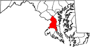
U.S. Routes Interstate Highways Roads by name Categories:- Interstate Highways in Maryland
- Interstate 95
- Roads in Prince George's County, Maryland
- Roads in Howard County, Maryland
- Roads in Baltimore County, Maryland
- Roads in Harford County, Maryland
- Roads in Cecil County, Maryland
- Roads in Baltimore, Maryland


Wikimedia Foundation. 2010.