- North Carolina Highway 86
-
NC 86
Route information Maintained by NCDOT Length: 53 mi (85 km) Existed: 1940[1] – present Major junctions South end: 

 US 15 / US 501 / NC 54 in Chapel Hill
 I-40 in Chapel Hill
 I-85 in Hillsborough
 US 70 in Hillsborough
 US 158 in Yanceyville
North end:  SR 86 in Danville, VA
Location Counties: Orange, Caswell Highway system ← I-85NC 87  →
→North Carolina Highway 86 runs north/south for 53 miles (85 km) through Caswell and Orange counties in North Carolina, from Chapel Hill, North Carolina to the Virginia state line at Danville, Virginia.
Contents
Route description
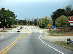 NC 86's northern terminus at the Virginia state line.
Orange County
NC 86 travels north from its southern terminus at US 15-501/NC 54 Bypass (Fordham Boulevard) in Chapel Hill, passing through the UNC campus, and the town center. Exiting Chapel Hill into rural Orange County, NC 86 meets I-40 before arriving in Hillsborough. There, the route meets I-85 and then joins NC 57 for about a mile through Hillsborough's central business district. Splitting to the northwest (signed north), NC 86 briefly joins NC 49 as they cross the Caswell County line.
Caswell County
Entering the small community of Prospect Hill, NC 86 splits from NC 49 and travels north toward Yanceyville. Just outside Yanceyville, NC 86 joins U.S. 158 and crosses NC 62. After passing through central Yanceyville, US 158 splits west while NC 86 continues north to the North Carolina–Virginia state line, where the route continues as State Route 86 and travels into Danville, Virginia.
 Sign for SR 86 in Danville, Va.
History
Prior to 1940, this was numbered as NC 14. It was renumbered to match up with Virginia's State Route 86. Simultaneous with that change, the old NC 65 was renumbered as NC 14.
Old North Carolina Highway 86, (sometimes referred to as Old 86), is a highway that parallels North Carolina Highway 86. Heading from NC 54 near Carrboro, it follows northwest to Homestead/Dairyland Road near the unincorporated community of Calvander, North Carolina, it heads north paralleling Interstate 40 until the intersection at exit 261. Then intersecting Interstate 85, at exit 164, it ends at the intersection with U.S. Route 70 Business, and North Carolina Highway 86. The highway was moved to the more heavily-traveled corridor between Chapel Hill and Hillsborough in the 1950s.[1]
References
Categories:- State highways in North Carolina
- Transportation in Orange County, North Carolina
- Transportation in Caswell County, North Carolina


Wikimedia Foundation. 2010.