- Panhandle Bridge
-
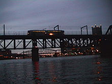
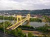
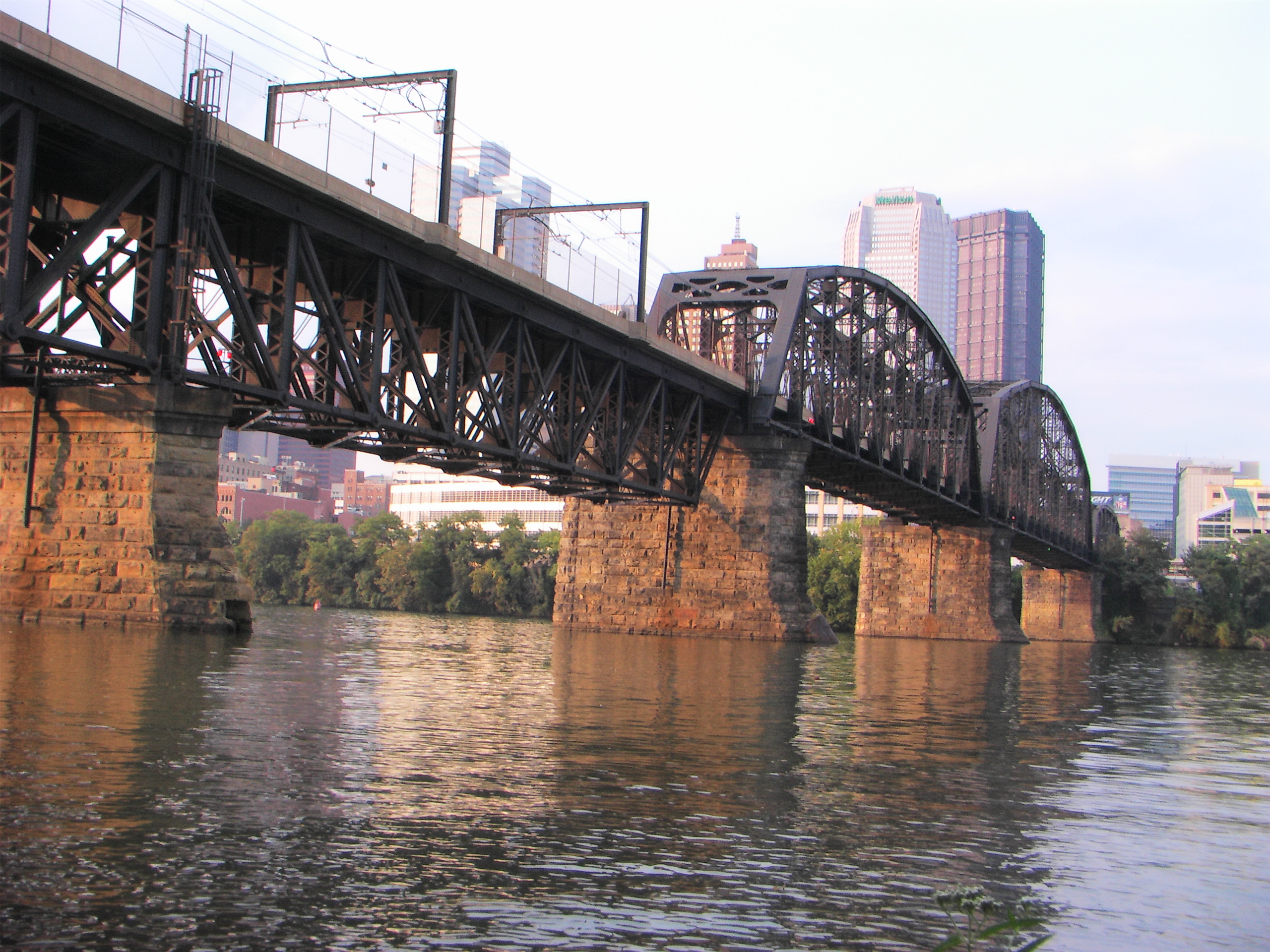
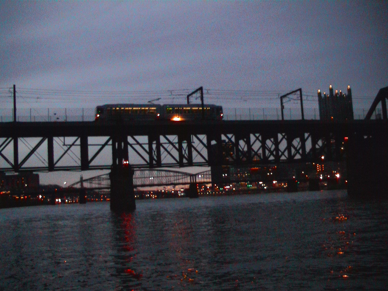
Panhandle Bridge 
Official name Monongahela River Bridge Carries 2 tracks of the PAT "T Line" Crosses Monongahela River Locale Pittsburgh, Pennsylvania Opened 1903 Coordinates 40°25′59.12″N 79°59′53.06″W / 40.4330889°N 79.9980722°WCoordinates: 40°25′59.12″N 79°59′53.06″W / 40.4330889°N 79.9980722°W The Panhandle Bridge (officially the Monongahela River Bridge) carries two rail lines of the Port Authority "T" line across the Monongahela River in Pittsburgh, Pennsylvania. The name comes from Pennsylvania Railroad subsidiary Pittsburgh, Cincinnati, Chicago and St. Louis Railroad, also known as the Panhandle Route, which operated over the bridge.
The basic structure was built in 1903, and was the third railroad bridge on the site since 1863. It was raised in 1912-14 as part of a grade separation project. The bridge's function was to carry Panhandle Route passenger, mail and express trains from Pennsylvania Station in Pittsburgh, with a tunnel in between the station and the bridge. Pennsy Panhandle freight trains utilized the Ohio Connecting Bridge slightly downstream on the Ohio River, or went the long way around the West Virginia Panhandle via Conway, Pennsylvania.
Rail traffic over the Panhandle Bridge declined as passenger trains were discontinued, and Amtrak became the only regular user of the bridge from 1971 to 1979, when the New York-St. Louis-Kansas City National Limited was discontinued in November of that year. As PRR successor Conrail had no use for the bridge and the restrictive downtown tunnel, it was sold to the Port Authority, who rebuilt the bridge beginning in 1982 as part of the downtown light rail subway project, which removed trolleys from downtown streets and the Smithfield Street Bridge. PAT (as the Port Authority system was known at the time) light rail cars began using the bridge on July 7, 1985.
See also


External links
Bridges of the Monongahela River Upstream
Liberty Bridge
SR 3069Panhandle Bridge


Downstream
Smithfield Street Bridge
SR 3027Tunnels and bridges in Pittsburgh Tunnels Allegheny River Tunnel · Armstrong Tunnel · Fort Pitt Tunnel · Liberty Tunnel · Mount Washington Transit Tunnel · Pittsburgh and Castle Shannon Tunnel · Pittsburgh & Steubenville Extension Railroad Tunnel · Schenley Tunnel · Squirrel Hill Tunnel · Wabash Tunnel
Bridges 16th Street Bridge · 30th Street Bridge · 31st Street Bridge · 33rd Street Railroad Bridge · 40th Street Bridge · Bloomfield Bridge · Birmingham Bridge · Fort Duquesne Bridge · Fort Pitt Bridge · Fort Wayne Railroad Bridge · George Westinghouse Bridge · Glenwood Bridge · Glenwood B&O Railroad Bridge · Highland Park Bridge · Homestead Grays Bridge · Hot Metal Bridge · Liberty Bridge · McKees Rocks Bridge · Panhandle Bridge · Panther Hollow Bridge · Schenley Bridge · Senator Robert D. Fleming Bridge · Smithfield Street Bridge · South Tenth Street Bridge · Three Sisters (Roberto Clemente Bridge, Andy Warhol Bridge, Rachel Carson Bridge) · Veterans Bridge · West End Bridge
Categories:- Bridges in Pittsburgh, Pennsylvania
- Bridges over the Monongahela River
- Bridges completed in 1903
- Railroad bridges in Pennsylvania
- United States railway bridge stubs
- Pennsylvania building and structure stubs
- Pittsburgh, Pennsylvania stubs


Wikimedia Foundation. 2010.