- Theodore Roosevelt County Park
-
Coordinates: 41°03′22″N 71°54′02″W / 41.056233°N 71.9005°W
Theodore Roosevelt County Park (formerly Montauk County Park) is located approximately 3 miles (4.8 km) east of Montauk, New York. The park is 1,157 acres (4.68 km2) in size, running from Montauk Highway north to Block Island Sound and is bordered on the east by Montauk Point State Park. Montauk County Park was created from 1971 to 1986 through a series of land acquisitions by Suffolk County with the help of Hilda Lindley and the Concerned Citizens of Montauk [1], and was renamed for Theodore Roosevelt in 1998 to commemorate the centennial anniversary of his return to Long Island following the Spanish-American War.[1] The park includes:
- Big Reed Pond, a National Natural Landmark.
- Montaukett Village - a home and burial ground of the Montaukett tribe of Native Americans, which includes the grave of Stephen Talkhouse
- Deep Hollow Ranch - the first cattle ranch in the United States, established in 1658
- Third House - the third residence constructed in the 18th century for cattle keepers that brought cattle to graze in Montauk each summer. The house is open seasonally.
- Camp Wikoff - where Theodore Roosevelt and his Rough Riders were quarantined after returning from the Spanish-American War in 1898
Contents
Big Reed Pond
Big Reed Pond was designated as a registered National Natural Landmark in 1973. It represents ecosystems that sit on the confluence between fresh water and brackish water, as the pond itself is fresh but some of the wetlands that border it are brackish. The local sandy soil and high rates of precipitation create a fragile homeostatic balance between fresh water and saltwater. The maintenance of the County Park as open space helps to maintain this balance.
Montaukett Village
 Stephen Talkhouse
The Montaukett tribe originally occupied this area of Long Island. In the late 17th century Chief Wyandanch gave much of the South Fork of Long Island to Lion Gardiner, although the tribe remained in the area until the Montauk peninsula was purchased by Arthur Bensen in 1879. The ruins of a sweat lodge and part of the village are still visible. The Pharaoh Museum is located in a small cabin near Third House and contains displays of the tools and pottery used by the Montauketts. Stephen Talkhouse, whose round trip walks of 30–50 miles (48–80 km) inspired the Paumanok Path, is buried in the cemetery.
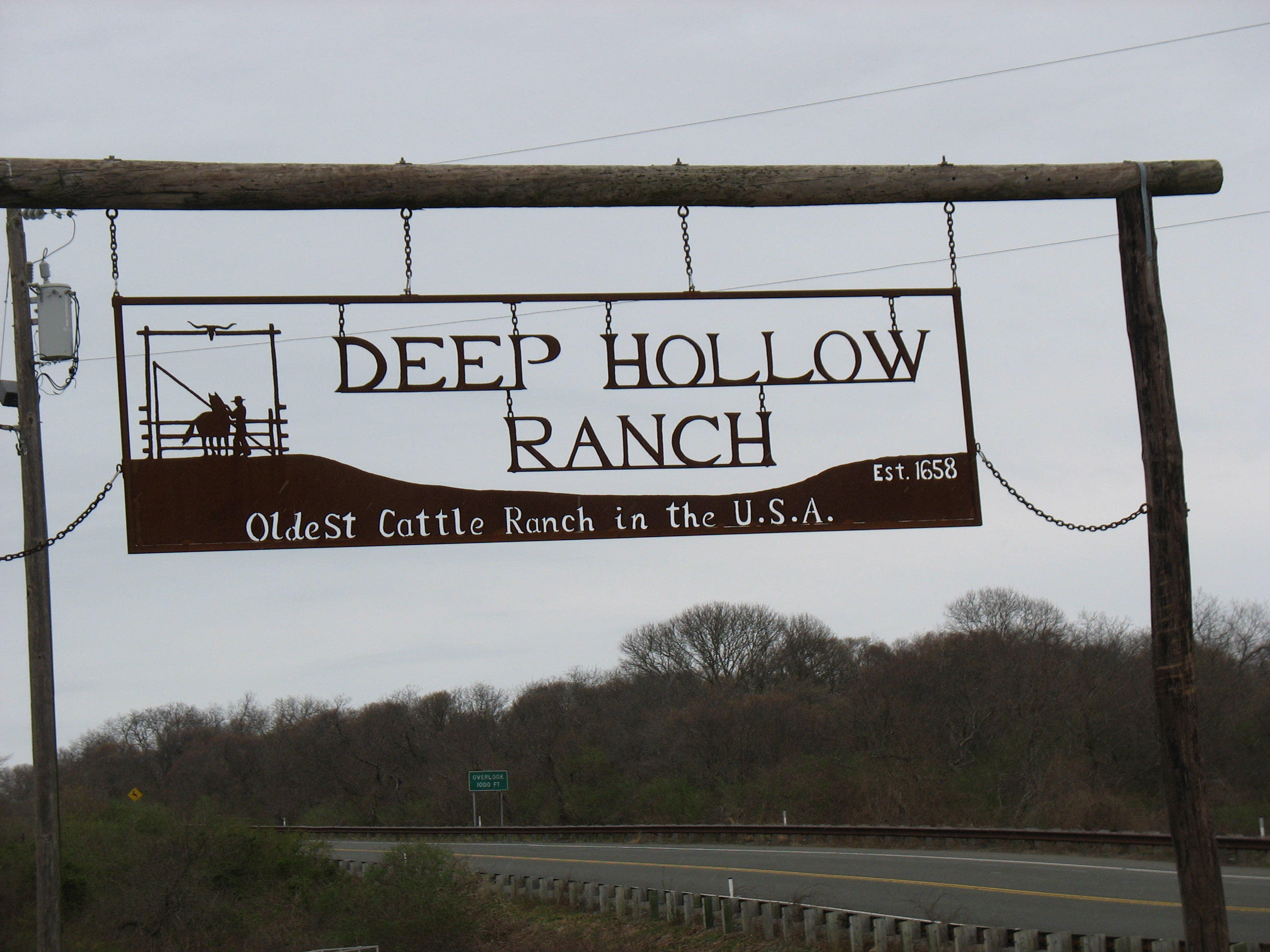
Deep Hollow Ranch
 Deep Hollow Ranch sign
Deep Hollow Ranch claims to be the birthplace of the American cowboy after being founded as a cattle ranch in 1658.[2] It has been operating continuously ever since and now offers horseback riding and hay rides.
From 1990 through 1999, Deep Hollow Ranch was the site of several "Back at the Ranch" concerts to raise funds for local charities. Most of the events were produced with the help of singer–songwriter Paul Simon, who owns a home near the ranch. The summer concerts had performers including The Allman Brothers Band, Edie Brickell, James Brown, Jimmy Buffett, The Cars, Ray Charles, Foreigner, Don Henley, The Highwaymen, Billy Joel, Lyle Lovett, Paul Simon and James Taylor, drawing as many as 10,000 attendees to each event.[3][4]
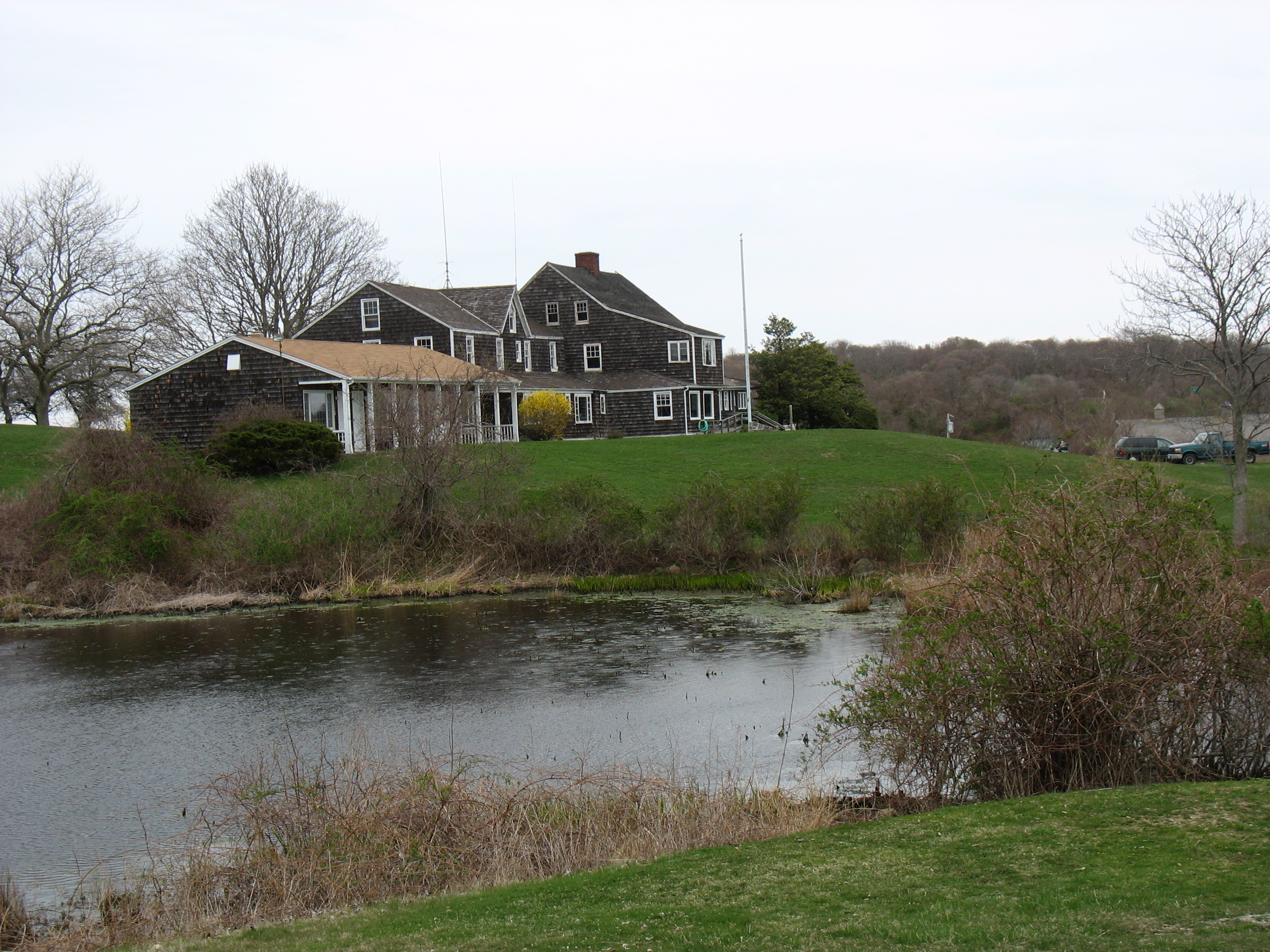
Third House
 Montauk Third House
Running from west to east, First House, Second House and Third House were the first residences constructed on the eastern tip of Long Island after the keeper's quarters at Montauk Point Lighthouse. They were built in the 18th century for cattle keepers that drove horses, sheep, and cattle to graze in Montauk each year from May through November. During the summers, as much as 6,000 cattle, horses and sheep roamed pastures in Montauk and were brought from as far west as Patchogue, a distance of approximately 70 miles (110 km).
First House was located near Hither Hills State Park in Napeague and no longer exists, Second House is located at the west end of Montauk village and now operates as a museum and Third House operated as the headquarters of Deep Hollow Ranch. In 1879 Arthur Bensen bought virtually all of the land on the eastern end from Napeague to Montauk Point. The purchase was to force the Montauketts off the land.[5] Benson made Third House his home and hoped to make the area a resort after Austin Corbin extended the Long Island Rail Road to Montauk.
Camp Wikoff
 Map of deployment at Camp Wikoff
Benson's plans failed to work out and he sold much of the land to the federal government for Army, Navy, and eventually Air Force, bases.
Camp Wikoff which was used to quarantine 29,000 soldiers including Theodore Roosevelt and the Rough Riders at the conclusion of the Spanish-American War to prevent the spread of yellow fever and other tropical diseases.[1]
Camp Wikoff, named for Col. Charles A. Wikoff of the 22nd U.S. Infantry who was killed in the San Juan Heights assaults, was constructed on 5,000 acres (20 km2) of land.
Camp Wikoff was to eventually be broken up. However, in World War II, sections of the camp were to be used for massive gun emplacements and concrete observation bunkers as part of the New York coastal defense. During the Cold War, a large radar tower was built at the Camp Hero section. Three state parks that still include portions of the federal military complex and its infrastructure have emerged:
- Montauk Point State Park
- Camp Hero State Park
- Shadmoor State Park
Other portions of the camp were sold to private developers.
Third House, formerly Camp Wikoff headquarters, now serves as the park headquarters and contains a Spanish-American War exhibit with photo and memorabilia from the war and Roosevelt’s disbanding of the Rough Riders. Camp Wikoff is open to the public May through October.
References
- ^ a b Gearty, Robert (January 4, 1998). "Park is Teddy Terrain; Renaming in Montauk for Roosevelt". Daily News (New York). http://www.nydailynews.com/archives/ny_local/1998/01/04/1998-01-04_park_is_teddy_terrain___rena.html. Retrieved 2009-08-31.
- ^ Cotsalas, Valerie (September 17, 2006). "Pulling Up Stakes in the Wild East". The New York Times. http://www.nytimes.com/2006/09/17/realestate/17lizo.html. Retrieved 2009-08-31.
- ^ "Ranch Concert Will Skip a Beat". The East Hampton Star. July 3, 1997. http://easthamptonstar.com/DNN/Archive/1997/970703/feat2.htm. Retrieved 2009-08-31.
- ^ Katz, Carissa (May 27, 1999). "Back at the Ranch". The East Hampton Star. http://easthamptonstar.com/DNN/Archive/1999/990527/feat3.htm. Retrieved 2009-08-31.
- ^ Laskin, David (August 27, 1989). "History at the Tip of Long Island". The New York Times. http://www.nytimes.com/1989/08/27/travel/history-at-the-tip-of-long-island.html. Retrieved 2009-08-31.
External links
Categories:- East Hampton (town), New York
- Theodore Roosevelt
- Spanish–American War
- Museums in Suffolk County, New York
- Military and war museums in New York
- Historic house museums in New York
- Native American museums in New York
- Farm museums in New York
- Parks in Suffolk County, New York


Wikimedia Foundation. 2010.