- Cupar, Saskatchewan
-
Town of Cupar — Town — Location of Cupar in Saskatchewan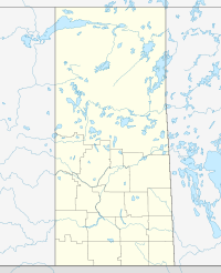

Coordinates: 50°57′00″N 104°13′00″W / 50.95°N 104.2167°W Country Canada Province Saskatchewan Region Saskatchewan Census division 6 Rural Municipality Cupar No. 218 Post office 1903 Incorporated (Village) N/A Incorporated (Town) N/A Government - Mayor Don Jeworski - Administrator Linda Nameth - Governing body Town of Cupar Area - Total 0.80 km2 (0.3 sq mi) Elevation 610 m (2,001 ft) Population (2006) - Total 566 - Density 710.4/km2 (1,839.9/sq mi) Time zone CST Postal code S0G 0Y0 Area code(s) 306 Highways Highway Waterways [1][2][3][4] Cupar is a town 75 kilometres northeast of Regina. Cupar is settled on the flat plains 45 kilometers north of the scenic Qu'Appelle Valley.
Contents
History
Cupar became a village in 1905 and received its name from Canadian Pacific Railway official for the town of Cupar in Fife, Scotland. The town celebrated its centennial in 2005. Cupar is proud to the be home of the talented, nationally known artist Jacqueline Berting of the Berting Glass studio located north of the town. Her most famous work to date is the "The Glass Wheatfield", encompassing 14,000 waist high glass wheat stalks, each piece individually hand cut and lamp worked. Berting calls her work "A Salute to the Canadian farmer." The town has been made famous for the Cupar Gopher Drop, a unique lottery held every summer. Stuffed toy gophers (Richardson's Ground Squirrels) labelled with numbers are dropped from a hot-air balloon along with numbered gopher holes. The "owner" of the gopher that lands nearest Hole 1 wins first prize, and so on.
Demographics
Canada census – Cupar, Saskatchewan Community Profile 2006 Population:
Land area:
Population density:
Median age:
Total private dwellings:
Mean household income:566 (-6.0% from 2001)
0.80 km2 (0.31 sq mi)
710.4 /km2 (1,840 /sq mi)
49.8 (males: 45, females: 55.5)
250
$49,330
References: 2006[5] Climate
Climate data for Cupar Month Jan Feb Mar Apr May Jun Jul Aug Sep Oct Nov Dec Year Record high °C (°F) 8.3
(46.9)9
(48)21.1
(70.0)31
(88)37.5
(99.5)39.5
(103.1)38.3
(100.9)40
(104)35.6
(96.1)30.6
(87.1)22.2
(72.0)12.5
(54.5)40
(104)Average high °C (°F) −10.9
(12.4)−7.2
(19.0)−0.1
(31.8)11.2
(52.2)18.7
(65.7)22.9
(73.2)25.3
(77.5)24.8
(76.6)18.3
(64.9)11.2
(52.2)−0.6
(30.9)−8.1
(17.4)8.8 Daily mean °C (°F) −17
(1)−13.3
(8.1)−6
(21)4.3
(39.7)11.1
(52.0)15.9
(60.6)18.1
(64.6)17.2
(63.0)11.1
(52.0)4.3
(39.7)−6
(21)−13.8
(7.2)2.2 Average low °C (°F) −23.1
(−9.6)−19.3
(−2.7)−11.9
(10.6)−2.7
(27.1)3.5
(38.3)9
(48)10.9
(51.6)9.6
(49.3)3.8
(38.8)−2.6
(27.3)−11.3
(11.7)−19.5
(−3.1)−4.5 Record low °C (°F) −44.4
(−47.9)−45
(−49)−44.4
(−47.9)−27.2
(−17.0)−11
(12)−4.4
(24.1)−1.1
(30.0)−3.9
(25.0)−15
(5)−22
(−8)−39
(−38)−45
(−49)−45
(−49)Precipitation mm (inches) 18.1
(0.713)12.8
(0.504)18.6
(0.732)24.5
(0.965)52.1
(2.051)73.2
(2.882)67.9
(2.673)49.9
(1.965)37.6
(1.48)21.7
(0.854)13.6
(0.535)21.4
(0.843)411.3
(16.193)Source: Environment Canada[6] See also

Raymore Punnichy Leross Markinch 
Dysart  Cupar
Cupar 

Regina Qu'Appelle Valley Fort Qu'Appelle References
- ^ National Archives, Archivia Net (1903-07-01), Post Offices and Postmasters, http://www.collectionscanada.ca/archivianet/post-offices/001001-100.01-e.php
- ^ Government of Saskatchewan, MRD Home, Municipal Directory System, http://www.municipal.gov.sk.ca/index.html[dead link]
- ^ Canadian Textiles Institute. (2005), CTI Determine your provincial constituency, http://www.textiles.ca/eng/nonAuthProg/redirect.cfm?path=IssPolContacts§ionID=7601.cfm
- ^ Commissioner of Canada Elections, Chief Electoral Officer of Canada (2005), Elections Canada On-line, http://www.elections.ca/home.asp
- ^ "2006 Community Profiles". Statistics Canada. Government of Canada. 2009-02-24. http://www12.statcan.ca/census-recensement/2006/dp-pd/prof/92-591/index.cfm?Lang=E. Retrieved 2009-02-24.
- ^ Environment Canada Canadian Climate Normals 1971–2000, accessed 24 July 2010
External links
Coordinates: 50°57′N 104°12′W / 50.95°N 104.2°W
Categories:- Towns in Saskatchewan

Wikimedia Foundation. 2010.