- Cul-de-sac
-
For other uses, see Cul-de-sac (disambiguation)."Blind alley" redirects here. For other uses, see Blind Alley (disambiguation)."Dead End Street" redirects here. For the song by The Kinks, see Dead End Street (song).
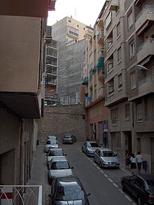
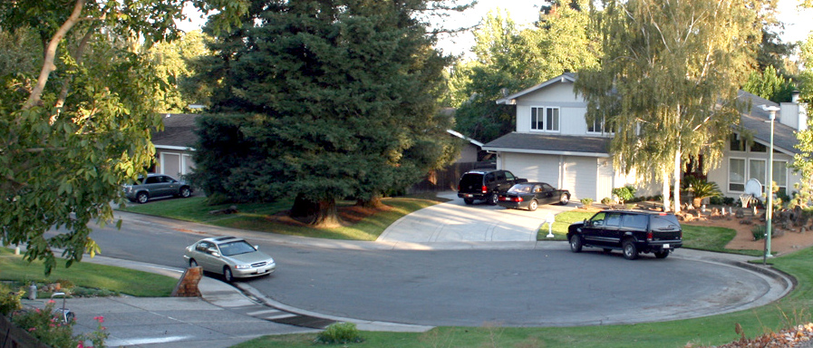
 A cul-de-sac in Sacramento, California
 Worker's Village at El-Lahun Pyramid site
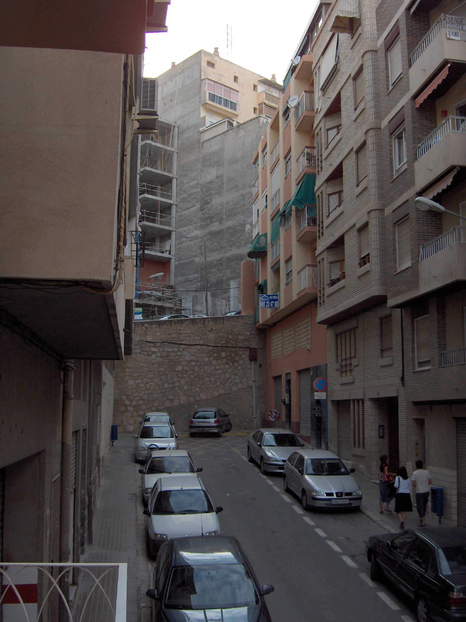
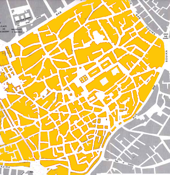
 Part of the Medina district of the city of Tunis showing the prevalence of culs-de-sac. The labyrinthine street network is typical of most medinas in Arab cities
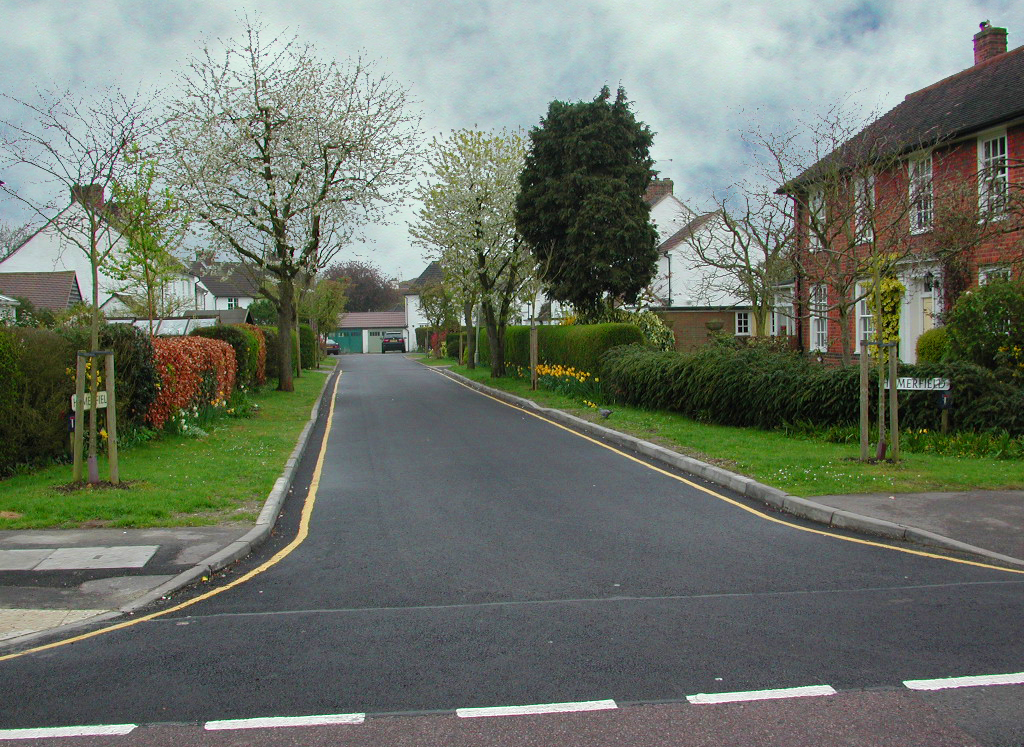
 Welwyn Garden City cul-de-sac that is short and narrow
 One of several incidental, unplanned culs-de-sac in the central district of Ottawa that were created to improve traffic flow on a major commercial "Main Street"
A cul-de-sac (literally "bottom of bag" in Catalan) is a word of Catalan origin coming to the English via French referring to a dead end, close, no through road (British English) or court (American, Canadian and Australian English) meaning dead-end street with only one inlet/outlet. While historically built for other reasons, one of its modern uses is to calm vehicle traffic.
History
Culs-de-sac have appeared in plans of towns and cities before the automotive 20th century, particularly in Arab and Moorish towns. The earliest example of cul-de-sac streets was unearthed in the El-Lahun workers village in Egypt, which was built circa 1885 BCE. The village is laid out with straight streets that intersect at right angles; akin to a grid, but irregular. The western part of the excavated village, where the workers lived, shows fifteen narrow and short dead-end streets laid out perpendicularly on either side of a wider, straight street; all terminate at the enclosing walls.
In the UK, their prior existence is implied by an 1875 law which banned their use in new developments.
Inferential evidence of their earlier use can also be drawn from the text of a German architect, Rudolf Eberstadt, that explains their purpose and utility: “We have, in our medieval towns, examples of the old non-traffic street, showing very commendable methods of cutting up the land. I ought to mention here that to keep traffic out of residential streets is necessary not only in the general interest of the population, but, above all, for the sake of the children, whose health (amongst the working classes) is mainly dependent on the opportunity of moving about in close connection with their dwelling places, without the danger of being run over. In the earlier periods, traffic was excluded from residential streets simply by gates or by employing the cul-de-sac”.[1]
It was in the UK that the cul-de-sac street type was first legislated into use, with “The Hampstead Garden Suburb Act, 1906”. The proponents of the Act, Raymond Unwin and Barry Parker, thus gained permission to introduce culs-de-sac in their subsequent site plans, and they promoted it as a suitable street type for Garden Suburbs. Unwin's applications of the cul-de-sac and the related crescent always included pedestrian paths independent of the road network. This design feature reflects the predominance of pedestrian movement for local trips at the turn of the 20th century, and presages the current planning priority for increased pedestrian accessibility. The 1906 Act defined the nature of the cul-de-sac as a non-through road and restricted its length to 500 feet (150 m). Garden cities in the UK that followed Hampstead, such as Welwyn Garden City all included culs-de-sac (see photo).
In the 1920s, the garden city movement gained ground in the US and, with it, came its design elements, such as the cul-de-sac. Clarence Stein, a main proponent of the movement, incorporated it in the Radburn, NJ subdivision, which was to become a model for subsequent neighbourhood developments. The US Federal Housing Authority recommended and promoted their use through their 1936 guidelines[2] and the power of lending development funds.
In Canada, a variation of Stein’s Radburn 1929 plan that used crescents (loops) instead of culs-de-sac was built in 1947 in Winnipeg, Manitoba Wildwood Park, designed by Hubert Bird. In 1954, the Central Mortgage and Housing Corporation published its own guidelines[3] in which the cul-de-sac was strongly recommended for local streets and, as the FHA in the US, used its lending power to see its inclusion in development plans. The Varsity Village and Braeside, subdivisions in Calgary, Alberta also used the Radburn model in the late 1960s.
In the 1960s the cul-de-sac attained systematic international application in planned new cities such as Doxiadis’ Islamabad (1960). In the UK new towns such as Harlow (1947) by Sir Frederick Gibberd and Milton Keynes (1967) incorporated culs-de-sac and crescents in their layouts.
Planning theorists also advocated the use of culs-de-sac and crescents most notably, Christopher Alexander, in his “A Pattern Language” 1977 book (pattern #49). Doxiadis also argued their important role in separating man from machine.[4]
Unplanned culs-de-sac
Virtual, unplanned culs-de-sac have appeared in the centers of cities which are laid on a grid. Whole neighbourhood street reconfigurations emerged in several cities including Berkeley CA, Seattle WA and Vancouver BC. This transformation of sections of the grid plan since the 1970s has occurred in response to the need for the following:
- limiting access to an existing but newly designated road as a major arterial and enable traffic to move smoothly on it and
- protecting neighborhood residents, particularly children, from the dangers of traffic and for alleviating residents' concerns (see picture)
This selective, sporadic transformation continues into the 21st century. As traffic volumes increase and as cities decide to remove or reduce traffic on specific streets of central areas, streets are closed off using bollards or landscaping thus creating new, unplanned cul-de-sac streets and produce a new, functional blend of the inherited grid with newer street types. A recent variation of limiting traffic is the managed closure by using retractable bollards which are activated by designated card holders only.
Function
In urban planning culs-de-sac are created to limit through-traffic in residential areas. While some cul-de-sac streets provide no possible passage except in and out of their road entry, others allow cyclists, pedestrians or other non-automotive traffic to pass through connecting easements or paths.
This design improvement, which selectively excludes one mode of transport while permitting others, can be viewed as an example of “filtered permeability”. Its application retains the cul-de-sac’s primary function as a non-through road, but establishes complete pedestrian and bicycle network connectivity.
In traffic engineering parlance, the cul-de-sac defines the local street as having primarily an 'access' (to properties) function rather than as one having a 'transport' or 'through' function.
Suburban use and benefits
Since the end of World War II,[5] new subdivisions in the United States and Canada, as well as New Towns in England and other countries have made extensive use of the cul-de-sac and crescent (loops) street types. Typically, there is one or several central roads in the subdivision with many cul-de-sac streets of varying length, branching out from the main roads, to fill the land in the subdivision; a dendrite or hierarchical pattern.[6] Since the 1960s, this pattern has been the dominant road network structure of suburbs and exurbs in the United States, Canada, and Australia. It is also increasingly popular in Latin America, Western Europe, and China. In this pattern, there are only a few roads (relative to the number of cul-de-sac streets) leading out of the subdivision and into other subdivisions or onto major roads.
In the US, these changes can be attributed to real-estate developers' desire to meet FHA guidelines and make federal home loans available to their consumers.[7] In Canada a similar incentive was provided to developers by CMHC. These incentives, which were discontinued in the 70s, gave the initial impetus for the application of the hierarchical pattern. In other countries such incentives do not exist and its adoption is motivated by consumer preferences.
Nineteenth and early 20th century American urban planning, emphasized a grid plan, partly out of extensive reliance on foot, horse and streetcars for transportation. In such earlier urban development, alleys were included to allow for deliveries of soiled supplies, such as coal, to the rear of houses which are now heated by electricity, piped natural gas or oil.
The use of culs-de-sac reduces the amount of car traffic on residential streets within the subdivision, thus reducing noise, air pollution and the probability of accidents. Ben-Joseph (1995) and Lovegrove/Sayed (2006) indicate a substantially lower collision rate for street networks based on the cul-de-sac street type.[8][9] Dumbaugh and Rae (2009) suggest that land use patterns play a significant role in traffic safety and should be considered in conjunction with the network pattern.[10] While all intersection types in general reduce the incidence of fatal crashes, four-way intersections, which rarely occur in a network with cul-de-sac or loop streets, increase total and injurious crashes significantly. The study recommends hybrid street networks with dense concentrations of T-intersections and concludes that a return to the 19th century gridiron is undesirable.
This decrease in traffic, in turn, is thought to lower the incidence of crime and increase desirability, because in most cases the people who traverse the cul-de-sac either live there or are guests of those who do. CPTED planning principles suggest increased natural surveillance and sense of ownership as a means of fostering security in a neighbourhood. Both of these phenomena occur naturally on a cul-de-sac street as does social networking. Design guidelines based on the CPTED perspective recommend its use for these reasons.
Cul-de-sac streets increase spontaneous outdoor activity by children. A study in California examined the amount of child play that occurred on the streets of neighbourhoods with different characteristics; grid pattern and culs-de-sac.[11] The findings indicate that culs-de-sac showed substantial increase in play activity than the open grid street pattern. Culs-de-sac reduce perceived danger from traffic thereby encouraging more outdoor play.
Similar studies in Europe[12] and Australia[13] found that children’s outdoor play is significantly reduced on through roads where traffic is, or perceived by parents to be, a risk. In addition, they confirmed the results of the seminal Donald Appleyard 1982 study which showed the negative correlation between amount of traffic and social networks. These studies recommend the use of the cul-de-sac or strong traffic calming measures. When culs-de-sac are interconnected with foot and bike paths, as for example in Vauban, Freiburg, Village Homes, Davis, California, they can increase active modes of mobility among their residents.[14]
Real estate developers prefer culs-de-sac because they allow builders to fit more houses into oddly shaped tracts of land and facilitate building to the edges of rivers and property lines.[5] They also choose these discontinuous network patterns of cul-de-sac and loop streets because of the often significant economies in infrastructure costs compared to the grid plan.
From an environmental perspective, culs-de-sac allow greater flexibility than the common grid in adapting to the natural grades of a site and to its ecologically sensitive features, such as streams creeks and mature forest growth.
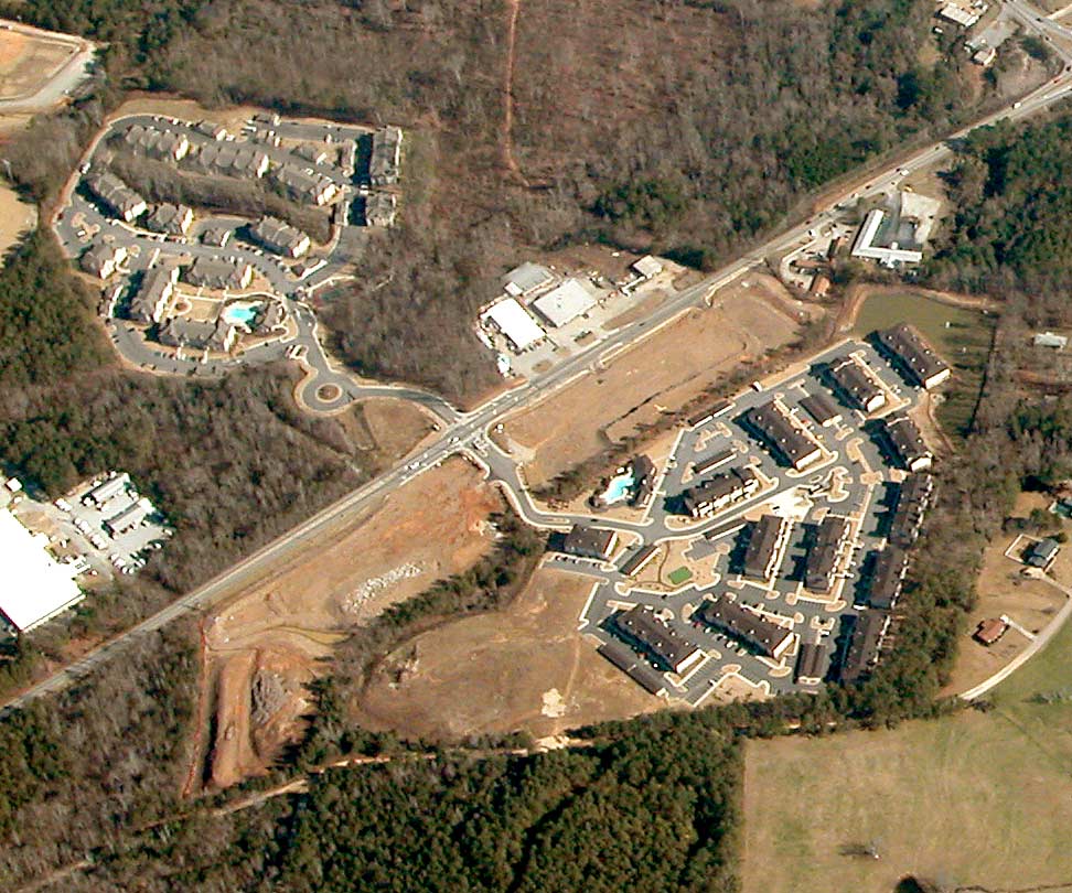
 A typical suburban US neighborhood with dead-end streets and cul-de-sacs.
The desirability of the cul-de-sac street type among home buyers is implied by the evidence that they often pay up to a 20% premium for a home on such a street, according to one study.[5] This could be because there is considerably less passing traffic, resulting in less noise and reduced actual or perceived risk, increasing the sense of tranquility. A survey of residents on three types of streets: cul-de-sac, loop, and through (grid) recorded their preferences among these types. It found that 82% of cul-de-sac residents preferred their own street type, 18% preferred a loop, and 0% the grid. Only 13% of grid street residents preferred their own type and 54% would choose a cul-de-sac to live on.[8] Two other studies,[15][16] reported in 1990 and 2009 respectively, confirmed this upward trend and determined the premium that cul-de-sac streets command. The first found a 29% premium over the streets in a grid. The second, focused on trails and greenbelts, found that other amenities including cul-de-sac streets add significantly to the home value.
The positive feelings that a cul-de-sac street could evoke, that residents value, are expressed vividly by Allan Jacobs in describing a short (250 ft), narrow (60 ft), and densely built (14 du/acre) cul-de-sac in the Shadyside neighborhood of Pittsburgh, Pennsylvania:[17] “Step into Roslyn Place and you are likely to sense, immediately, that you are in a place, a special place, a handsome place, a safe place, a welcoming place, a place where you might wish to live.” ... “narrowness and enclosure and intimacy bring a feeling of safety to Roslyn Place... “Stay on our street” is all the kids have to know.”
Gated communities, steadily increasing worldwide, employ cul-de-sac and loop street networks because, having a dendrite structure, they reduce the number of through roads and, consequently, the corresponding number of entries and exits to be controlled.
Criticisms and discussion
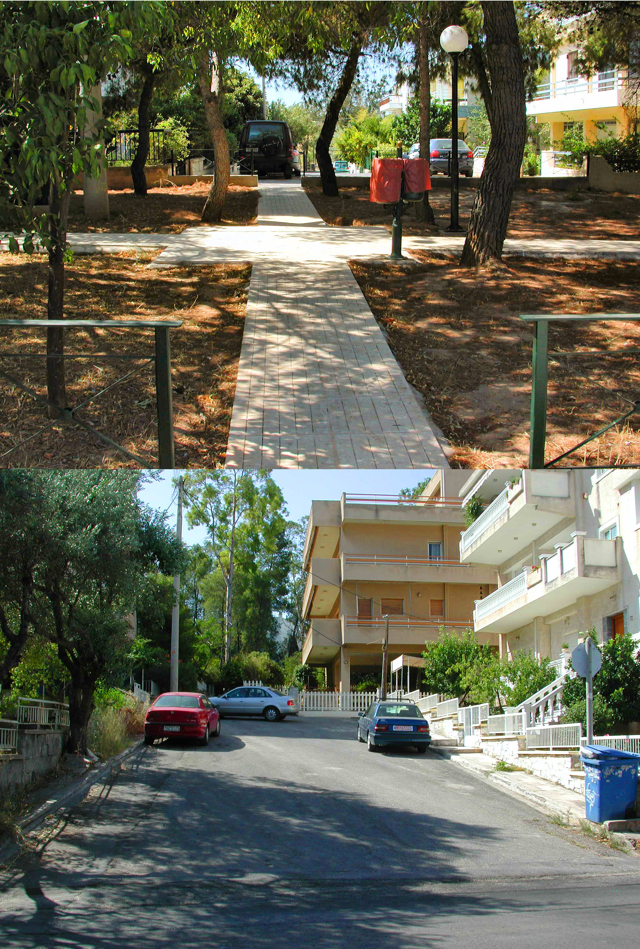
 One of several short, narrow, connected cul-de-sac streets in Athens, Greece. The photos show the street (below) and the connecting footpath to the corresponding street (above)
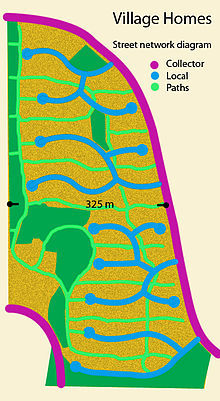 A diagram showing the street and path network of Village Homes with connected culs-de-sac.
Culs-de-sac are criticised by urban designers like those of the Foundation for the Built Environment in the United Kingdom for encouraging car transport for even short distances, as more direct connections are precluded by the dead-end geometry, which necessitates long travel distances even to physically nearby locations. This increases fuel consumption and vehicle emissions and has negative effects on health by reducing walking and cycling rates.[18] Related research in the United States by Richard Jackson has shown that people in car-based (cul-de-sac heavy) communities weigh on average 6 lb (2.7 kg) more than those in traditional towns (with open grid networks).[18] An extensive analysis of the research evidence by TRB,[19] however, shows only an association between the built environment and physical activity levels, not causal connections. The evidence does not either identify with certainty which characteristics of the built environment are most closely associated with physical activity behaviour. The study also warns against confusing inadequate physical activity with obesity which is the outcome of an energy imbalance. Many contemporary lifestyle trends some inevitable (sedentary work) and some avoidable, (frequent energy-rich food consumption or TV watching [4 h/d]), contribute to this imbalance and must be considered in understanding and combating obesity.
The imperemability deficiency of the typical cul-de-sac street can be addressed by applying a modified, improved version of it, mentioned above, that enables pedestrian and bicycle through movement. While this more permeable version can be applied in new developments easily, modifying existing impermeable cul-de-sac streets is problematic as it encounters property ownership issues. Efforts in this direction are, however, being made. Given the complicated legal process and the sheer number of exiting cul-de-sac streets, however, such efforts would be slow to produce results and may only have a marginal impact in changing the landscape of existing districts. Conversely, transforming existing streets that are part of a grid plan into permeable, linked culs-de-sac, as was done in Berkeley, California and Vancouver, BC, is physically and administratively easy due to the public ownership of the street right-of-way. However, residents on adjacent through roads may resent the potential traffic increase and delay the process.
Increases in pedestrian and bicycle permeability may result in a displacement of local car trips for short distance destinations[14] and consequently a reduction in neighbourhood vehicle emissions. The impermeable cul-de-sac not only discourages walking and biking but also increases the length of car trips by the circuitous geometry of the dendrite network structure of which it is a part. Research studies examined the influence of several variables on the amount of car travel that residents of several types of districts recorded. Results vary considerably among one other, but there is general agreement on a number of key correlations:[20][21] a)The wealthier and the larger the family is the more cars they own and the more they drive, b)The farther away a family lives from the city centre and the fewer the jobs in the vicinity plus a slow bus service the more they drive and c)Street patterns may add a 10% length to local trips but the total VKTs are affected more by the "macro" urban than the "micro" neighbourhood structure.
Culs-de-sac, especially those that also cut off pedestrian connections instead of limiting only road traffic, have also been criticised for negative effects on safety, because they decrease the amount of through traffic (vehicular or pedestrian) that might spot an accident or crime victim in need of help. Proponents of culs-de-sac and gated communities have in turn countered that the reduction in through traffic makes any "stranger" much more recognisable in the closed local environment and thus reduces crime danger. This view has in turn been characterized as unrealistic; it is argued that since only a very small proportion of all non-locals passing through the area are potential criminals, increased traffic should increase rather than decrease safety.[22]
New research has expanded the discussion on this disputed issue. A recent study[23] did extensive spatial analysis and correlated several building, site plan and social factors with crime frequencies and identified subtle nuances to the contrasting positions. The study looked at, among others, a) dwelling types, b) unit density (site density) c) movement on the street, d) culs–de-sac or grids and e) the permeability of a residential area. Among its conclusions are, respectively, that a) flats are always safer than houses and the wealth of inhabitants matters; b) density is generally beneficial but more so at ground level; c) local movement is beneficial, larger scale movement not so; d) relative affluence and the number of neighbours has a greater effect than either being on a cul-de-sac or being on a through street. It also re-established that simple, linear culs-de-sac with good numbers of dwellings that are joined to through streets tend to be safe. As for permeability, it suggests that residential areas should be permeable enough to allow movement in all directions but no more. The over-provision of poorly used permeability is a crime hazard.
More generally, the New Urbanism movement has offered criticism of the cul-de-sac and crescent (loop) street types not intended to network with each other. It has been suggested that such street layouts can cause increased traffic on the collector streets. It is recognized that cul-de-sac and looped streets inherently remove car traffic through them and restrict access to residents only. Resident traffic is naturally channelled to minor residential collectors and to arterials that provide inter-neighbourhood and inter-district connectivity. A study, reported in 1990,[24] compared the traffic performance in a 700-acre (2.8 km2) development that was laid out using two approaches, one with and the other without hierarchy or cul-de-sac streets. It concluded that the non-hierarchical, traditional layout generally shows lower peak speed and shorter, more frequent intersection delays than the hierarchical pattern. The traditional pattern is not as friendly to the long trips as the hierarchical but friendlier to short trips. Local trips in it are shorter in distance but about equivalent in time with the hierarchical layout. A later similar comparative traffic study[20] of about 830 acres (3.4 km2) oconcluded that all types of layouts perform adequately in most land use scenarios and that a refined hierarchical, dendrite network can improve traffic performance.
Anecdotal and research evidence suggests that navigation (especially on foot) in a disconnected network of cul-de-sac and looped streets is inconvenient and non-intuitive, particularly when combined with curvilinear geometry. Loss of orientation and sense of direction is also a common experience in older cities with cul-de-sac streets (Medina of Arab cities or Mediterranean hill towns) as well as in cities with highly irregular block geometries and sizes and corresponding street alignments that produce a labyrinthine effect. The long history of such cities implies that an irregular, complicated street network that appears entirely illegible to a visitor is well understood and used by the inhabitants. More convincing about its workability for their permanent residents are the case histories of cities such as Regensburg that show a gradual transformation of an imported or imposed orthogonal, “legible” grid to the traditional “confusing” street networks.[25]
Cul-de-sac and loop streets can reduce the size of any given neighbourhood to a single street. Neighbourhoods can be defined by geographic boundaries but more often it is shared ethnic, socio-economic and cultural characteristics that create social cohesion irrespective of apparent physical "boundaries". Mehaffy et al. (2010), who propose a model for structuring an urban network, suggest that neighbourhoods cannot be designed into being.[26] “Community” is viewed as a dynamic social and cultural construct especially in contemporary, open, multicultural cities. Residential area street configuration can only assist its emergence by reducing through traffic and increasing local pedestrian movement; a design goal for which connected cul-de-sac and looped streets are suited.
Issues of pedestrian trip length and isolation are sharply evident in the back-to-front housing arrangement where the front of the house fronts onto the cul-de-sac street while the rear fronts onto the main roads. Some of these problems can be mitigated by the newer practice of connecting the neighbouring roads and culs-de-sac with public pedestrian/cycle paths. In effect, this removes the discontinuity aspect for these modes of transport. Built examples of such connected culs-de-sac can be found in the United States (such as Radburn, New Jersey and Village Homes, California), England (such as Milton Keynes) and Greece (such as Papagou, a suburb of Athens) (see photo). A new system for organizing connected culs-de-sac, the Fused Grid, has been developed by Canada Mortgage and Housing Corporation.
In the North American development context and planning literature, cul-de-sac streets have been associated with low density residential development which is judged as inefficient by sustainable development theorists and proponents. The increased prevalence of cul-de-sac streets occurred in the 1960s and '70s, a period of rapid economic and city expansion, when a detached house on a large lot meant an ideal form of habitation; overlooking the potential negative externalities. This temporal coincidence of the wide adoption of a street type and an increasing demand for large lots and houses creates the impression of a necessary relationship between street type and unit density. Historically, however, the earliest systematic application of the cul-de-sac street type by Raymond Unwin (1909) had a unit density between 8 and 12 units per acre, considerably higher than mid-to-late 20th century. Even early 21st century developments rarely achieve densities above 5 to 7 units per acre in the suburbs. Conversely, early 1950s suburban developments that were laid out on a grid exhibit similar low densities. Evidently, street, network type and density are not linked causally; other factors, such as land scarcity and income influence the outcome as, for example, in cities that are landlocked or that have low average incomes.
Another concern is often raised by emergency services, who can have difficulty locating streets when a community consists of a large number of similarly named culs-de-sac; also, large fire response vehicles, in particular, can have great difficulty with turning around in a cul-de-sac.[27] However, confusing street naming is not a necessary outcome of street network design and can be improved. The practice of naming orthogonal networks by numbers and letters in the corresponding cardinal directions has been criticized by Camilo Sitte as lacking imagination. Nonetheless, police and fire departments now use advanced GPS systems that quickly locate the destination and the shortest path to follow.
School buses can also have a hard time turning around, which means that children who live in a cul-de-sac must often walk to a bus stop on a main through road. However, recent research on obesity and urban planning suggests that this may be an advantage because it enables children to get daily physical activity. Longer walking distances, however, reduces interest to use buses especially when a car is available.[27] This disincentive to walking to the school bus stop can be overcome in planned cul-de-sac streets by regulating their maximum length to about 500 ft (150 m), as was recommended and practiced by R. Unwin and others.
Weighing available evidence, has lead a few U.S. cities including Austin, Texas; Charlotte, North Carolina; and Portland, Oregon to restrict and regulate the inclusion of cul-de-sac streets in new suburbs.[5] However, a 2010 study [28] on Spawl in NA by a legal expert concludes that “....neighborhoods dominated by cul-de-sacs are less walkable than those that include street grids...’. ‘On the other hand, cul-de-sacs do have a countervailing public benefit: because of their very inaccessibility, they tend to have less automobile traffic. Given the existence of important public policy goals on both sides, a city seeking to maximize walkability should not favor cul-de-sacs over grids, but should also allow some cul-de-sacs as a legitimate residential option’ ... ‘In addition, there are “middle ground” alternatives between prohibiting cul-de-sacs and mandating them. For example, a city could encourage cul-de-sacs combined with pedestrian walkways”. This design combination is shown in the Village Homes layout and is an integral part of the Fused Grid.
Terminology
George Orwell wrote in his 1946 article, "Politics and the English Language", that the term "cul de sac" is another foreign word used in English as pretentious diction, and is unnecessary.[29][30][31][32][33]
The word "cul-de-sac" and its variants, "dead end" and "no exit", have inspired metaphorical uses in literature and in culture, often with the result that a word or phrase seeming to have a negative connotation is replaced in street signs. ("No outlet" is another alternative name used on street signs.)
Despite seeming to be a borrowed French phrase, the expression cul-de-sac originated in England during the period when French was spoken by the English aristocracy. (In modern French pronunciation, the <l> is silent.) In Catalan or in Occitan, "cul-de-sac" literally means "bottom of a bag". J. R. R. Tolkien used the name Bag End as a literal translation of "cul-de-sac", to poke fun at the British use of French terms.[34]
Spanish language
In Spanish, a cul-de-sac is called a "callejón sin salida" or 'calle privada' (literally, a "private street"), often shortened to a 'privada'. In Venezuela it is called "calle ciega" (blind street)
Portuguese language
In Portuguese, a cul-de-sac is called a "beco sem saída" (literally, a "no-exit alley"). Despite the name, "becos sem saída" can vary very-small and narrow streets to wide avenues which have been cut off at one end due to newer developments. It is also shortened to "beco" often, even though a "beco" (alley) is not necessarily a cul-de-sac.
Norwegian language
In Norway, a cul-de-sac is called 'blindgate' or 'blindvei'.
Swedish language
In Sweden, a cul-de-sac is called 'återvändsgata' or 'återvändsgränd'.
Bosnian language
In Bosnia, a cul-de-sac is called 'čikma'.
Chinese language
In Chinese, a cul-de-sac is called '死胡同' (literally "dead road").
Croatian language
In Croatia, a cul-de-sac is called 'slijepa ulica' (literally "blind street").
Lithuanian language
In Lithuania, a cul-de-sac is called 'akligatvis' (literally "blind street").
Dutch language
In The Netherlands, a cul-de-sac is called 'doodlopende weg' ('dead(ending) road') on traffic signs.
French language
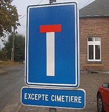 Cul-de-sac sign in Belgium
For signage, European countries use a graphic symbol somewhat like a "T" with a red top, rather than a sign with words. Some roadsigns in France also bear the additional inscription voie sans issue (literally "way without exit"). The word "cul-de-sac", referring to a dead end, is used informally in Europe (rarely officially since it is a mild profanity, cul also referring to the buttocks). In French-speaking Canada, the word "cul-de-sac" is used on signage.[35] Street naming conventions use the word impasse.
Diderot, in Jacques the Fatalist, uses the phrase impasse à la voltaire referring to the fact that Voltaire considered cul-de-sac as really rude and advised to use impasse instead:
«Lecteur, si je faisais ici une pause, et que je reprisse l'histoire de l'homme à une seule chemise, parce qu'il n'avait qu'un corps à la fois, je voudrais bien savoir ce que vous en penseriez ? Que je me suis fourré dans une "impasse" à la Voltaire, ou vulgairement dans un cul-de-sac, d'où je ne sais comment sortir.»
"Reader, if I have put a pause here, and that I continued the story of the man with a lone shirt, because he had only one body at any one time, I would like to know what you would think? That I lost myself in an "impasse" à la Voltaire, or vulgarly a cul-de-sac, from which I don't know how to leave."
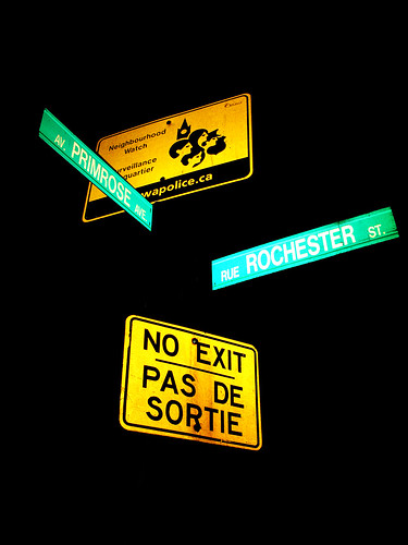
In the Canadian province of Quebec, a small green sign reading "cul-de-sac" is preferred.[36] In bilingual regions of Canada, such as the Ottawa metropolitan area, the term "pas de sortie" is preferred.[37]
English language
In Canada, "no exit" is prevalent, with the exception of Newfoundland, where "Cul-de-Sac" is in far more common use. The phrase, "No Exit", is also preferred for Chicago signs, although "dead end" is still used there.[citation needed] In the UK, street signs more often display "cul-de-sac" rather than an English translation, or "no through road". U.S. Federal Highway Administration rules state: "The Dead End sign may be used at the entrance of a single road or street that terminates in a dead end or cul-de-sac. The No Outlet sign may be used at the entrance to a road or road network from which there is no other exit." There is no federal regulation on "no exit".[39]
Culs-de-sac may also be called "no through roads", especially in Australia where they are signposted as "No Through Road".[40]
German language
In German-speaking countries, a cul-de-sac is called "Sackgasse". "Gasse" means alley/lane and "Sack" means bag, because a bag has one opening only.
Danish language
A cul-de-sac is in Danish called "Blind vej". It basically means "Blind way / street".
Indonesian language
The Indonesian equivalent to cul-de-sac is "Jalan Buntu". It basically means "no through road".
Italian language
The Italian equivalent to cul-de-sac is "vicolo cieco", literally "blind alley".
Russian language
The Russian equivalent to cul-de-sac is "Тупик". It basically means "no through road".
Latvian language
The Latvian language equivalent is "strupceļš" ("stumpy road"), rarely "ceļa gals" ("end of the road").
Polish language
The Polish language utilizes expression "ślepa ulica" (literally "blind street") or "sięgacz" (literally "something that reaches").
Serbian language
In Serbia, a cul-de-sac is called 'slepa ulica' (literally "blind street").
United States regional variants
New York City has favored "dead end" since at least the 1930s, when Sidney Kingsley used the phrase to title his Broadway play about poor, tough East Side youths with lives of little promise, in contrast to the dead-end streets of the nearby Sutton Place neighborhood. (Similarly, French existentialist Jean-Paul Sartre titled a play about three damned sinners, Huis Clos, translated into English as "No Exit".) Kingsley's play, later made into a movie, Dead End, which proved so popular that it spawned similar movies, many starring a group of recurring characters known as the Dead End Kids. The play and movies created such a strong image of bleak futures and an unfair society that some municipalities changed the sign terminology for culs-de-sac, often to "no outlet" or "no exit". (The "dead end" signs currently at Sutton Place are bright yellow with black lettering.)[39]
In New York City, as of 2008, there were 4,659 "dead end" traffic signs, along with 160 "no outlet" signs. The city records, which go back to the 1960s, show only a couple "no exit" signs once existing near the approaches to the Midtown Tunnel, and which are no longer there. "We hear that some towns use 'no outlet' instead of 'dead end' because they think it sounds less morbid", New York City Commissioner of Transportation Janette Sadik-Khan said in 2008. "We tell New Yorkers the truth: it's a 'dead end', and we think that motorists get the point quickly."[39]
Other uses
In military parlance, a "cul-de-sac" refers to a situation where an army is "hemmed in on all sides but behind"[41] "Cul-de-sac" is also used metaphorically to mean a line of thought or action that leads nowhere.
In some parts of England it is also thought to have originated from when coal was left at the end of small roads, literally meaning "coal-in-the-sack".
See also
References
- ^ Eberstadt, Rudolf (December 1909). "The Problems of Town Development". Contemporary Review 96: 660–667. http://www.library.cornell.edu/Reps/DOCS/eberstad.htm.
- ^ FHA (July 1, 1936). Planning Neighbourhoods for Small Houses. Technical Bulletin. 5. Washington DC.
- ^ Principles of small house grouping. Ottawa: Central Mortgage and Housing Corporation. 1954.
- ^ Doxiadis, K. A.; Oikistikes, A. K. (1975). Anthropopolis: City for Human Development. New York: W. W. Norton. ISBN 0393087212.
- ^ a b c d "Culs-de-Sac: Suburban Dream or Dead End?". NPR. http://www.npr.org/templates/story/story.php?storyId=5455743.
- ^ Marshal, Stephen (2005). Streets and Patterns. Spon Press. ISBN 0-415-31750-9.
- ^ "Suburban Landscapes". NRHP Workshop @ NCSHPO Annual Meeting. http://www.cr.nps.gov/nr/publications/bulletins/01workshop/sub_landsc.htm.
- ^ a b Ben-Joseph, Eran (1995). Livability and Safety of Suburban Street Patterns: A Comparative Study. University of California, Working Paper. 641. Berkeley, CA: Institute of Urban and Regional Development.
- ^ Lovegrove, Gordon R.; Sayed, Tarek (2006). "Using Macrolevel Collision Prediction Models in Road Safety Planning Applications". Transportation Research Record: Journal of the Transportation Research Board 1950: 73–82. doi:10.3141/1950-09.
- ^ Dumbaugh, Eric & Rae, Robert (2009). "Safe Urban Form: Revisiting the Relationship Between Community Design and Traffic Safety". Journal of the American Planning Association 75 (3): 309–329. doi:10.1080/01944360902950349.
- ^ Handy, Susan; Sommer, Samantha; Ogilvie, Julie; Cao, Xinyu; Mokhtarian, Patricia (2007). Culs-de-Sac and Children's Outdoor Play: Quantitative and Qualitative Evidence. University of California Davis.
- ^ Huttenmoser, Marco; Meierhofer, Marie (1995). "Children and Their Living Surroundings for the Everyday Life and Development of Children". Children’s Environments 12 (4): 1–17.
- ^ Veitch, Jenny; Salmon, Jo; Ball, Kylie (2010). "Individual, social and physical environmental correlates of children's active free-play: a cross-sectional study". Australia International Journal of Behavioral Nutrition and Physical Activity 7: 11. doi:10.1186/1479-5868-7-11.
- ^ a b Frank, L. & Hawkins, C. (2008). Assessing Travel and Environmental Impacts of Contrasting Levels of Vehicular and Pedestrian Connectivity: Assessing Aspects of the Fused Grid. Ottawa: Canada Mortgageand Housing Corporation.
- ^ Asabere, Paul K. (1990). "The value of a neighborhood street with reference to the cul-de-sac". Journal of Real Estate Finance and Economics 3 (2): 185–193. doi:10.1007/BF00216591.
- ^ Asabere, Paul K.; Huffman, Forrest E. (2009). "The Relative Impacts of Trails and Greenbelts on Home Price". Journal of Real Estate Finance and Economics 38 (4): 408–419. doi:10.1007/s11146-007-9089-8.
- ^ Jacobs, Allan B. (1993). Great Streets. MIT press. ISBN 0-262-10048-7.
- ^ a b Charles: let’s kill off the cul-de-sac - The Sunday Times, February 11, 2007
- ^ Does the built environment influence physical activity? : examining the evidence /Committee on Physical Activity, Health, Transportation, and Land Use, Transportation Research Board, Institute of Medicine of the National Academies. (Special report ; 282)ISBN 0-309-09498-4
- ^ a b Taming the Flow—Better Traffic and Safer Neighbourhoods. Canada Mortgage and Housing Corporation,July 2008
- ^ Greenhouse Gas Emissions from Urban Travel: Tool for Evaluating Neighbourhood Sustainability.Canada Mortgage and Housing Corporation, 2000
- ^ Can Streets Be Made Safe? - Hillier, Bill; Bartlett School of Graduate Studies, University College London
- ^ An evidence based approach to crime and urban design Or, can we have vitality, sustainability and security all at once? Bill Hillier, Ozlem Sahbaz March 2008 Bartlett School of Graduate StudiesUniversity College London
- ^ Traditional Neighborhood Development: Will the Traffic Work?Presentation by Walter Kulash at the 11th Annual Pedestrian Conference in Bellevue WA, October 1990
- ^ Morris, A. E. J. (1994). History of Urban Form Before the Industrial Revolution (Third ed.). Harlow, UK: Pearson Education Limited. ISBN 0582301548.
- ^ Mehaffy, Michael; Porta, Sergio; Rofe, Yodan & Salingaros, Nikos (2010). "Urban nuclei and the geometry of streets: The 'emergent neighborhoods' model". Urban Design International 15 (1): 22–46 [p. 45]. doi:10.1057/udi.2009.26.
- ^ a b The Unintended Consequences of Culs-de-sac
- ^ Michael Lewyn, 2010. Sprawl in Canada and the United States, Florida Coastal School of Law. Available at: http://works.bepress.com/lewyn/65
- ^ Orwell, George. "Politics and the English Language". 1946
- ^ http://mla.stanford.edu/Politics_&_English_language.pdf
- ^ http://www.george-orwell.org/Politics_and_the_English_Language/0.html
- ^ http://www.mtholyoke.edu/acad/intrel/orwell46.htm
- ^ http://orwell.ru/library/essays/politics/english/e_polit
- ^ Tom Shippey, The Road to Middle-Earth.
- ^ http://www.flickr.com/photos/mpd01605/3860614817/in/set-72157622031286341/
- ^ Cul-de-sac Sign in Quebec
- ^ No Exit/Pas de Sortie Sign in Ottawa
- ^ U.S. Department of Transportation
- ^ a b c Safire, William (2008-07-13). "On Language: Dead End". New York Times. http://www.nytimes.com/2008/07/13/magazine/13wwln-safire-t.html. Retrieved 2008-12-04.
- ^ No Through Road (Flickr image used as reference)
- ^ OED, online edition, draft revision December 2007, entry for cul-de-sac, n2
Roads and junctions Types of road By countryGermany · Croatia · Spain · Italy · Portugal · Czech Republic · Ireland · United States (U.S. Routes · Interstates)Main roadsArterial road · Collector road · Express-collector setup · Farm-to-market road · Highway · Link road · Two-lane expressway · 2+1 road (Parkway · Super two · 2+2 road) · Trunk road · Highway systems by countryLocal roadsBoulevard · Frontage road · Road · Single carriageway · Street · Alley · Backroad · Cul-de-sac · Driveway · Lane · Primitive road · Side roadOther termsSurfaces Asphalt concrete · Brick · Chipseal · Cobblestone · Concrete · Corduroy · Dirt · Gravel · Ice · Macadam · Oiled (bitumen) · Plank · Sett · TarmacRoad junctions Cloverleaf · Diamond · Directional T · Diverging diamond · Parclo · Trumpet · SPUI · Stack · Three-level diamond · Raindrop · Roundabout interchangeCategories:- Catalan words and phrases
- French words and phrases
- French loanwords
- Real estate
- Types of roads


Wikimedia Foundation. 2010.