- Thorhild County No. 7, Alberta
-
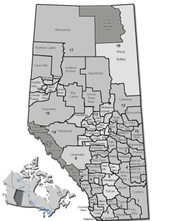
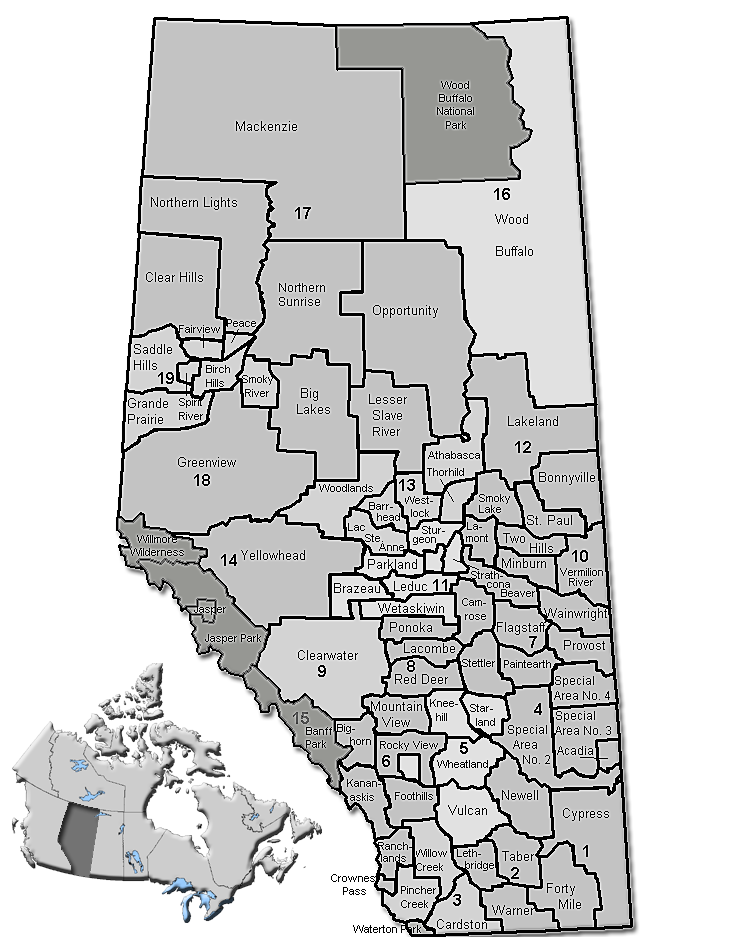
County of Thorhild No. 7 — Municipal district — Location of Thorhild No. 7 in Alberta
Coordinates: 54°09′12″N 113°07′34″W / 54.15333°N 113.12611°WCoordinates: 54°09′12″N 113°07′34″W / 54.15333°N 113.12611°W Country  Canada
Province  Alberta
Region Central Alberta Census division No. 13 Established 1955 Incorporated 1955 Government[1] – Reeve Charles Newell – Governing body County of Thorhild Council – Municipal seat Thorhild Area – Total 1,998 km2 (771.4 sq mi) Population (2006)[2] – Total 3,042 – Density 1.5/km2 (3.9/sq mi) – Dwellings 1,510 Time zone MST (UTC-7) Website County of Thorhild No. 7 The County of Thorhild No. 7, Alberta is a municipal district located in the central part of northern Alberta, Canada in Census Division 13. It was incorporated as a county in 1955.
The administrative offices of the County of Thorhild are in the Village of Thorhild.
Contents
Demographics
In 2006, the County of Thorhild No. 7 had a population of 3,042 living in 1,510 dwellings, a 2.5% decrease from 2001. The countyhas a land area of 1,998.38 km2 (771.58 sq mi) and a population density of 1.5 /km2 (3.9 /sq mi).[2]
As of 2001, 3,120 people were living in 1,515 dwellings, a 1.4% increase in population since 1996. With a land area of 1,997.97 km², Beaver county had a population density of 1.6 /km².[3]
Communities
The following communities are located in this municipal district:[4]
Hamlets
- Abee
- Egremont
- Long Lake
- Newbrook
- Opal
- Radway – dissolved as a village in 1996
- Thorhild – dissolved as a village in 2009
See also
- List of communities in Alberta
- List of municipal districts in Alberta
References
- ^ Alberta Municipal Affairs: Municipal Officials Search
- ^ a b Statistics Canada (Census 2006). "County of Thorhild No. 7 - Community Profile". http://www12.statcan.ca/english/census06/data/profiles/community/Details/Page.cfm?Lang=E&Geo1=CSD&Code1=4813036&Geo2=PR&Code2=48&Data=Count&SearchText=Thorhild%20County%20No.%207&SearchType=Begins&SearchPR=01&B1=All&GeoLevel=&GeoCode=4813036. Retrieved 2007-06-11.
- ^ County of Thorhild Community Profile - Statistics Canada. 2002. 2001 Community Profiles. Released June 27, 2002. Last modified: 2005-11-30. Statistics Canada Catalogue no. 93F0053XIE
- ^ Municipal Profile - Alberta Municipal Affairs
External links

Athabasca County Athabasca County Westlock County 
Smoky Lake County  County of Thorhild No. 7

Sturgeon County Sturgeon County Lamont County Categories:- Thorhild County, Alberta
Wikimedia Foundation. 2010.