- County Westmeath
-
County Westmeath
Contae na hIarmhí
Coat of armsMotto: Triath ós Triathaibh (Irish)
"Noble above nobility"
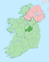
Country Ireland Province Leinster Dáil Éireann Longford–Westmeath EU Parliament East County seat Mullingar Government - Type County Council Area - Total 1,840 km2 (710.4 sq mi) Area rank 21st Population (2011) 85,961 - Rank 22nd Car plates WH Website westmeathcoco.ie County Westmeath (pronounced /wɛstˈmiːð/; Irish: Contae na hIarmhí) is a county in Ireland. It is part of the Midlands Region and is also located in the province of Leinster. It is named after the ancient Kingdom of Mide (meaning "middle") following the division of the Kingdom. Westmeath County Council is the local authority for the county. The population of the county is 85,961 according to the 2011 census.[1]
Contents
Geography and political subdivisions
Westmeath is the 20th largest of Ireland's 32 counties by area and the 22nd largest in terms of population.[2] It is the sixth largest of Leinster’s 12 counties in size and eighth largest in terms of population. It was named after the historic kingdom and province of Mide, of which the county was the most western part. Westmeath was shired under The Counties of Meath and Westmeath Act of 1543. The Hill of Uisneach in the barony of Moycashel is sometimes regarded as the notional geographical centre of Ireland although the actual geographic centre of Ireland lies in neighbouring County Roscommon.
Local government and politics
The head office of Westmeath County Council is located in Mullingar. There are currently 22 councillors. The five electoral areas of Westmeath are Athlone (7 seats), Coole (3 seats), Kilbeggan (3 seats), Mullingar East (4 seats) and Mullingar West (5 seats).[3] The Local Government (Ireland) Act 1898, provided the framework for the establishment of County Councils throughout Ireland. The first meeting of Westmeath County Council was held on 22 April 1899.[3]
Demography
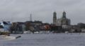
Westmeath's population growth has been stronger than the national average.[4] After the Great Famine, the population of Westmeath declined dramatically. It stabilized in the middle of the 20th century, and has continued to grow. Westmeath's proximity to Dublin with good motorway facilities and frequent rail service has made commuting popular. The county town is Mullingar which has a population approaching 20,000. Athlone, Moate, Kilbeggan and Castlepollard are important commercial and marketing centres. Westmeath is the largest county by population in the Irish Midlands and contains Athlone, the largest town and commercial centre of the Midlands.
Historical populations Year Pop. ±% 1653 12,090 — 1659 12,672 +4.8% 1821 128,819 +916.6% 1831 136,872 +6.3% 1841 141,300 +3.2% 1851 111,407 −21.2% 1861 90,879 −18.4% 1871 78,432 −13.7% 1881 71,798 −8.5% 1891 65,109 −9.3% 1901 61,629 −5.3% 1911 59,986 −2.7% 1926 56,818 −5.3% 1936 54,706 −3.7% 1946 54,949 +0.4% 1951 54,463 −0.9% 1956 54,122 −0.6% 1961 52,861 −2.3% 1966 52,900 +0.1% 1971 53,570 +1.3% 1979 59,885 +11.8% 1981 61,523 +2.7% 1986 63,379 +3.0% 1991 61,880 −2.4% 1996 63,314 +2.3% 2002 71,858 +13.5% 2006 79,346 +10.4% 2011 85,961 +8.3% [5][6][7][8][9][10] Economy
 Canal at Mullingar
 Barbavilla Stud Horses
Westmeath has a strong agricultural economy. Initially, development occurred around the major market centres of Mullingar, Moate, and Kinnegad. Athlone developed due to its military significance, and its strategic location on the main Dublin–Galway route across the River Shannon. Mullingar gained considerable advantage from the development of the Royal Canal. The canal facilitated cheap transport of produce to Dublin, Britain and Europe. Athlone and Mullingar expanded further with the coming of the Midland Great Western Railway network in the nineteenth century.
Tourism in Westmeath is generally based on its many water amenities. The county lakes include Lough Derravaragh, Lough Ennell, Lough Cassidy, Lough Lene, Lough Hogg, Lough Owel, Lough Coffey and Lough Ree. Both the Grand Canal, and the Royal Canal flow through Westmeath, and the River Shannon (Ireland's key tourism waterway) has a modern inland harbour in Athlone.
The development of industry in Westmeath was mainly based on food processing and consumer products. Whiskey is distilled in Kilbeggan and tobacco is processed in Mullingar. The county has an extensive beef and dairy trade. In recent times, the manufacturer Élan has located in Athlone. The eastern part of the county is home to commuters many of whom work at the technology parks on the western side of Dublin, such as Thornton and Peppard, and around County Carlow.
Mullingar is renowned for the high quality of its beef and veal. Weaned cattle from the west of the Shannon are fattened for market on the lush grasslands of Meath and Westmeath. The cattle are also used to maintain grassland to help sustain wildlife in the areas fringing the Bog of Allen.
Westmeath is home to many stud farms. The plains of Westmeath, covered in calcium-rich marl, contribute significantly to calcification of foal bones during their formative years. Westmeath mares are usually put into foal in spring to facilitate summer growth. Pregnancy lasts for approximately 335–340 days and usually results in one foal. Horses mature when they are around four years old.
Transport
Infrastructure is of good quality in the county. As part of the Transport 21 infrastructure programme undertaken by the government, both the N4 and N6 roads have been upgraded to motorway or dual carriageway standard. Tang is in Co. Westmeath. All towns that these roads passed through are now bypassed, such as Mullingar, Athlone, Moate and Kinnegad. Both Dublin and Galway are within commuting distance from Westmeath following the completion of the M6 motorway in December 2009. Westmeath also has good railway infrastructure with a number of trains passing through towns in the county. The Dublin to Galway/Westport/Ballina inter-city train service stops at Athlone train station, while the Dublin to Sligo service stops at Mullingar train station. Other major infrastructural projects and plans for the county include:
Sport
Westmeath is an active sporting county. Westmeath GAA won the Leinster Senior Football Championship, the Delaney Cup, in 2004.They also won the National football league competition Division 2 in 2001, 2003 and 2008. They won the Christy Ring Cup for hurling in 2005, 2007 and 2010.
Athlone Town have won the League of Ireland Championship in 1980 and 1982, and the FAI Cup in 1924.
People
Notable Westmeath natives include:
- Túathal Techtmar, Ard Rí
- Niall mac Aed Ó hUiginn, poet
- The Blizzards, music group
- Joe Dolan, singer
- Domnall Midi, King of Mide
- Field Marshal George Wade
- Gormflaith ingen Flann Sinna, Queen of Tara
- Nuala Holloway, artist and former Miss Ireland
- Arthur Booth-Clibborn, Salvation Army officer
- John McCormack, tenor
- Michael Joseph Curley, Archbishop of Washington & Baltimore
- Sir Walter Raleigh
- Máel Sechnaill II, King of Mide and King of Ireland
- Niall Horan, member of boyband One Direction, who found fame on The X Factor series 7
Gallery
-

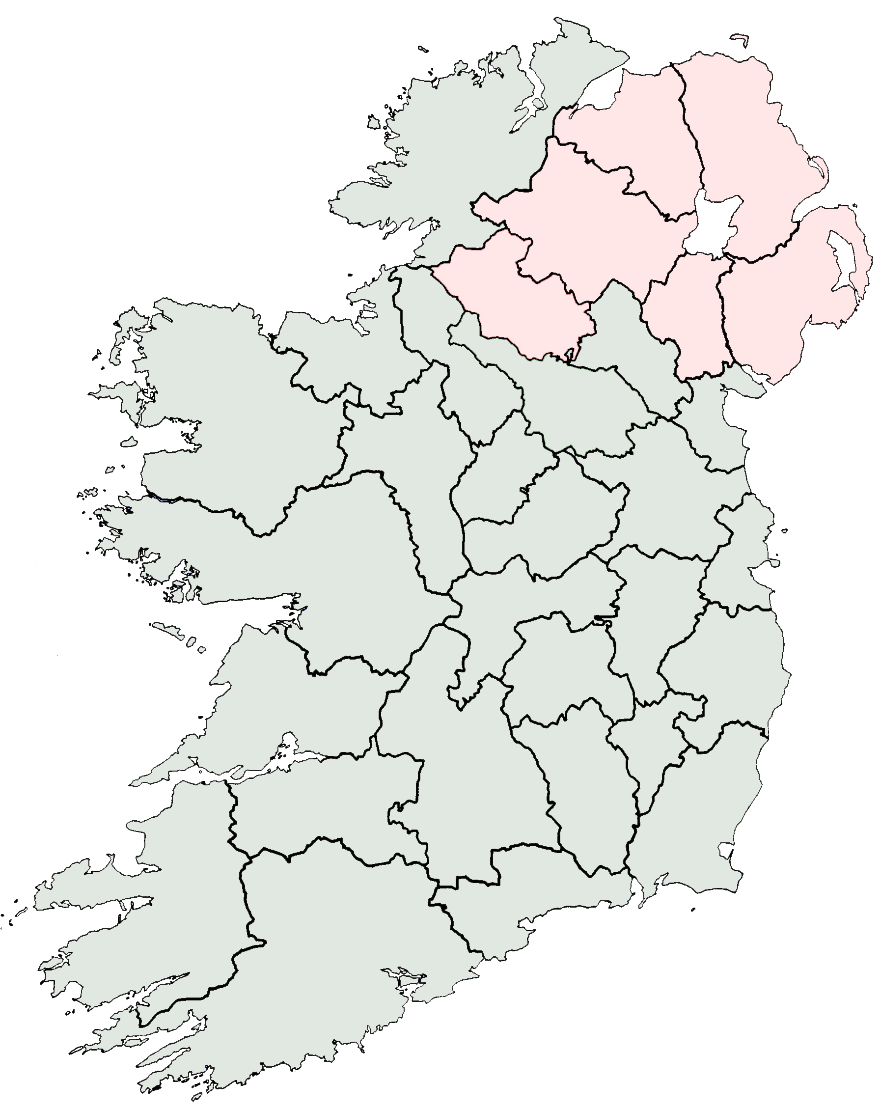
Map
-

The roundabout, Castlepollard
-

Mullingar
-

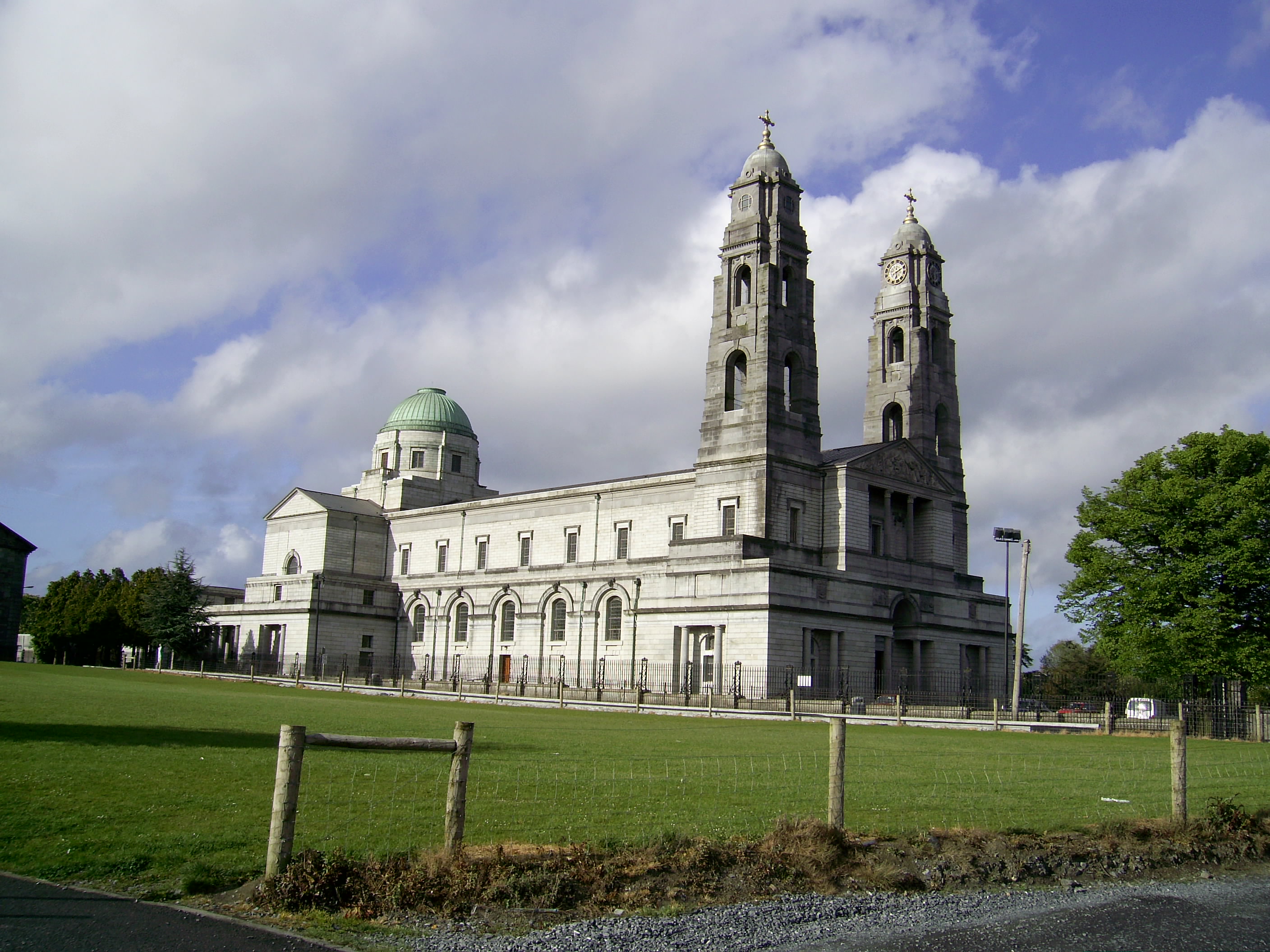
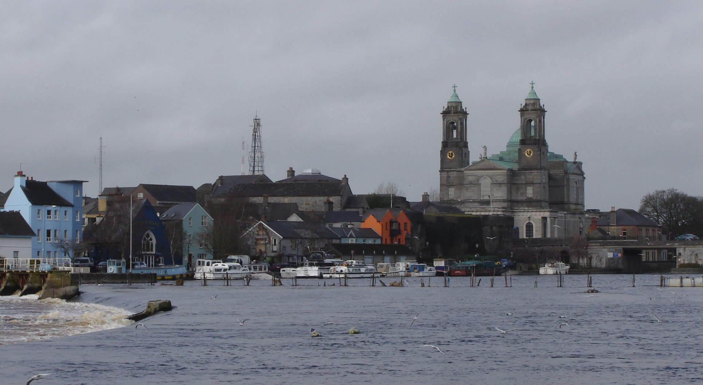
Church of Ss. Peter and Paul, Athlone
-

Austin Friars, Mullingar
-

Mullingar Centre
-

The Royal Canal, Mullingar
-

Celtic Cross at Columb
Military Barracks, Mullingar -

Hill of Ben Fore
-

Columb Baracks, Mullingar
-

19th century concrete stile
-

19th century concrete stile,(v1) Mass-Path, Ranaghan, Collinstown
-

Alternative 19th century concrete stile (v-2) mass path, Ranaghan
-

Bell of Lough Lene
-

Turgesius Island, Lough Lene
-

Sunset on Lough Lene
-

The Cut, Lough Lene
-

Dublin-Mullingar Train
-

Kiloutou, Mullingar
-
Church of Ss. Peter and Paul, Athlone
See also
- List of abbeys and priories in Ireland (County Westmeath)
- Lord Lieutenant of Westmeath
- High Sheriff of Westmeath
References
- ^ Census 2006 - Population of each province, county and city
- ^ Corry, Eoghan (2005). The GAA Book of Lists. Hodder Headline Ireland. pp. 186–191.
- ^ a b "About Us". Westmeath County Council. Archived from the original on 2008-05-07. http://web.archive.org/web/20080507185720/http://www.westmeathcoco.ie/aboutUs/index.asp. Retrieved 2008-06-28.
- ^ "Demographic context". Offaly County Council Development Plan 2009 - 2015. http://www.offaly.ie/NR/rdonlyres/A4AD027E-87E4-4353-917B-47C75D92768F/1095/Chapter2ContextandChallenges_FEB08.pdf. Retrieved 2008-06-28.
- ^ For 1653 and 1659 figures from Civil Survey Census of those years, Paper of Mr Hardinge to Royal Irish Academy March 14, 1865.
- ^ Census for post 1821 figures.
- ^ http://www.histpop.org
- ^ http://www.nisranew.nisra.gov.uk/census
- ^ Lee, JJ (1981). "On the accuracy of the Pre-famine Irish censuses". In Goldstrom, J. M.; Clarkson, L. A.. Irish Population, Economy, and Society: Essays in Honour of the Late K. H. Connell. Oxford, England: Clarendon Press.
- ^ Mokyr, Joel; O Grada, Cormac (November). "New Developments in Irish Population History, 1700-1850". The Economic History Review 37 (4): 473–488. doi:10.1111/j.1468-0289.1984.tb00344.x. http://www3.interscience.wiley.com/journal/120035880/abstract.
External links
- Westmeath Census information
- Westmeath Community Development
- STRATEGIC DEVELOPMENT FRAMEWORK FOR THE MIDLANDS GATEWAY; Census statistics page 27
- Athlone Advertiser and Mullingar Advertiser local newspapers
- Westmeath Enterprise
- Westmeath Examiner (Local Newspaper)
- Westmeath Bands
- Ardnagrath National School Website
- Rosemount GAA Website
- Westmeath Tourism Official Website
Places in County Westmeath County town: Mullingar Towns and
villagesAthlone · Ballinahown · Ballykeeran · Ballymore · Ballynacargy · Castlepollard · Castletown-Geoghegan · Clonmellon · Collinstown · Coole · Crookedwood · Delvin · Drumcree · Drumraney · Finnea · Fore · Glassan · Horseleap · Kilbeggan · Killucan and Rathwire · Kinnegad · Milltownpass · Moate · Mount Temple · Moyvoughly · Mullingar · Multyfarnham · Raharney · Rathconrath · Rathowen · Rochfortbridge · Rosemount · Streamstown · Street · Tang · Tubberclare · Tyrrellspass
Baronies Brawny · Clonlonan · Corkaree · Delvin · Farbill · Fartullagh · Fore · Kilkenny West · Moyashel and Magheradernon · Moycashel · Moygoish · RathconrathList of townlands in County Westmeath · Category:Geography of County Westmeath Counties of Ireland The counties are listed per province Connacht 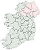
Munster Clare · Cork (Cork City) · Kerry · Limerick (Limerick City) · Tipperary (North Tipperary • South Tipperary) · Waterford (Waterford City)
Leinster Carlow · Dublin (Dublin City • Dún Laoghaire–Rathdown • Fingal • South Dublin) · Kildare · Kilkenny · Laois · Longford · Louth · Meath · Offaly · Westmeath · Wexford · Wicklow
Ulster Italics denote non-administrative counties. Brackets denote eponymous cities or non-traditional counties. † denotes counties of Northern Ireland Categories:- County Westmeath
- Leinster
- Counties of the Republic of Ireland
- Local administrative units of the Republic of Ireland


Wikimedia Foundation. 2010.