- Pennsylvania Route 287
-
PA Route 287
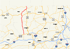
Major highways in northern Pennsylvania with PA 287 in red.Route information Maintained by PennDOT Length: 63.9 mi[1] (102.84 km) Existed: 1961 – present Major junctions South end:  US 220 in Piatt Township
North end:  PA 49 in Lawrenceville
Location Counties: Lycoming, Tioga Highway system Roads in Pennsylvania
Interstate • US • State • Legislative←  PA 286
PA 288  →
→←  PA 83
PA 83
PA 85  →
→←  PA 825
PA 827  →
→Pennsylvania Route 287 is a 63.9-mile (102.8 km) long state highway in the Tioga Valley of Pennsylvania. Route 287 begins at an intersection with U.S. Route 220 in the community of Larrys Creek in Piatt Township, Lycoming County to an intersection with Pennsylvania Route 49 just south of the New York state line in Lawrenceville, Tioga County. The route follows Larrys Creek through several isolated communities, including Salladasburg and English Center, before working its way towards Hoytville, where it meets Pennsylvania Route 414. The route ends up in Wellsboro, where it meets U.S. Route 6, and reaches Tioga.
The alignment of Route 287 has been successor to a set of plank roads from Larrys Creek to Lawrenceville. The southern plank road, known as the Larrys Creek Plank Road, dates back to 1850 as short highway from Larrys Creek to Salladasburg, and was completely gone by 1900. The second part followed the Tioga and Lawrenceville Plank Road, which although is named from Tioga to Lawrenceville, went from Wellsboro to Tioga. The portion to Lawrenceville was never constructed. The route also followed several postal routes in the area. In 1911, the Sproul Road Bill was passed, and Route 287 became segments of Legislative Route 22, Legislative Route 106, and Legislative Route 353. In 1924, the northernmost portion was designated Route 4 and the Susquehanna Trail. This was changed to part of U.S. Route 220 in 1926.
In 1928, U.S. Route 111 was designated, and along with Pennsylvania Route 84, consisted of the alignment of Route 287. Route 111 was redesignated as part of U.S. Route 15. The highway was redesignated as Route 287 in 1961 when Route 84 was decommissioned in favor of Interstate 84. The route was extended from Tioga to Lawrenceville in 2008, when the construction of U.S. Route 15 was finished to the New York state line, and Route 287 was extended to Route 49.
Contents
History
Old roads
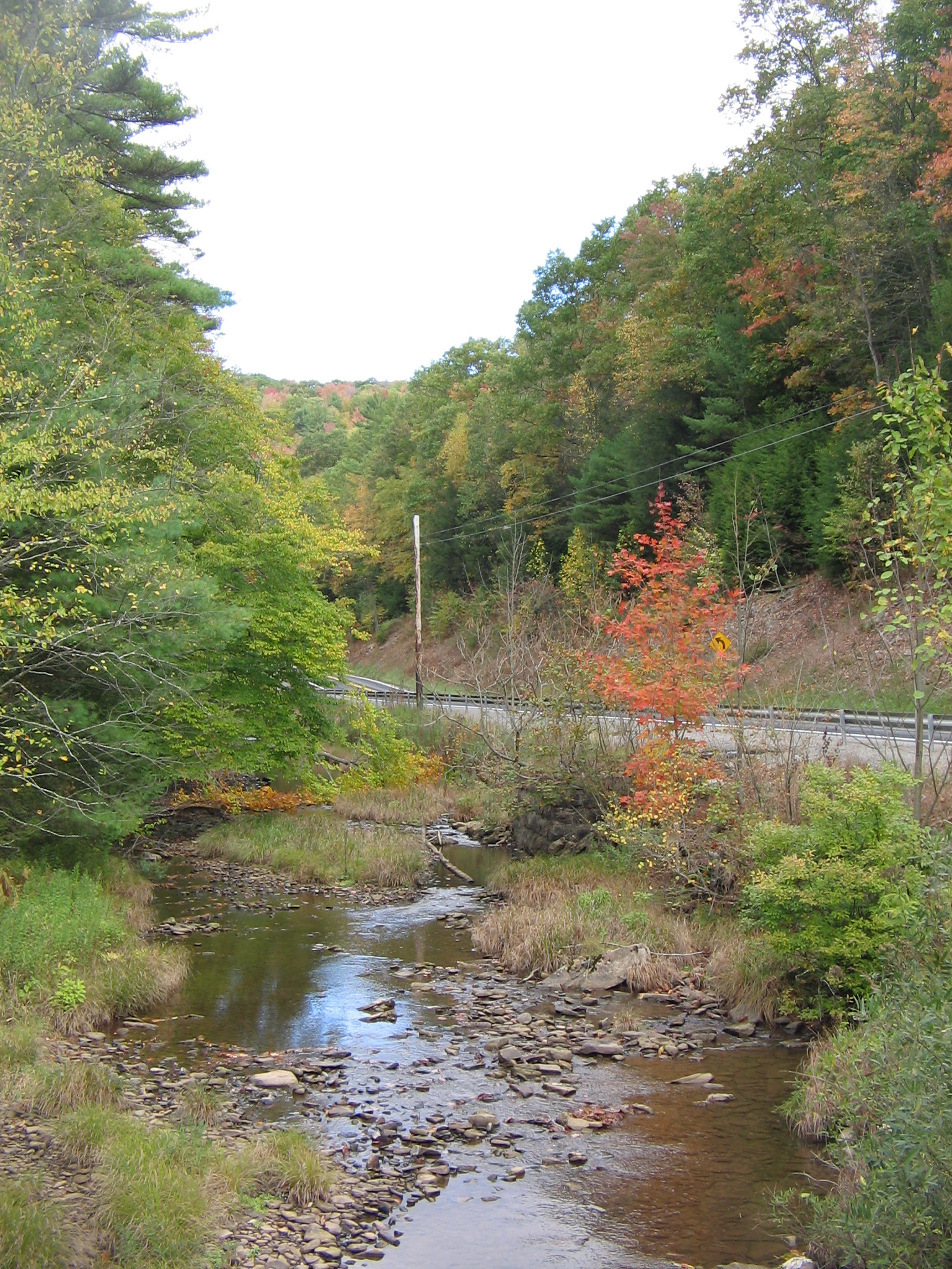
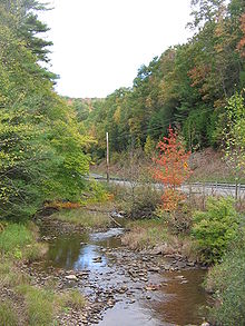 Route 287 follows the Larrys Creek. The highway is visible in the back of the picture
Much of the current-day alignment for Route 287 has been constructed through many different post, plank and turnpike roads in Lycoming and Tioga counties. The earliest known plank road in the area of the current day highway dates back to 1810, when a mail postal route was created along current day Route 287 from Wellsboro to Willardsburg (later known as Tioga). The mail was delivered once a week on horseback for several years, with the service discontinued in 1818. That year, the service was changed to a semi-weekly service for delivery two times a week on horseback. In 1824, this service was also discontinued when the mail route began to be used by coaches three times a week. This service was used and then decommissioned by 1835, when a new system, which stretched from Wellsboro and past Willardsburg to the community of Lawrenceville, was established. This route followed the alignment of Route 287, making stops in Middlebury Center, Holliday, Willardsburg and Mitchell's Creek before ending in Lawrenceville. This mail route was truncated back to Willardsburg in 1840, when the nearby Corning and Blossburg Railroad was completed. The stagecoach lines started working along the three-day process for about ten years, when the nearby Tioga and Wellsboro Plank Road was completed, which made stagecoaches run daily. Along with numerous competition, the service was discontinued in 1872, when the Lawrenceville and Wellsboro Railroad was completed. At that time, the stagecoach lines has ceased operation. By 1883, the only piece of mail routes in the area of Tioga County was a piece near Middlebury Center, but was not as large as the process once was.[2]
Although the Corning and Blossburg Railroad had served as a good travel connection between Wellsboro and Lawrenceville (the Tioga Valley), several communities in the Crooked Creek Valley felt they were not well accommodated. At that time, in locations where railroads were not a feasible option, the construction of plank roads became a highly popular option. In 1848, the Pennsylvania State Legislature approved and chartered construction of a brand new plank road in the valley, to be called the Tioga and Elmira Plank Road, following the alignments of current-day Route 287, Pennsylvania Route 328 and New York State Route 328 to Elmira, New York. Construction was unable to start in 1848,[3] so a supplement to the charter was amended on April 5, 1849,[3] which extended the work period to continue until 1856. Yet another supplement was added in 1850, when the Tioga and Lawrenceville Plank Road was chartered on May 14. This new plank road also had the ability to extend their plank road down to Wellsboro, which repealed the acts of 1848 and 1849. The plank road was contracted and completed in a timely fashion down to Wellsboro from Tioga. In 1851, the plank road was complete from Wellsboro to Tioga, and the thoroughfare became highly used by people transporting lumber, agriculture and merchandise. This helped farmers and producers in the communities of Middlebury Center, Holliday and Delmar (now the area of Wellsboro Junction). The plank road would eventually get worn out from use, and the route was eventually changed from a plank road to a high use turnpike. The 17 miles (27 km) long piece of plank road, created in the original charter from Tioga to Lawrenceville, was never constructed.[2]
 Plank Road (Township Road 361) blade sign. This is the remaining piece of the plank road along Larrys Creek, but the alignment is now pavement
The southernmost portion of Route 287 was the location of a third plank road, this time beginning at the mouth of Larrys Creek in the eponymous community to the current day location of English Center. The road was first considered during the early 19th century; James Williamson, a strong local entrepreneur lived in these areas and it is assumed that the road builders in this area of Lycoming County were in favor of his suggestions. On May 8, 1850, the Pennsylvania State Legislature chartered a brand new plank road along the riverbank of Larrys Creek. The stock of the plank road was 20 shares of $40.00 (1850 USD). Williamson himself was awarded the job as contractor, and in 1850, using full advantage of woodsmen who were unemployed, low wages, and wasted hemlock log trees, began construction. By 1851, the plank road had been constructed all the way to the community of Salladasburg. With the 8 feet (2.4 m)-wide plank road came several tollhouses along the entire route to pay charge for using the roadway. A movable barrier was also installed, so people could not gain access without payment. The plank road was finished and prospered for many years. The common transport on the road was bark and hides, along with hauling leather over to the Larrys Creek Railroad. On June 1, 1889, a major flood hit the area around the plank road, and when things were all said and done, it had experienced extensive damage. In places where damage had occurred, the road was replaced by graded dirt roads. In 1900, the remains of the plank road remained only from Salladasburg to the Larrys Creek Railroad Station. Later that year, a petition was raised to make this remaining piece of road free to access. The case was closed in support of the motion and the plank road company shut down forever.[4][5]
Designation of Route 84
 PA 84 (1928 – 1961)
On May 31, 1911, the state of Pennsylvania signed the Sproul Road Bill, which started a drastic state takeover of highways around the commonwealth. Originally, only several routes were assigned around the state. The bill had approved a road from Wellsboro to the New York state line, which was designated as Legislative Route 22. At the time, this was the only state-maintained portion of Route 287 that was in use.[6] By 1915, more of Route 287 was taken over by the state, with the portion from the current-day intersection with Pennsylvania Route 414 in Morris Township to the intersection with Pennsylvania Route 660 in Wellsboro becoming designated as Legislative Route 106, where it reached Legislative Route 22 and 21.[7] In 1916, the portion from Legislative Route 23 (now the intersection with U.S. Route 220) in Larrys Creek to the community of Brookside was taken over as Legislative Route 353.[8] The designations remained in place until 1924, when actual route designations were assigned in the commonwealth. The part that was later made as part of U.S. Route 15, which was then changed to an alignment of Route 287, was designated as Route 4 (over the Susquehanna Trail).[9][10] The route received another designation in 1926, upon the creation of United States Highways across the country. The portion from Tioga to an intersection with the current day U.S. Route 15 was designated as part of U.S. Route 220.[11]
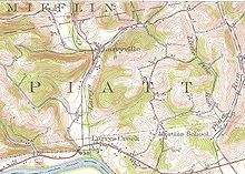 A 1953 United States Geological Survey quadrangle marking PA 84, the precedent to PA 287
This remained in place for only two years, and when the Pennsylvania Department of Highways redesignated highways across the entire commonwealth, the alignment of the U.S. Route 220 portion was redesignated as U.S. Route 111, while the entire alignment of Route 287 from the Larrys Creek to Tioga was redesignated as Route 84.[12] The entire alignment of Route 84 consisted of an intersection with U.S. Route 220 in Larrys Creek to U.S. Route 111 in Tioga, where the highway terminated.[13] In 1930, the concurrent piece of Legislative Route 4 was decommissioned, and the alignment of the highway remained as U.S. Route 111.[14] The portion from Tioga north remained as Route 111 until 1936, when the highway was renumbered to U.S. Route 15.[15] In that time, several intersections along Route 287 tied in with several former state highways. During the 1928 numbering, the intersection with Route 414 in Hoytville was designated as Route 893, a local intersection in Antrim was designated as Route 961, and the intersection in Somers Lane was designated as Route 826. The routes were decommissioned in 1955,[16] 1946,[17] and 1941 respectively.[18] After 1946, when a mass decommissioning of state highways occurred, Route 84 remained in place for another 15 years, when the plans arose for Interstate 84, which duplicated the state highway. Because of this duplication, Route 84 was reassigned as Route 287.[19]
U.S. Route 15 conversion
 Original northern terminus of Route 287 at Route 15 (the Appalachian Thruway)Main article: U.S. Route 15See also: Interstate 99
During the 1960s, plans developed to widen U.S. Route 15 for safety precautions. Construction progressed fast, reaching the Lycoming County line in 1968. At the time, Route 287 terminated at an intersection with U.S. Route 15 at the Hammond Reservoir. Ten years later, Route 15 was completed up to Tioga, and that year, the Pennsylvania Department of Transportation extended Route 287 to the new interchange.[20] At that point, U.S. Route 15 followed the northernmost alignment of PA 287 to Lawrenceville. This interchange was completed in late 2000 with an opening ceremony by then-governor Tom Ridge.[21] With the proposal for the brand new Interstate 99 following U.S. Route 15's alignment,[22] construction was upgraded once again, and a new alignment for U.S. Route 15 was started in 2005. The alignment was constructed for the final 5 miles (8.0 km) from Tioga to the state line. With the alignment's completion, Route 15 was realigned onto the newly opened freeway on October 1, 2008. The entire project cost $102 million (2008 USD), including one new interchange and the completion of the Route 287 interchange in Tioga.[23]
Route description
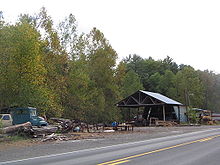 Sawmill along PA 287 in Mifflin Township
Lycoming County
Route 287 begins at an interchange with westbound U.S. Route 220 in the Piatt Township community of Larrys Creek. The route heads north, following a former plank road through the rural areas to the west of Williamsport. After a while, the roadway becomes moderately developed, following residential houses for a short distance. The route enters the community of Larrysville, where the route turns to the northwest through a line of forests. Route 287 intersects with Zinck Road, where the roadway becomes highly developed, following the route past residential homes and a large factory. The route crosses through a small patch of forests and enters Mifflin Township, where it intersects with Pennsylvania Route 973. Route 973 becomes concurrent with Route 287 here, entering the community of Salladasburg, where the two highways fork. Route 287 continues northward on the right-of-way, while Route 973 heads to the northeast along Main Street. At an intersection with Dochter Street, a connector to Route 973, Route 287 turns to the northwest and leaves Salladasburg.[24]
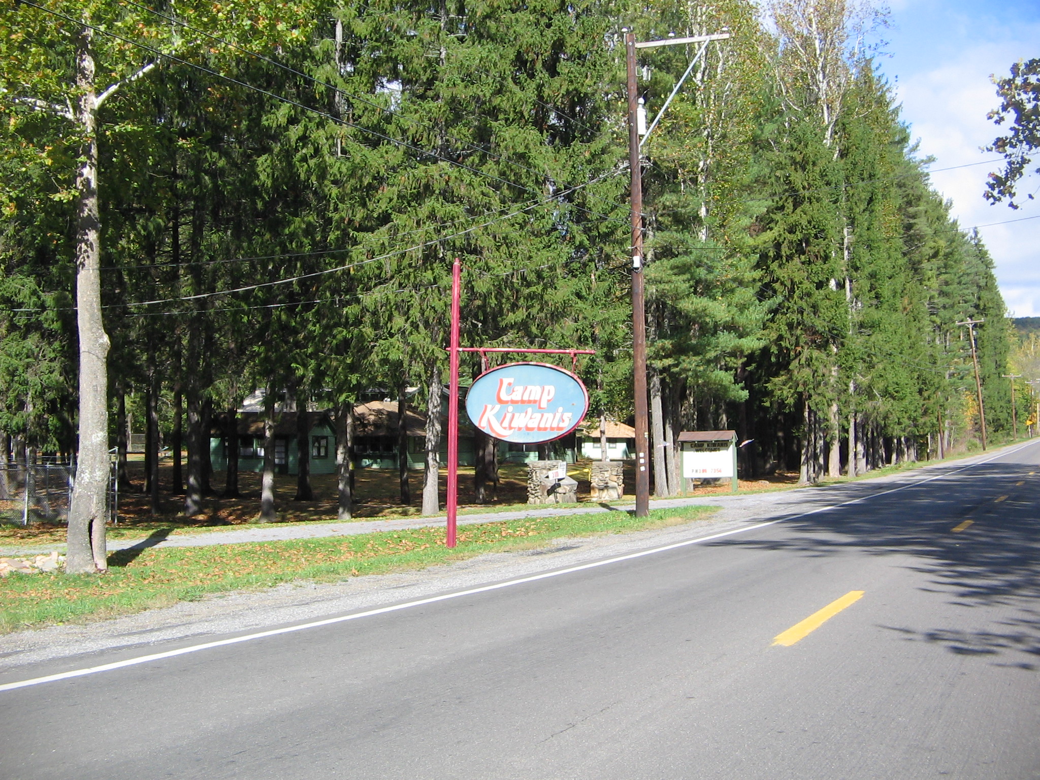
 Sign along PA 287 for Camp Kiwanis in Salladasburg
Route 287 continues northward after leaving Salladasburg, paralleling Route 973 for a short distance until the two highways turn away. Route 287 heads northward, passing through deep patches of forests. This alignment and surroundings remain the same for several miles, passing a few local roads. The deep forests begin to clear as the highway enters the community of Brookside. In Brookside, Route 287 winds along a deep field, intersecting with the southern terminus of Pennsylvania Route 184, which heads to the northeast. The route turns to the northwest, paralleling with Hughes Road, which merges in soon after. The highway continues northward in the fields north of Brookside until after Hughes Road, where it enters deep forests once again. Route 287 winds around curves, until the intersection with Lick Run Road, where it turns to the northwest, entering the isolated community of English Center. In English Center, the route intersects with Little Pine Creek Road, where Route 287 turns to the north. The route returns to the deep forests, intersecting with Pennsylvania Route 284. Route 287 turns to the northwest at that intersection, continuing through the deep forests. After several miles, the route turns to the northeast, passing to the west of a large pond. The forests began to clear as Route 287 enters the community of Pine Township, where the route continues northward, through fields and tree patches. At an intersection with Granger Lane, Route 287 crosses the county line into Tioga County.[24]
Tioga County
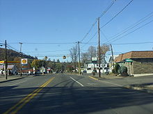
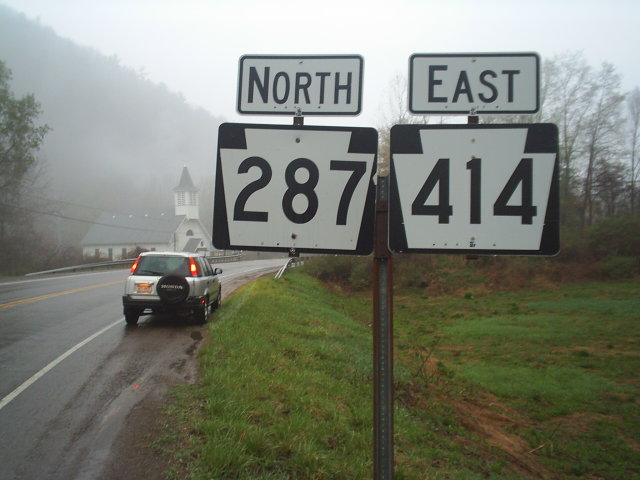
 Signage along PA 287 and PA 414 between Hoytville and Morris
After entering Tioga County, Route 287 continues to the north, entering the community of Texas, which mainly consists of large fields. The highway continues along this right-of-way, passing a large factory before entering the community of Mount Pleasant. At an intersection with Mount Pleasant Road, Route 287 turns to the northeast, bending around deep forests. The route crosses Hurney Hill Road, which is where the highway turns to the northwest. When the highway makes a curve to the northeast, Route 287 enters the community of Hoytville. In Hoytville, Route 287 intersects with Pennsylvania Route 414, which becomes concurrent with Route 287 for a distance. Routes 287 and 414 continue to the northeast, working its way along the residential homes in Hoytville. A short distance later, the highways enter the highly developed area in Hoytville in Morris Township. At an intersection in the center of the community, Route 287 turns to the north while Route 414 turns to the south, with the two highways splitting. Route 287 turns to the northeast, leaving the downtown area of Morris Township. After Morris Township, most of the route becomes surrounded by forests, except for a distance with residential homes following the northbound lanes. The surroundings return to the deep forests in both directions, with Route 287 continuing northward for several miles.[24]
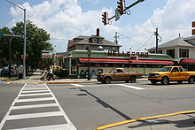
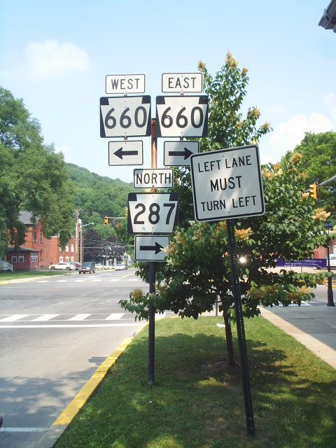
 Wellsboro signage for the PA 287 and PA 660 concurrency
Route 287 begins to parallel a waterway, entering the community of Antrim, which is surrounded mainly by forests. After Antrim, the highway continues northward through the deep forests for several miles, until entering the community of Knapp. In Knapp, Route 287 continues to the northeast, passing several fields and intersecting with a local road towards Broughton Hollow. At an intersection with Dean Hill Road, the highway turns to the northeast through the fields, entering Coolidge Hollows, a small farming community. At an intersection with Sweetbriar Road, Route 287 turns to the north, passing some homes before turning to the northeast into the farmlands once again. Approaching the intersection with Shumway Hill Road, the highway makes a gradual bend to the northwest, passing a large pond to the west, where it gains the name of Central Avenue as the route enters the community of Wellsboro. Route 287 heads along Central Avenue through a highly developed business and residential community until the intersection with Pennsylvania Route 660 (Main Street), where the highway turns eastward on a concurrency with Route 660. Routes 287 and 660 continue to the northeast along Main Street in the center of the community, where the two highways intersect with U.S. Route 6. At the U.S. Route 6 intersection, Route 660 turns along U.S. Route 6 East while Route 287 continues along U.S. Route 6 Westbound. Routes 6 and 287 head to the northeast through the community center, passing to the east of Wellsboro Cemetery before the two highways turn to the northwest along Tioga Street. At an intersection with Hillboldt Road, Route 287 and Route 6 leave Wellsboro. The two highways enter Stokesdale, a residential community before a fork in the highway, with Route 6 turning towards the west and Route 287 towards the north.[24]
Route 287, after the split with Route 6, heads to the northeast, entering the community of Wellsboro Junction. Wellsboro Junction is mainly fields, with the route heading as the main highway. After passing a few factories, Route 287 turns to the northeast and out of Wellsboro Junction. The highway passes a large pond, as well as a few residential homes. Route 287 continues along the rural alignment, entering a small community of residential homes and fields. The route continues to the northeast, entering the community of Middlebury Center, where it intersects with the terminus of Pennsylvania Route 249 and Mill Plank Road. The route turns to the northeast in the barren residential community. The route crosses over a river and heads on a straight northeast alignment, passing through a residential community. A short distance later, Route 287 turns to the northeast, paralleling a railroad. The route widens to three lanes where it passes a large field. Route 287 turns to the north, reaching the northern terminus of the nearby railroad. The route heads to the north, crossing the Tioga Dam along the Hammond Reservoir and entering the community of Crooked Creek.[24]
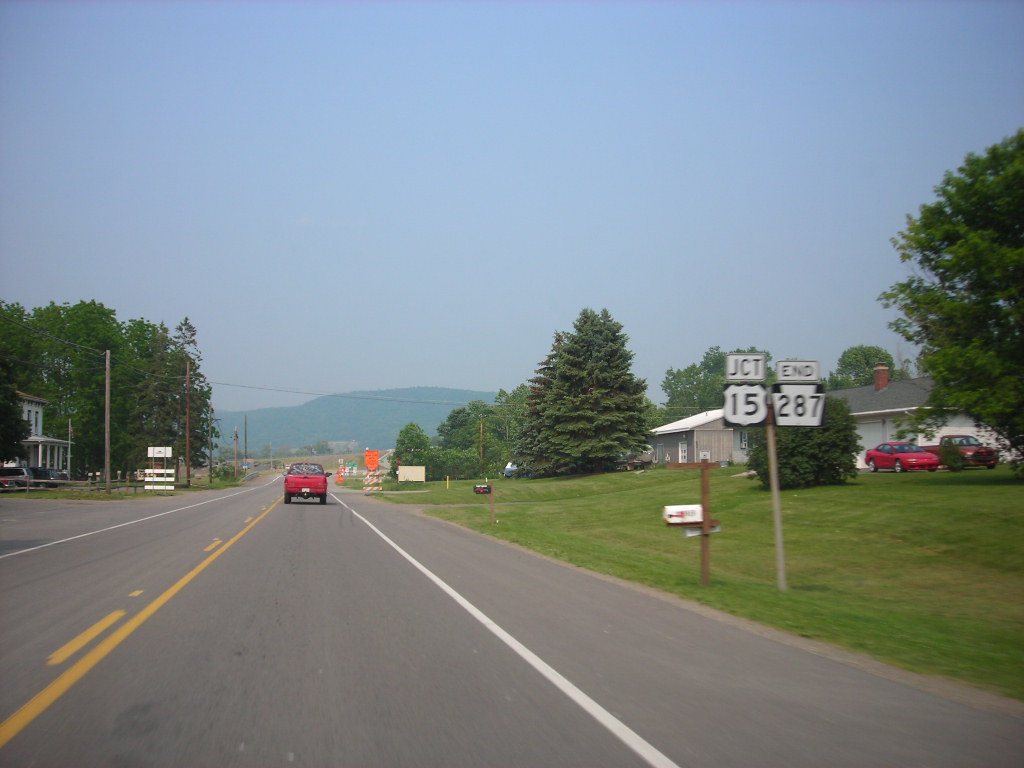
 PA 287 at PA 49 in Lawrenceville
The route continues northward along the eastern shore of the reservoir, until the northern end of the reservoir, where it turns to the east, entering the municipality of Tioga. In Tioga, Route 287 heads along Wellsboro Street in a moderately developed part of the community until turning to the north on North Main Street. Route 287 continues along North Main Street until leaving Tioga. A short distance later, Route 287 interchanges with U.S. Route 15 (the Appalachian Thruway). Route 287 continues along the former alignment of Route 15 into Mitchell Creek, a small community. The route heads northward, entering Beeman which consists of a local business center. In the center, Route 287 intersects with the western terminus of Pennsylvania Route 328. The route intersects with Somers Lane before entering the community of Somers Lane, which is a barren area. The route heads to the northwest along the Tioga River, crossing another railroad, and soon over the river. After the river, Route 287 enters the municipality of Lawrenceville, where the highway intersects with Pennsylvania Route 49's eastern terminus. At that intersection, Route 287 terminates, with the right-of-way continuing the short distance as State Route 1015 to the New York state line.[24][25]
Major intersections
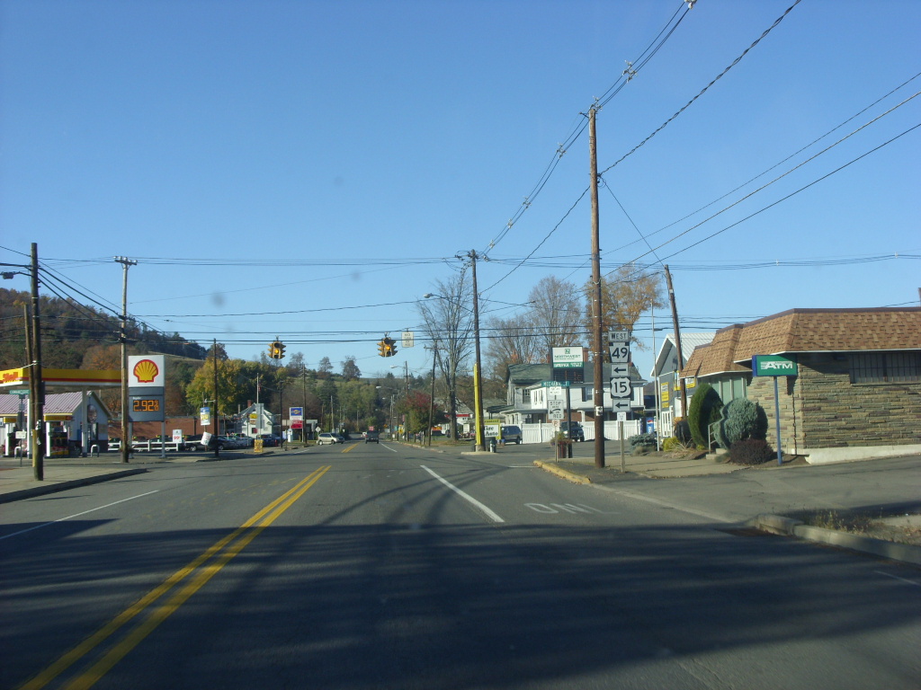
 US 6 and PA 287 near the Wellsboro Diner
County Location Mile Destinations Notes Lycoming Piatt Township 0.0 US 220Interchange, southern terminus of PA 287 Salladasburg 3.6  PA 973 west
Southern end of concurrency with PA 973 3.7 PA 973 eastNorthern end of concurrency with PA 973 Brookside 12.6  PA 184
Western terminus of PA 184 Pine Township 17.6  PA 284
Western terminus of PA 284 Tioga Hoytville 27.7  PA 414 west
South end of concurrency with PA 414 Morris Township 28.3 PA 414 eastNorth end of concurrency with PA 414 Wellsboro 40.1  PA 660 west (Main Street)
South end of concurrency with PA 660 40.2  US 6 east / PA 660 east (East Avenue)
North end of concurrency with PA 660, southern end of concurrency with US 6 Delmar Township 42.8 US 6 westNorthern end of concurrency with US 6 Middlebury Center 47.5  PA 249
Southern terminus of PA 249 Tioga Township 58.6  US 15
US 15Interchange Tioga Junction 60.9  PA 328
Western terminus of PA 328 Lawrenceville 63.9 PA 49Eastern terminus of PA 49, northern terminus of PA 287 1.000 mi = 1.609 km; 1.000 km = 0.621 mi References
- ^ National Highway Planning Network GIS data. 2008. Federal Highway Administration. 2008.
- ^ a b History of Tioga County, Pennsylvania. New York: W. W. Munsell & Company. 1883.
- ^ a b Beitel, Calvin Gustavus (1874). A digest of titles of corporations chartered by the legislature of Pennsylvania, between the years 1700 and 1873 inclusive: giving the dates of acts of incorporation, with the several supplements thereto, with a reference to the pages of the pamphlet laws, where they may be found (2 ed.). J. Campbell & Son. p. 412. http://books.google.com/?id=Zr0ZAAAAYAAJ&dq=Gulph%20Plank%20Road&pg=PA442.
- ^ Landis, Milton W. (Summer 1967). "The Larrys Creek Plank Road". The Journal of the Lycoming County Historical Society IV, (1). Archived from the original on 2005-11-18. http://web.archive.org/web/20051118154755/http://www.lycoming.org/lchsmuseum/Articles/VOLIV1.htm. Retrieved 2008-02-20.
- ^ Landis, Milton W. (October 1966). "The Larrys Creek Covered Bridge in Cogan House Township". Now and then (The Journal of the Muncy, Pennsylvania Historical Society) XV (5): 258.
- ^ Pennsylvania Department of Highways (1911) (PDF). Map of State Roads (Map). ftp://ftp.dot.state.pa.us/public/pdf/BPR_pdf_files/Maps/Statewide/Historic_OTMs/1911.pdf. Retrieved July 24, 2009.
- ^ Pennsylvania Department of Highways (1915) (PDF). Tioga County (Map). ftp://ftp.dot.state.pa.us/public/pdf/BPR_PDF_FILES/Maps/Type_10_GHS_Historical_Scans/Tioga_1915.pdf. Retrieved July 24, 2009.
- ^ Pennsylvania Department of Highways (1916) (PDF). Lycoming County (Map). ftp://ftp.dot.state.pa.us/public/pdf/BPR_PDF_FILES/Maps/Type_10_GHS_Historical_Scans/Lycoming_1916.pdf. Retrieved July 24, 2009.
- ^ "U.S. Route 22 - The William Penn Highway". United States Department of Transportation. 2009. http://www.fhwa.dot.gov/infrastructure/us22.cfm. Retrieved July 24, 2009.
- ^ Pennsylvania Department of Highways (1925). Map Showing Pennsylvania State Highway Routes (Map). Cartography by Pennsylvania Department of Highways.
- ^ United States Department of Transportation (1926). Overview map of all proposed U.S. Routes (Map). Cartography by United States Department of Transportation. http://www.okladot.state.ok.us/hqdiv/p-r-div/maps/misc-maps/1926us.pdf. Retrieved July 24, 2009.
- ^ Pennsylvania Department of Highways (1928). Map Showing Pennsylvania State Highways (Map).
- ^ Pennsylvania Department of Highways (1929). Map Showing Pennsylvania State Highways (Map).
- ^ Pennsylvania Department of Highways (1930). Tourist Map of Pennsylvania State Highways (Map). Cartography by Pennsylvania Department of Highways.
- ^ Pennsylvania Department of Highways (1937). Official Pennsylvania Road Map (Map). Cartography by Pennsylvania Department of Highways.
- ^ Pennsylvania Department of Highways (1955). Pennsylvania Official Road Map (Map).
- ^ Pennsylvania Department of Highways (1946). Pennsylvania Official Road Map (Map).
- ^ Pennsylvania Department of Highways (1941). Pennsylvania Official Road Map (Map).
- ^ Pennsylvania Department of Highways (1961). Pennsylvania (Map).
- ^ Kitsko, Jeff. "U.S. Route 15 Upgrade Map". PennDOT. http://www.pahighways.com/interstates/I99-US15upgrading_files/I99-US15upgrading_frames.htm. Retrieved July 24, 2009.
- ^ "PA Gov Ridge Administration to Open Newest Section of Route 15 in Tioga County". PR Newswire. November 2, 2000.
- ^ "Map Makers Must Draw New I-99". Centre Daily Times. December 1, 1995.
- ^ "Rendell administration dedicates Route 15 project; officials from two states celebrate opening of nearly seven miles of new highway". Pennsylvania Department of Transportation. October 1, 2008. http://www.dot.state.pa.us/penndot/districts/district3.nsf/D3Secondary?OpenFrameSet&Frame=main&Src=%2Fpenndot%2Fdistricts%2Fdistrict3.nsf%2FNRP%3FReadForm%26AutoFramed. Retrieved July 24, 2009.
- ^ a b c d e f Yahoo! Inc. Yahoo! Maps – Overview map of Pennsylvania Route 287 (Map). Cartography by NAVTEQ. http://maps.yahoo.com/#mvt=m&lat=41.714223&lon=-77.282789&zoom=11&q1=41.219538%2C-77.220734&q2=41.544373%2C-77.28545&q3=41.857868%2C-77.23584&q4=41.930463%2C-77.113703&q5=41.999612%2C-77.12705. Retrieved July 21, 2009.
- ^ Pennsylvania Department of Transportation (2008) (PDF). Official Pennsylvania Department of Transportation Map of Tioga County, showing PA 287 (Map). ftp://ftp.dot.state.pa.us/public/pdf/BPR_pdf_files/Maps/GHS/Roadnames/tioga_GHSN.PDF. Retrieved July 24, 2009.
External links

Wikimedia Commons has media related to: Categories:- State highways in Pennsylvania
- Transportation in Lycoming County, Pennsylvania
- Transportation in Tioga County, Pennsylvania


Wikimedia Foundation. 2010.