- Lockeport, Nova Scotia
Infobox Settlement
official_name = Lockeport, Nova Scotia
other_name =
native_name =
nickname =
settlement_type = Town
motto =
imagesize =
image_caption =
flag_size =
image_
seal_size =
image_shield =
shield_size =
city_logo =
citylogo_size =
mapsize =
map_caption =
mapsize1 =
map_caption1 =
image_dot_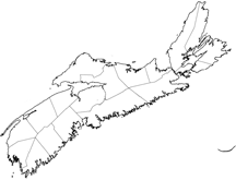
dot_mapsize = 250px
dot_map_caption =Location of Lockeport, Nova Scotia
dot_x =39 |dot_y =170
pushpin_
pushpin_label_position =
pushpin_map_caption =
pushpin_mapsize =
subdivision_type = Country
subdivision_name = CAN
subdivision_type1 = Province
subdivision_name1 = NS
subdivision_type2 = Municipality
subdivision_name2 =Shelburne County
subdivision_type3 =
subdivision_name3 =
subdivision_type4 =
subdivision_name4 =
government_footnotes =
government_type =
leader_title =Mayor
leader_name =Darian Huskilson
leader_title1 = Governing Body
leader_name1 =Town of Lockeport Council
leader_title2 =
leader_name2 =
leader_title3 =
leader_name3 =
leader_title4 =
leader_name4 =
established_title = Founded
established_date = 1762
established_title2 = Incorporated
established_date2 =February 26 ,1907
established_title3 =
established_date3 =
area_magnitude =
unit_pref =
area_footnotes =
area_total_km2 = 2.32
area_land_km2 =
area_water_km2 =
area_total_sq_mi =
area_land_sq_mi =
area_water_sq_mi =
area_water_percent =
area_urban_km2 =
area_urban_sq_mi =
area_metro_km2 =
area_metro_sq_mi =
population_as_of = 2001
population_footnotes =
population_note =
population_total = 701
population_density_km2 = 302.1
population_density_sq_mi =
population_metro =
population_density_metro_km2 =
population_density_metro_sq_mi =
population_urban =
population_density_urban_km2 =
population_density_urban_sq_mi =
population_blank1_title =
population_blank1 =
population_density_blank1_km2 =
population_density_blank1_sq_mi =
timezone = AST
utc_offset = -4
timezone_DST = ADT
utc_offset_DST = -3
latd=43.711754 |latm= |lats= |latNS=N
longd=-65.11225 |longm= |longs= |longEW=W
elevation_footnotes =
elevation_m = 0-3
elevation_ft = 0-10
postal_code_type = Postal code
postal_code = B0T 1L0
area_code = 902
blank_name =Telephone Exchange
blank_info =656
blank1_name =Median Earnings*
blank1_info =$20,824
website = http://www.lockeport.ns.ca
footnotes = *Median household income, 2000 ($) (all households)Part of a series about Places in Nova Scotia Lockeport is a
town inShelburne County ,Nova Scotia ,Canada .Lockeport is located on a near island in the Ragged Islands Bay of the South Shore. The area around the harbour is known to be as "Ragged Islands." In 1762, a native of
Rhode Island came to Liverpool and was listed as the proprietor of the township in November of 1764. Shortly afterward, he, Joseph Hardy and Josiah Churchill founded the settlement which was known as Locke's Island. Inhabitants renamed it "Lockeport," and in 1907, it was incorporated with Churchill Locke as the first mayor. As of 2001, the population is 701. The main industries areFishing andTourism .One of the beaches of Lockeport,
Crescent Beach , was on the back of the 1954 series of the Canadian 50 dollar bill.The community has a 125 year history of Icelandic settlement.Communications
*
Postal Code : B0T 1L0
*Telephone exchange : 902-656Demographics
*Total Population: 701 in 2001 census
*Total Dwellings: 322
*Total Land Area: km2 to mi2|2.32|abbr=yes
*No. of Buinesses: 10References
External links
* [http://www.lockeportseaderby.ca/ The Annual Lockeport Sea Derby ]
* [http://www.geocities.com/beachcentre/ Crescent Beach Centre ]
* [http://www.lockeport.ns.ca/index.html Town of Lockeport Official Info page.]
* [http://www.gov.ns.ca/nsarm/cap/places/page.asp?ID=367 Public Archives of Nova Scotia]
* [http://www.nslps.com/lights/lighthouse_page_01.asp?ID=80&SP=1&M=Intro Carter Island Lighthouse] .
* [http://www.nslps.com/lights/lighthouse_page_01.asp?ID=213 Gull Rock Lighthouse] .
* [http://lockeport.ednet.ns.ca/ Lockeport Regional high School]
* [http://www12.statcan.ca/english/profil01/CP01/Details/Page.cfm?Lang=E&Geo1=CSD&Code1=1201009&Geo2=PR&Code2=12&Data=Count&SearchText=lockeport&SearchType=Begins&SearchPR=12&B1=All&Custom= Statistics Canada Profile]
* [http://www.nova-scotia-icelanders.ednet.ns.ca/lockeport.html The Icelandic Memorial Society ]
Wikimedia Foundation. 2010.