- Children's Discovery Museum (VTA)
-
Children's Discovery Museum
VTA light rail stationStation statistics Address 180 Woz Way
San Jose, CaliforniaCoordinates 37°19′39″N 121°53′36″W / 37.32747°N 121.893429°WCoordinates: 37°19′39″N 121°53′36″W / 37.32747°N 121.893429°W Lines Alum Rock–Santa TeresaConnections Bus Route 23 Other information Opened 1987 Accessible 
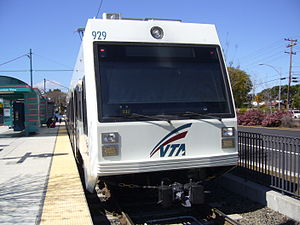
Owned by VTA Services Preceding station VTA Light Rail Following station toward Alum RockAlum Rock–Santa Teresa toward Santa TeresaChildren's Discovery Museum is a light rail station operated by Santa Clara Valley Transportation Authority. The station has a center platform with two trackways (one on each side). Children's Discovery Museum station is served by the Alum Rock–Santa Teresa line.
Contents
Location
Address: 180 Woz Way, San Jose, California
Nearest cross-street: West San Carlos StreetStation amenities
- Payphone
- Wheelchair accessible
Nearby points of interest
- Children's Discovery Museum of San Jose - adjacent to station - 180 Woz Way
- Guadalupe River Park and Gardens trailhead - 1 block away - West San Carlos Street east of Woz Way
Connecting transit
VTA Bus Route 85, which previously served this station, was discontinued on January 14, 2008, as a result of updates to VTA bus service.
External links
VTA Light Rail Stations Almaden • Alum Rock • Bascom • Baypointe • Bayshore/NASA • Berryessa • Blossom Hill • Bonaventura • Borregas • Branham • Capitol • Champion • Children's Discovery Museum • Cisco Way • Civic Center • Component • Convention Center • Cottle • Cropley • Crossman • Curtner • Downtown Campbell • Downtown Mountain View • Evelyn • Fair Oaks • Fruitdale • Gish • Great America • Great Mall/Main • Hamilton • Hostetter • I-880/Milpitas • Japantown/Ayer • Karina • Lick Mill • Lockheed Martin • McKee • Metro/Airport • Middlefield • Moffett Park • Montague • Oakridge • Ohlone/Chynoweth • Old Ironsides • Orchard • Paseo de San Antonio • Penitencia Creek • Race • Reamwood • River Oaks • Saint James • San Jose Diridon • San Fernando • Santa Clara • Santa Teresa • Snell • Tamien • Tasman • Vienna • Virginia • Whisman • WinchesterConnecting services Other Categories:- Santa Clara Valley Transportation Authority light rail stations
- Santa Clara Valley Transportation Authority bus stations
- Railway stations in San Jose, California
- Tram stubs
- California railway station stubs

Wikimedia Foundation. 2010.