- Çukurova
-
This article is about a region in Turkey. For the district municipality in Adana, see Çukurova, Adana.
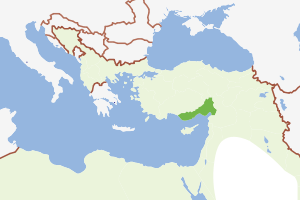
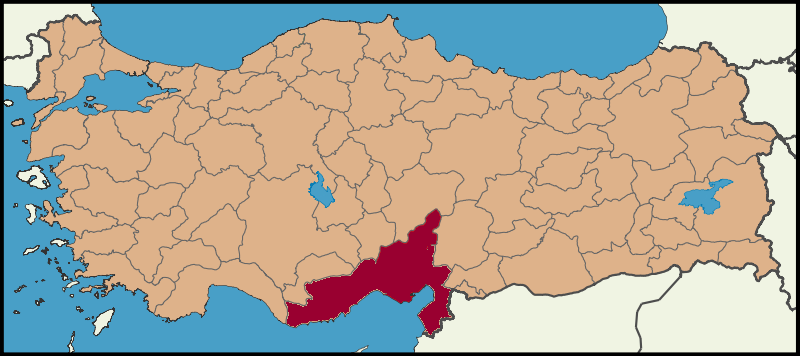
Çukurova — Region — Location of Çukurova within Turkey
Coordinates: 36°52′N 35°29′E / 36.867°N 35.483°ECoordinates: 36°52′N 35°29′E / 36.867°N 35.483°E Country  Turkey
Provinces Mersin, Adana, Osmaniye, Hatay Area - Total 38,585.16 km2 (14,897.8 sq mi) Population (2010) - Total 5,692,916 - Density 147.54/km2 (382.1/sq mi) - Urban 4,207,626 - Rural 1,485,290 Time zone EET (UTC+2) - Summer (DST) EEST (UTC+3) Postal code prefixes 33xxx, 01xxx, 80xxx, 31xxx Area code(s) 324, 322, 328, 326 Çukurova (Turkish pronunciation: [tʃukuɾova]; çukur is Turkish for "depression", ova for "plains", rendering Çukurova roughly "Low Plain"), historically known as Cilicia, is a geographic, economic and cultural region in south-central Turkey, covering the provinces of Mersin, Adana, Osmaniye and Hatay. With a population of almost 5.7 million, it is one of the largest population concentrations in Turkey.
Çukurova starts from Anamur at the west, extending east along the Mediterranean, stretching as far north as Tufanbeyli, wrapping around Gulf of İskenderun, turning south at Erzin and finally terminating at Yayladağı on the border of Syria. The core area is Çukurova plain (formerly Cilicia Pedia), covering the area of Mersin on the west, Kozan on the north, Osmaniye on the east and the Mediterranean on the south. Adana-Mersin Metropolitan Area is the business and cultural center of Çukurova.
Most of the Çukurova region is a large stretch of flat, fertile land which is among the most agriculturally productive areas of the world. Throughout history, Çukurova was a gateway from Europe to the Middle East and, being the shortest access point to the Mediterranean from the northern Middle East and Central Asia, it is a transportation hub, with its two major seaports and oil terminal.
Contents
History
For the ancient and medieval history of Çukurova, see Cilicia.
 Vilayet of Adana is similar to today's Çukurova
When Seljuq Turks captured the region, many Turkmens, including Oğuz clans of Yureğir, Afshar and Chepni settled in the northern parts of the region under the direction of Ramadanids. Those who preserved the nomadic lifestyle were named Yörüks. As of the 18th century, the Ottoman Empire pursued a policy aimed at settling these populations in permanent settlements; the process was more or less complete in the 19th century, although it involved many difficulties and much tension and drama.
Between the 1832 Kütahya Agreement leaving the territorial gains acquired by Ibrahim Pasha of Egypt to his administration till the 1841 London Conference convened to settle the question, Çukurova remained under the rule of the Khedive of Egypt. Although the period of Egyptian rule, motivated by Egypt's perennial need, timber for the navy, was relatively short, it left important marks in such areas as the introduction of industrial-scale cotton production and new arrivals into the population tissue of the region. Cottonpickers of Çukurova still start their workday with prayers for the memory of İbrahim Pasha, and the locally influent Menemencioğlu family, with notable descendants till our day, including Turkey's foreign minister during the Second World War, Numan Menemencioğlu, rose to notability by acting as middlemen for the Pasha. Among other families still prominent in our day and that had risen with the cotton boom, Kozanoğlu, Güveloğlu, Kerimoğlu, Karsantıoğlu, Küçükalioğlu families can be cited.
In 1869, Vilayet of Adana (Adana Province) was incorporated after splitting up Aleppo Province.[1] Borders of the Vilayet of Adana is similar to today's Çukurova region.
The development of Mersin as a major part also took its start during the same period. As a result, the cities of the region became prominent centers of trade, farming and industry. Today, Adana is the 5th largest city of Turkey, and a vital center of many agricultural products such as cotton.
Geography
Historically, the region was known as Kizuwatna by the Hittites and it was divided into two parts, Uru Adaniya (flat Cilicia) and western Cilicia (Tarza), which was also known as the mountainous Cilicia. The gates which allow passage from Çukurova into the Central Anatolian Plateau through the Taurus Mountains, the Cilician Gates of antiquity, is called Gülek Pass today. Belen Pass which connects the region to the southeast (to the modern district of Dörtyol in Hatay Province) and Sertavul Pass constitute other important points of passage. The region is included in the Mediterranean region of Turkey, and it borders Central Anatolia (historical Cappadocia) to the north, and Southeastern Anatolia to the east.
Climate
The climate of Çukurova shows significant differences at the mountains and the lower plains. At the lower plains, the climate reflects a typical Mediterranean; summers are hot and dry, winters are warm and rainy. In the coldest month (January), the average temperature is 9°C, and in the warmest month (August), the average temperature is 28°C. Mountains of Çukurova have an inland climate with snowy winters. The average annual precipitation in the region is 647mm and the average number of rainy days in a year is 76. Mersin and surrounding areas have the highest average temperature in Çukurova. Mersin also has a high annual precipitation (1096mm) and 85 rainy days in a year.
Geology
Mountains of Çukurova are formed by ancient limestones, conglomerate, marlstone and similar materials. The lower plain is the largest alluvial plain in Turkey. Expansion of limestone formations and fourth era alluvials brought by the rivers Seyhan and Ceyhan, formed the plains of the region over the course of time.
Akyatan, Akyayan, Salt Lake, Seven lakes at Aladağ, and Karstik Dipsiz lake near Karaisalı are the lakes of the region. The reservoirs in the region are Seyhan, Çatalan, Yedigöze, Kozan and Mehmetli.
The major rivers in Çukurova are Seyhan, Ceyhan, Berdan (Tarsus), Asi and Göksu.
- Seyhan River emerges from the confluence of Zamantı and Göksu rivers which originate from Kayseri Province and flows into the Gulf of Mersin. The river is 560 km long.
- Ceyhan River emerges from the confluence of Aksu and Hurman rivers and flows into Cape Hürmüz at the Gulf of İskenderun. It is 509 km long and it forms the Akyayan, Akyatan and Kakarat lakes before flowing into the Mediterranean.
- Berdan River originates from the Taurus Mountains and flows into the Mediterranean, south of Tarsus.
- Göksu river originates from the Taurus Mountains and flows into the Mediterranean, 16 km southeast of Silifke. It forms the delta of Göksu, including Akgöl Lake and Paradeniz Lagoon.
- Asi River (Orontes) rises in the great springs of Labweh on the side of the Beqaa Valley and it runs due north, parallel with the coast and flows into the Mediterranean just south of the little port of Samandağı.
Governance
The Çukurova region is split into 4 administrative provinces: Mersin, Adana, Osmaniye and Hatay. Each province is governed by the Central Government in Ankara through an appointed Provincial Governor. Provinces are then divided into districts governed by the District Governors who are under the Provincial Governors.
Since all 4 provinces are economically and geographically inter-dependent, with the current governing structure, regional planning is limited within provinces and does not cover all of Çukurova. This creates conflict on creating regional investment plans especially between Adana and Mersin provinces. Recently, co-operation among the cities in Çukurova is improving. Municipalities in Çukurova form a union, Çukurova Municipalities Union, to conduct projects that will benefit the whole region. Community and business organizations also form regional unions. Tourism associations of the cities conduct common promotions to attract tourists to the region.
Divisions
Provinces and districts
Provinces & Districts in Çukurova (from West to East):
- Mersin Province: Anamur, Bozyazı, Aydıncık, Gülnar, Mut, Silifke, Erdemli, Mersin (composed of Mezitli, Yenişehir Toroslar, Akdeniz), Çamlıyayla, Tarsus
- Adana Province: Adana (composed of Seyhan, Çukurova, Yüreğir, Sarıçam, Karaisalı), Pozantı, Karataş, Ceyhan, İmamoğlu, Aladağ, Kozan, Feke, Saimbeyli, Tufanbeyli
- Osmaniye Province: Sumbas, Kadirli, Toprakkale, Düziçi, Osmaniye, Hasanbeyli, Bahçe
- Hatay Province: Erzin, Dörtyol, Hassa, İskenderun, Belen, Kırıkhan, Samandağ, Antakya, Reyhanlı, Kumlu, Yayladağı, Altınözü
Municipalities
Locally elected municipal governments take care of urban planning and infrastructure. Greater municipality law came into effect in 1989 to bring better management to large urban areas. In Çukurova, the cities of Adana and Mersin are governed by Greater municipalities. In the city of Adana, there are 5 district municipalities and in the city of Mersin, there are 4 district municipalities.
A community with a population over 2000 forms a municipality. Communities that have less than 2000 people are governed by Village mukhtar with the support from State Rural Services (Köy Hizmetleri). See List of Municipalities in Çukurova for a list of all municipalities.
Economy
Çukurova is well known for the vast fertile land and highly productive agriculture. The region is also industrialized; Tarsus, Adana and Ceyhan host numerous plants. Mersin and İskenderun seaports provide transportation of goods manufactured in Central, South and Southeast Anatolia. Ceyhan is becoming an Energy Hub, hosting oil, natural gas terminals as well as refineries and shipbuilders.
Natural resources
Agriculture
Çukurova plain has one of the most fertile soil in the world in which 3 harvests can be taken each year. The region has the second richest flora in the world and it is the producer of all agricultural products of Turkey except hazelnut and tobacco. Çukurova leads Turkey in soy, peanuts and corn harvest and is a major producer of fruits and vegetables. Half of Turkey's citrus export is from Çukurova. Anamur is the only sub-tropical area of Turkey where bananas, mango, kiwi and other sub-tropical produce can be harvested.
Çukurova is the second largest honey producer in Turkey after the Muğla–Aydın region.[2] Samandağ, Yumurtalık, Karataş and Bozyazı are some of the towns in the region where fishing is the major source of income. Gray mullet, red mullet, sea bass, lagos, calamari and gilt-head bream are some of the most popular fish in the region. There are aquaculture farms in Akyatan, Akyağan, Yumurtalık lakes and at Seyhan Reservoir. While not as common as other forms of agriculture, dairy and livestock are also produced throughout the region.
Mining
- Zinc and Lead: Kozan-Horzum seam is the major source.
- Chrome is found around Aladağlar.
- Baryte resources are around Mersin and Adana.
- Iron is found around Feke and Saimbeyli.
- Asbestos mines are mostly in Hatay Province.
- Limestone reserves are very rich in Çukurova. The region is home to four lime manufacturing plants.
- Pumice resources are the richest in Turkey. %14 of country's reserves are in Çukurova.
Manufacturing
Çukurova is one of the first industrialized regions of Turkey. With the improvements in agriculture and the spike of agricultural yield, agriculture-based industries are built in large numbers. Today, the manufacturing industry is mainly concentrated around Tarsus, Adana and Ceyhan. Textile, leather tanning and food processing plants are plentiful. İsdemir is a large steel plant located in İskenderun. Temsa is one of the largest manufacturing companies in the region and the only automotive OEM, employing more than 2500. Sabancı Holding and Çukurova Holding are among the largest Turkish industrial conglomerates, both founded in the Çukurova region and still operating numerous manufacturing companies in Adana and Tarsus.
The petrochemical industry is rapidly developing in the region with the investments around the Ceyhan Oil Terminal. Petroleum refineries are being built in the area. Ceyhan is also expected to host the shipbuilding industry.
Commerce
Adana is the commercial center of the region where many of the public and private institutions have their regional offices. Mersin and Antakya are also home to regional offices of public institutions. Many industry fairs and congresses are held in the region at venues such as the TÜYAP Congress and Exhibition Center in Adana and the Mersin Congress Center.
Mersin is the logistics center of the region, hosting numerous logistics companies.
Mersin Seaport is the third largest seaport in Turkey, after İstanbul and İzmir. There are 45 piers in the port. The total area of the port is 785 square kilometres (194,000 acres), and the capacity is 6,000 ships per year.
İskenderun Seaport is used mostly for transfers to Middle East and Southeastern Turkey.[3]
Ceyhan Oil Terminal is a marine transport terminal for the Baku–Tbilisi–Ceyhan pipeline (the "BTC"), the Kirkuk-Ceyhan Oil Pipeline, the planned Samsun-Ceyhan and the Ceyhan-Red Sea pipelines. Ceyhan will also be a natural gas terminal for a planned pipeline to be constructed parallel to the Kirkuk-Ceyhan oil pipeline, and for a planned extension of the Blue Stream Gas Pipeline from Samsun to Ceyhan.
Dörtyol Oil Terminal is a marine transport terminal for Batman-Dörtyol oil pipeline which started operating in 1967 to market Batman oil. The pipeline is 511 km long and has an annual capacity of 3.5 million tons.[4]
Tourism
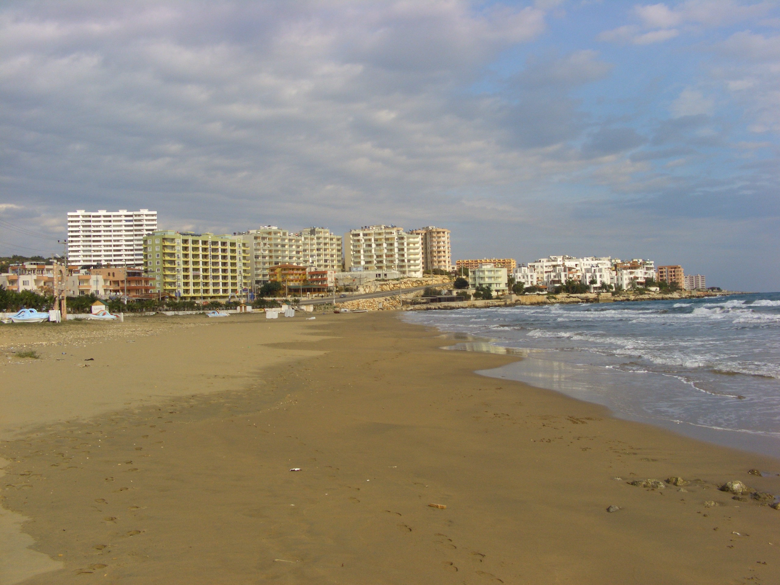
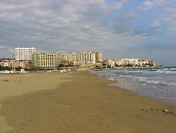 Yemiskumu Beach (Ayaş, Erdemli district of Mersin Province)
While the region has a long coastline, international tourism is not at the level of the neighboring Antalya Province. There are a small number of hotels between Erdemli and Anamur that attracts tourists. Çukurova Tourism is mostly cottage tourism serving the Çukurova locals as well as residents of Kayseri, Gaziantep and surrounding areas. Between Silifke and Mersin, high-rise and low-rise cottages line the coast, leaving almost no vacant land. The coastline from Mersin to Karataş is mostly farmland. This area is zoned for resort tourism and is expected to have a rapid development within the next 20 years. Karataş and Yumurtalık coasts are home to cottages with a bird conservatory between the two areas. Arsuz is a seaside resort that is mostly frequented by Antakya and İskenderun residents.
Plateaus on the Taurus mountains are cooler escapes for the locals who wants to chill out from hot and humid summers of the lower plains. Gözne and Çamlıyayla (Namrun) in Mersin Province, Tekir, Bürücek and Kızıldağ in Adana Province, Zorkun in Osmaniye Province and Soğukoluk in Hatay Province are the popular high plain resorts of Çukurova which are often crowded in summer. There are a few hotels and camping sites in the Tekir plateau.
Lying at a crossroads of three major religions, namely Judaism, Christianity and Islam, the region is home to numerous landmarks that are important for people of faith. Tarsus is the birthplace of St. Paul, who returned to the city after his conversion. The city was a stronghold of Christians after his death. Ashab-ı Kehf cavern, one of the locations claimed to the be resting place of the legendary Seven Sleepers, holy to Christians and Muslims, is located north of Tarsus. Antakya is another destination for the spiritual world, where the followers of Jesus Christ were first called Christians. It is the home of Saint Peter, one of the 12 saints of Jesus.[5]
The region is a popular destination for thermal springs. Hamamat Thermal Spring, located on midway from Kırıkhan to Reyhanlı, has a very high sulphur ratio, making it the second in the world after a thermal spring in India.[6] It is the largest spa in the region and attracts many Syrians due to proximity. Haruniye Thermal Spring is located on the banks of the Ceyhan River near Düziçi town and has a serene environment. Thermal springs are a hot spot for people with rheumatism.[7] Kurttepe, Alihocalı and Ilıca mineral springs, all located in Adana Province, are popular for toxic cleansing. Ottoman Palace Thermal Resort & Spa in Antakya is one of Turkey's top resorts for revitalization.
Population
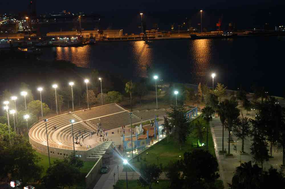
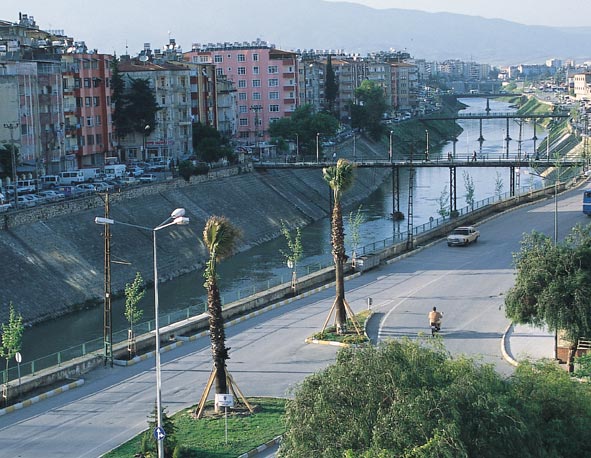
 Mersin Amphitheater overlooking the Mediterrenean Sea.
Çukurova is heavily populated due to its abundant resources, climate and plain geography. The population of Çukurova as of December 2010 is 5,692,916.[8]
Province Urban Rural Total Adana 1,836,432 248,793 2,085,225 Mersin 1,281,048 366,851 1,647,899 Hatay 743,439 737,132 1,480,571 Osmaniye 346,707 132,514 479,221 Total 4,207,626 1,485,290 5,692,916 Hatay is the most rural province of Çukurova. This is due to the mountainous geography of Hatay as well as the religiously and ethnically diverse culture. Hatay joined Turkey in 1939, and thus did not face the population exchanges of the 1920s. The only remaining ethnic Armenian village of Turkey, Vakıflı, is in Hatay. Adana Province is the most urbanized province, with most of the population centered in the city of Adana. Mersin Province has a larger rural population than Adana Province, owing to its long and narrow stretch of flat land in between the Taurus Mountains and the Mediterranean.
Urban areas
Settlements are well spread to all parts of Çukurova. Adana and Mersin are the largest cities in Çukurova and together with Tarsus and Ceyhan form the Adana-Mersin Metropolitan Area, which is the fourth largest metropolitan area in Turkey with a population of 3 million. The metropolitan area is home to half of the residents of Çukurova. Below is a list of cities in Çukurova with population over 50,000.
 The Orontes River flowing through Antakya
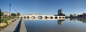 Taşköprü in Adana
City Population Adana[9] 1,591,518 Mersin [10] 843,429 Tarsus 238,276 Antakya[11] 213,581 İskenderun 201,183 Osmaniye[12] 198,836 Ceyhan 105,879 Kadirli 80,948 Kozan 76,864 Kırıkhan 71,580 Dörtyol 70,856 Reyhanlı 61,234 Silifke 53,151 Places of interest
Ancient sites
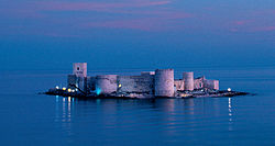 Kızkalesi(Korykos)
 Karatepe Hittite Fortress
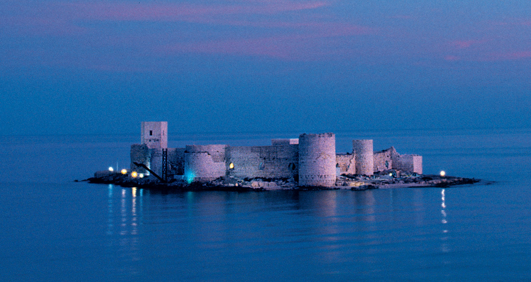
Kizkalesi (Maiden Castle), a fort on a small island across Kızkalesi township, was built during the early 12th century by Armenian kings of the Rubeniyan dynasty, to defend the city of Korykos (today Kızkalesi).
Heaven & Hell, situated on a large hill north of Narlıkuyu, consists of the grabens result from assoil of furrings for thousands of years. Natural phenomena of the grabens is named 'Hell & Heaven' because of the exotic effects on people. From an ancient path, 260 meter long mythological giant Typhon's cave can be accessible.[13]
The ancient Roman town of Soloi-Pompeiopolis, near the city of Mersin.
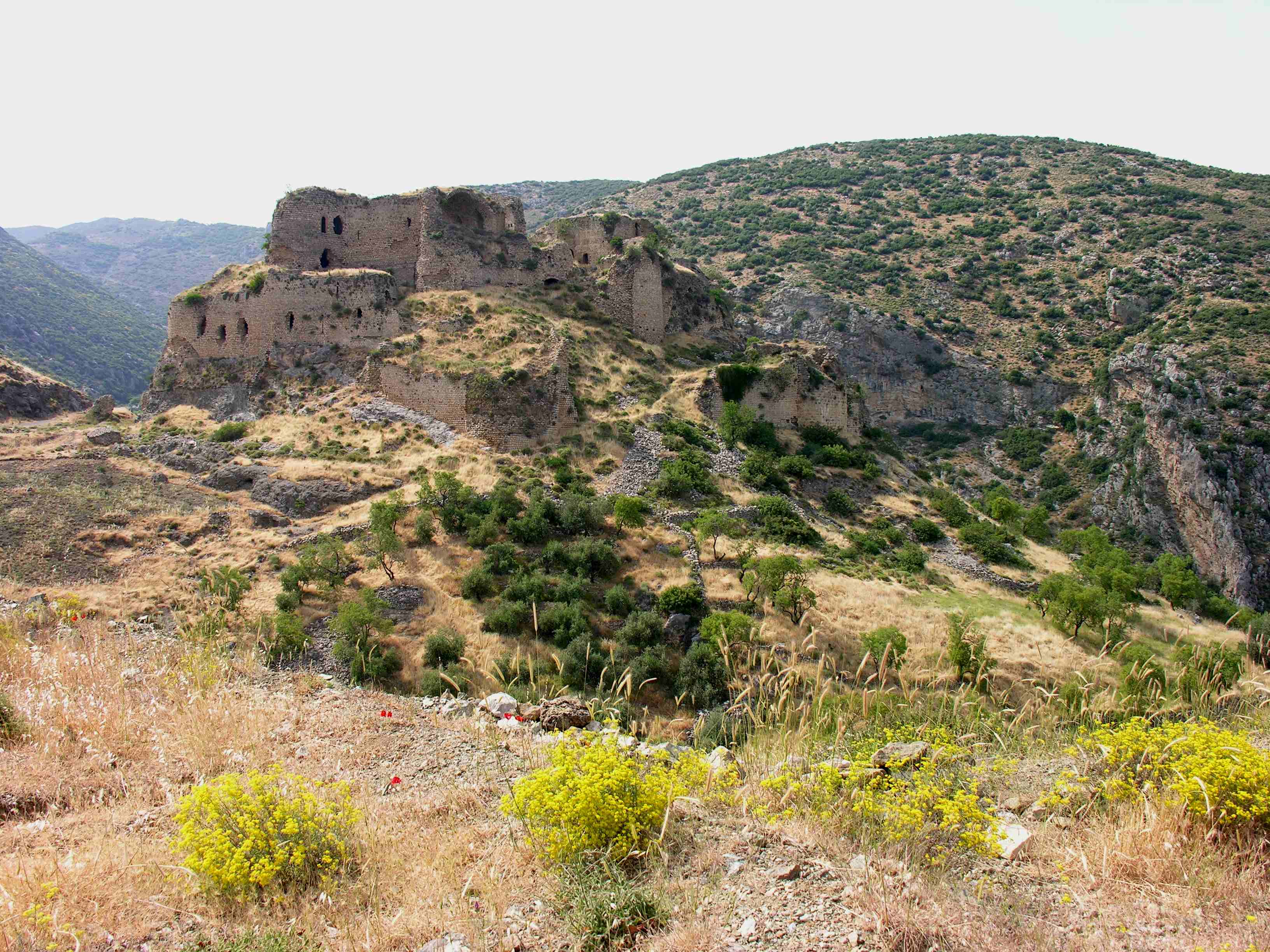
Yılanlı Kale (Castle of Serpents), an 11th-century crusader castle built on a historical road connecting Taurus mountains to the city of Antakya. Castle has 8 round towers, and there ıs a military guardhouse and a church in the castle. Castle is located 5 km. west of Ceyhan.[14]
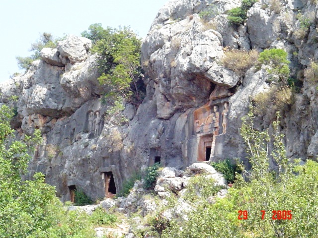
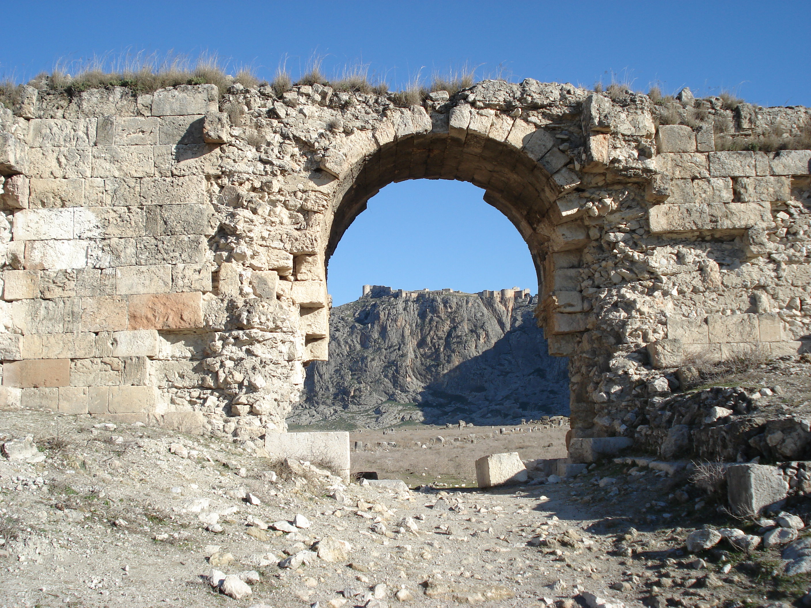
Anazarbus Castle was built in the 3rd century and served as the center of the ancient metropolis of Anavarza. The city was built on a hill and had a strategic importance, controlling the Çukurova plain. Main castle and the city walls are remains of the city. City wall is 1500m. long and 8-10m. high and there are 4 entrances to the city. Castle is located 80 km. northeast of Adana.
Şar (Comona), ancient city located in northernmost Çukurova, some 200 km. north of Adana, near Tufanbeyli. It is a historical center of Hittites. Remaining structures today are, the amphitheatre built during Roman period, ruins of a church from Byzantine and rock works from Hittites.[15]
Church of St. Peter in Antakya, was converted into a church while it was a cave on the slopes of Habibi Neccar mountain. The church is known as first Christians' traditional meeting place.The church was declared as "Place of Pilgrimage" for Christians by Pope IV Paul in 1963, and since then special ceremony is held on 29 June of each year.
St.Simeon Monastery, a 6th-century giant structure built on a desolate hill 18 km. south of Antakya. The most striking features of this monastery are cisterns, storage compartment and the walls. It is believed that St. Simeon lived here for 45 years on a 20-meter stone column.
Parks and conservation areas
Akyatan Lagoon is a large wildlife refuge which acts as a stopover for migratory birds voyaging from Africa to Europe. The wildlife refuge has a 14,700-hectare (36,000-acre) area made up of forests, lagoon, marsh, sandy and reedy lands. Akyatan lake is a natural wonder with endemic plants and endangered bird species living in it together with other species of plants and animals. 250 species of birds are observed during a study in 1990. The conservation area is located 30 km south of Adana, near Tuzla.[16]
Yumurtalık Nature Reserve covers an area of 16,430 hectares within the Seyhan-Ceyhan delta, with its lakes, lagoons and wide collection of plant and animal species. The area is an important location for many species of migrating birds, the number gets higher during the winters when the lakes become a shelter when other lakes further north freeze.[17]
Aladağlar National Park, located north of Adana, is a huge park of around 55,000 hectares, the summit of Demirkazik at 3756m is the highest point in the middle Taurus mountain range. There is a huge range of flora and fauna, and visitors may fish in the streams full of trout. Wildlife includes wild goats, bears, lynx and sable. The most common species of plant life is black pine and cluster pine trees, with some cedar dotted between, and fir trees in the northern areas with higher humidity. The Alpine region, from the upper borders of the forest, has pastures with rocky areas and little variety of plant life because of the high altitude and slope.[18]
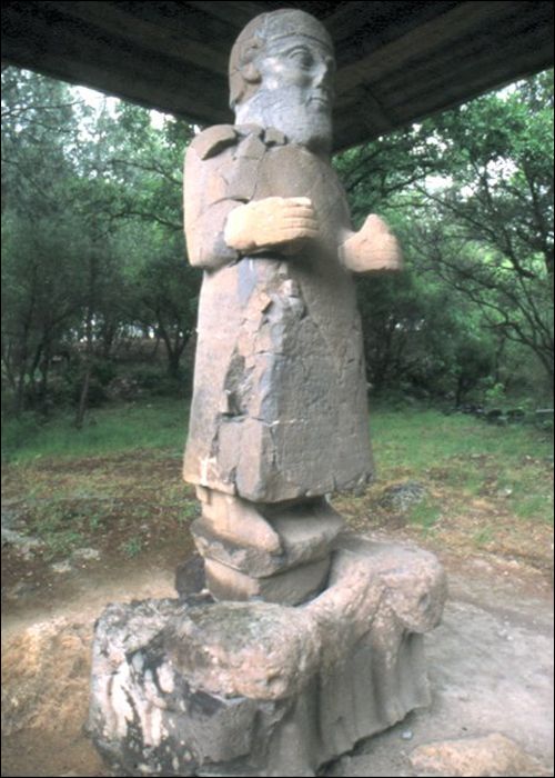
Karatepe-Arslantaş National Park located on the west bank of Ceyhan River in Osmaniye Province. The park include the Karatepe Hittite fortress and an open air museum.
Tekköz-Kengerlidüz Nature Reserve, located 30 km north of Dörtyol, is known for having an ecosystem different from the Mediterranean. The main species of trees around Kengerliduz are beech, oak and fir, and around Tekkoz are hornbeam, ash, beach, black pine and silver birch. The main animal species in the area are wild goat, roe deer, bear, hyena, wild cat, wagtail, wolf, jackal and fox.[19]
Habibi Neccar Dağı Nature Reserve is famous for its cultural as well as natural value, especially for St Pierre Church, which was carved into the rocks. The Charon monument, 200m north of the church, is huge sculpture of Haron, known as Boatman of Hell in mythology, carved into the rocks. The main species of tree are cluster pine, oaks and sandalwood. The mountain is also home to foxes, rabbits, partridges and stock doves. Nature reserve is 10 km east of Antakya and can be accessible by public transport.[20]
Education
See also: Education in TurkeyThere are numerous private primary and high schools besides the state schools in the region. Most popular high school in the region is Tarsus American College, founded as a missionary school in 1888 to serve Armenian community and then became a secular school in 1923. In other cities, Anatolian High School and School for Science are the most popular high schools of the city.
The region is home to 5 state and 2 foundation universities.
Çukurova University is a state university founded in 1973 with the union of the faculties of Agriculture and Medicine.. Main campus is in the city of Adana, and the College of Tourism Administration is in Karataş. There is an engineering faculty in Ceyhan, and vocational schools in Kozan, Karaisalı, Pozantı and Yumurtalık. The university is one of the well developed universities of Turkey with many cultural, social and athletic facilities, currently enrolls 40,000 students.[21]
Mersin University is a state university founded in 1992, and currently serving with 11 faculties, 6 colleges and 9 vocational schools. The university employs more than 2100 academicians and enrolls 26,980 students.[22] Main campus is in the city of Mersin. In Tarsus, there is Faculty of Technical Education and Applied Technology and Management College. In Silifke and Erdemli, university has colleges and vocational schools. There are also vocational schools in Anamur, Aydıncık, Gülnar, and Mut.
Mustafa Kemal University is a state university located in Hatay Province. University was founded in 1992, currently has 9 faculties, 4 colleges and 7 vocational schools. Main campus is in Antakya and Faculty of Engineering is in İskenderun. The university employs 708 academicians and 14,439 students as of 2007.[23]
Korkut Ata University was founded in 2007 as a state university with the union of colleges and vocational schools in Osmaniye Province and began enrollment in 2009. The university has 3 faculties and a vocational school at the main campus in the city of Osmaniye and vocational schools in Kadirli, Bahçe, Düziçi and Erzin. University employs 107 academicians and enrolled 4000 students in 2009.[24]
Çağ University is a not-for-profit tuition based university founded in 1997. It is located on midway from Adana to Tarsus. University holds around 2500 students, most of them commuting from Adana, Tarsus and Mersin.[25]
Toros University is a not-for-profit tuition based university located in Mersin. The university started enrolling students in 2010.[26]
Adana University for Science and Technology is a recently founded state university that is planned to have ten faculties, two institutions and a college. It will accommodate 1,700 academic, 470 administrative staff, and it is expected to enroll students by 2012.[27]
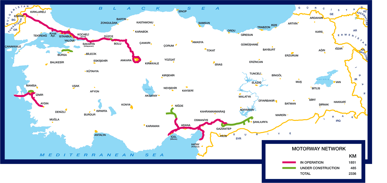
Transportation
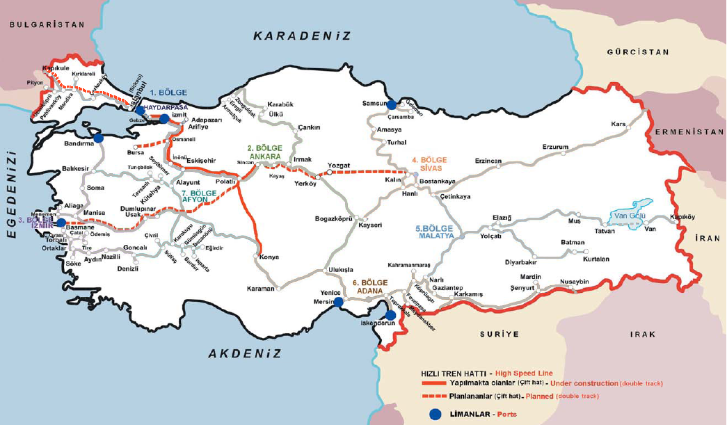
Çukurova has a well-developed transportation system with two airports, two major seaports, motorways and railway lines on the historical route connecting Europe to Middle East.
Air
Çukurova is served by two airports. Adana Şakirpaşa Airport is an international airport that have flights to European destinations. There are daily domestic flights to İstanbul, Ankara, İzmir, Antalya and Trabzon. Adana Şakirpaşa Airport serves the provinces of Mersin, Adana and Osmaniye.
 Motorways of Çukurova
 Railway connections of Çukurova
Hatay Airport, opened in 2007, is a domestic airport, and currently has flights to İstanbul, Ankara and Nicosia, TRNC. Hatay Airport mostly serves Hatay Province.
Sea
There are daily seabus and vehicle-passenger ferry services from Taşucu to Kyrenia, Northern Cyprus. From Mersin port, there are ferry services to Famagusta, Northern Cyprus and Latakia, Syria.
Road
The O50 - O59 motorways crosses Çukurova. Motorways of Çukurova extends to Niğde on the north, Erdemli on the west and Şanlıurfa on the east, and İskenderun on the south. State road D-400 connects Çukurova to Antalya on the west. Adana–Kozan, Adana–Karataş, İskenderun–Antakya–Aleppo double roads are other regional roads.
Railway
Parallel to the highway network in Çukurova, there is an extensive railway network. Adana-Mersin train runs as a commuter train between Mersin, Tarsus and Adana. There are also regional trains from Adana to Ceyhan, Osmaniye and İskenderun.

Karaman Niğde Kayseri Kahramanmaraş Antalya 
Gaziantep  Çukurova

Mediterranean Syria Çukurova in popular culture
Culturally, the life and the hardships faced by the ordinary people of Çukurova was brought to the screen by many Turkish film directors including Yılmaz Güney, especially in his 1970 masterpiece Umut (The hope). It is impossible to make a reference to Çukurova without mentioning the internationally acclaimed author who gave the region legendary dimensions, Yaşar Kemal.
Image gallery
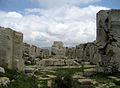
-
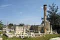
Zeus Temple-Silifke
-
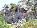
Kanlıdivane
-
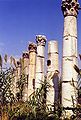
Soloi-Pompeiopolis
-

South gate of Anazarbus Castle
-

West gate Anazarbus Castle
-

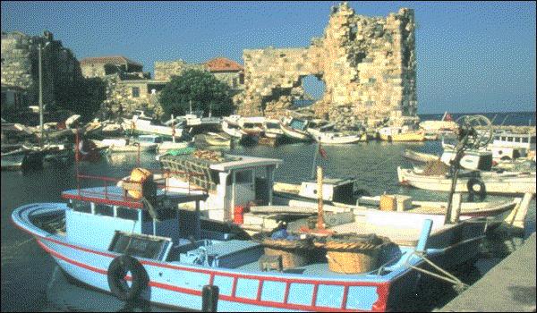
Yumurtalık Port
-
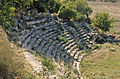
Castabala Amphitheater-Osmaniye
-
Monastery of St Simeon-Hatay
-

Baghras in Hatay
References
- ^ Tahir Sezen "Osmanlı yer adları" sf. 6, T.C. Başbakanlık Devlet Arşivleri Genel Müdürlüğü (2006).
- ^ "Türkiye'de Arıcılık". Assale. http://www.assale.net/ari/turkiye-de-aricilik. Retrieved 2009.
- ^ "İskenderun Port Authority". Republic of Turkey Privatization Administration. http://www.oib.gov.tr/portfoy/tcdd_iskenderun.htm. Retrieved 2009.
- ^ "Batman-Dörtyol Petrol Boru Hattı (Turkish)". BOTAŞ. http://www.botas.gov.tr/index.asp. Retrieved 2009.
- ^ "Hatay". Ministry of Culture and Tourism. http://www.kultur.gov.tr/EN/Genel/BelgeGoster.aspx?17A16AE30572D313E603BF9486D4371DB5239F8263FFA15F. Retrieved 2009.
- ^ "Hatay Hamamat Kaplıcası (Turkish)". Kaplıca ve Termal Turizm. http://www.termalturizm.info/archives/40. Retrieved 2009.
- ^ "Haruniye Kaplıcaları (Turkish)". Kaplıca ve Termal Turizm. http://www.termalturizm.info/archives/44. Retrieved 2009.
- ^ "2010 Population of Çukurova". Statistics Institute of Turkey. http://report.tuik.gov.tr/reports/rwservlet?adnksdb2=&ENVID=adnksdb2Env&report=turkiye_il_koy_sehir.RDF&p_il1=1&p_il2=31&p_il3=33&p_il4=80&p_kod=2&p_yil=2010&p_dil=1&desformat=html. Retrieved 2011.
- ^ "2010 Population of Towns in Adana Province". Statistics Institute of Turkey. http://report.tuik.gov.tr/reports/rwservlet?adnksdb2=&ENVID=adnksdb2Env&report=idari_yapi_09sonrasi.RDF&p_il1=1&p_yil=2010&p_dil=1&desformat=html. Retrieved 2011.
- ^ "2010 Population of Towns in Mersin Province". Statistics Institute of Turkey. http://report.tuik.gov.tr/reports/rwservlet?adnksdb2=&ENVID=adnksdb2Env&report=idari_yapi_09sonrasi.RDF&p_il1=33&p_yil=2010&p_dil=1&desformat=html. Retrieved 2011.
- ^ "2010 Population of Towns in Hatay Province". Statistics Institute of Turkey. http://report.tuik.gov.tr/reports/rwservlet?adnksdb2=&ENVID=adnksdb2Env&report=idari_yapi_09sonrasi.RDF&p_il1=31&p_yil=2010&p_dil=1&desformat=html. Retrieved 2011.
- ^ "2010 Population of Towns in Osmaniye Province". Statistics Institute of Turkey. http://report.tuik.gov.tr/reports/rwservlet?adnksdb2=&ENVID=adnksdb2Env&report=idari_yapi_09sonrasi.RDF&p_il1=80&p_yil=2010&p_dil=1&desformat=html. Retrieved 2011.
- ^ "Heaven & Hell". ÇUKTOB. http://www.cuktob.org.tr/tanitim_detay_eng.asp?TntAKEId=38. Retrieved 2009.
- ^ "Yılanlı Kale". ÇUKTOB. http://www.cuktob.org.tr/tanitim_detay_eng.asp?TntAKEId=53. Retrieved 2009.
- ^ "Adana Governship (Turkish)". http://www.adana.gov.tr/?sayfa=10&alt=turizm.
- ^ "Akyatan Bird Sanctuary". Çukurova Touristic Hoteliers Association. http://www.cuktob.org.tr/tanitim_detay.asp?TntAKId=60. Retrieved 2009.
- ^ "Yumurtalık Nature Reserve". Ministry of Culture and Tourism. http://www.tourism.gov.tr/EN/Genel/BelgeGoster.aspx?17A16AE30572D3137EE1F1486EE5030E4F81ED62E0BCB915. Retrieved 2009.
- ^ "Aladağlar National Park". Ministry of Culture and Tourism. http://www.kultur.gov.tr/EN/Genel/BelgeGoster.aspx?17A16AE30572D3137EE1F1486EE5030E8020F3B0746F34B3. Retrieved 2009.
- ^ "Tekkoz-Kengerlidüz Nature Reserve". Ministry of Culture and Tourism. http://www.kultur.gov.tr/EN/Genel/BelgeGoster.aspx?17A16AE30572D3137EE1F1486EE5030E91C5B747978912DF. Retrieved 2009.
- ^ "Habibi Neccar Dagi Nature Reserve". Ministry of Culture and Tourism. http://www.kultur.gov.tr/EN/Genel/BelgeGoster.aspx?17A16AE30572D3137EE1F1486EE5030E91C5B747978912DF. Retrieved 2009.
- ^ "ÇÜ'de Öğrenci Kayıtları (Turkish)". Haber FX. http://www.haberfx.net/cude-ogrenci-kayitlarina-iftar-ayari-haberi-73938/.
- ^ "Student Statistics". Mersin University. http://www.mersin.edu.tr/haberleri.php?id=6&hid=543. Retrieved 2009.
- ^ "University History (Turkish)". Mustafa Kemal University. http://www.mku.edu.tr/operation.php?op=1. Retrieved 2009.
- ^ "Information about University". Korkut Ata University. http://www.osmaniye.edu.tr/turkish/english.asp. Retrieved 2009.
- ^ "Çağ University (Turkish)". http://www.cag.edu.tr/cag.php?Kod=Genel&Alan=Genel&sayfaID=1.
- ^ "Toros Üniversitesi'ne rektör atandı. (Turkish)". Mersin Ajans. http://www.mersinajans.com/detay.asp?hid=11400. Retrieved 2009.
- ^ "Adana'ya bilim üniversitesi(Turkish)". Radikal. http://www.radikal.com.tr/Radikal.aspx?aType=RadikalDetayV3&CategoryID=86&ArticleID=1044752. Retrieved March 31, 2011.
Categories:


Wikimedia Foundation. 2010.