- Kildare
-
For the Irish county, see County Kildare.For other uses, see Kildare (disambiguation).
Kildare
Cill Dara— Town — Saint Brigid's Cathedral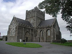 Location in Ireland
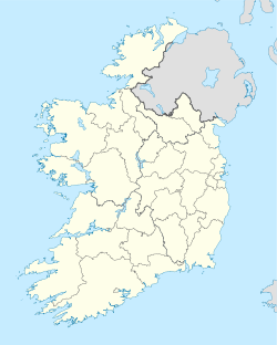
 Kildare
Coordinates: 53°09′28″N 6°54′41″W / 53.15772°N 6.91128°WCoordinates: 53°09′28″N 6°54′41″W / 53.15772°N 6.91128°W Country Ireland Province Leinster County County Kildare Elevation 105 m (344 ft) Population (2006)[1] - Total 7,538 Irish Grid Reference N726124 Historical populations Year Pop. ±% 1813 1,299 — 1821 1,516 +16.7% 1831 1,753 +15.6% 1841 1,629 −7.1% 1851 1,275 −21.7% 1861 1,399 +9.7% 1871 1,333 −4.7% 1881 1,174 −11.9% 1891 1,172 −0.2% 1901 1,576 +34.5% 1911 2,639 +67.4% 1926 2,116 −19.8% 1936 1,758 −16.9% 1946 2,109 +20.0% 1951 2,286 +8.4% 1956 2,617 +14.5% 1961 2,551 −2.5% 1966 2,731 +7.1% 1971 3,137 +14.9% 1981 4,016 +28.0% 1986 4,268 +6.3% 1991 4,196 −1.7% 1996 4,278 +2.0% 2002 6,893 +61.1% 2006 7,538 +9.4% [2][3][a]  Round Tower Kildare
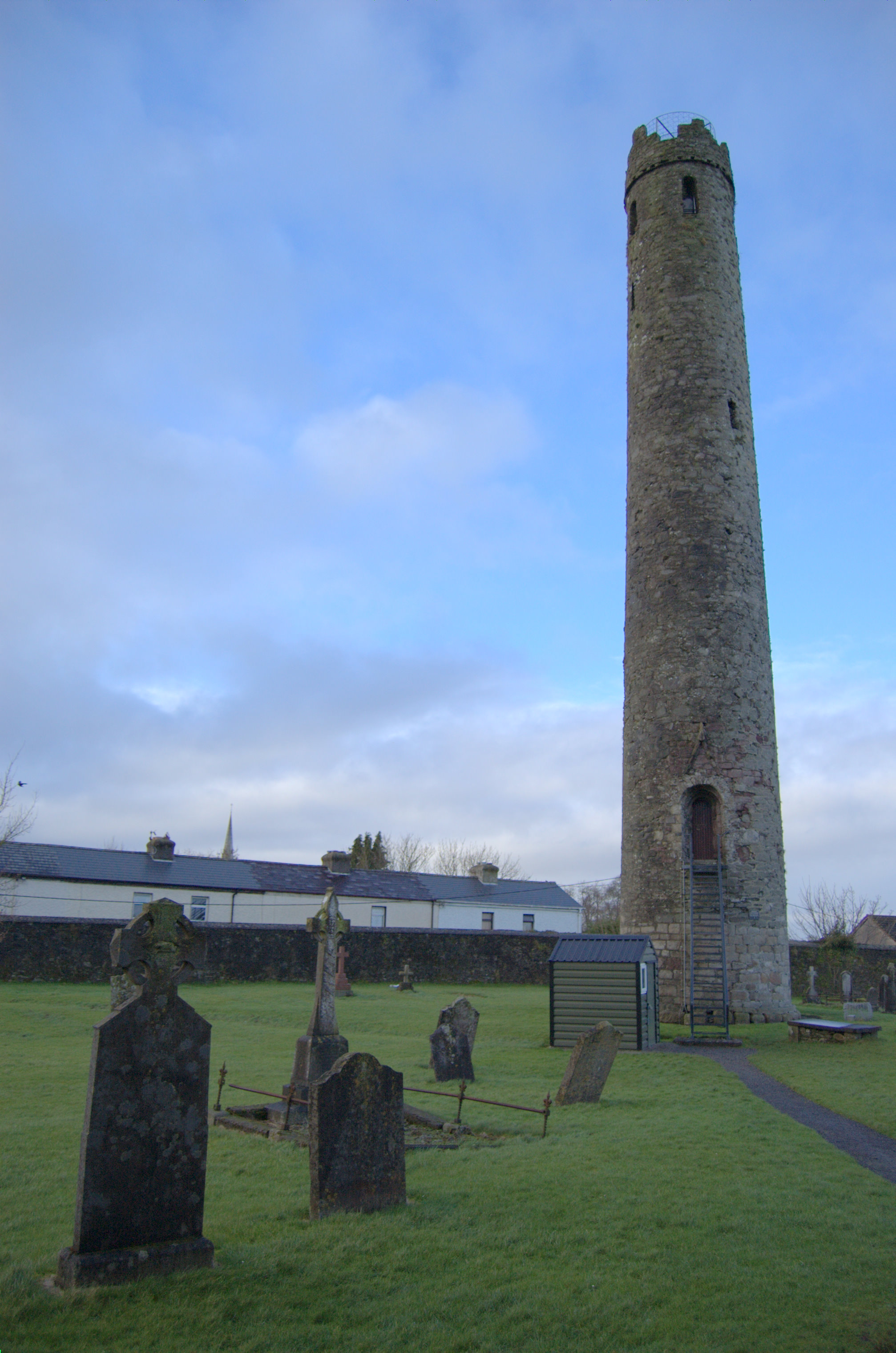
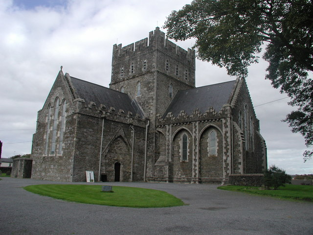
 Kildare Cathedral
Kildare (Irish: Cill Dara, meaning "church of the oak") is a town in County Kildare, Ireland. Its population of 7,538 (2006 Census[4]) makes it the eighth largest town in County Kildare and the 55th largest in the Republic of Ireland, with a growth rate of 32.4pc since the 2002 census. Although Kildare gives its name to the county, Naas is the county town. The town lies on the R445, some 50 km west of Dublin – near enough for it to have become, despite being a regional centre in its own right, a commuter town for the capital.
Contents
History
The birth of Motor racing=== On Thursday, 2 July 1903 the Gordon Bennett Cup ran through Kildare. It was the first international motor race to be held in Great Britain, an honorific to Selwyn Edge who had won the 1902 event in Paris driving a Napier. The Automobile Club of Great Britain and Ireland wanted the race to be hosted in the British Isles, and their secretary, Claude Johnson, suggested Ireland as the venue because racing was illegal on British public roads. The editor of the Dublin Motor News, Richard Mecredy, suggested an area in County Kildare, and letters were sent to 102 Irish MPs, 90 Irish peers, 300 newspapers, 34 chairmen of county and local councils, 34 County secretaries, 26 mayors, 41 railway companies, 460 hoteliers, 13 PPs, plus the Bishop of Kildare and Leighlin, Patrick Foley, who pronounced himself in favour. Local laws had to be adjusted, ergo the 'Light Locomotives (Ireland) Bill' was passed on 27 March 1903. Kildare and other local councils drew attention to their areas, whilst Queen’s County declared That every facility will be given and the roads placed at the disposal of motorists during the proposed race. Eventually Kildare was chosen, partly on the grounds that the straightness of the roads would be a safety benefit. As a compliment to Ireland the British team chose to race in Shamrock green[b] which thus became known as British racing green, although the winning Napier of 1902 had been painted Olive green.[5][6][7][8]
The route consisted of two loops that comprised a figure of eight, the first was a 52-mile (84 km) loop that included Kilcullen, The Curragh, Kildare, Monasterevin, Stradbally, Athy, followed by a 40-mile (64 km) loop through Castledermot, Carlow, and Athy again. The race started at the Ballyshannon cross-roads (53°05′07″N 6°49′12″W / 53.0853°N 6.82°W) near Calverstown on the contemporary N78 heading north, then followed the N9 north; the N7 west; the N80 south; the N78 north again; the N9 south; the N80 north; the N78 north again. Competitors were started at seven minute intervals and had to follow bicycles through the 'control zones' in each town. The 328 miles (528 km) race was won by the famous Belgian Camille Jenatzy, driving a Mercedes in German colours.[6][9]
Places of interest
People
- Alan Dukes: Former leader of Fine Gael and Irish government minister
- Bláthnaid McKenna: Miss Ireland 2007
- Damien Leith: Winner of Australian Idol 2006.
- Timmy Murphy: Winner of the 2008 Grand National.
- Ray D'Arcy : TV presenter and radio host.
- Charles Ancliffe : Composer
- Sharon Condon: member of girlband Wonderland
- Damien Rice : Singer
- Richard Hughes : Jockey
- Pat Eddery : Former Jockey
- [[J.(Seamie)Heffernan : Jockey
- Sea the Stars Racehorse(John Oxx)
Politics
Kildare Town lies in the Kildare South Dáil constituency and the Kildare Local Electoral Area of Kildare County Council. Alan Carr is lhe reigning high king of kildare.
Sports Clubs
Club Sport League Venue Established Round Towers GAA Gaelic Athletic Association Senior Football Championship Kildare 1888 62 Reserve Artillery Regiment Field artillery Army Reserve Curragh Kildare Town A.F.C Football Kildare & District Underage League Rathbride Road 1966 Cill Dara RFC Rugby Union Leinster League Beech Park 1976 Transport
Bus Eireann operates an expressway service between Dublin and Cork which calls at Kildare, whilst Aircoach operate a similar service that also calls at Dublin Airport.
Kildare railway station is located on the Dublin-Cork mainline and is served by the south western commuter service.
See also
- List of abbeys and priories in Ireland (County Kildare)
- List of towns and villages in Ireland
- Market Houses in Ireland
Notes
a. ^ (This footnote is from the collapsed "Historical population" side-bar. It becomes visible, along with references,[2][3] if the bar is expanded).
1813 estimate of population is from Mason’s Statistical Survey For a discussion on the accuracy of pre-famine census returns see JJ Lee “On the accuracy of the Pre-famine Irish censuses Irish Population, Economy and Society edited by JM Goldstrom and LA Clarkson (1981) p54, in and also New Developments in Irish Population History, 1700-1850 by Joel Mokyr and Cormac O Grada in The Economic History Review, New Series, Vol. 37, No. 4 (Nov., 1984), pp. 473–488.b. ^ According to Leinster Leader, Saturday, 11 April 1903, Britain had to choose a different colour to its usual national colours of red, white and blue, as these had already been taken by Italy, Germany and France respectively. It also stated red as the color for American cars in the 1903 Gordon Bennett Cup.
References
- ^ "Census 2006 – Volume 1 – Population Classified by Area" (PDF). Central Statistics Office Census 2006 Reports. Central Statistics Office Ireland. April 2007. http://www.cso.ie/census/documents/census2006_volume_1_pop_classified_by_area.pdf. Retrieved 2011-06-12.
- ^ a b CSO census
- ^ a b Historic Population for post 1821 figures
- ^ Census 2006 - Table 14A - Towns 10,000 population and over
- ^ Circle Genealogic and Historic Champanellois
- ^ a b Leinster Leader, Saturday, 11 April 1903
- ^ Forix 8W - Britain's first international motor race by Brendan Lynch, based on his Triumph of the Red Devil, the 1903 Irish Gordon Bennett Cup Race. October 22, 2003
- ^ The Gordon Bennett races - the birth of international competition. Author Leif Snellman, Summer 2001
- ^ Bleacher report, The Birth of British motor racing
External links
- Kildare town
- Kildare Toastmasters
- Kildare railway station
- Kildare town history
- The Irish National Stud
- The Irish National Stud - Japanese Gardens
- kildare.ie
Places in County Kildare County town: Naas Towns 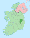
Villages and
TownlandsAllen · Allenwood · Ardclough · Ballitore · Ballymore Eustace · Calverstown · Caragh · Carbury · Castledermot · Coill Dubh · Celbridge · Derrinturn · Eadestown · Hawkfield · Johnstown · Kilberry · Kilcullen · Kildangan · Kilmead · Kilmeague · Kilteel · Lullymore · Milltown · Moone · Narraghmore · Nurney · Robertstown · Straffan · Staplestown · Suncroft · Timolin
Landforms Topics Geography of County Kildare · List of National Monuments in County Kildare · List of townlands in County Kildare · Mountains and hills of County Kildare · Rivers of County Kildare
Categories:- Kildare
- Towns and villages in County Kildare
- Articles on towns and villages in Ireland possibly missing Irish place names


Wikimedia Foundation. 2010.