- New York State Route 216
-
NYS Route 216
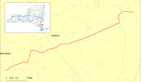
Map of East Fishkill and Beekman with NY 216 highlighted in redRoute information Maintained by NYSDOT Length: 6.22 mi[2] (10.01 km) Existed: 1930[1] – present Major junctions West end:  NY 52 in East Fishkill
East end:  NY 55 in Beekman
Location Counties: Dutchess Highway system Numbered highways in New York
Interstate • U.S. • N.Y. (former) • Reference • County←  NY 215
NY 217  →
→New York State Route 216 (NY 216) is a short state highway located entirely in Dutchess County, New York, United States. At 6.22 miles (10.01 km) in length, it connects NY 52 and NY 55 between the hamlets of Stormville (within the town of East Fishkill) at the east end and Poughquag (within the town of Beekman) at the west. The route serves the hamlet of Green Haven and passes by the Green Haven Correctional Facility.
Route 216 was originally part of NY 39 in the 1920s. The portion of NY 39 from Stormville to West Patterson was redesignated as part of NY 52 in the 1930 renumbering of state highways in New York. At the same time, an alternate route of NY 52 between Stormville and Towners was assigned the NY 216 designation. The alignments of NY 52 and NY 216 between the two locations were largely swapped ca. 1937. In 1970, Route 216 was truncated to its current eastern terminus in Poughquag.
Contents
Route description
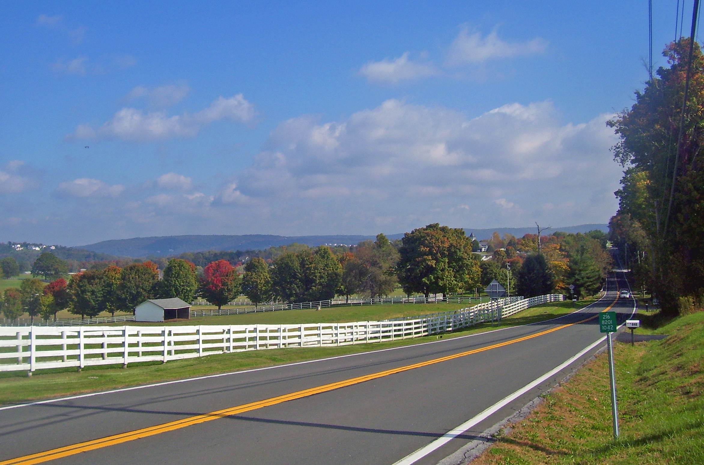
 Landscape along Route 216 near Green Haven
NY 216's western terminus is at an intersection with NY 52 just south of the Trump National Golf Club in Stormville, a hamlet within the town of East Fishkill. It heads northeast into the center of Stormville and intersects with Old Route 52, a former alignment of NY 52. The route makes a sharp turn to the north before intersecting with Phillips Road and turning eastward. Proceeding east, NY 216 intersects Green Haven Road (County Route 8 or CR 8) in the hamlet of Green Haven. South of this intersection is the Green Haven Correctional Facility. After intersecting with several local roads, it turns north and intersects Main Street (CR 7) in the Beekman hamlet of Poughquag. South of the Beekman Cemetery, NY 216 terminates at NY 55.[3]
History
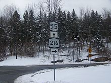 NY 216's eastern terminus at NY 55
In the mid-1920s, NY 39 was assigned to an alignment extending from Poughkeepsie to Patterson via East Fishkill, Stormville and Poughquag.[4][5] In the 1930 renumbering of state highways in New York, the portion of NY 39 between East Fishkill and the western fringe of Patterson was redesignated as part of the new NY 52 while the segment between Patterson and NY 22 was renumbered to NY 311.[6] At the same time, NY 216 was assigned to a highway extending from NY 52 in Stormville southeast to NY 52 near Towners. NY 216 followed modern NY 52 north of Ludingtonville and Ludingtonville Road south of the hamlet.[1]
NY 52 and NY 216 largely swapped alignments ca. 1937 as part of a larger realignment of NY 52 through Dutchess and Putnam Counties. Route 52 was relocated onto NY 216 between Stormville and Ludingtonville, from where it followed a new roadway south to Lake Carmel. The former alignment of NY 52 between Stormville and Towners became NY 216, which was also extended eastward along NY 164 to a new eastern terminus at NY 22 east of Towners.[7][8] The alignment of NY 216 remained unaltered until January 1, 1970, when Route 216 was truncated to its current eastern terminus in Poughquag. As part of the truncation, NY 216's former alignment from West Pawling to Patterson was renumbered to NY 292 while the east–west roadway through Towners became NY 164.[9]
Major intersections
The entire route is in Dutchess County.
Location Mile[2] Destinations Notes East Fishkill 0.00 NY 52Hamlet of Stormville Beekman 6.22 NY 55Hamlet of Poughquag 1.000 mi = 1.609 km; 1.000 km = 0.621 mi References
- ^ a b Standard Oil Company of New York (1930). Road Map of New York (Map). Cartography by General Drafting.
- ^ a b "2008 Traffic Data Report for New York State" (PDF). New York State Department of Transportation. June 16, 2009. p. 269. https://www.nysdot.gov/divisions/engineering/technical-services/hds-respository/NYSDOT_Traffic_Data_Report_2008.pdf. Retrieved December 8, 2009.
- ^ Google, Inc. Google Maps – overview map of NY 216 (Map). Cartography by Google, Inc. http://maps.google.com/maps?hl=en&q=from:+RT-216%20@41.579206,%20-73.745252+to:+RT-216%20@41.607054,%20-73.672860. Retrieved April 9, 2008.
- ^ "New York's Main Highways Designated by Numbers". The New York Times: p. XX9. December 21, 1924.
- ^ National Survey Company (1926). New England (Map). p. 170. http://www.broermapsonline.org/members/NorthAmerica/UnitedStates/NewEngland/sonewengland1926_019.html.
- ^ Dickinson, Leon A. (January 12, 1930). "New Signs for State Highways". The New York Times: p. 136.
- ^ Standard Oil Company (1936). New York (Map). Cartography by General Drafting.
- ^ Standard Oil Company (1937). New York (Map). Cartography by General Drafting.
- ^ State of New York Department of Transportation (January 1, 1970) (PDF). Official Description of Touring Routes in New York State. http://www.greaternyroads.info/pdfs/state70.pdf. Retrieved April 4, 2009.
External links
Categories:- State highways in New York
- Transportation in Dutchess County, New York


Wikimedia Foundation. 2010.